Category:Grafton Flyford
Jump to navigation
Jump to search
village and civil parish in Worcestershire, United Kingdom  | |||||
| Upload media | |||||
| Instance of | |||||
|---|---|---|---|---|---|
| Location | Wychavon, Worcestershire, West Midlands, England | ||||
| Population |
| ||||
| Area |
| ||||
 | |||||
Subcategories
This category has only the following subcategory.
Media in category "Grafton Flyford"
The following 115 files are in this category, out of 115 total.
-
 A farm at Libbery - geograph.org.uk - 6071730.jpg 1,600 × 1,200; 429 KB
-
 Autumn Seeds - Flickr - gailhampshire.jpg 3,584 × 3,032; 638 KB
-
 Black and white farmhouse Grafton Flyford (50825246436).jpg 4,154 × 2,773; 3.22 MB
-
 Bridleway to Hill Court, Grafton Flyford - geograph.org.uk - 5105766.jpg 1,600 × 1,192; 362 KB
-
 Bulrushes beside the Wychavon Way - geograph.org.uk - 2508845.jpg 1,024 × 680; 260 KB
-
 Church at Grafton Flyford - geograph.org.uk - 4917144.jpg 640 × 480; 90 KB
-
 Church Farm, Grafton Flyford - geograph.org.uk - 5479730.jpg 1,600 × 1,200; 449 KB
-
 Church Farm, Grafton Flyford, Worcestershire - geograph.org.uk - 5105810.jpg 1,600 × 1,200; 449 KB
-

-
 Common Barn. - geograph.org.uk - 6895.jpg 640 × 480; 131 KB
-
 Cottage at Grafton Flyford - geograph.org.uk - 1968338.jpg 640 × 480; 80 KB
-
 Cottage, Grafton Flyford - geograph.org.uk - 5346443.jpg 640 × 480; 49 KB
-
 Countryside near Grafton Flyford - geograph.org.uk - 1967920.jpg 640 × 416; 92 KB
-

-
 Crop field near Hill Top Farm - geograph.org.uk - 5346448.jpg 640 × 480; 72 KB
-
 Crop field near Huddington Hill Farm - geograph.org.uk - 5346436.jpg 640 × 480; 72 KB
-
 Dingy Skipper. Erynnis tages - Flickr - gailhampshire (2).jpg 1,408 × 1,392; 650 KB
-
 Elizabeth II postbox and telephone box, Grafton Flyford - geograph.org.uk - 5355918.jpg 2,848 × 2,136; 1.27 MB
-
 Elizabeth II postbox and telephone box, Grafton Flyford - geograph.org.uk - 5355922.jpg 2,848 × 2,136; 1.28 MB
-
 Entrance to footpath to Grafton Flyford church - geograph.org.uk - 5105880.jpg 1,600 × 1,200; 504 KB
-
 False footpath, Grafton Flyford - geograph.org.uk - 5105850.jpg 1,600 × 1,200; 637 KB
-
 Farm buildings north of Libbery - geograph.org.uk - 6071724.jpg 1,600 × 1,200; 511 KB
-
 Farmhouse, Church Farm, Grafton Flyford - geograph.org.uk - 4911206.jpg 480 × 640; 117 KB
-
 Farmhouse, Church Farm, Grafton Flyford - geograph.org.uk - 5105801.jpg 1,600 × 1,200; 575 KB
-
 Farmland at Grafton Flyford - geograph.org.uk - 846170.jpg 640 × 480; 85 KB
-

-
 Field boundaries near Libbery - geograph.org.uk - 6071720.jpg 1,600 × 1,200; 427 KB
-
 Field entrance, Grafton Flyford - geograph.org.uk - 5346439.jpg 640 × 480; 136 KB
-
 Footpath goes through gap in the hedge - geograph.org.uk - 6071715.jpg 1,600 × 1,200; 716 KB
-
 Footpath sign and footbridge, Grafton Flyford - geograph.org.uk - 5479739.jpg 1,600 × 1,200; 761 KB
-
 Footpath sign and stile, Grafton Flyford - geograph.org.uk - 5479736.jpg 1,600 × 1,200; 492 KB
-
 Footpath to Hill Top Farm - geograph.org.uk - 3090389.jpg 1,024 × 680; 288 KB
-
 Froghopper. Cercopis vulnerata - Flickr - gailhampshire (5).jpg 820 × 720; 296 KB
-
 Gated farm track near Hill Top Farm - geograph.org.uk - 5346450.jpg 640 × 480; 104 KB
-
 Grafton Flyford village road sign - geograph.org.uk - 2076920.jpg 640 × 480; 64 KB
-
 Grafton Mill - geograph.org.uk - 1718749.jpg 480 × 640; 104 KB
-
 Grafton Mill - geograph.org.uk - 1718762.jpg 640 × 480; 101 KB
-
 Grazing, Grafton Flyford - geograph.org.uk - 5346441.jpg 640 × 480; 55 KB
-
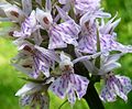
 Greater. Butterfly Orchid - Flickr - gailhampshire.jpg 1,968 × 1,588; 456 KB
-
 Green-veined Whites mating. - Flickr - gailhampshire.jpg 956 × 904; 278 KB
-
 Hill Court, Grafton Flyford - geograph.org.uk - 5479734.jpg 1,600 × 1,200; 422 KB
-
 Hill Court, Grafton Flyford, from the church - geograph.org.uk - 5105806.jpg 1,600 × 1,200; 453 KB
-
 Hill Top Farm, Stock Green - geograph.org.uk - 5479785.jpg 1,600 × 1,200; 318 KB
-
 House at Grafton Flyford - geograph.org.uk - 5479770.jpg 1,600 × 1,200; 567 KB
-
 House Fly. Helina reversio - Flickr - gailhampshire.jpg 904 × 868; 255 KB
-
 Junction for Grafton Flyford - geograph.org.uk - 3150972.jpg 640 × 415; 59 KB
-
 Lane from Huddington turns sharply - geograph.org.uk - 5479728.jpg 1,600 × 1,200; 508 KB
-
 Lane to Grafton Flyford - geograph.org.uk - 3530379.jpg 800 × 451; 177 KB
-
 Large skipper. - Flickr - gailhampshire.jpg 1,488 × 1,544; 368 KB
-
 Libbery crossroads on A422 - geograph.org.uk - 3150883.jpg 640 × 446; 77 KB
-
 Libbery Farm entrance - geograph.org.uk - 6071741.jpg 1,600 × 1,200; 541 KB
-
 Libbery viewed from the south - geograph.org.uk - 809674.jpg 640 × 426; 96 KB
-
 Longhorn Beetle. Saperda populnea. Cerambycidae - Flickr - gailhampshire.jpg 1,224 × 1,000; 410 KB
-
 Longhorn Beetle. Strangalia melanura. Cerambycidae - Flickr - gailhampshire.jpg 984 × 1,064; 371 KB
-
 Looking across fields to Grafton Flyford Church - geograph.org.uk - 5479725.jpg 1,600 × 1,200; 529 KB
-
 Lower Kites Wood. - geograph.org.uk - 9587.jpg 640 × 480; 111 KB
-
 Millennium Way at Upton Snodsbury - geograph.org.uk - 6071751.jpg 1,600 × 1,200; 384 KB
-

-
 Minor road near Hill Top Farm - geograph.org.uk - 5346449.jpg 640 × 480; 94 KB
-
 Minor road towards Grafton Flyford - geograph.org.uk - 5346437.jpg 640 × 480; 125 KB
-
 Minor road, Grafton Flyford - geograph.org.uk - 5346442.jpg 640 × 480; 129 KB
-
 Mirid Bug. Stenotus binotatus. - Flickr - gailhampshire.jpg 948 × 852; 275 KB
-
 Oilseed rape crop, Grafton Flyford - geograph.org.uk - 5346445.jpg 640 × 480; 91 KB
-
 Ordnance Survey Cut Mark - geograph.org.uk - 6119206.jpg 1,024 × 853; 419 KB
-
 P1230604 - Flickr - gailhampshire.jpg 1,194 × 1,050; 177 KB
-
 P1230605 - Flickr - gailhampshire.jpg 1,614 × 1,410; 205 KB
-
 P1230606 - Flickr - gailhampshire.jpg 1,488 × 1,326; 152 KB
-
 P1250226 - Flickr - gailhampshire.jpg 1,496 × 1,232; 617 KB
-
 P1250253 - Flickr - gailhampshire.jpg 1,182 × 1,140; 553 KB
-
 P1250297 - Flickr - gailhampshire.jpg 1,956 × 2,820; 1.54 MB
-
 Parish Hall, Grafton Flyford - geograph.org.uk - 850626.jpg 640 × 480; 93 KB
-
 Peacock on Teasel. - Flickr - gailhampshire.jpg 2,520 × 2,003; 1.15 MB
-
 Pirata species. Female carrying eggcase - Flickr - gailhampshire (1).jpg 1,356 × 1,284; 477 KB
-
 Plums and Custard. Tricholomopsis rutilans - Flickr - gailhampshire (1).jpg 4,608 × 3,456; 1.39 MB
-
 Pond and Church Farm House, Grafton Flyford - geograph.org.uk - 5105824.jpg 1,600 × 1,200; 783 KB
-
 Post box at Grafton Flyford - geograph.org.uk - 850632.jpg 480 × 640; 108 KB
-
 Post box at Libbery - geograph.org.uk - 809655.jpg 426 × 640; 106 KB
-
 Priest Bridge - geograph.org.uk - 9565.jpg 640 × 480; 151 KB
-
 Priocnemis species. (Pompilidae), maybe P. perturbator. - Flickr - gailhampshire.jpg 2,104 × 1,761; 782 KB
-

-

-
 Ragged Robin - Flickr - gailhampshire (1).jpg 2,166 × 2,034; 515 KB
-
 Rectory Barns, Grafton Flyford, Worcestershire - geograph.org.uk - 5105778.jpg 1,600 × 1,200; 722 KB
-
 Resurfacing road to Grafton Flyford Church - geograph.org.uk - 5105792.jpg 1,600 × 1,200; 653 KB
-
 Russula species - Flickr - gailhampshire (2).jpg 2,984 × 2,696; 970 KB
-
 Sawfly larva^ or Lacewing larva - Flickr - gailhampshire.jpg 772 × 660; 161 KB
-
 Sawfly sp. Tenthredinidae - Flickr - gailhampshire.jpg 952 × 992; 221 KB
-
 Sawpitts, Grafton Flyford - geograph.org.uk - 5479758.jpg 1,600 × 1,200; 588 KB
-
 Scat from - Flickr - gailhampshire.jpg 2,892 × 2,364; 2.13 MB
-
 Scorpion Fly. (Panorpa communis^) - Flickr - gailhampshire.jpg 1,024 × 1,488; 282 KB
-
 Sheep and Hill Top Farm - geograph.org.uk - 2508855.jpg 1,024 × 680; 222 KB
-

-
 St John the Baptist, Grafton Flyford, Worcestershire - geograph.org.uk - 5105782.jpg 1,600 × 1,200; 464 KB
-
 Straw bales and Hill Court, Grafton Flyford - geograph.org.uk - 5105773.jpg 1,600 × 1,200; 395 KB
-
 Straw bales and white cattle - geograph.org.uk - 5105769.jpg 1,600 × 1,200; 274 KB
-
 Thatched cottage at Libbery - geograph.org.uk - 6071737.jpg 1,600 × 1,200; 680 KB
-
 The correct path from Grafton Flyford church - geograph.org.uk - 5105863.jpg 1,600 × 1,200; 672 KB
-
 The Old Cottage, Grafton Flyford - geograph.org.uk - 5479780.jpg 1,600 × 1,200; 824 KB
-
 Thecla betulae . topside - Flickr - gailhampshire.jpg 3,264 × 2,744; 608 KB
-
 View across fields from Grafton Flyford church - geograph.org.uk - 5105834.jpg 1,600 × 1,200; 445 KB
-
 Wheat field - geograph.org.uk - 1968349.jpg 640 × 480; 101 KB
-
 Wind pump near Libbery - geograph.org.uk - 809627.jpg 640 × 426; 93 KB
-
 WWT Grafton Woods. SO 973563 - Flickr - gailhampshire.jpg 4,200 × 2,784; 685 KB
-
 Yew Tree Farm, Libbery - geograph.org.uk - 6128563.jpg 1,600 × 1,200; 512 KB
-
 Yew Tree Farm, Libbery - geograph.org.uk - 809646.jpg 640 × 426; 83 KB
-
 Grafton Wood - geograph.org.uk - 141523.jpg 640 × 480; 142 KB
-
 Grafton Wood . - geograph.org.uk - 6374.jpg 640 × 480; 99 KB
-
 Hill Barn trig - geograph.org.uk - 249917.jpg 640 × 480; 117 KB
-
 Rape field at Stock Wood - geograph.org.uk - 5993.jpg 480 × 640; 168 KB
-
 Rape field at Stock Wood - geograph.org.uk - 6220.jpg 640 × 480; 152 KB
-
 Saldon Farm - geograph.org.uk - 84180.jpg 640 × 479; 65 KB
-
 Stock Wood Lodge Farm - geograph.org.uk - 42903.jpg 447 × 294; 27 KB
-
 The Flyford Arms - geograph.org.uk - 12570.jpg 640 × 480; 103 KB
-

-
 Upper Kites Wood. - geograph.org.uk - 9593.jpg 480 × 640; 176 KB


.jpg)


.jpg)


.jpg)


.jpg)
.jpg)


,_maybe_P._perturbator._-_Flickr_-_gailhampshire.jpg)


.jpg)


.jpg)


_-_Flickr_-_gailhampshire.jpg)


