Category:Grand Trunk Road
Pereiti į navigaciją
Jump to search
major road in Asia  | |||||
| Įkelti mediją | |||||
| Tai yra | |||||
|---|---|---|---|---|---|
| Vieta |
| ||||
| Paveldo statusas |
| ||||
| Ilgis |
| ||||
 | |||||
The Grand Trunk Road (commonly abbreviated to GT Road), also formerly known as Uttarapatha ("northern road"), Shah Rah-e-Azam or Sadak-e-Azam ("great road") or Badshahi Sadak ("king's road"), is one of South Asia's oldest and longest major roads. For several centuries, it has linked the eastern and western regions of the Indian subcontinent, running from Bangladesh, across north India, into Peshawar in Pakistan up to Kabul, Afghanistan. It was rebuilt on existing road during Maurya Empire in 3rd century BCE and later renovated by Suri empire, Mughal empire and British empire.
Subkategorijos
Rodomos 6 subkategorijos (iš viso yra 6 subkategorijos).
W
Daugialypės terpės rinkmenos kategorijoje „Grand Trunk Road“
Rodomi 8 šios kategorijos rinkmenos (iš viso kategorijoje yra 8 rinkmenos).
-
 An inspection of Sher Shah Sur's Great North Road.jpg 1 152 × 1 562; 1,27 MiB
-
 Grand Trunk Road Route.png 1 474 × 1 574; 2,1 MiB
-
 Grand Trunk Road.svg 100 × 25; 2 KiB
-
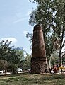 KosMinar.jpg 1 700 × 2 221; 1,34 MiB
-
 People travelling on the Grand Trunk Road by foot.jpg 1 072 × 794; 659 KiB
-
 Pottery wheel before 1910.jpg 768 × 548; 214 KiB
-
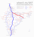 Renumbered National Highways map of India (Schematic) hilight 19 44.png 937 × 1 024; 580 KiB
-
 Travelling on the Grand Trunk Road, Riding a native TAT (Pony).jpg 1 036 × 798; 620 KiB


_hilight_19_44.png)
.jpg)