Category:Grande Ronde River
Jump to navigation
Jump to search
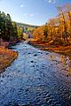
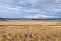
English: The Grande Ronde River is a tributary of the Snake River, long, in northeastern Oregon and southeastern Washington in the United States. It drains an area southeast of the Blue Mountains, and northwest of the Wallowa Mountains, on the Columbia Plateau. It flows through the agricultural Grande Ronde Valley in its middle course and through a series of scenic canyons in its lower course.
Français : La Grande Ronde (Grande Ronde River) est une rivière dans les États de Washington et de l'Oregon aux États-Unis. Prenant sa source dans les Montagnes Bleues, elle se jette dans la Snake, un affluent du fleuve Columbia.
river in Asotin County, Washington and Wallowa and Union counties in Oregon in the United States  | |||||
| Upload media | |||||
| Instance of | |||||
|---|---|---|---|---|---|
| Located in protected area |
| ||||
| Location |
| ||||
| Length |
| ||||
| Elevation above sea level |
| ||||
| Mouth of the watercourse | |||||
| Drainage basin | |||||
| Tributary |
| ||||
 | |||||
Subcategories
This category has the following 4 subcategories, out of 4 total.
Media in category "Grande Ronde River"
The following 93 files are in this category, out of 93 total.
-
 02-23-02, grande ronde river - panoramio.jpg 2,065 × 1,400; 2.5 MB
-
 02-41-21, bridge over grande ronde river - panoramio.jpg 2,078 × 1,400; 2.25 MB
-
 02-41-22, grande ronde river - panoramio.jpg 2,075 × 1,400; 1.65 MB
-
 03-42-05, grande ronde river - panoramio.jpg 2,060 × 1,400; 1.85 MB
-
 03-57-11, grande ronde river - panoramio.jpg 2,048 × 1,394; 1.95 MB
-
 04-35-23-river.jpg 2,048 × 1,374; 1.83 MB
-
 04-35-24-river.jpg 2,048 × 1,376; 1.78 MB
-
 Grande Ronde at Hilgard Rec.JPG 1,197 × 1,498; 1.14 MB
-
 Grande Ronde at Hilgard.JPG 647 × 467; 187 KB
-
 Grande Ronde Dip.jpg 1,818 × 1,228; 939 KB
-
 Grande Ronde River (10489260305).jpg 2,048 × 1,536; 1.06 MB
-
 Grande Ronde River (10489269144).jpg 2,048 × 1,536; 1.05 MB
-
 Grande Ronde River (10489269885).jpg 2,048 × 1,536; 1.24 MB
-
 Grande Ronde River (10489271735).jpg 2,048 × 1,536; 1.21 MB
-
 Grande Ronde River (10489272494).jpg 2,048 × 1,536; 1.06 MB
-
 Grande Ronde River (10489275366).jpg 2,048 × 1,536; 1.09 MB
-
 Grande Ronde River (10489275644).jpg 2,048 × 1,536; 1.2 MB
-
-

-

-

-

-

-

-

-

-

-

-

-

-

-
 Grande Ronde River 2.jpg 334 × 211; 32 KB
-
 Grande Ronde River aerial.jpg 2,552 × 1,912; 1.73 MB
-
 Grande Ronde River and Grande Ronde Basalt IMG 4536.jpg 3,888 × 2,592; 4.05 MB
-
 Grande Ronde River at Elgin.jpg 4,080 × 2,771; 8.14 MB
-
 Grande Ronde River Bridge. SR 129, Washington.JPG 4,320 × 3,240; 5.7 MB
-
 Grande ronde river map.png 1,400 × 1,362; 3.62 MB
-
 Grande Ronde River with Elkhorn Mountains-Umatilla (24852882394).jpg 4,368 × 2,912; 2.19 MB
-
 Grande Ronde River, Wallupa Road, Troy Road - DPLA - a7c4cf04d0d50f0e6df6e02a589e6dcc.jpg 1,335 × 2,000; 1.21 MB
-
 Grande Ronde River.jpg 471 × 342; 48 KB
-
 Grande Ronde River.JPG 479 × 599; 178 KB
-
 Grande Ronde Valley (908743118).jpg 1,200 × 1,800; 552 KB
-
 Grande ronde valley near elgin.jpg 4,288 × 2,848; 8.02 MB
-
 Grande Ronde Wild and Scenic River (33569174954).jpg 1,920 × 1,080; 851 KB
-
 Grande Ronde Wild and Scenic River (33569175014).jpg 1,920 × 1,080; 964 KB
-
 Grande Ronde Wild and Scenic River (33569175064).jpg 1,920 × 1,080; 888 KB
-
 Grande Ronde Wild and Scenic River (33569176534).jpg 1,920 × 1,080; 171 KB
-
 Grande Ronde Wild and Scenic River (34026114700).jpg 1,920 × 1,080; 181 KB
-
 Grande Ronde Wild and Scenic River (34156396144).jpg 5,184 × 3,456; 9.32 MB
-
 Grande Ronde Wild and Scenic River (34156399954).jpg 4,764 × 3,176; 8.78 MB
-
 Grande Ronde Wild and Scenic River (34156400964).jpg 3,862 × 3,080; 6.29 MB
-
 Grande Ronde Wild and Scenic River (34156404154).jpg 4,992 × 3,456; 9.31 MB
-
 Grande Ronde Wild and Scenic River (34156406784).jpg 5,184 × 3,456; 8.73 MB
-
 Grande Ronde Wild and Scenic River (34156410274).jpg 5,048 × 3,240; 9.79 MB
-
 Grande Ronde Wild and Scenic River (34156412524).jpg 5,184 × 3,456; 9.65 MB
-
 Grande Ronde Wild and Scenic River (34156414904).jpg 4,768 × 3,456; 8.62 MB
-
 Grande Ronde Wild and Scenic River (34156418014).jpg 5,184 × 3,456; 11.76 MB
-
 Grande Ronde Wild and Scenic River (34188997563).jpg 4,824 × 3,232; 8.06 MB
-
 Grande Ronde Wild and Scenic River (34188998223).jpg 4,304 × 3,192; 6.48 MB
-
 Grande Ronde Wild and Scenic River (34188999053).jpg 4,963 × 3,309; 8.6 MB
-
 Grande Ronde Wild and Scenic River (34188999583).jpg 5,184 × 3,456; 9.47 MB
-
 Grande Ronde Wild and Scenic River (34251768902).jpg 1,920 × 1,080; 929 KB
-
 Grande Ronde Wild and Scenic River (34251769022).jpg 1,920 × 1,080; 834 KB
-
 Grande Ronde Wild and Scenic River (34251769082).jpg 1,920 × 1,080; 894 KB
-
 Grande Ronde Wild and Scenic River (34251769112).jpg 1,920 × 1,080; 847 KB
-
 Grande Ronde Wild and Scenic River (34251769142).jpg 1,920 × 1,080; 796 KB
-
 Grande Ronde Wild and Scenic River (34251769192).jpg 1,920 × 1,080; 915 KB
-
 Grande Ronde Wild and Scenic River (34251778702).jpg 1,920 × 1,080; 1.02 MB
-
 Grande Ronde Wild and Scenic River (34369408216).jpg 1,920 × 1,080; 863 KB
-
 Grande Ronde Wild and Scenic River (34369411236).jpg 1,920 × 1,080; 171 KB
-
 Grande Ronde Wild and Scenic River (34410967835).jpg 1,920 × 1,080; 931 KB
-
 Grande Ronde Wild and Scenic River (34410967855).jpg 1,920 × 1,080; 926 KB
-
 Grande Ronde Wild and Scenic River (34410971085).jpg 1,920 × 1,080; 214 KB
-
 Grande Ronde Wild and Scenic River (34836101472).jpg 5,688 × 3,156; 11.65 MB
-
 Grande Ronde Wild and Scenic River (34867542501).jpg 3,264 × 2,274; 4.38 MB
-
 Grande Ronde Wild and Scenic River (34867543061).jpg 3,264 × 2,448; 3.63 MB
-
 Grande Ronde Wild and Scenic River (34867543901).jpg 2,682 × 1,980; 3.44 MB
-
 Grande Ronde Wild and Scenic River (34867555431).jpg 8,316 × 2,982; 15.13 MB
-
 Grande Ronde Wild and Scenic River (34959849796).jpg 4,731 × 3,154; 8.15 MB
-
 Grande Ronde Wild and Scenic River (34959860276).jpg 5,184 × 3,456; 9.69 MB
-
 Grande Ronde Wild and Scenic River (34959862156).jpg 5,184 × 3,456; 8.72 MB
-
 Grande Ronde Wild and Scenic River (34959863146).jpg 5,063 × 3,375; 9.44 MB
-
 Grande Ronde Wild and Scenic River (34959865736).jpg 3,075 × 2,306; 4.51 MB
-
 Grande Ronde Wild and Scenic River (35034497501).jpg 1,920 × 1,080; 266 KB
-
 Grande Ronde Wild and Scenic River (35034510631).jpg 1,920 × 1,080; 168 KB
-
 Grande Ronde Wild and Scenic River (35034519291).jpg 1,920 × 1,080; 247 KB
-
 Granderonderivermap.jpg 700 × 710; 249 KB
-
 Hilgard Jct Campground.JPG 479 × 599; 236 KB
-
 Intersate Bridge 2104.jpg 4,608 × 3,072; 2.92 MB
-
 NorthWest Oregon Rivers.svg 663 × 484; 22 KB
-
 River 2106.jpg 4,608 × 3,072; 4.13 MB
-
 Wallowa & Grande Ronde Rivers - final management plan-environmental assessment (IA wallowagranderon5745unit).pdf 1,510 × 1,258, 282 pages; 64.23 MB
-
 Water snake.JPG 599 × 480; 209 KB


.jpg)
.jpg)
.jpg)
.jpg)
.jpg)
.jpg)
.jpg)
_(uniD0009).jpg)
_(uniDA0116).jpg)
_(uniDA0117).jpg)
_(uniDA0120).jpg)
_(uniDA0121).jpg)
_(uniDA0124).jpg)
_(uniDB0481).jpg)
_(uniDB0534).jpg)
_(uniDB0535).jpg)
_(walDA0089).jpg)
_(walDA0091).jpg)
_(walDA0093).jpg)
_(walDA0094).jpg)
_(walDA0098).jpg)


.jpg)


.jpg)

.jpg)
.jpg)
.jpg)
.jpg)
.jpg)
.jpg)
.jpg)
.jpg)
.jpg)
.jpg)
.jpg)
.jpg)
.jpg)
.jpg)
.jpg)
.jpg)
.jpg)
.jpg)
.jpg)
.jpg)
.jpg)
.jpg)
.jpg)
.jpg)
.jpg)
.jpg)
.jpg)
.jpg)
.jpg)
.jpg)
.jpg)
.jpg)
.jpg)
.jpg)
.jpg)
.jpg)
.jpg)
.jpg)
.jpg)
.jpg)
.jpg)
.jpg)


.jpg)