Category:Rivers of Oregon
Jump to navigation
Jump to search
States of the United States: Alabama · Alaska · Arizona · Arkansas · California · Colorado · Connecticut · Delaware · Florida · Georgia · Hawaii · Idaho · Illinois · Indiana · Iowa · Kansas · Kentucky · Louisiana · Maine · Maryland · Massachusetts · Michigan · Minnesota · Mississippi · Missouri · Montana · Nebraska · Nevada · New Hampshire · New Jersey · New Mexico · New York · North Carolina · North Dakota · Ohio · Oklahoma · Oregon · Pennsylvania · Rhode Island · South Carolina · South Dakota · Tennessee · Texas · Utah · Vermont · Virginia · Washington · West Virginia · Wisconsin · Wyoming – Washington, D.C.
Guam · Puerto Rico
Guam · Puerto Rico
Wikimedia category | |||||
| Upload media | |||||
| Instance of | |||||
|---|---|---|---|---|---|
| Category combines topics | |||||
| Category contains | |||||
| Oregon | |||||
state of the United States of America     | |||||
| Pronunciation audio | |||||
| Instance of | |||||
| Part of | |||||
| Named after |
| ||||
| Location |
| ||||
| Located in or next to body of water | |||||
| Capital | |||||
| Legislative body | |||||
| Executive body | |||||
| Highest judicial authority | |||||
| Anthem | |||||
| Head of government |
| ||||
| Inception |
| ||||
| Highest point | |||||
| Population |
| ||||
| Area |
| ||||
| Elevation above sea level |
| ||||
| Different from | |||||
| Maximum temperature record |
| ||||
| Minimum temperature record |
| ||||
| official website | |||||
 | |||||
Subcategories
This category has the following 96 subcategories, out of 96 total.
*
- River banks in Oregon (2 F)
- Streambed boulders in Oregon (17 F)
+
.
- River name signs in Oregon (5 F)
A
B
- Blue River (Oregon) (6 F)
C
- Calapooia River (7 F)
- Collawash River Bridge (2 F)
- Coos River (1 F)
D
- D River (4 F)
- Donner und Blitzen River (48 F)
E
G
H
- Hood River (river) (10 F)
I
- Illinois River (Oregon) (1 P, 48 F)
- Imnaha River (7 F)
J
K
L
M
- Middle Fork John Day River (10 F)
N
- Necanicum River (12 F)
- Nestucca River (66 F)
- New River (Oregon) (14 F)
- North Fork John Day River (8 F)
O
P
- Powder River (Oregon) (42 F)
R
S
- Siltcoos River (9 F)
- Silvies River (7 F)
- Smith River (Umpqua River) (20 F)
- South Fork John Day River (79 F)
- South Fork Silver Creek (1 F)
- Sprague River (Oregon) (6 F)
T
U
W
- Wallowa River (49 F)
- Warm Springs River (2 F)
- Wheeler Creek (5 F)
Y
- Youngs River (6 F)
Media in category "Rivers of Oregon"
The following 181 files are in this category, out of 181 total.
-
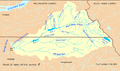
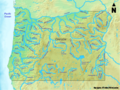 Oregon Rivers.png 1,500 × 1,125; 3.37 MB
-
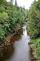
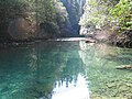
 "Passageway" channel 2.jpg 4,608 × 3,072; 6.54 MB
-
 "Passageway" channel.jpg 4,608 × 3,072; 6.15 MB
-
 069 Bull Run trolly trestle no date (35816052810).jpg 5,352 × 3,612; 8.93 MB
-
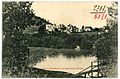
 08170-Roseburg, Ore.-1906-River Scene-Brück & Sohn Kunstverlag.jpg 1,491 × 1,000; 537 KB
-
 08171-Roseburg, Ore.-1906-Some Residence-Brück & Sohn Kunstverlag.jpg 1,526 × 1,000; 686 KB
-
 08173-Roseburg, Ore.-1906-Fording the River-Brück & Sohn Kunstverlag.jpg 1,500 × 1,000; 568 KB
-
 08175-Roseburg, Ore.-1906-A River Vista-Brück & Sohn Kunstverlag.jpg 1,000 × 1,554; 788 KB
-
 08212-Seaside, Ore.-1906-Beautiful Necanicum-Brück & Sohn Kunstverlag.jpg 1,519 × 1,000; 552 KB
-
 08304-Pendleton, Ore.-1906-Umatilla River Scene, Pendleton-Brück & Sohn Kunstverlag.jpg 1,514 × 1,000; 618 KB
-
 08305-Pendleton, Ore.-1906-Tepees on Umatilla Reservation-Brück & Sohn Kunstverlag.jpg 1,514 × 1,000; 506 KB
-
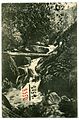
 08313-Hood River-1906-Dead Point Falls-Brück & Sohn Kunstverlag.jpg 1,000 × 1,514; 714 KB
-
 08318-Eugene, Ore.-1906-"The Alders"-Brück & Sohn Kunstverlag.jpg 1,523 × 1,000; 839 KB
-
 08319-Eugene, Ore.-1906-Canoeing on the Mill Race-Brück & Sohn Kunstverlag.jpg 1,514 × 1,000; 760 KB
-
 08325-Eugene, Ore.-1906-A Mill Race Vista-Brück & Sohn Kunstverlag.jpg 1,000 × 1,514; 793 KB
-
 08350-Ashland, Ore.-1906-Ashland Creek Canyon-Brück & Sohn Kunstverlag.jpg 1,000 × 1,516; 729 KB
-
 08363-Oregon-1906-Mammoth Log Raft on Columbia River-Brück & Sohn Kunstverlag.jpg 1,523 × 1,000; 543 KB
-
 Ana River habitat, Summer Lake, Oregon.jpg 500 × 375; 138 KB
-
 Ana River near Summer Lake, Oregon.jpg 500 × 375; 111 KB
-
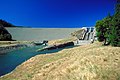 USACE Applegate Dam Oregon.jpg 1,500 × 1,001; 302 KB
-

-

-
 Bridge over Luckiamute River.JPG 2,592 × 3,872; 3.65 MB
-
 Bridge over the South Fork of the Siuslaw River in Cascadia State Park.jpg 4,752 × 3,168; 6.21 MB
-
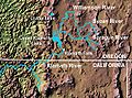
 Bull run river oregon watershed map.png 710 × 420; 64 KB
-
-

-
 Burnt River dam.jpg 350 × 230; 104 KB
-
 Burnt River, Oregon (14187132955).jpg 2,272 × 1,704; 3.62 MB
-
 Capsized cataraft Hood River.jpg 3,072 × 2,048; 2.41 MB
-
 Cascadia State Park, Oregon (39714062044).jpg 5,184 × 3,456; 6.85 MB
-
 Clearwater Falls, Oregon.jpg 2,328 × 2,912; 1.73 MB
-
 Cold Spring Creek at Mount Hood National Forest in Oregon 1.jpg 2,048 × 1,536; 2.67 MB
-
 Cold Spring Creek at Mount Hood National Forest in Oregon 2.jpg 2,048 × 1,536; 2.59 MB
-

-

-
 Columbia River Bar detail.jpg 1,289 × 1,032; 376 KB
-
 Columbia river bar.jpg 674 × 496; 152 KB
-
 Columbia River Mouth and Bar.jpg 3,957 × 2,557; 4.04 MB
-
 Coos Bay Restore Salmon Habitat (8095170169).jpg 1,800 × 1,350; 991 KB
-
 Coquille river falls.jpg 1,182 × 788; 344 KB
-
 Crooked River (Crook County, Oregon scenic images) (croDA0174).jpg 324 × 488; 35 KB
-
 Dodge Park (Oregon).jpg 2,048 × 1,121; 1.66 MB
-
 Dry Creek waterfall.jpg 4,608 × 3,456; 7.79 MB
-
 East Fork Humbug Creek (6954872565).jpg 8,190 × 5,460; 15.89 MB
-
 East fork millicoma river.jpg 4,288 × 2,848; 10.11 MB
-

-

-

-
 Fall River on South Century Drive near Bend, Oregon (3226189181).jpg 4,284 × 2,705; 6.48 MB
-
 Fall River winter, Oregon.jpg 640 × 584; 199 KB
-
 Fall River, Deschutes County, OR.jpg 640 × 480; 115 KB
-
 Fallen trees across river above Multnomah Falls.JPG 4,272 × 2,848; 2.39 MB
-
 Falls on South Umpqua, Umpqua Forest, Oregon, 1922 - NARA - 299209.jpg 2,170 × 3,000; 2.61 MB
-
 Fish wheel on river, Oregon, between 1894 and 1904 (AL+CA 2613).jpg 768 × 460; 60 KB
-
 Fish6528 - Flickr - NOAA Photo Library.jpg 3,848 × 2,636; 5.98 MB
-
 Fly Fishing (Klamath County, Oregon scenic images) (klaDA0075a).jpg 488 × 324; 41 KB
-
 Fremont NF ped bridge.jpg 768 × 512; 128 KB
-
 Fresh water, irridescent green, pale wildflowers.JPG 3,240 × 4,320; 4.76 MB
-
 Greenery~.JPG 4,320 × 3,240; 7.56 MB
-
 Harris-Park-South-Fork-WW-9.JPG 1,488 × 1,984; 701 KB
-
 High Cascades Metz (23691101141).jpg 3,264 × 1,836; 2.53 MB
-
 Hood River scenic near Oregon 35 by Chris Harris (8272121531).jpg 1,840 × 3,264; 2.21 MB
-
 Irrigation flume, Deschutes River in Central Oregon (3226145949).jpg 3,664 × 2,648; 4.53 MB
-
 Kpho 1.jpg 1,200 × 900; 164 KB
-
-
 Little Applegate River bw.jpg 380 × 535; 49 KB
-
 Little Luckiamute River in 2010.jpg 5,616 × 3,744; 18.28 MB
-
 Little North Santiam River Trail - Marshburn (25973700684).jpg 1,280 × 960; 1.55 MB
-
 Little Sandy River (Oregon).jpg 640 × 454; 99 KB
-

-

-
 Long creek Oregon.jpg 2,100 × 1,410; 190 KB
-
 Long Tom and Willamette Rivers during 1964 Christmas flood.jpg 720 × 526; 162 KB
-

-
-

-
 Looking up Cow Creek Canon Postcard (3227034536).jpg 4,170 × 2,685; 11.39 MB
-
 Lost River (Klamath County, Oregon scenic images) (klaDA0056).jpg 324 × 488; 36 KB
-
 Lost River (Klamath County, Oregon scenic images) (klaDA0057).jpg 488 × 324; 37 KB
-

-
 Lostine River at Lostine.jpg 4,288 × 2,848; 8.74 MB
-
 Lostine River valley.jpg 2,123 × 1,400; 2.33 MB
-
 Lower Kilchis River.jpg 3,725 × 2,483; 5.89 MB
-
 Lower tillamook river.jpg 4,288 × 2,848; 8.92 MB
-
 Luckiamute River at Helmick.JPG 3,872 × 2,276; 3.35 MB
-
 Man climbing toward rock in river (3945319149).jpg 2,367 × 1,865; 316 KB
-
 Maury Geography 071A fish wheel.jpg 966 × 703; 128 KB
-
 McDowell Creek Falls trail, Oregon - Flickr - Bonnie Moreland (free images).jpg 5,202 × 3,464; 18.69 MB
-
 Miami river oregon.jpg 4,288 × 2,848; 8.04 MB
-
-
 Millicoma river.jpg 4,288 × 2,848; 10.13 MB
-
 Minam River near confluence with Wallowa River IMG 4501.jpg 3,888 × 2,592; 5.62 MB
-
 Mohawk River.jpg 4,530 × 3,020; 8.62 MB
-
 Mt Pisgah view.jpg 1,656 × 1,242; 307 KB
-
 Necanicum River bridge at Seaside - Oregon.JPG 3,594 × 2,301; 2.68 MB
-
 Necanicum River looking south at Seaside - Oregon.JPG 3,171 × 2,277; 2.36 MB
-
 Nestucca River BLM.jpg 1,955 × 1,330; 607 KB
-
 North Fork Alsea River at Clemens Park.JPG 4,608 × 3,456; 3.21 MB
-
 North Fork Smith River.jpg 668 × 494; 142 KB
-
 North Fork Umatilla River, Oregon.jpg 467 × 350; 38 KB
-
 Northern Pistol River State Scenic Viewpoint.JPG 3,872 × 2,592; 5.6 MB
-
 NRCSOR00004 - Oregon (5707)(NRCS Photo Gallery).jpg 2,100 × 1,500; 4.54 MB
-
 NRCSOR00004 - Oregon (5707)(NRCS Photo Gallery).tif 2,100 × 1,500; 12.02 MB
-
 NRCSOR00004(19468)(NRCS Photo Gallery).jpg 2,100 × 1,500; 273 KB
-
 OregonCoastRangeRivers.png 410 × 1,056; 92 KB
-

-
 Portland river water.jpg 1,000 × 750; 120 KB
-
 Prineville Banner.jpg 2,416 × 345; 810 KB
-
 PrinevilleOregonPano1.jpg 2,961 × 891; 1.77 MB
-
 Pudding river near aurora.jpg 2,048 × 1,360; 1.23 MB
-
 Pudding River.jpg 500 × 359; 181 KB
-
 Report of the Oregon Conservation Commission to the Governor (1908 - 1914).djvu 680 × 937, 506 pages; 7.81 MB
-
 Riparian zone by Willamette River.jpg 1,024 × 768; 423 KB
-
 River above Multnomah Falls.JPG 4,272 × 2,848; 2.97 MB
-
 Rogue river (south yamhill river).jpg 4,288 × 2,848; 10.07 MB
-
-
 Rogue-Umpqua Scenic Byway - Whistler's Bend Park - NARA - 7721405.jpg 2,560 × 1,920; 1.98 MB
-
 ROTC on bridge near Corvallis, Oregon (3387333433).jpg 3,696 × 2,605; 890 KB
-
 Rustic bridge in Silver Creek Falls Park (6478862359).jpg 1,621 × 2,000; 1.05 MB
-
 Salmon Falls, Little North Santiam River - DPLA - 1dc66eab4c4cbadd28f283dc2a8e3c31.jpg 2,000 × 1,335; 717 KB
-
 Salmon Falls, Little North Santiam River - DPLA - 2a50202023fb0c5b9bad908213ac4183.jpg 2,000 × 1,335; 1.31 MB
-
 Salmon Falls, Little North Santiam River - DPLA - 3266bbe23e33c8676c1238f907718730.jpg 2,000 × 1,335; 1.25 MB
-
 Salmon Falls, Little North Santiam River - DPLA - 3ab712e6484700c314bde6bcaf3ea6ce.jpg 2,000 × 1,335; 1.24 MB
-
 Salmon Falls, Little North Santiam River - DPLA - 3d8e905230e3ec9fe6f2138dbdb1349c.jpg 1,335 × 2,000; 1.05 MB
-
 Salmon Falls, Little North Santiam River - DPLA - 99ffa8d7a5de69bed4ce5b87d831d5f7.jpg 2,000 × 1,335; 759 KB
-
 Salmon Falls, Little North Santiam River - DPLA - a3cc13fb572d0ffe46537a8f59bb911b.jpg 2,000 × 1,335; 840 KB
-
 Salmon Falls, Little North Santiam River - DPLA - acc83c0a96d9180b1c33ab06598d9bcf.jpg 2,000 × 1,335; 825 KB
-
 Salmon Falls, Little North Santiam River - DPLA - b4f9081e6b43fddf86f6fb4e892bc06b.jpg 2,000 × 1,335; 725 KB
-
 Salmon Falls, Little North Santiam River - DPLA - c9b827e668c9e57a0bfda20774f24568.jpg 1,335 × 2,000; 978 KB
-
 Salmon Falls, Little North Santiam River - DPLA - c9d5639abacb13a039608d248dbc7fa9.jpg 2,000 × 1,335; 846 KB
-
 Salmon River Oregon - panoramio.jpg 3,264 × 2,448; 3 MB
-
 Salmonberry River (Oregon).jpg 1,600 × 1,063; 572 KB
-
 Salmonberry River and POTB line.jpg 2,048 × 1,370; 645 KB
-
 Salmonriver.jpg 1,280 × 960; 321 KB
-
 Santiam River at I-5.JPG 3,048 × 2,004; 2.72 MB
-
 Seaside Convention Center and marina - Oregon.JPG 3,249 × 1,641; 2.1 MB
-
-
 Siletz River (Lincoln County, Oregon scenic images) (lincDA0071).jpg 324 × 488; 31 KB
-
 Siletzbay.jpg 1,632 × 1,224; 732 KB
-
 Silvies River and levee (5600666139).jpg 640 × 480; 79 KB
-
 Soda Creek and Broken Top-Deschutes (23566496039).jpg 2,284 × 1,529; 3.5 MB
-
 Somewhere in Oregon (23212244322).jpg 2,472 × 1,655; 741 KB
-
 South fork crooked river.jpg 4,288 × 2,848; 9.25 MB
-
 South-Fork-WW.JPG 1,488 × 1,984; 710 KB
-
 Southwest Oregon rivers map.jpg 300 × 200; 40 KB
-
 Spring willows (8644092053).jpg 2,121 × 1,414; 3.05 MB
-

-
 Sycan Marsh.jpg 2,454 × 1,563; 1.47 MB
-
 The American angler (Page (2), Photograph- landscape) BHL13118152.jpg 3,584 × 2,546; 1.58 MB
-
-
 Tillamook Banner.jpg 4,281 × 612; 2.38 MB
-
 Train approaching Mohler on the Nahalem River, Oregon (3230009514).jpg 4,298 × 2,708; 12.75 MB
-

-
 Two Men Boating on the Santiam River (7839715286).jpg 3,152 × 1,985; 1.17 MB
-
 Upper alsea bay.jpg 4,288 × 2,848; 3.1 MB
-
 Upper Klamath national park.jpg 2,100 × 1,380; 142 KB
-
 Upperklamathlake.jpg 1,500 × 1,200; 204 KB
-
 USA 001077 - Oregón (3848394347).jpg 3,264 × 2,448; 1.38 MB
-
 USACE Detroit Dam Oregon.jpg 1,500 × 977; 1.14 MB
-
 USACE Tillamook Bay Oregon.jpg 1,500 × 990; 360 KB
-
 USFWS nestucca sedge (23741914322).jpg 1,024 × 683; 187 KB
-
 USGS Oregon river basins.png 1,849 × 1,501; 642 KB
-
 Usgs rogue river watershed map.png 1,624 × 1,286; 314 KB
-
 View of the Molalla River from walking trail, of Molalla River State Park, Oregon.jpg 2,560 × 1,920; 2.37 MB
-
 Wallowa River (Wallowa County, Oregon scenic images) (walDA0052).jpg 324 × 488; 60 KB
-

-
 Welches2.JPG 3,648 × 2,736; 5 MB
-
 Wenaha river map.png 1,741 × 1,342; 3.35 MB
-
 Wenaha River, USFS.jpg 1,536 × 2,048; 1.01 MB
-
 West fork millicoma river.jpg 2,848 × 4,288; 9.14 MB
-
 Wildwood underground viewing chamber P1588.jpeg 2,423 × 1,729; 1.25 MB
-
 Williams River, tributary to South Fork Coos River.jpg 1,538 × 1,755; 1.64 MB
-
 Williamson River OR.JPG 3,472 × 2,604; 1.64 MB
-
 Williamson River, Oregon.jpg 3,264 × 2,448; 1.96 MB
-
 Williamson River.jpg 1,932 × 2,576; 782 KB
-
 Winchuck River.jpg 400 × 300; 90 KB
-
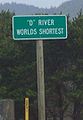 Worlds shortest river small.jpg 185 × 268; 9 KB
-
 Wpdms shdrlfi020l smith river oregon.jpg 300 × 200; 35 KB
-
 Wpdms shdrlfi020l sprague river.jpg 300 × 222; 45 KB
-
 Yakso Falls, Oregon.jpg 480 × 640; 71 KB


.jpg)


.jpg)
.jpg)


_(bakDA0049a).jpg)
_(bakDA0050a).jpg)

.jpg)

.jpg)


_near_Seneca,_Oregon_(13843616315).jpg)
_near_Seneca,_Oregon_(13843622165).jpg)


.jpg)

_(croDA0174).jpg)
.jpg)

.jpg)


.jpg)
.jpg)


.jpg)

_(klaDA0075a).jpg)


.jpg)
.jpg)
.jpg)

.jpg)


.jpg)
.jpg)
.jpeg)
.jpeg)


.jpg)
.jpg)
.jpg)
.jpg)
_(klaDA0056).jpg)
_(klaDA0057).jpg)
_(klaDA0058).jpg)


.jpg)

.jpg)

.jpg)


(NRCS_Photo_Gallery).jpg)
(NRCS_Photo_Gallery).jpg)
.jpg)


.jpg)
.jpg)

.jpg)
.jpg)


.jpg)


_(lincDA0071).jpg)

.jpg)
.jpg)
.jpg)


.jpg)
.jpg)

,_Photograph-_landscape)_BHL13118152.jpg)
.jpg)
.jpg)
.jpg)
.jpg)


.jpg)


.jpg)


_(walDA0052).jpg)
_(wascD0037).jpg)


