Category:Grange Road, Birkenhead
Jump to navigation
Jump to search
| Object location | | View all coordinates using: OpenStreetMap |
|---|
Mostly converted into a pedestrianised shopping precinct, although short sections remain for vehicles at each end.
Subcategories
This category has only the following subcategory.
G
Media in category "Grange Road, Birkenhead"
The following 20 files are in this category, out of 20 total.
-
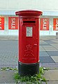 Post box at the Garrick Snug, Birkenhead.jpg 3,252 × 4,710; 7.02 MB
-
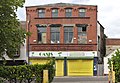 Corkhill and Job warehouse.jpg 4,952 × 3,442; 19.37 MB
-
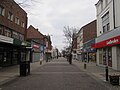 Grange Road, Birkenhead - 2013-02-24.JPG 4,320 × 3,240; 3.04 MB
-
 Grange Road, Birkenhead 1.JPG 3,648 × 2,736; 3.6 MB
-
 Grange Road, Birkenhead 2.JPG 3,648 × 2,736; 3.52 MB
-
 Grange Road, Birkenhead 3.JPG 3,648 × 2,736; 3.58 MB
-
 Grange Road, Birkenhead 4.JPG 3,648 × 2,736; 3.45 MB
-
 Grange Road, Birkenhead 5.JPG 3,648 × 2,736; 3.49 MB
-
 Grange Road, Birkenhead 6.JPG 3,648 × 2,736; 3.52 MB
-
 Grange Road, Birkenhead 7.JPG 3,648 × 2,736; 3.51 MB
-
 Grange Road, Birkenhead 8.JPG 3,648 × 2,736; 3.54 MB
-
 Grange Road, Birkenhead on a Sunday morning (1).JPG 4,608 × 3,456; 3.43 MB
-
 Grange Road, Birkenhead on a Sunday morning (2).JPG 3,456 × 4,608; 3.34 MB
-
 Grange Road, Birkenhead on a Sunday morning (3).JPG 4,608 × 3,456; 3.37 MB
-
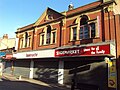
 HMV store, Birkenhead.JPG 4,320 × 3,240; 3.32 MB
-
 HMV store, Grange Road, Birkenhead (1).JPG 4,608 × 3,456; 3.39 MB
-
 HMV store, Grange Road, Birkenhead (2).JPG 4,608 × 3,456; 3.28 MB
-
 House of Fraser, Birkenhead (1).JPG 4,608 × 3,456; 3.34 MB
-
 House of Fraser, Birkenhead (2).JPG 4,608 × 3,456; 3.5 MB
-
 House of Fraser, Birkenhead (3).JPG 4,608 × 3,456; 3.39 MB


.JPG)
.JPG)
.JPG)

.JPG)
.JPG)
.JPG)
.JPG)
.JPG)