Category:Grass paths in Essex
Jump to navigation
Jump to search
Ceremonial counties of England: Bedfordshire · Buckinghamshire · Cambridgeshire · Cheshire · Cornwall · Cumbria · Derbyshire · Devon · Dorset · Durham · East Riding of Yorkshire · East Sussex · Essex · Gloucestershire · Greater London · Hampshire · Herefordshire · Hertfordshire · Isle of Wight · Kent · Lancashire · Leicestershire · Lincolnshire · Norfolk · North Yorkshire · Northamptonshire · Northumberland · Nottinghamshire · Oxfordshire · Rutland · Shropshire · Somerset · South Yorkshire · Staffordshire · Suffolk · Surrey · Warwickshire · West Sussex · West Yorkshire · Wiltshire · Worcestershire
City-counties:
Former historic counties:
Other former counties:
City-counties:
Former historic counties:
Other former counties:
Media in category "Grass paths in Essex"
The following 124 files are in this category, out of 124 total.
-
 'Sophora japonica' Feeringbury Manor garden, Feering Essex England 2.jpg 5,472 × 3,648; 24.37 MB
-
 Moyns Park Essex Lupines and Poppies in Gardens old and new 1900 - colorized.jpg 1,341 × 908; 1.78 MB
-
 Moyns Park Essex The Bowling Green in Gardens old and new 1900 - colorized.jpg 1,406 × 917; 1.82 MB
-
 Moyns Park Essex The Fish-pond in Gardens old and new 1900 - colorized.jpg 1,278 × 861; 1.29 MB
-
-
 Moyns Park Essex The South Walk in Gardens old and new 1900 - colorized.jpg 958 × 682; 1.03 MB
-
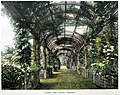 The North Pergola Easton Lodge in Gardens Old & New Vol 3 MG2GO AI.jpg 973 × 774; 484 KB
-

-
 19th century cottages by Beachet Wood - geograph.org.uk - 775957.jpg 640 × 480; 81 KB
-
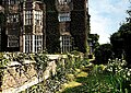
 Church of Ss Mary & Lawrence - churchyard east cottage from west.JPG 5,472 × 3,648; 11.96 MB
-
 Country desire path at Woodland Trust wood Theydon Bois Essex England.JPG 3,648 × 4,677; 10.48 MB
-
 Double gate to field in Hatfield Broad Oak, Essex, England.jpg 3,500 × 2,333; 8.8 MB
-
 Grass path in a field at Hatfield Broad Oak, Essex, England.jpg 2,333 × 3,500; 7.3 MB
-
 Pincey Brook footpath east off Church Lane, Sheering, Essex, England 01.jpg 2,333 × 3,500; 10.06 MB
-
 Pincey Brook footpath east off Church Lane, Sheering, Essex, England 02.jpg 3,500 × 2,333; 10.5 MB
-
 Pincey Brook footpath off Matching Road, Hatfield Heath, Essex, England.jpg 3,500 × 2,333; 10.56 MB
-
 RHS Garden Hyde Hall, Essex, England ~ Rose Garden 01.jpg 3,500 × 2,333; 10.02 MB
-
 RHS Garden Hyde Hall, Essex, England ~ Rose Garden 02.jpg 3,500 × 2,333; 7.94 MB
-
 RHS Garden Hyde Hall, Essex, England ~ Rose Garden 03.jpg 3,500 × 2,333; 9.2 MB
-
 RHS Garden Hyde Hall, Essex, England ~ grass path through daffodils.jpg 3,500 × 2,333; 9.91 MB
-
 St Mary's Church, Stapleford Tawney, Essex, England ~ nave west wall.jpg 2,333 × 3,500; 8.58 MB
-
 Matching Pond fishing lake embankment path at Matching, Essex, England.jpg 3,000 × 2,250; 7.73 MB
-
 Garden path through meadow at Boreham, Essex, England 1.jpg 2,333 × 3,500; 8.56 MB
-
 Garden path through meadow at Boreham, Essex, England 2.jpg 2,333 × 3,500; 8.85 MB
-
 Garden path through meadow at Boreham, Essex, England 3.jpg 2,333 × 3,500; 8.33 MB
-
 Garden grass path at Boreham, Essex, England 1.jpg 2,333 × 3,500; 7.13 MB
-
 Garden grass path at Boreham, Essex, England 2.jpg 2,333 × 3,500; 7.48 MB
-
 Garden grass path at Boreham, Essex, England 3.jpg 2,333 × 3,500; 7.72 MB
-
 Garden grass path at Boreham, Essex, England 4.jpg 2,333 × 3,500; 9.26 MB
-
 Garden grass path at Boreham, Essex, England 5.jpg 2,333 × 3,500; 9.19 MB
-
 Garden grass path at Boreham, Essex, England 6.jpg 2,333 × 3,500; 9.02 MB
-
 Boundary gate and fence.jpg 2,333 × 3,500; 9.82 MB
-
 Easton Lodge Gardens, Little Easton, Essex, England ~ garden path.jpg 3,648 × 5,472; 29.24 MB
-
 Easton Lodge Gardens, Little Easton, Essex - trees and shrubs.jpg 4,160 × 5,547; 21.55 MB
-
 Yew hedge avenue Easton Lodge Gardens, Little Easton, Essex, England looking northeast 01.jpg 6,240 × 4,160; 25.19 MB
-
 Yew hedge avenue Easton Lodge Gardens, Little Easton, Essex, England looking northeast 02.jpg 4,160 × 6,240; 25.86 MB
-
 Grass path across Hatfield Heath village green, Essex, England.jpg 3,456 × 4,608; 14.89 MB
-
 Churchyard crosses at St Mary the Virgin's Church, Aythorpe Roding, Essex, England.jpg 6,088 × 4,058; 14.45 MB
-
 Blocked public footpath to All Saints Church, Berners Roding, Essex, England 01.jpg 6,240 × 4,160; 23.72 MB
-
 Blocked public footpath to All Saints Church, Berners Roding, Essex, England 02.jpg 4,160 × 6,240; 21.23 MB
-
 Copped Hall path avenue, Epping, Essex, England 1 - winter.jpg 3,962 × 5,943; 27.17 MB
-
 Copped Hall kitchen walled garden, Essex, England 1.jpg 6,240 × 4,160; 31.04 MB
-
 Copped Hall kitchen walled garden, Essex, England 2.jpg 6,240 × 4,160; 33.58 MB
-
 Copped Hall kitchen walled garden, Essex, England 3.jpg 3,577 × 5,365; 21.79 MB
-
 Copped Hall kitchen walled garden, Essex, England 4.jpg 3,538 × 4,718; 19.71 MB
-
 Copped Hall kitchen walled garden, Essex, England 5.jpg 6,240 × 4,160; 27 MB
-
 Avenue path Copped Hall Garden, Epping, Essex, England 1.jpg 4,160 × 6,240; 24.87 MB
-
 Copped Hall path avenue, Epping, Essex, England 2 - summer.jpg 4,160 × 5,547; 19.25 MB
-
 Copped Hall kitchen walled garden, Essex, England 6.jpg 6,154 × 3,462; 21.53 MB
-
 Greenhouses Copped Hall kitchen walled garden, Essex, England.jpg 6,240 × 4,160; 27.21 MB
-
 Flower border Copped Hall Kitchen Garden, Epping, Essex, England 2.jpg 6,240 × 4,160; 23.19 MB
-
 Copped Hall kitchen walled garden, Essex, England 7.jpg 4,160 × 6,240; 20.74 MB
-
 Copped Hall kitchen walled garden, Essex, England 8.jpg 6,240 × 4,160; 23.45 MB
-
 Copped Hall kitchen walled garden, Essex, England 9.jpg 4,160 × 6,240; 27.07 MB
-
 The Glade in Easton Lodge Gardens, Little Easton, Essex, England 01.jpg 5,988 × 3,992; 33.84 MB
-
 The Glade in Easton Lodge Gardens, Little Easton, Essex, England 02.jpg 6,039 × 4,026; 35.13 MB
-
 Paycocke's House and Garden, Coggeshall, lawn path, Essex, England.jpg 4,160 × 6,240; 39.41 MB
-
 Paycocke's House and Garden, Coggeshall, pink rose, Essex, England 01.jpg 3,719 × 3,719; 10.71 MB
-
 A Hatfield Plain - geograph.org.uk - 2149528.jpg 429 × 640; 86 KB
-
 A lane at the west of High Beech, Essex, England.jpg 5,472 × 3,648; 16.75 MB
-
 Approaching the folly - geograph.org.uk - 1000686.jpg 640 × 480; 108 KB
-
 Back garden gate Clavering Essex England.jpg 5,472 × 3,648; 16.14 MB
-
 Betts Lane cottage 02 at Nazeing, Essex, England.JPG 5,472 × 3,648; 13.33 MB
-
 Betts Lane cottage 07 at Nazeing, Essex, England.JPG 5,371 × 3,524; 13.1 MB
-
 Bridleway by Poplars Shaw - geograph.org.uk - 3534750.jpg 640 × 480; 156 KB
-
 Bridleway near Henham - geograph.org.uk - 536123.jpg 426 × 640; 120 KB
-
 Bridleway near New Barn Hall, Holders Green - geograph.org.uk - 3595287.jpg 3,648 × 2,736; 4.89 MB
-
 Bridleway Quendon Essex England 2.jpg 3,648 × 4,560; 29.32 MB
-
 Bridleway to Brazenhead Farm - geograph.org.uk - 3593565.jpg 640 × 424; 56 KB
-
 Bridleway to Bustard Green - geograph.org.uk - 3593614.jpg 640 × 424; 96 KB
-
 Bridleway to Duck End Farm, Lindsell - geograph.org.uk - 3595293.jpg 3,648 × 2,736; 4.66 MB
-
 Bridleway to Housham Hall - geograph.org.uk - 3535752.jpg 640 × 480; 185 KB
-
 Bridleway to New Barn Farm - geograph.org.uk - 3593612.jpg 424 × 640; 88 KB
-
 Buttercup sward and grass path in Hatfield Forest Essex England 1.jpg 3,000 × 2,000; 6.21 MB
-
 Buttercup sward and grass walk in Hatfield Forest Essex England 2.jpg 3,000 × 2,000; 5.63 MB
-
 Buttercup sward and grass walk in Hatfield Forest Essex England.jpg 3,000 × 2,000; 7.32 MB
-
 By-way near Rye Hill - geograph.org.uk - 1300159.jpg 640 × 480; 88 KB
-
 Byway Near Calthorpes Farm - geograph.org.uk - 564493.jpg 640 × 432; 111 KB
-
 Colliersley Wood, Gestingthorpe (geograph 2540401).jpg 1,600 × 1,067; 368 KB
-
 Copped Hall pound.jpg 640 × 480; 110 KB
-
 Country desire vehicle route for Woodland Trust wood Theydon Bois Essex England.JPG 5,364 × 2,826; 10.59 MB
-
 Dead tree - geograph.org.uk - 1000711.jpg 480 × 640; 66 KB
-
 Feeringbury Manor flower herbaceous shrub border, Feering Essex England 1.jpg 5,472 × 3,648; 26.43 MB
-
 Feeringbury Manor flower herbaceous shrub border, Feering Essex England 2.jpg 5,472 × 3,648; 27.57 MB
-
 Feeringbury Manor flower herbaceous shrub border, Feering Essex England 7.jpg 5,472 × 3,648; 34.86 MB
-
 Feeringbury Manor flowering prunus, Feering Essex England 04.jpg 2,250 × 3,000; 6.69 MB
-
 Feeringbury Manor garden path and gazebo, Feering Essex England.jpg 3,000 × 1,999; 6.88 MB
-
 Feeringbury Manor garden path from gazebo, Feering Essex England.jpg 3,000 × 2,000; 6.45 MB
-
 Feeringbury Manor garden path gazebo, Feering Essex England.jpg 4,761 × 3,571; 24.4 MB
-
 Feeringbury Manor grass path and tulips, Feering Essex England.jpg 3,000 × 2,000; 7 MB
-
 Feeringbury Manor grass path with tulip verge, Feering Essex England.jpg 2,000 × 3,000; 6.11 MB
-
 Feeringbury Manor grass path with tulip verges, Feering Essex England.jpg 2,000 × 3,000; 7.57 MB
-
 Feeringbury Manor lawn path, Feering Essex England.jpg 5,472 × 3,648; 30.19 MB
-

-
 Footpath Near Bury Spring - geograph.org.uk - 515601.jpg 640 × 426; 159 KB
-
 Footpath north from Hatfield Broad Oak - geograph.org.uk - 4302558.jpg 640 × 480; 126 KB
-
 Footpath Off Old Road (geograph 4651297).jpg 1,024 × 768; 258 KB
-
 Footpath on arable field boundary, Gestingthorpe (geograph 4979558).jpg 3,648 × 2,432; 3.6 MB
-
 Footpath to Belchamp Otten (geograph 1994445).jpg 427 × 640; 83 KB
-
 Footpath to Belchamp Otten - geograph.org.uk - 580843.jpg 640 × 427; 87 KB
-
 Footpath to Green Lane - geograph.org.uk - 161908.jpg 640 × 426; 106 KB
-
 Footpath to Lambourne End - geograph.org.uk - 413347.jpg 640 × 480; 153 KB
-
 Footpath to Meesden. - geograph.org.uk - 700221.jpg 640 × 480; 72 KB
-
 Footpath to Norton Hall - geograph.org.uk - 128100.jpg 480 × 640; 66 KB
-

-
 Gibberd Garden woodland path Harlow Essex England 01.jpg 6,240 × 4,160; 37.19 MB
-
 Grass field and gate near Cutler's Green - geograph.org.uk - 494230.jpg 640 × 480; 151 KB
-
 Harcamlow Way - geograph.org.uk - 846090.jpg 640 × 427; 78 KB
-
 Harcamlow Way - geograph.org.uk - 957412.jpg 480 × 640; 73 KB
-
 Near Ravenstock Green Farm - geograph.org.uk - 1462806.jpg 640 × 428; 58 KB
-
 Path to Pointwell Mill - geograph.org.uk - 2884953.jpg 1,067 × 1,600; 620 KB
-

-
 Roper's Lane - geograph.org.uk - 700220.jpg 640 × 480; 90 KB
-
 The Essex Way 2 - geograph.org.uk - 1774228.jpg 1,600 × 1,064; 513 KB
-
 The Essex Way 62 (geograph 1904817).jpg 426 × 640; 114 KB
-

-
 Towards Brazenhead Farm - geograph.org.uk - 3593559.jpg 640 × 424; 60 KB
-
 Towards New Barn Farm - geograph.org.uk - 3593642.jpg 424 × 640; 115 KB
-
 Track from Shelley Common (geograph 3496071).jpg 640 × 480; 212 KB
-
 View along bridle path - geograph.org.uk - 503145.jpg 500 × 375; 141 KB
-
 Wheat near footpath to Bustard Green, Lindsell - geograph.org.uk - 3595259.jpg 3,648 × 2,736; 3.68 MB
-
 Willowherb and Bridleway - geograph.org.uk - 3593647.jpg 424 × 640; 83 KB
-
 Workhouse Lane - geograph.org.uk - 751222.jpg 640 × 426; 101 KB
-
 Triangulation Point at Nobles Green - geograph.org.uk - 119891.jpg 640 × 480; 125 KB


.jpg)


.jpg)


.jpg)
.jpg)
.jpg)


.jpg)


.jpg)


