Category:Gravesend
Zur Navigation springen
Zur Suche springen
Hafenstadt im Verwaltungsbezirk Kent, England  | |||||
| Medium hochladen | |||||
| Ist ein(e) | |||||
|---|---|---|---|---|---|
| Ort | Gravesham, Kent, Südostengland, England | ||||
| Liegt am oder im Gewässer | |||||
| Einwohnerzahl |
| ||||
| Fläche |
| ||||
 | |||||
Unterkategorien
Es werden 20 von insgesamt 20 Unterkategorien in dieser Kategorie angezeigt:
In Klammern die Anzahl der enthaltenen Kategorien (K), Seiten (S), Dateien (D)
B
- Gravesend Blockhouse (10 D)
C
G
- HMS Gordon (shore establishment) (21 D)
- Gravesend Clocktower (13 D)
- Gravesend Town Pier (20 D)
M
N
P
R
- RAF Gravesend (10 D)
S
- Shorne Wood Country Park (138 D)
T
- The Mug and Meeple (3 D)
Medien in der Kategorie „Gravesend“
Folgende 200 Dateien sind in dieser Kategorie, von 486 insgesamt.
(vorherige Seite) (nächste Seite)-

-

-
 'Arrival at Gravesend on Monday morning' Wellcome L0022196.jpg 1.636 × 1.180; 901 KB
-

-
 'Morgenster' passes Tilbury International Cruise Terminal - geograph.org.uk - 4156414.jpg 3.270 × 2.180; 5,03 MB
-
 'Symphorine' heads downriver - geograph.org.uk - 4150992.jpg 640 × 480; 74 KB
-
 'The World's End', Tilbury - geograph.org.uk - 2608976.jpg 1.024 × 768; 156 KB
-
 2011 Bentley Continental GTC.jpg 4.896 × 3.672; 6,98 MB
-
-
 466028 Passing Milton Range.jpg 3.264 × 2.448; 1,36 MB
-
 A Brace of Jetties - geograph.org.uk - 2408508.jpg 640 × 428; 82 KB
-
 A foggy Lower Higham Road, Chalk - geograph.org.uk - 6077133.jpg 1.024 × 684; 143 KB
-
 A Sikh wedding party at the Guru Nanak Darbar Gurdwara - geograph.org.uk - 5689030.jpg 3.609 × 2.706; 1,86 MB
-

-
 A view of Gravesend.-London - btv1b53010521p.jpg 5.284 × 3.356; 3,71 MB
-
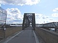
 Access bridge to the Tilbury Ferry - geograph.org.uk - 3789655.jpg 768 × 1.024; 237 KB
-

-
 Airport Plaque - geograph.org.uk - 145641.jpg 640 × 545; 88 KB
-
 Along the river bank from Tilbury Fort - geograph.org.uk - 6165491.jpg 1.024 × 683; 234 KB
-
 An Admiralty Yacht in crowded waters in a stiff breeze off Gravesend, by L De Man.jpg 1.829 × 1.338; 932 KB
-
 Anchor Cove 1 - Flickr - Lano Ling.jpg 2.797 × 1.554; 826 KB
-
 Anchor Cove, Gravesend (I).jpg 3.448 × 4.592; 18,82 MB
-
 Anchor Cove, Gravesend (II).jpg 4.592 × 3.448; 18,95 MB
-
 Anchor Cove, Gravesend (III).jpg 4.592 × 3.448; 19,36 MB
-
 Anti-aircraft gun at New Tavern Fort - geograph.org.uk - 5777381.jpg 4.000 × 3.000; 5,04 MB
-
 Apartment Building at Gravesend Marina - geograph.org.uk - 6254795.jpg 800 × 533; 456 KB
-

-
 Approaching Tilbury Fort from the west - geograph.org.uk - 6165466.jpg 1.024 × 683; 203 KB
-
 Arrival of the Royal Yacht at Gravesend ILN0-1889-0706-0005.jpeg 1.431 × 1.014; 1,19 MB
-
 Bank Street, Gravesend - geograph.org.uk - 1390510.jpg 640 × 480; 98 KB
-
 Bat and ball Gravesend cc - panoramio.jpg 8.336 × 2.504; 8,12 MB
-
 Beaumont Drive over A2260 Thames Way - geograph.org.uk - 1095946.jpg 481 × 640; 75 KB
-
 Between inner and outer moats, Tilbury Fort - geograph.org.uk - 6079802.jpg 1.024 × 768; 235 KB
-
 BF Fortaleza (IMO 9130432) River Thames 2020.jpg 5.000 × 3.340; 8,64 MB
-
 Bill Meroy Creek - geograph.org.uk - 6080019.jpg 1.024 × 768; 280 KB
-
 Bill Meroy Creek - inland part - geograph.org.uk - 6080034.jpg 1.024 × 768; 288 KB
-
 Bill Meroy Creek, Tilbury - geograph.org.uk - 4138750.jpg 3.488 × 2.616; 2,14 MB
-
 Black & White Swans on the River Thames, Gravesend, Kent (26956466402).jpg 7.238 × 3.279; 6,04 MB
-
 Blossom in Gordon Gardens at Riverside Leisure Area - geograph.org.uk - 5777470.jpg 4.000 × 3.000; 4,73 MB
-
 Blossom in Gordon Gardens at Riverside Leisure Area - geograph.org.uk - 5777478.jpg 4.000 × 3.000; 4,95 MB
-
 Borough Market, Gravesend - geograph.org.uk - 1390511.jpg 640 × 480; 89 KB
-
 Bridge below the Landport gate, Tilbury Fort - geograph.org.uk - 6165483.jpg 1.024 × 683; 224 KB
-
-
 Bridge to passenger ferry landing stage, Tilbury - geograph.org.uk - 3549863.jpg 810 × 1.200; 929 KB
-
 Bridge towards the Ferry Landing Stage, Tilbury - geograph.org.uk - 4138760.jpg 3.488 × 2.616; 2,31 MB
-
 Bridge, Ferry Landing Stage, Tilbury - geograph.org.uk - 5123225.jpg 3.125 × 2.345; 1,22 MB
-
 Bridge, Ferry Landing Stage, Tilbury - geograph.org.uk - 5123294.jpg 3.264 × 2.448; 1,42 MB
-
 Bulk carrier Nicholas, registered in Monrovia, departing for Gibraltar (48338372192).jpg 3.072 × 2.304; 1,29 MB
-
 Bus img 8183 (15576988674).jpg 3.072 × 2.304; 1,85 MB
-
 Bus img 8185 (16013306579).jpg 3.072 × 2.304; 1,74 MB
-
 Bus img 8192 (16197526301).jpg 2.613 × 1.960; 1,85 MB
-
 Bus img 8194 (15579586283).jpg 2.496 × 1.872; 1,75 MB
-
 Bus img 8195 (16011925868).jpg 2.420 × 1.815; 1,63 MB
-
 Bus img 8196 (16173566656).jpg 2.619 × 1.964; 2,71 MB
-
 Bus img 8197 (16013609367).jpg 2.469 × 1.852; 2,26 MB
-
 Bus img 8198 (16198596592).jpg 2.555 × 1.916; 2,57 MB
-
 Bus img 8201 (16012071550).jpg 2.581 × 1.936; 2,54 MB
-
 Bus img 8203 (16199415455).jpg 2.085 × 1.564; 1,68 MB
-
 Bus img 8205 (16199417235).jpg 2.368 × 1.776; 2,08 MB
-
 Bus img 8206 (16197546221).jpg 2.921 × 2.191; 3,14 MB
-
 Bus img 8207 (16013337029).jpg 3.072 × 2.304; 1,98 MB
-
 Bus img 8210 (16011948128).jpg 3.072 × 2.304; 2,11 MB
-
 Bus stop - geograph.org.uk - 879309.jpg 640 × 437; 92 KB
-
 Cannon on the parade ground, Tilbury Fort - geograph.org.uk - 6165486.jpg 1.024 × 683; 216 KB
-
 Cannons at the Southern End of the New Tavern Fort, Gravesend (04).jpg 3.136 × 4.255; 12,67 MB
-
 Car Dealer, Gravesend - geograph.org.uk - 1402783.jpg 640 × 480; 76 KB
-
 Car park (34842738721).jpg 4.000 × 3.000; 2,63 MB
-
 Car park (34934398906).jpg 4.000 × 3.000; 3,24 MB
-
 Car park at Tilbury Ferry Terminal - geograph.org.uk - 4290522.jpg 800 × 548; 56 KB
-
 Car park in Gravesend (34164270003).jpg 4.000 × 3.000; 2,18 MB
-
 Car park, Thong Lane Sports Ground - geograph.org.uk - 6232136.jpg 1.024 × 684; 270 KB
-
 StateLibQld 1 127655 Carlisle Castle (ship).jpg 1.000 × 696; 56 KB
-
 Grand Entrance to Gravesend Cemetery - geograph.org.uk - 1096043.jpg 640 × 481; 51 KB
-
 Centrans Lucky - geograph.org.uk - 2091807.jpg 800 × 531; 52 KB
-
 Chinese Takeaway Harmer Street - geograph.org.uk - 287444.jpg 640 × 480; 52 KB
-
 Clarendon Hotel, Gravesend - geograph.org.uk - 1390561.jpg 640 × 480; 100 KB
-
 Clarendon Road, Gravesend - geograph.org.uk - 1390579.jpg 640 × 480; 74 KB
-
 Clifton Marine Parade, Gravesend - geograph.org.uk - 601881.jpg 640 × 480; 59 KB
-
 Clive Road, Gravesend - geograph.org.uk - 5518499.jpg 3.264 × 2.448; 2,43 MB
-

-
 Clubbs Jetty - geograph.org.uk - 6254814.jpg 800 × 533; 554 KB
-
 Coal Crane - geograph.org.uk - 2408513.jpg 640 × 428; 67 KB
-
 Coal Cranes, Tilbury Power Station - geograph.org.uk - 3182738.jpg 4.288 × 3.216; 5,08 MB
-
 Coal unloaders, Tilbury power station jetty - geograph.org.uk - 6080203.jpg 1.024 × 768; 250 KB
-
 Coal Wharf - geograph.org.uk - 2584754.jpg 3.008 × 2.000; 2,41 MB
-
 Coming alongside - geograph.org.uk - 3789669.jpg 1.024 × 768; 159 KB
-
 CPC at Gravesend setup.JPG 1.200 × 1.600; 840 KB
-

-
 Cruise Liner Berth at Tilbury - geograph.org.uk - 6254918.jpg 800 × 600; 767 KB
-
 Cruise ship at the London International Cruise Terminal - geograph.org.uk - 5778893.jpg 4.000 × 3.000; 4,48 MB
-
 Cruise ship at the London International Cruise Terminal - geograph.org.uk - 5778895.jpg 4.000 × 3.000; 4,58 MB
-

-
 Cyclist on the sea wall - geograph.org.uk - 3789670.jpg 1.024 × 768; 151 KB
-
 Denton Village, Gravesend, Kent, England.jpg 1.453 × 917; 1,18 MB
-
 Departure from Gravesend of troops for India. ILN 1858.jpg 1.442 × 1.038; 561 KB
-
 Depot and jetty at Rosherville - geograph.org.uk - 6165151.jpg 1.024 × 683; 157 KB
-

-
 Disused Cinema, Gravesend - geograph.org.uk - 1390508.jpg 640 × 480; 80 KB
-
 Doorway to the HM Customs and Immigration Office, Gravesend.jpg 3.448 × 4.592; 15,2 MB
-

-
 Drill ship Sertao docked at the former Tilbury Power Station - geograph.org.uk - 5777485.jpg 4.000 × 3.000; 4,47 MB
-
 Drill ship Sertao docked at the former Tilbury Power Station - geograph.org.uk - 5777492.jpg 4.000 × 3.000; 4,51 MB
-
 Eastcourt Marshes - geograph.org.uk - 6255096.jpg 800 × 533; 541 KB
-
 Elizabeth Gardens, Gravesend - geograph.org.uk - 6218716.jpg 3.837 × 2.879; 1,59 MB
-
 End of Sea Wall Path - geograph.org.uk - 1095690.jpg 640 × 481; 76 KB
-
 Engine room of PS Waverley - geograph.org.uk - 5922077.jpg 1.600 × 1.071; 871 KB
-
 Entrance to Milton Firing Range - geograph.org.uk - 1095651.jpg 640 × 481; 66 KB
-
 Entrance to the Guru Nanak Darbar Gurdwara in Gravesend - geograph.org.uk - 5689012.jpg 4.000 × 3.000; 4,96 MB
-
 Ferry Landing Stage, Tilbury - geograph.org.uk - 5123232.jpg 3.264 × 2.448; 1,08 MB
-
 Ferry Landing Stage, Tilbury - geograph.org.uk - 5123250.jpg 3.264 × 2.448; 1,25 MB
-
 Ferry Landing Stage, Tilbury - geograph.org.uk - 5123297.jpg 3.264 × 2.448; 1,57 MB
-

-
 Flag Of Gravesend.jpg 2.048 × 1.152; 251 KB
-
 Flats at Gravesend - geograph.org.uk - 2091866.jpg 800 × 531; 47 KB
-
 Flats Overlooking Gravesend Marina - geograph.org.uk - 888349.jpg 640 × 480; 69 KB
-

-
 Flooded path at Riverside Leisure Area - geograph.org.uk - 6402623.jpg 4.000 × 3.000; 4,71 MB
-

-
 Flower bed in Gordon Gardens at Riverside Leisure Area - geograph.org.uk - 5777475.jpg 4.000 × 3.000; 4,77 MB
-
 Flower bed in Riverside Leisure Area - geograph.org.uk - 5777460.jpg 4.000 × 3.000; 4,91 MB
-
 Flower beds in Gordon Gardens at Riverside Leisure Area - geograph.org.uk - 5777465.jpg 4.000 × 3.000; 4,62 MB
-
 Flower border at the Guru Nanak Darbar Gurdwara in Gravesend - geograph.org.uk - 6184935.jpg 4.000 × 3.000; 4,66 MB
-
 Flowers at the entrance to St Mary the Virgin Church, Chalk - geograph.org.uk - 6402565.jpg 4.000 × 3.000; 4,89 MB
-
 Footpath Past Tilbury Powerstation - geograph.org.uk - 2408531.jpg 640 × 428; 79 KB
-
 Footpath to Fort Road - geograph.org.uk - 3182726.jpg 4.288 × 3.216; 6,81 MB
-

-
 Former Motel - geograph.org.uk - 931463.jpg 640 × 480; 61 KB
-

-
 Former Tilbury power station jetty - geograph.org.uk - 6165522.jpg 1.024 × 683; 219 KB
-
 Fort Gardens in Gravesend - geograph.org.uk - 5778898.jpg 4.000 × 3.000; 4,68 MB
-
 Fort Gardens in Gravesend - geograph.org.uk - 6402612.jpg 4.000 × 3.000; 4,81 MB
-

-
 G4S van, Gravesend High Street, 14 March 2014.jpg 480 × 478; 137 KB
-
 General cargo vessel Aasheim, registered in Gibraltar (48338230146).jpg 3.072 × 2.304; 1,35 MB
-
 General Gordon Lake, Riverside Leisure Area - geograph.org.uk - 5777388.jpg 4.000 × 3.000; 4,73 MB
-
 General Gordon Lake, Riverside Leisure Area - geograph.org.uk - 5777438.jpg 4.000 × 3.000; 4,72 MB
-
 General Gordon Lake, Riverside Leisure Area - geograph.org.uk - 5777442.jpg 4.000 × 3.000; 4,75 MB
-
 General Gordon Lake, Riverside Leisure Area - geograph.org.uk - 6402615.jpg 3.837 × 2.879; 1,84 MB
-
 General Gordon Lake, Riverside Leisure Area - geograph.org.uk - 6402617.jpg 4.000 × 3.000; 4,59 MB
-
 Gordon Gardens, Gravesend - geograph.org.uk - 888387.jpg 640 × 480; 72 KB
-
 Gordon Promenade East, Gravesend (2) - geograph.org.uk - 888347.jpg 640 × 480; 76 KB
-
 Gordon Promenade East, Gravesend (3) - geograph.org.uk - 888348.jpg 640 × 480; 65 KB
-
 Gordon Promenade East, Gravesend - geograph.org.uk - 888345.jpg 480 × 640; 68 KB
-
 Gravesend (34132370954).jpg 3.000 × 4.000; 3,13 MB
-
 Gravesend (34811367762).jpg 4.000 × 3.000; 2,62 MB
-
 Gravesend (34811403682).jpg 3.000 × 4.000; 2,79 MB
-
 Gravesend (34842865191).jpg 4.000 × 3.000; 2,72 MB
-
 Gravesend , view from Tilbury Fort - geograph.org.uk - 5494227.jpg 1.600 × 1.067; 264 KB
-
 Gravesend Bawley Bay.jpg 1.600 × 1.200; 370 KB
-
 Gravesend Canal - geograph.org.uk - 1390591.jpg 640 × 480; 67 KB
-
 Gravesend cc - panoramio.jpg 7.136 × 2.392; 6,31 MB
-
 Gravesend High Street - geograph.org.uk - 931446.jpg 640 × 480; 85 KB
-

-
 Gravesend Pier - geograph.org.uk - 6391844.jpg 1.200 × 802; 859 KB
-
 Gravesend Pontoon.jpg 3.431 × 3.174; 4,41 MB
-
 Gravesend Reach - geograph.org.uk - 4687314.jpg 640 × 446; 80 KB
-

-
 Gravesend shoreline - geograph.org.uk - 2545641.jpg 640 × 480; 94 KB
-
 Gravesend to Tilbury ferry (48338371552).jpg 3.072 × 2.304; 1,3 MB
-
 Gravesend Town Pier, from the ferry - geograph.org.uk - 6165442.jpg 1.024 × 683; 163 KB
-
 Gravesend, Kent - geograph.org.uk - 3930684.jpg 1.024 × 683; 656 KB
-
 Gravesend, King Street.JPG 2.030 × 1.512; 1,28 MB
-
 Gravesend, riverside walk.jpg 2.048 × 1.536; 1,45 MB
-
 Gravesend, Royal Terrace Pier - geograph.org.uk - 6254790.jpg 800 × 533; 657 KB
-

-
 GravesendCanalBasin3454.JPG 2.848 × 2.136; 1,39 MB
-
 GravesendCanalBasin3455.JPG 2.848 × 2.136; 1,42 MB
-
 GravesendCanalBasin3456.JPG 2.848 × 2.136; 1,48 MB
-
 Gravesendmap 1946.jpg 2.669 × 1.625; 936 KB
-
 Gravesendmap1945.jpg 2.544 × 3.504; 1,69 MB
-
 GravesendNewTavern3320.JPG 2.848 × 2.136; 1,48 MB
-
 GravesendNewTavern3326.JPG 2.848 × 2.136; 1,36 MB
-
 GravesendRailway3431.JPG 2.848 × 2.136; 1,38 MB
-
 GravesendThames3329.JPG 2.848 × 2.136; 1,42 MB
-
 GravesendThames3332.JPG 2.848 × 2.136; 1,48 MB
-
 GravesendThames3333.JPG 2.848 × 2.136; 1,54 MB
-
 GravesendThames3336.JPG 2.848 × 2.136; 1,46 MB
-
 GravesendThames3346.JPG 2.750 × 1.748; 404 KB
-
 GravesendThames3349.JPG 2.848 × 2.136; 1,49 MB
-
 GravesendThames3357.JPG 2.848 × 2.136; 1,43 MB
-
 GravesendThames3381.JPG 2.848 × 2.136; 1,34 MB
-
 GravesendThames3382.JPG 2.848 × 2.136; 1,45 MB
-
 GravesendThames3441.JPG 2.848 × 2.136; 1,51 MB
-
 GravesendThames3442.JPG 2.848 × 2.136; 1,45 MB
-
 GravesendThames3443.JPG 2.848 × 2.136; 1,48 MB
-
 GravesendThames3444.JPG 2.848 × 2.136; 1,47 MB
-
 GravesendThames3448.JPG 2.847 × 1.708; 422 KB
-
 Grazing horses, Tilbury - geograph.org.uk - 6080010.jpg 1.024 × 768; 265 KB
-
 Greenpeace ship "Esperanza" off Gravesend.jpg 3.269 × 1.813; 799 KB
-
 Grimaldi Lines "Grande Abidjan" - geograph.org.uk - 6165458.jpg 1.024 × 683; 87 KB
-
 Growltiger Placenames.svg 689 × 274; 200 KB
-
 Gulls on the foreshore at Gravesend - geograph.org.uk - 6403725.jpg 3.837 × 2.879; 1,28 MB
-
 Gulls on the foreshore at Gravesend - geograph.org.uk - 6403726.jpg 4.000 × 3.000; 1,29 MB
-
 Gulls on the foreshore at Gravesend - geograph.org.uk - 6403731.jpg 3.685 × 2.714; 1,7 MB
-
 Guns overlooking the River Thames, Tilbury Fort - geograph.org.uk - 4138744.jpg 3.488 × 2.616; 2,45 MB
-
 Guru Nanak Darbar Gurdwara, Gravesend - geograph.org.uk - 5648262.jpg 1.024 × 682; 92 KB
-
 Henry Nelson O'Neil - Eastward Ho (1857).jpg 469 × 600; 117 KB
-
 Henry Nelson O'Neil - Eastward Ho! - 1857.jpg 682 × 900; 195 KB
-
 Henry Nelson O'Neil - Home Again (1858).jpg 475 × 600; 89 KB
-
 High Street, Gravesend - geograph.org.uk - 1390522.jpg 640 × 480; 89 KB


%27_(11298498025).jpg)


.jpg)
.jpg)
.jpg)


_River_Thames_2020.jpg)


.jpg)


.jpg)
.jpg)
.jpg)
.jpg)
.jpg)
.jpg)
.jpg)
.jpg)
.jpg)
.jpg)
.jpg)
.jpg)
.jpg)
.jpg)
.jpg)


.jpg)

.jpg)
.jpg)

.jpg)

.jpg)


_-_geograph.org.uk_-_3189894.jpg)


.jpg)


_-_geograph.org.uk_-_888347.jpg)
_-_geograph.org.uk_-_888348.jpg)

.jpg)
.jpg)
.jpg)
.jpg)


.jpg)


.jpg)

.jpg)
