Category:Grayshott
Jump to navigation
Jump to search
village in United Kingdom  | |||||
| Upload media | |||||
| Instance of | |||||
|---|---|---|---|---|---|
| Location | East Hampshire, Hampshire, South East England, England | ||||
 | |||||
Български: Грейшот
English: Grayshott is a village and civil parish in the East Hampshire district of Hampshire, England. It is located on the Hampshire / Surrey border 2.4 miles (3.9 km) northwest of Haslemere, approximately one hour by road from central London.
Subcategories
This category has the following 5 subcategories, out of 5 total.
Media in category "Grayshott"
The following 173 files are in this category, out of 173 total.
-
-
 An isolated spot in Crossways Road - geograph.org.uk - 931171.jpg 480 × 640; 77 KB
-
 Applegarth Farm Shop, Grayshott - geograph.org.uk - 4392040.jpg 4,320 × 3,240; 2.42 MB
-
 Avenue Rd, Grayshott - geograph.org.uk - 2059683.jpg 640 × 430; 144 KB
-
 Avenue Road - geograph.org.uk - 931199.jpg 640 × 480; 76 KB
-
 Avenue Road, Grayshott - geograph.org.uk - 3800556.jpg 1,536 × 2,048; 645 KB
-
 Beacon Hill from Grayshott - geograph.org.uk - 3794445.jpg 1,536 × 2,048; 689 KB
-
 Bottom of Avenue Road, Grayshott - geograph.org.uk - 3800554.jpg 2,048 × 1,536; 876 KB
-
 Boundary Rd, Grayshott - geograph.org.uk - 2062313.jpg 640 × 430; 150 KB
-
 Boundary Road - geograph.org.uk - 931083.jpg 640 × 480; 120 KB
-

-

-
 Bridge at Whitmoor Bottom - geograph.org.uk - 2858062.jpg 4,288 × 3,216; 3.7 MB
-
 Bridges, Whitmore Bottom - geograph.org.uk - 2859109.jpg 4,288 × 3,216; 3.67 MB
-
 Bridleway near Grayshott - geograph.org.uk - 1160740.jpg 640 × 360; 110 KB
-
 Bridleway off Stoney Bottom - geograph.org.uk - 2057817.jpg 640 × 430; 173 KB
-
 Burley and Geach, Headley Road - geograph.org.uk - 931271.jpg 640 × 480; 61 KB
-

-
 Bus shelter, Headley Rd, Grayshott - geograph.org.uk - 2059661.jpg 640 × 430; 182 KB
-

-
 Car park at Peter Leete's - geograph.org.uk - 931161.jpg 640 × 480; 100 KB
-
 Church Lane - geograph.org.uk - 931159.jpg 640 × 480; 111 KB
-
 Church Lane off Whitmore Vale Rd - geograph.org.uk - 2057974.jpg 640 × 430; 182 KB
-
 Church of St Luke's, Grayshott - geograph.org.uk - 2057972.jpg 640 × 430; 196 KB
-

-
 Cottages, Stoney Bottom, Grayshott - geograph.org.uk - 2057964.jpg 640 × 430; 152 KB
-
 Coxhead and Welsh, Headley Rd, Grayshott - geograph.org.uk - 2059690.jpg 640 × 430; 130 KB
-
 Crossways Rd - geograph.org.uk - 2059490.jpg 640 × 430; 131 KB
-
 Crossways Road - geograph.org.uk - 3733830.jpg 800 × 452; 85 KB
-
 Dennis loline III grayshott.JPG 500 × 368; 55 KB
-
 Dentists in Crossways Road, Grayshott - geograph.org.uk - 931127.jpg 480 × 640; 79 KB
-
-
 Entering Surrey - geograph.org.uk - 2062322.jpg 640 × 430; 155 KB
-
 Entrance to Grayshott Hall - geograph.org.uk - 2793238.jpg 640 × 331; 160 KB
-
 Footbridge, Whitmore Bottom - geograph.org.uk - 2859099.jpg 4,288 × 3,216; 3.46 MB
-
 Footpath above Whitmore Vale - geograph.org.uk - 5690415.jpg 640 × 427; 152 KB
-
 Footpath approaching Kingswood Firs - geograph.org.uk - 2056846.jpg 640 × 430; 194 KB
-
-
 Footpath in Grayshott - geograph.org.uk - 3794426.jpg 2,048 × 1,536; 936 KB
-
 Footpath junction south of Grayshott - geograph.org.uk - 2057801.jpg 640 × 430; 196 KB
-
 Footpath north to Grayshott - geograph.org.uk - 2057796.jpg 640 × 430; 185 KB
-
 Footpath north to Grayshott - geograph.org.uk - 2057800.jpg 640 × 430; 207 KB
-
 Footpath signposted off Stoney Bottom - geograph.org.uk - 2057815.jpg 640 × 430; 195 KB
-
 Footpath to Grayshott near Stoney Bottom - geograph.org.uk - 2057806.jpg 640 × 430; 208 KB
-
 Footpath to Stoney Bottom - geograph.org.uk - 2057803.jpg 640 × 430; 208 KB
-
 Ford at Whitmore Vale - geograph.org.uk - 3743533.jpg 3,872 × 2,592; 4.78 MB
-
 Ford on Whitmore Vale - geograph.org.uk - 4018390.jpg 640 × 480; 212 KB
-
 Free car park in Grayshott - geograph.org.uk - 3733835.jpg 800 × 600; 79 KB
-
 Gate off Stoney Bottom - geograph.org.uk - 2057966.jpg 640 × 430; 183 KB
-
 Grayshott - geograph.org.uk - 3733.jpg 640 × 439; 35 KB
-
 Grayshott - geograph.org.uk - 3800561.jpg 2,048 × 1,536; 600 KB
-
 Grayshott Allotments - geograph.org.uk - 3794422.jpg 2,048 × 1,536; 1.04 MB
-
 Grayshott Allotments - geograph.org.uk - 3794423.jpg 2,048 × 1,536; 962 KB
-
 Grayshott at night.jpg 397 × 600; 85 KB
-
 Grayshott British Legion - geograph.org.uk - 931276.jpg 640 × 480; 62 KB
-
 Grayshott Fire Station - geograph.org.uk - 2062309.jpg 640 × 379; 94 KB
-
 Grayshott Fire Station - geograph.org.uk - 430845.jpg 640 × 426; 229 KB
-
 Grayshott House - geograph.org.uk - 3936422.jpg 1,366 × 1,024; 537 KB
-
 Grayshott Library - geograph.org.uk - 2062305.jpg 640 × 430; 129 KB
-
 Grayshott Library - geograph.org.uk - 931270.jpg 640 × 480; 63 KB
-
 Grayshott Playing Field - geograph.org.uk - 21553.jpg 640 × 426; 51 KB
-
 Grayshott Post Office - geograph.org.uk - 931121.jpg 640 × 480; 99 KB
-
 Grayshott Pottery - geograph.org.uk - 3794437.jpg 2,048 × 1,536; 479 KB
-
 Grayshott Primary School - geograph.org.uk - 1171721.jpg 640 × 360; 80 KB
-
 Grayshott Recreation Ground - geograph.org.uk - 1171716.jpg 640 × 360; 64 KB
-
 Grayshott Royal British Legion Club - geograph.org.uk - 2060024.jpg 640 × 372; 91 KB
-
 Grayshott Social Club, Hill Rd - geograph.org.uk - 2057970.jpg 640 × 430; 144 KB
-
 Grayshott Tennis Club - geograph.org.uk - 1171711.jpg 640 × 360; 62 KB
-

-
 Grayshott Village Hall - geograph.org.uk - 931259.jpg 640 × 480; 69 KB
-
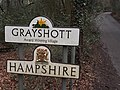
 Grayshott village sign - geograph.org.uk - 2059299.jpg 640 × 430; 192 KB
-
 Grayshott, Hampshire - geograph.org.uk - 2859127.jpg 4,288 × 3,216; 3.54 MB
-
 Grayshott, postbox № GU26 161 - geograph.org.uk - 1989898.jpg 480 × 640; 88 KB
-
 Grayshott, the post office - geograph.org.uk - 1989896.jpg 480 × 640; 90 KB
-
 Green in Grayshott village centre - geograph.org.uk - 931116.jpg 640 × 480; 93 KB
-
 Grove House, Grayshott - geograph.org.uk - 4367522.jpg 639 × 474; 163 KB
-

-
 Halters End, Grayshott - geograph.org.uk - 3800581.jpg 1,536 × 2,048; 460 KB
-
 Halters End, Grayshott - geograph.org.uk - 4367570.jpg 640 × 480; 97 KB
-
 Hampshire boundary at Grayshott - geograph.org.uk - 1171726.jpg 360 × 640; 93 KB
-
 Headley Road and St Luke's Church Hall, Grayshott - geograph.org.uk - 3800567.jpg 1,536 × 2,048; 621 KB
-
 Headley Road, Grayshott - geograph.org.uk - 5690409.jpg 640 × 427; 83 KB
-
 Hill House, Hill Rd - geograph.org.uk - 2057967.jpg 640 × 430; 151 KB
-
 Hill Rd, Grayshott - geograph.org.uk - 2057971.jpg 640 × 430; 154 KB
-
 Hill Road, Grayshott - geograph.org.uk - 3800565.jpg 2,048 × 1,536; 700 KB
-
 House on Hammer Lane - geograph.org.uk - 1622042.jpg 640 × 360; 77 KB
-
 Hurstmere Close - geograph.org.uk - 2060026.jpg 640 × 430; 172 KB
-

-
 In the woods south of Grayshott - geograph.org.uk - 2057805.jpg 640 × 430; 215 KB
-
 Junction of Crossways Road and Portsmouth Road - geograph.org.uk - 3911406.jpg 2,179 × 1,632; 949 KB
-
 Kingswood Firs - geograph.org.uk - 2056835.jpg 640 × 430; 216 KB
-
 Kingswood Firs - geograph.org.uk - 2056847.jpg 640 × 430; 145 KB
-
 Kingswood Firs, Grayshott - geograph.org.uk - 3735.jpg 640 × 428; 53 KB
-

-
 Lloyds TSB at Grayshott - geograph.org.uk - 931205.jpg 480 × 640; 63 KB
-
-

-

-

-
 Ludshott Common - geograph.org.uk - 21552.jpg 640 × 480; 104 KB
-
 Ludshott Common - geograph.org.uk - 3445279.jpg 3,264 × 2,448; 1.95 MB
-
 Ludshott Common car park - geograph.org.uk - 3445262.jpg 640 × 480; 106 KB
-
 Ludshott Common, aerial 2015 - geograph.org.uk - 4526068.jpg 640 × 427; 79 KB
-
 Memorial wall, Grayshott - geograph.org.uk - 3800569.jpg 2,048 × 1,536; 1,019 KB
-
 Mount Alvernia near Grayshott - geograph.org.uk - 1160730.jpg 640 × 360; 80 KB
-
 National Trust sign in Whitmore Vale, Grayshott - geograph.org.uk - 3800539.jpg 2,048 × 1,536; 1.04 MB
-
 Old Yew Tree Cottage, Stoney Bottom - geograph.org.uk - 2057962.jpg 640 × 430; 175 KB
-
 Path at Kingswood Firs - geograph.org.uk - 2793108.jpg 640 × 443; 234 KB
-
 Path behind Waggoners Estate, Grayshott - geograph.org.uk - 3794418.jpg 1,536 × 2,048; 1.06 MB
-
 Path in Grayshott - geograph.org.uk - 3794451.jpg 1,536 × 2,048; 1.18 MB
-
 Path in Whitmore Vale, Grayshott - geograph.org.uk - 3800545.jpg 1,536 × 2,048; 1.1 MB
-
 Path to Stoney Bottom - geograph.org.uk - 2793106.jpg 461 × 640; 297 KB
-
 Path to Whitmoor Vale - geograph.org.uk - 2793239.jpg 640 × 398; 216 KB
-
 Pond, Whitmoor Bottom - geograph.org.uk - 2858029.jpg 4,288 × 3,216; 3.51 MB
-
 Post Office, Grayshott - geograph.org.uk - 1574754.jpg 640 × 480; 130 KB
-

-
 Postbox, Grayshott - geograph.org.uk - 1574759.jpg 480 × 640; 140 KB
-

-
 Public toilets and car park, Grayshott - geograph.org.uk - 2059665.jpg 640 × 430; 173 KB
-
 Recreation ground and Philips House, Grayshott - geograph.org.uk - 3800579.jpg 2,048 × 1,536; 601 KB
-
 Recreation ground, Grayshott - geograph.org.uk - 3800574.jpg 2,048 × 1,536; 477 KB
-
 Road at Kingswood Firs - geograph.org.uk - 2793110.jpg 640 × 427; 183 KB
-
 Road sign, Grayshott - geograph.org.uk - 2059297.jpg 640 × 430; 167 KB
-
 Rockdale Drive off Headley Rd, Grayshott - geograph.org.uk - 2060004.jpg 640 × 430; 156 KB
-
 Row of shops, Headley Rd, Grayshott - geograph.org.uk - 2059675.jpg 640 × 435; 104 KB
-
 School Road, Grayshott - geograph.org.uk - 3794432.jpg 2,048 × 1,536; 1.05 MB
-
 School Road, Grayshott - geograph.org.uk - 3794435.jpg 2,048 × 1,536; 949 KB
-
 School Road, Grayshott - geograph.org.uk - 3794442.jpg 2,048 × 1,536; 1.13 MB
-

-
 Seat by Grayshott Fire Station - geograph.org.uk - 931282.jpg 640 × 480; 118 KB
-
 Shops in Crossways Road, Grayshott - geograph.org.uk - 931108.jpg 640 × 480; 86 KB
-
 Shops, Grayshott - geograph.org.uk - 2059687.jpg 640 × 430; 137 KB
-
-
 St Edmund's School - geograph.org.uk - 3911385.jpg 3,264 × 2,448; 2.78 MB
-
 St Edmund's School - geograph.org.uk - 3911403.jpg 3,264 × 2,448; 1.93 MB
-
 Stoney Bottom - geograph.org.uk - 2057812.jpg 640 × 430; 204 KB
-
 Stoney Bottom heading east - geograph.org.uk - 2057813.jpg 640 × 430; 200 KB
-
 Stoney Bottom, Grayshott - geograph.org.uk - 2057965.jpg 640 × 430; 186 KB
-
 Summerhouse Court, Grayshott - geograph.org.uk - 2060017.jpg 640 × 502; 103 KB
-

-
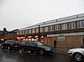
 Tesco Express, Grove House, Grayshott - geograph.org.uk - 2059676.jpg 640 × 430; 124 KB
-
 The Avenue, Grayshott - geograph.org.uk - 2059969.jpg 640 × 430; 133 KB
-
 The Co-operative, Grayshott - geograph.org.uk - 4018366.jpg 640 × 480; 124 KB
-
 The Gables, Headley Rd - geograph.org.uk - 2060008.jpg 640 × 410; 94 KB
-
 The Gurkha Durbar, Grayshott - geograph.org.uk - 2059682.jpg 640 × 444; 97 KB
-
 The Rowans - geograph.org.uk - 931015.jpg 640 × 480; 109 KB
-
 The Sea-Raj in Grayshott - geograph.org.uk - 931211.jpg 640 × 480; 61 KB
-
 The Square, Grayshott - geograph.org.uk - 3800559.jpg 2,048 × 1,536; 455 KB
-
 The Square, Grayshott - geograph.org.uk - 931186.jpg 640 × 480; 85 KB
-
 Top of Avenue Road, Grayshott - geograph.org.uk - 3800557.jpg 1,536 × 2,048; 434 KB
-

-
 Traffic management, Headley Rd - geograph.org.uk - 2060018.jpg 640 × 430; 164 KB
-
 Waggoners Estate, Grayshott - geograph.org.uk - 3478576.jpg 2,048 × 1,536; 653 KB
-
 Waggoners Estate, Grayshott - geograph.org.uk - 3478583.jpg 2,048 × 1,536; 540 KB
-
 Waggoners Estate, Grayshott - geograph.org.uk - 3478588.jpg 2,048 × 1,536; 516 KB
-
 Waggoners Wells, Grayshott 01.jpg 5,152 × 3,864; 4.46 MB
-
 War Memorial, Grayshott - geograph.org.uk - 3800563.jpg 1,536 × 2,048; 427 KB
-
 Whitmore Vale - geograph.org.uk - 2858078.jpg 4,288 × 3,216; 3.29 MB
-
 Whitmore Vale - geograph.org.uk - 4018411.jpg 640 × 480; 234 KB
-
 Whitmore Vale - geograph.org.uk - 4018440.jpg 640 × 480; 225 KB
-
 Whitmore Vale - geograph.org.uk - 5690412.jpg 640 × 427; 139 KB
-
 Whitmore Vale Farm Building - geograph.org.uk - 3800537.jpg 2,048 × 1,536; 1.17 MB
-
 Whitmore Vale Rd - geograph.org.uk - 2059286.jpg 640 × 430; 171 KB
-
-
 Windy Gap, Grayshott - geograph.org.uk - 1574785.jpg 640 × 480; 236 KB
-
 Woodland above Whitmore Vale - geograph.org.uk - 5690417.jpg 640 × 427; 147 KB
-
 Woodland beside Whitmore Vale - geograph.org.uk - 5690413.jpg 640 × 427; 135 KB
-
 Woodland near Hunter's Moon - geograph.org.uk - 2057799.jpg 640 × 430; 195 KB
-
 Woodland south of Grayshott - geograph.org.uk - 2057802.jpg 640 × 430; 210 KB
-
 Woodland south of Grayshott - geograph.org.uk - 2057809.jpg 640 × 430; 210 KB
-
 Cows - geograph.org.uk - 29783.jpg 640 × 428; 50 KB
-
 Fields of Ragwort - geograph.org.uk - 29585.jpg 640 × 428; 38 KB
-
 Grayshott Surgery - geograph.org.uk - 634525.jpg 640 × 359; 209 KB


