Category:Great Basin Desert
Jump to navigation
Jump to search
desert in the United States   | |||||
| Upload media | |||||
| Instance of | |||||
|---|---|---|---|---|---|
| Located in protected area | |||||
| Location |
| ||||
 | |||||
The Great Basin Desert is the portion of the hydrographic Great Basin of the western United States, between the Sierra Nevada (U.S.) in California and the Wasatch Range in Utah. This forms an ecologically distinct area.
Media in category "Great Basin Desert"
The following 21 files are in this category, out of 21 total.
-

-

-
-
 2013-08-15 17 15 38 Subalpine Fir cones on the northwestern slopes of Jarbidge Peak.jpg 2,448 × 3,264; 3.37 MB
-
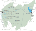 Central Basin and Range ecoregion.gif 495 × 435; 17 KB
-
 Central Basin and Range ecoregion.png 310 × 273; 40 KB
-
 Deep Springs NV from White Mountains.jpg 3,888 × 2,592; 3.37 MB
-
 FriscoMountainUT.jpg 3,072 × 2,048; 1.02 MB
-
 Gb 600.jpg 600 × 253; 32 KB
-
 Inyo mountains salamander habitat.png 1,136 × 853; 2.34 MB
-

-

-

-

-
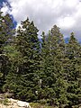
 2013-07-14 10 10 30 Ponderosa Pine along the lower portion of Wheeler Peak Scenic Drive.jpg 2,448 × 3,264; 3.18 MB
-
 2013-07-14 10 15 37 Ponderosa Pine along the lower portion of Wheeler Peak Scenic Drive.jpg 2,448 × 3,264; 3.34 MB
-

-
 Great Basin Montane Forests map.svg 1,712 × 1,992; 343 KB
-
 Great Basin Shrub Steppe map.svg 1,712 × 1,992; 337 KB
-
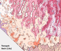 TonopahBasin.png 753 × 625; 240 KB
-
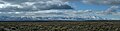 Nevada Great Basin pano.jpg 5,972 × 1,528; 1.66 MB
_in_Elko_County,_Nevada.jpg)


_and_the_Jarbidge_River_north_of_Jarbidge,_Nevada.jpg)
_and_the_Jarbidge_River_north_of_Jarbidge,_Nevada.jpg)


