Category:Great Bromley
Jump to navigation
Jump to search
village in United Kingdom  | |||||
| Upload media | |||||
| Instance of | |||||
|---|---|---|---|---|---|
| Location | Tendring, Essex, East of England, England | ||||
| Population |
| ||||
 | |||||
Subcategories
This category has the following 5 subcategories, out of 5 total.
Media in category "Great Bromley"
The following 120 files are in this category, out of 120 total.
-
 A120 Spur to the A133 - geograph.org.uk - 3846822.jpg 640 × 480; 293 KB
-
 A120 towards Harwich - geograph.org.uk - 2942915.jpg 640 × 480; 71 KB
-
 A120 westbound - geograph.org.uk - 4221350.jpg 640 × 480; 35 KB
-
 A120 westbound - geograph.org.uk - 4221351.jpg 640 × 480; 53 KB
-
 A120 westbound - geograph.org.uk - 4221353.jpg 640 × 480; 49 KB
-
 A120, east - geograph.org.uk - 5159639.jpg 640 × 410; 39 KB
-
 A120, eastbound - geograph.org.uk - 5159645.jpg 640 × 330; 26 KB
-
 A120, Sliproad to A133 - geograph.org.uk - 3846817.jpg 640 × 480; 245 KB
-
 A133 at Hare Green - geograph.org.uk - 3848215.jpg 640 × 480; 225 KB
-
 A133 nearing merging junction with A120 - geograph.org.uk - 6058334.jpg 1,024 × 684; 163 KB
-
 B1029 - geograph.org.uk - 5159689.jpg 640 × 343; 68 KB
-
 B1029 towards Brightlingsea - geograph.org.uk - 2942891.jpg 640 × 480; 53 KB
-
 B1029 towards Brightlingsea - geograph.org.uk - 2942911.jpg 640 × 480; 98 KB
-
 B1029 towards Brightlingsea - geograph.org.uk - 2942918.jpg 640 × 480; 78 KB
-
 B1029, Frating Rd - geograph.org.uk - 5159652.jpg 640 × 307; 55 KB
-
 Badley Hall Road - geograph.org.uk - 6057445.jpg 1,024 × 684; 185 KB
-
 Badley Hall Road - geograph.org.uk - 6057461.jpg 1,024 × 684; 221 KB
-
 Badley Hall Road by Badley Hall Farm - geograph.org.uk - 6057450.jpg 1,024 × 684; 265 KB
-
 Bajaj in Essex TM0724 121 - geograph.org.uk - 123127.jpg 1,600 × 1,200; 359 KB
-
 Briar Road, Bromley Cross - geograph.org.uk - 2231519.jpg 640 × 480; 70 KB
-
 Brook Street, Great Bromley - geograph.org.uk - 2942906.jpg 640 × 480; 93 KB
-

-
 Carringtons Road, Bromley Cross - geograph.org.uk - 2231521.jpg 640 × 480; 58 KB
-
 Carringtons Road, near Bromley Cross - geograph.org.uk - 2231531.jpg 640 × 480; 37 KB
-
 Church of St George - geograph.org.uk - 5159697.jpg 640 × 426; 56 KB
-
 Clacton and Harwich traffic part company - geograph.org.uk - 5899444.jpg 1,024 × 684; 180 KB
-
 Cock Lane - geograph.org.uk - 5174965.jpg 640 × 480; 218 KB
-
 Entering Great Bromley, B1029 - geograph.org.uk - 5159691.jpg 640 × 390; 69 KB
-
 Farmland near Great Bromley - geograph.org.uk - 2942909.jpg 640 × 480; 67 KB
-
 Field by Harwich Road, Hare Green - geograph.org.uk - 5341914.jpg 1,682 × 1,228; 520 KB
-
 Footbridge over A120 south of Great Bromley - geograph.org.uk - 4062507.jpg 1,536 × 1,150; 817 KB
-
 Footbridge over the A120 near Cold Hall - geograph.org.uk - 3846811.jpg 640 × 480; 251 KB
-
 Footbridge, A120 - geograph.org.uk - 5159641.jpg 640 × 353; 41 KB
-
 Footpath to Carringtons Road - geograph.org.uk - 2942894.jpg 640 × 480; 83 KB
-
 Frating Road - geograph.org.uk - 5174937.jpg 640 × 428; 118 KB
-
 Frating Road Bridge A120 - geograph.org.uk - 5159642.jpg 640 × 357; 32 KB
-
 Grazing land near Bromley Cross - geograph.org.uk - 2942888.jpg 640 × 480; 51 KB
-
 Great Bromley 239.jpg 1,600 × 1,200; 381 KB
-
 Great Bromley church - geograph.org.uk - 6058344.jpg 1,024 × 684; 253 KB
-
 Great Bromley Post Office and church 1978 - Flickr - sludgegulper.jpg 2,176 × 3,280; 249 KB
-
 Great Bromley Post Office CO7, 1978 - Flickr - sludgegulper.jpg 2,699 × 1,752; 540 KB
-
 Great Bromley, St. Georges Church - geograph.org.uk - 6167386.jpg 5,669 × 3,779; 5.15 MB
-
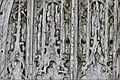
 Great Bromley, St. Georges Church, Altar piece (detail) - geograph.org.uk - 6167420.jpg 7,224 × 4,816; 7.4 MB
-
 Great Bromley, St. Georges Church, Altar piece - geograph.org.uk - 6167418.jpg 6,619 × 4,413; 5.11 MB
-

-

-

-

-

-

-

-

-

-

-

-

-

-

-

-
-
 Great Bromley, St. Georges Church, Double sedilia - geograph.org.uk - 6167435.jpg 7,166 × 4,777; 5.7 MB
-

-
 Great Bromley, St. Georges Church, First World War memorial - geograph.org.uk - 6167476.jpg 4,429 × 6,643; 6.11 MB
-
 Great Bromley, St. Georges Church, Lych gate - geograph.org.uk - 6167542.jpg 3,407 × 2,271; 2.37 MB
-

-

-

-
 Great Bromley, St. Georges Church, Plain capital - geograph.org.uk - 6167527.jpg 5,894 × 3,930; 4.45 MB
-
 Great Bromley, St. Georges Church, Roof corbel 1 - geograph.org.uk - 6167506.jpg 5,255 × 3,504; 3.86 MB
-
 Great Bromley, St. Georges Church, Roof corbel 2 - geograph.org.uk - 6167508.jpg 4,426 × 2,951; 2.56 MB
-
 Great Bromley, St. Georges Church, Roof corbel 3 - geograph.org.uk - 6167524.jpg 6,596 × 4,396; 6.08 MB
-

-

-

-

-
 Great Bromley, St. Georges Church, Stained glass window - geograph.org.uk - 6167492.jpg 5,084 × 7,625; 5.25 MB
-

-

-
 Great Bromley, St. Georges Church, The altar - geograph.org.uk - 6167417.jpg 7,191 × 4,793; 6.3 MB
-
 Great Bromley, St. Georges Church, The chancel roof - geograph.org.uk - 6167500.jpg 7,185 × 4,790; 7.21 MB
-
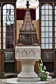
 Great Bromley, St. Georges Church, The font - geograph.org.uk - 6167403.jpg 8,027 × 5,351; 7.8 MB
-
 Great Bromley, St. Georges Church, The font - geograph.org.uk - 6167405.jpg 6,925 × 4,617; 5.85 MB
-
 Great Bromley, St. Georges Church, The font - geograph.org.uk - 6167486.jpg 4,834 × 7,250; 7.72 MB
-
 Great Bromley, St. Georges Church, The font - geograph.org.uk - 6167489.jpg 6,473 × 4,316; 6.71 MB
-
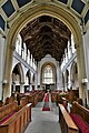
 Great Bromley, St. Georges Church, The nave - geograph.org.uk - 6167406.jpg 7,409 × 4,939; 6.2 MB
-
 Great Bromley, St. Georges Church, The nave - geograph.org.uk - 6167412.jpg 7,337 × 4,891; 6.28 MB
-
 Great Bromley, St. Georges Church, The nave - geograph.org.uk - 6167429.jpg 7,115 × 4,744; 5.37 MB
-
-
 Great Bromley, St. Georges Church, The nave from the chancel - geograph.org.uk - 6167413.jpg 7,499 × 5,000; 6.45 MB
-
 Great Bromley, St. Georges Church, The nave roof - geograph.org.uk - 6167408.jpg 7,339 × 4,892; 6.04 MB
-
 Great Bromley, St. Georges Church, The nave roof - geograph.org.uk - 6167432.jpg 7,083 × 4,722; 5.26 MB
-
 Hall Rd - geograph.org.uk - 5159698.jpg 640 × 315; 38 KB
-
 Hall Road (B1029) - geograph.org.uk - 2942899.jpg 640 × 480; 53 KB
-
 Harwich Rd - geograph.org.uk - 5159649.jpg 640 × 339; 44 KB
-
 Harwich Rd, Hare Green - geograph.org.uk - 5159650.jpg 640 × 313; 38 KB
-
 Harwich Road entering Great Bromley - geograph.org.uk - 5336678.jpg 2,304 × 1,728; 825 KB
-
 Harwich Road, Hare Green - geograph.org.uk - 5534323.jpg 4,608 × 3,072; 1.76 MB
-
 Hedgerow by Harwich Road, Hare Green - geograph.org.uk - 5341913.jpg 1,969 × 1,466; 728 KB
-
 Hilliards Road - geograph.org.uk - 5174981.jpg 640 × 480; 281 KB
-
 Hilliards Road - geograph.org.uk - 5174985.jpg 640 × 480; 258 KB
-
 Honeypot Lane - geograph.org.uk - 5174977.jpg 640 × 480; 224 KB
-
 Houses on Harwich Road, Raven's Green - geograph.org.uk - 5341912.jpg 2,186 × 1,631; 1.33 MB
-
 Lane towards Raven's Green - geograph.org.uk - 6058349.jpg 1,024 × 768; 475 KB
-
 Lilley's Lane, east of Bromley Cross - geograph.org.uk - 2231528.jpg 640 × 480; 120 KB
-
 Mary Lane North - geograph.org.uk - 5174942.jpg 640 × 480; 246 KB
-
 New House, Westwood House - geograph.org.uk - 2793118.jpg 640 × 395; 102 KB
-
 Ploughed field north of Raven's Green - geograph.org.uk - 6054921.jpg 1,024 × 768; 261 KB
-
 Rural hold up, Great Bromley - geograph.org.uk - 5159693.jpg 640 × 426; 64 KB
-
 Selecta Cars, Great Bromley - geograph.org.uk - 5336679.jpg 2,304 × 1,728; 851 KB
-
 Telecom Mast by the B1029 - geograph.org.uk - 5159654.jpg 640 × 381; 32 KB
-
 Towards Great Bromley from The Cross - geograph.org.uk - 1198790.jpg 640 × 425; 80 KB
-
 Village Hall, Great Bromley - geograph.org.uk - 2942913.jpg 640 × 480; 57 KB
-
 War Memorial, Great Bromley - geograph.org.uk - 2942904.jpg 640 × 480; 104 KB
-
 Badley Hall Farm - geograph.org.uk - 302530.jpg 640 × 426; 99 KB
-
 Cell phone mast - geograph.org.uk - 122877.jpg 640 × 480; 60 KB
-
 Cottage on Frating Hill - geograph.org.uk - 395109.jpg 640 × 432; 117 KB
-
 Farmhouse at Hazel's Farm - geograph.org.uk - 256734.jpg 640 × 459; 99 KB
-
 Frost Hall - geograph.org.uk - 302554.jpg 640 × 426; 163 KB
-
 Morehams Hall - geograph.org.uk - 196631.jpg 640 × 480; 119 KB
-
 Pond - geograph.org.uk - 196634.jpg 640 × 480; 99 KB


_-_geograph.org.uk_-_6167420.jpg)


_-_geograph.org.uk_-_6167497.jpg)


_-_geograph.org.uk_-_2942899.jpg)


