Category:Greater East Asia Co-Prosperity Sphere
Jump to navigation
Jump to search
propaganda term for the sphere of influence of the Japanese empire, purporting to provide pan-Asian autonomy free from European colonialism    | |||||
| Upload media | |||||
| Instance of | |||||
|---|---|---|---|---|---|
| Location |
| ||||
| Inception |
| ||||
| |||||
Subcategories
This category has the following 3 subcategories, out of 3 total.
Media in category "Greater East Asia Co-Prosperity Sphere"
The following 31 files are in this category, out of 31 total.
-

-
 Administrative map of the United Mongol Autonomous Government.png 3,000 × 1,800; 586 KB
-
 Armed Asian people in 1943.png 992 × 686; 666 KB
-
 Better version greater east asia japanese influence.png 744 × 544; 81 KB
-

-
 China-nanjing.png 599 × 599; 143 KB
-
 DaitouaKyoueiken.JPG 283 × 338; 80 KB
-
 Greater Asian Co-prosperity sphere.png 1,000 × 1,000; 263 KB
-
 Greater east asia co-prosperity sphere.png 330 × 330; 75 KB
-
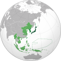 Japanese Empire (orthographic projection).svg 600 × 600; 665 KB
-
 Japanese Empire - 1942.svg 1,100 × 837; 875 KB
-
 Japanese government-issued Philippine fiat peso with overprinting.jpg 2,560 × 1,312; 1.41 MB
-
 Japanese Korea (orthographic projection).svg 600 × 600; 515 KB
-
 Karafuto.png 1,000 × 1,000; 287 KB
-
 Karafuto.svg 600 × 600; 667 KB
-
 Korea in japanese empire.png 1,000 × 1,000; 287 KB
-
 Manchu State.png 998 × 999; 264 KB
-
 Manchukuo locator map.svg 1,260 × 1,003; 2.66 MB
-
 Manchukuo011.jpg 342 × 500; 43 KB
-
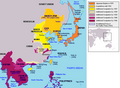
 Map of Greater East Asia Co-Prosperity Sphere 1941.jpg 1,800 × 1,932; 522 KB
-

-

-
 Map of Reformed, Provisional Gov of ROC and Mengjiang - zh-hant.svg 217 × 277; 256 KB
-
 Mengjiang, North Shanxi, South Chahar Map - Circa 1937-1939.png 3,085 × 2,091; 7.18 MB
-
 Mengjiang.png 599 × 599; 147 KB
-
 North Shanxi Autonomous Government Map, 1937.png 1,006 × 1,006; 1.94 MB
-
 South Chahar Autonomous Government Map c. 1937.png 1,006 × 1,006; 2.11 MB
-
 State of Burma orthographic map V2.png 1,000 × 1,000; 267 KB
-
 State of Burma orthographic map.png 1,000 × 1,000; 291 KB
-
 Strong and generous Greater East Asia in 1943.png 984 × 689; 644 KB
-
 時局小叢書之七 大東亞共榮圈.pdf 1,239 × 1,754, 51 pages; 5.94 MB


_-_B%C3%B9i_Quang_Tu%E1%BA%A5n_(16_August_2020).jpg)


.svg)


.svg)


_-_en.svg)
_-_es.svg)


