Category:Grimsargh
Jump to navigation
Jump to search
English: Grimsargh is a village and civil parish in the City of Preston, England. According to the 2001 census the parish had a population of 2,164. It is one of the parishes which is included with the electoral ward of Preston Rural East. (→Grimsargh)
Nederlands: Grimsargh is een plaats en civil parish in het bestuurlijke gebied Preston, in het Engelse graafschap Lancashire met 2.164 inwoners. (→Grimsargh)
Polski: Grimsargh – wieś w Anglii, w hrabstwie Lancashire, w dystrykcie Preston. Leży 46 km na północny zachód od miasta Manchester i 306 km na północny zachód od Londynu. W 2001 miejscowość liczyła 2164 mieszkańców. (→Grimsargh)
West-Vlams: Grimsargh is e dorp en civil parish in 't district Preston, in 't Iengels groafschap Lancashire. Der zyn 2.164 inweuners. (→Grimsargh)
village in the United Kingdom  | |||||
| Upload media | |||||
| Instance of | |||||
|---|---|---|---|---|---|
| Location | Preston, Lancashire, North West England, England | ||||
 | |||||
Subcategories
This category has the following 4 subcategories, out of 4 total.
Media in category "Grimsargh"
The following 102 files are in this category, out of 102 total.
-
 A sort of stile on the Ribble Way - geograph.org.uk - 3922529.jpg 4,063 × 2,704; 7.51 MB
-
 A stile on the Ribble Way - geograph.org.uk - 3916532.jpg 4,330 × 2,769; 7.11 MB
-
 A well hidden stile - geograph.org.uk - 4476755.jpg 4,273 × 2,844; 5.64 MB
-
 B6243 and The Plough Inn, Grimsargh - geograph.org.uk - 2383954.jpg 800 × 593; 53 KB
-
 B6243, Grimsargh - geograph.org.uk - 5131518.jpg 640 × 480; 71 KB
-
 Benchmark on a gatepost north of Elston New Hall Farm - geograph.org.uk - 3443992.jpg 2,048 × 1,536; 797 KB
-
 Brabiner House Farm - geograph.org.uk - 1053563.jpg 640 × 480; 61 KB
-

-

-
 Cricket pavilion at Grimsargh - geograph.org.uk - 4612656.jpg 1,024 × 767; 619 KB
-
 Cuckooflower (cardamine pratensis) - geograph.org.uk - 4479657.jpg 1,764 × 1,865; 2.54 MB
-
 Dismantled railway - geograph.org.uk - 1369498.jpg 640 × 480; 141 KB
-
 Drainage Problems Grimsargh Green Play Area - geograph.org.uk - 3252463.jpg 1,024 × 768; 280 KB
-

-
 Elizabeth II postbox on Preston Road, Grimsargh - geograph.org.uk - 5134289.jpg 2,136 × 2,848; 1.24 MB
-
-
 Elizabeth II postbox outside Post Office, Grimsargh - geograph.org.uk - 5134276.jpg 1,880 × 2,767; 1.14 MB
-
 Elston Lane, Grimsargh - geograph.org.uk - 2384958.jpg 800 × 600; 103 KB
-
 Elston New Hall Farm - geograph.org.uk - 896076.jpg 640 × 480; 79 KB
-
 Entering Grimsargh - geograph.org.uk - 5131535.jpg 640 × 480; 64 KB
-
 Farmland near Grimsargh - geograph.org.uk - 1053552.jpg 640 × 480; 90 KB
-
 Footbridge over Savick Brook - geograph.org.uk - 4476785.jpg 2,889 × 3,056; 6.33 MB
-
 Footbridge over Tun Brook - geograph.org.uk - 3443988.jpg 1,536 × 2,048; 529 KB
-
 Footpath - geograph.org.uk - 1369507.jpg 640 × 480; 130 KB
-
 Footpath Over Grimsargh Grassland - geograph.org.uk - 3304503.jpg 2,560 × 1,920; 2.95 MB
-
 Grimargh - panoramio.jpg 2,048 × 1,536; 709 KB
-
 Grimsargh - panoramio - jim walton (1).jpg 2,048 × 1,536; 730 KB
-
 Grimsargh - panoramio - jim walton (2).jpg 2,048 × 1,536; 741 KB
-
 Grimsargh - panoramio - jim walton (3).jpg 2,048 × 1,536; 754 KB
-
 Grimsargh - panoramio - jim walton (4).jpg 2,048 × 1,536; 718 KB
-
 Grimsargh - panoramio - jim walton (5).jpg 2,048 × 1,536; 719 KB
-
 Grimsargh - panoramio - jim walton.jpg 2,048 × 1,536; 710 KB
-
 Grimsargh - panoramio.jpg 2,048 × 1,536; 663 KB
-
 Grimsargh Field Day - Floats in the Parade.jpg 447 × 336; 104 KB
-
 Grimsargh Field Day - Rose Queen Crowning.jpeg 420 × 336; 44 KB
-
 Grimsargh Field Day Parade - Steam Engine.jpg 448 × 336; 57 KB
-
 Grimsargh Reservoir - geograph.org.uk - 3915863.jpg 4,442 × 2,957; 7.78 MB
-
 He's doing a good job of guarding the footpath - geograph.org.uk - 4476831.jpg 3,854 × 2,450; 6.65 MB
-
 Heading north east from Grimsargh - geograph.org.uk - 5131536.jpg 640 × 480; 46 KB
-
 House on the B6243, Grimsargh - geograph.org.uk - 5131533.jpg 640 × 385; 43 KB
-
 Houses on the B6243, Grimsargh - geograph.org.uk - 5131513.jpg 640 × 434; 54 KB
-
 Just Passed Marsh House - geograph.org.uk - 3304582.jpg 2,560 × 1,920; 3.48 MB
-
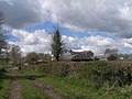 Marsh House Farm - geograph.org.uk - 3444041.jpg 2,048 × 1,536; 546 KB
-
 New house, Grimsargh - geograph.org.uk - 551121.jpg 640 × 480; 104 KB
-
 New houses, Grimsargh - geograph.org.uk - 538817.jpg 640 × 480; 102 KB
-
 New Roundabout Furniture - geograph.org.uk - 3331888.jpg 2,592 × 1,944; 1,018 KB
-
 Path To Sudell's Farm - geograph.org.uk - 3304523.jpg 2,560 × 1,920; 2.48 MB
-
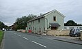
 Post Office and stores, Grimsargh - geograph.org.uk - 5131527.jpg 640 × 480; 58 KB
-
 Preston Road - geograph.org.uk - 2845672.jpg 640 × 480; 47 KB
-
 Preston Road, Grimsargh - geograph.org.uk - 5134291.jpg 2,602 × 1,650; 1.05 MB
-
 Preston Road, Grimsargh - geograph.org.uk - 5134293.jpg 640 × 480; 72 KB
-
 Preston Road, Grimsargh - geograph.org.uk - 545357.jpg 640 × 480; 69 KB
-
 Public Footpath near Grimsargh - geograph.org.uk - 2385016.jpg 1,024 × 768; 138 KB
-
 Ribble Way Track To Marsh House - geograph.org.uk - 3304589.jpg 2,560 × 1,920; 2.54 MB
-
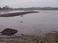
 River Ribble - geograph.org.uk - 5155098.jpg 3,456 × 2,592; 4.2 MB
-
 River Ribble near Elston - geograph.org.uk - 701998.jpg 640 × 480; 97 KB
-
 Salisbury House - geograph.org.uk - 3261470.jpg 1,600 × 1,200; 409 KB
-
 Savick Brook - geograph.org.uk - 4476815.jpg 2,952 × 4,424; 7.88 MB
-
 Savick Brook - geograph.org.uk - 4479547.jpg 4,592 × 3,056; 7.8 MB
-
 Shops on Preston Road, Grimsargh - geograph.org.uk - 5131526.jpg 640 × 480; 53 KB
-
 Sign on the Plough Inn, Grimsargh - geograph.org.uk - 5131532.jpg 640 × 387; 39 KB
-
 Site of Grimsargh railway station 236-19.JPG 1,759 × 1,131; 510 KB
-

-

-
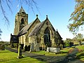
 St Michael's Church, Grimsargh - geograph.org.uk - 5131522.jpg 640 × 480; 106 KB
-
 St Michael's, Grimsargh - geograph.org.uk - 3489758.jpg 4,000 × 3,000; 3.04 MB
-
 St Michael, Church of England, Grimsargh - geograph.org.uk - 3261390.jpg 2,560 × 1,920; 2.74 MB
-
 St. Michael's, Grimsargh - geograph.org.uk - 4612659.jpg 1,024 × 756; 692 KB
-
 Stile on the path to Shay Farm - geograph.org.uk - 4479505.jpg 3,056 × 4,188; 7.02 MB
-
 Straight Footpath Between Two Grimsargh Reservoirs - geograph.org.uk - 3276946.jpg 2,560 × 1,920; 2.95 MB
-
 The approach to Grimsargh Reservoir - geograph.org.uk - 3920032.jpg 3,056 × 4,592; 6.24 MB
-

-
 The east bank of Grimsargh Reservoir - geograph.org.uk - 1053578.jpg 640 × 480; 70 KB
-
 The Hills, Grimsargh - geograph.org.uk - 5134284.jpg 2,848 × 2,136; 1.19 MB
-
 The island on Grimsargh Reservoir - geograph.org.uk - 4476601.jpg 4,592 × 3,056; 7.47 MB
-
 The Old School, Grimsargh - geograph.org.uk - 466786.jpg 640 × 480; 88 KB
-
 The Parish Church of Grimsagh, St Michael - geograph.org.uk - 3909508.jpg 4,439 × 2,384; 7.75 MB
-
 The Plough Inn, Grimsargh - geograph.org.uk - 466797.jpg 640 × 480; 83 KB
-
 The Plough Inn, Grimsargh - geograph.org.uk - 5131531.jpg 640 × 480; 64 KB
-
 The Plough, Grimsargh 236-16.jpg 1,691 × 1,021; 456 KB
-
 The Ribble Way follows the track past Marsh House - geograph.org.uk - 3916527.jpg 4,592 × 2,911; 6.64 MB
-
 The Ribble Way north of Elston New Hall Farm - geograph.org.uk - 3444005.jpg 2,048 × 1,536; 632 KB
-
 The Ribble Way towards Marsh House - geograph.org.uk - 3444022.jpg 2,048 × 1,536; 618 KB
-

-
 There's no way through there - geograph.org.uk - 4476676.jpg 4,592 × 2,856; 7.88 MB
-
 Tunbrook In Tunbrook Wood - geograph.org.uk - 3261445.jpg 2,560 × 1,920; 3.37 MB
-
 Water Board Gate - geograph.org.uk - 3304570.jpg 2,498 × 1,834; 2.96 MB
-
 Welcome to Grimsargh - geograph.org.uk - 2845671.jpg 640 × 481; 49 KB
-
 Alston Cottage - geograph.org.uk - 132920.jpg 640 × 480; 109 KB
-
 Bolton Fold Farm near Longridge - geograph.org.uk - 132917.jpg 640 × 480; 94 KB
-
 Clock House Farm - geograph.org.uk - 26304.jpg 640 × 480; 86 KB
-
 Farm Junk near Grimsargh Reservoirs - geograph.org.uk - 131858.jpg 640 × 480; 120 KB
-
 Farmland near Grimsargh - geograph.org.uk - 131852.jpg 640 × 480; 100 KB
-

-
 Footbridge Over Savick Brook - geograph.org.uk - 1439789.jpg 480 × 640; 126 KB
-
 Grimsargh Recreation Ground - geograph.org.uk - 67110.jpg 640 × 480; 69 KB
-
 Motorway Bridge Looking Towards Longsands - geograph.org.uk - 26300.jpg 640 × 480; 123 KB
-
 Place House Farm - geograph.org.uk - 171132.jpg 640 × 480; 203 KB
-

-
 The Road to Chapel House - geograph.org.uk - 171130.jpg 640 × 480; 163 KB
-
 White Bull Reservoir Bank - geograph.org.uk - 132908.jpg 640 × 480; 84 KB
-
 White Bull Water Treatment Works - geograph.org.uk - 132905.jpg 640 × 480; 94 KB


_-_geograph.org.uk_-_4479657.jpg)


.jpg)
.jpg)
.jpg)
.jpg)
.jpg)


