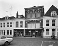
Category:Groenewoud 44, Vlissingen
Jump to navigation
Jump to search
| Object location | | View all coordinates using: OpenStreetMap |
|---|
 | |||||
| Upload media | |||||
| Instance of |
| ||||
|---|---|---|---|---|---|
| Location | Vlissingen, Zeeland, Netherlands | ||||
| Street address |
| ||||
| Located on street | |||||
| Heritage designation |
| ||||
 | |||||
|
This is a category about rijksmonument number 37660
|
| Address |
|
Media in category "Groenewoud 44, Vlissingen"
The following 3 files are in this category, out of 3 total.
-
 Groenwoud 44.jpg 2,162 × 4,017; 3.09 MB
-
 Voorgevels - Vlissingen - 20243782 - RCE.jpg 1,200 × 961; 217 KB
-
 Voorgevels - Vlissingen - 20243785 - RCE.jpg 807 × 1,200; 173 KB

