Category:Groningerstraat 17 (Zuidlaren)
Jump to navigation
Jump to search
| Object location | | View all coordinates using: OpenStreetMap |
|---|
 | |||||
| Upload media | |||||
| Instance of | |||||
|---|---|---|---|---|---|
| Location | Zuidlaren, Drenthe, Netherlands | ||||
| Street address |
| ||||
| Located on street |
| ||||
| Heritage designation |
| ||||
 | |||||
|
This is a category about rijksmonument number 510907
|
| Address |
|
Media in category "Groningerstraat 17 (Zuidlaren)"
The following 51 files are in this category, out of 51 total.
-
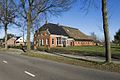
 Groningerstraat 17.jpg 4,608 × 3,456; 2.96 MB
-

-

-

-

-

-

-

-

-

-

-

-

-

-

-

-

-

-

-

-

-

-

-

-

-

-

-

-

-

-

-

-

-
 Overzicht met omgeving, gezien vanaf de straat - Zuidlaren - 20412966 - RCE.jpg 1,200 × 797; 209 KB
-
 Overzicht met omgeving, gezien vanaf de straat - Zuidlaren - 20412967 - RCE.jpg 1,200 × 797; 263 KB
-
 Overzicht met omgeving, gezien vanaf de straat - Zuidlaren - 20412968 - RCE.jpg 1,200 × 797; 265 KB
-
 Overzicht met omgeving, gezien vanaf de straat - Zuidlaren - 20412973 - RCE.jpg 1,200 × 797; 240 KB
-
 Overzicht van de achterzijde met de schuren - Zuidlaren - 20412974 - RCE.jpg 1,200 × 797; 273 KB
-
 Overzicht van de achterzijde met de schuren - Zuidlaren - 20412975 - RCE.jpg 1,200 × 797; 260 KB
-
 Overzicht van de achterzijde van de schuren - Zuidlaren - 20412976 - RCE.jpg 1,200 × 797; 258 KB
-

-

-

-

-
 Overzicht van de rechter zijgevel met serre - Zuidlaren - 20412970 - RCE.jpg 1,200 × 797; 199 KB
-

-

-

-

-

-


