Category:Grote of Sint-Lambertuskerk, Strijen
Jump to navigation
Jump to search
| Object location | | View all coordinates using: OpenStreetMap |
|---|
church in Strijen, Netherlands  | |||||
| Upload media | |||||
| Instance of | |||||
|---|---|---|---|---|---|
| Named after | |||||
| Location | Strijen, Hoeksche Waard, South Holland, Netherlands | ||||
| Street address |
| ||||
| Located on street |
| ||||
| Heritage designation |
| ||||
 | |||||
|
This is a category about rijksmonument number 34945
|
| Address |
|
Subcategories
This category has the following 2 subcategories, out of 2 total.
Media in category "Grote of Sint-Lambertuskerk, Strijen"
The following 30 files are in this category, out of 30 total.
-
 58, voorgevel - Strijen - 20206608 - RCE.jpg 1,200 × 809; 218 KB
-
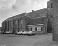
 Exterieur van het zuid-oosten - Strijen - 20206595 - RCE.jpg 1,200 × 864; 208 KB
-
 Exterieur zuid-west tijdens dakherstelling - Strijen - 20206596 - RCE.jpg 1,200 × 871; 222 KB
-
 Hervormde Kerk, Strijen. Consistorie.jpg 3,586 × 2,432; 4.96 MB
-
 Hervormde Kerk, Strijen. Zonnewijzer.jpg 4,320 × 2,432; 4.99 MB
-
 Ingang schip zuidgevel - Strijen - 20327087 - RCE.jpg 861 × 1,200; 214 KB
-
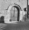 Ingang toren - Strijen - 20206587 - RCE.jpg 1,176 × 1,200; 397 KB
-
 Koor gezien vanuit het noordoosten - Strijen - 20327092 - RCE.jpg 875 × 1,200; 216 KB
-
 Noordgevel - Strijen - 20206584 - RCE.jpg 1,200 × 955; 207 KB
-
 Oostgevel - Strijen - 20206585 - RCE.jpg 1,200 × 969; 259 KB
-
 Oostgevel - Strijen - 20206586 - RCE.jpg 947 × 1,200; 248 KB
-
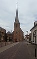
 Overzicht vanuit het westen - Strijen - 20327086 - RCE.jpg 863 × 1,200; 127 KB
-
 Overzicht vanuit het zuidoosten - Strijen - 20327094 - RCE.jpg 1,200 × 914; 173 KB
-
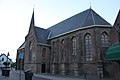
 Overzicht zuidgevel met dwarskapel en kerktoren - Strijen - 20206579 - RCE.jpg 1,200 × 894; 183 KB
-
 Sint Lambertus kerk, Kerkstraat 54, Strijen.JPG 4,752 × 3,168; 5.03 MB
-
 Sint Lambertus kerk, Kerkstraat Strijen.JPG 4,752 × 3,168; 3.9 MB
-
 Sint Lambertus kerk, Strijen.JPG 3,168 × 4,752; 5.6 MB
-
 Strijen, de Grote- of Sint Lambertuskerk RM34945 IMG 0960 2021-09-06 16.04.jpg 3,429 × 5,472; 8.52 MB
-
 Strijen, kerk foto7 2010-09-11 17.33.JPG 2,592 × 3,456; 4.72 MB
-
 Tekstbord van orgel (achterzijde orgelkast) - Strijen - 20206593 - RCE.jpg 1,195 × 1,200; 217 KB
-
 Toren - Strijen - 20206581 - RCE.jpg 942 × 1,200; 198 KB
-
 Zicht vanuit het noordoosten - Strijen - 20327088 - RCE.jpg 836 × 1,200; 169 KB
-
 Zicht vanuit het noordoosten tijdens restauratie - Strijen - 20327090 - RCE.jpg 892 × 1,200; 201 KB
-
 Zicht vanuit het noordwesten - Strijen - 20327073 - RCE.jpg 878 × 1,200; 170 KB
-
 Zicht vanuit het westen - Strijen - 20326720 - RCE.jpg 893 × 1,200; 135 KB
-
 Zicht vanuit het zuidoosten - Strijen - 20326721 - RCE.jpg 889 × 1,200; 156 KB
-
 Zicht vanuit het zuidoosten - Strijen - 20327091 - RCE.jpg 853 × 1,200; 214 KB
-
 Zicht vanuit het zuidoosten - Strijen - 20327093 - RCE.jpg 880 × 1,200; 188 KB
-
 Zuidgevel - Strijen - 20206583 - RCE.jpg 1,200 × 976; 251 KB
-
 Zuidgevel exterieur - Strijen - 20206582 - RCE.jpg 1,200 × 975; 238 KB


_-_Strijen_-_20206593_-_RCE.jpg)


