Category:Gulf of Saint Lawrence
Bước tới điều hướng
Bước tới tìm kiếm
estuary on the east coast of Canada   | |||||
| Tải lên phương tiện | |||||
| Là một | |||||
|---|---|---|---|---|---|
| Một phần của | |||||
| Vị trí | |||||
| Gồm có | |||||
| Diện tích |
| ||||
| Inflows |
| ||||
| Lưu vực |
| ||||
 | |||||
Thể loại con
Thể loại này có 9 thể loại con sau, trên tổng số 9 thể loại con.
A
C
F
M
N
P
S
Tập tin trong thể loại “Gulf of Saint Lawrence”
91 tập tin sau nằm trong thể loại này, trong tổng số 91 tập tin.
-
 022 127 Pointe aux Loups.jpg 2.730×4.117; 3,24 MB
-
 022 128 Cap Meules.jpg 4.042×2.570; 5,42 MB
-
 022 129 Cap Meules.jpg 4.042×2.570; 5,4 MB
-
 023 004 Havre Aubert.jpg 4.085×2.719; 5,7 MB
-
 023 065 Havre Aubert.jpg 4.117×2.570; 5,06 MB
-
 023 098 Cap aux Meules.jpg 4.096×2.570; 5,07 MB
-
 023 100 Cap aux Meules.jpg 4.117×2.826; 6 MB
-
 023 101 Cap aux Meules.jpg 4.117×2.719; 6,27 MB
-
 024 01 Havre aux Maisons.jpg 4.106×2.730; 5,28 MB
-
 024 065 Ile Madeleine.jpg 4.149×2.570; 5,41 MB
-
 024 066 Ile Madeleine.jpg 4.095×2.570; 5,47 MB
-
 024 115 Ies Madeleine.jpg 2.709×4.106; 3,41 MB
-
 025 016 Grande Entree.jpg 4.085×2.730; 6,15 MB
-
 025 018 Grande Entree.jpg 4.117×2.720; 5,88 MB
-
 025 019 Grande Entree.jpg 4.106×2.720; 5,27 MB
-
 025 021 Grande Entree.jpg 4.095×2.720; 6,4 MB
-
 960616 17 Cap aux Meules.jpg 3.547×2.374; 4,53 MB
-
 960616 18 Cap aux Meules.jpg 3.550×2.399; 4,49 MB
-
 960616 19 Cap aux Meules 3542 2189.jpg 3.542×2.189; 3,43 MB
-
 960616 24 Rochers aux Oiseauxa.jpg 3.561×2.393; 8,5 MB
-
 960616 24 Rochers aux Oiseauxaa.jpg 3.561×2.393; 3,93 MB
-
 960618 01a Rochers aux Oiseaux a.jpg 3.561×2.370; 8,07 MB
-
 960618 01a Rochers aux Oiseaux aa.jpg 3.561×2.370; 3,65 MB
-
 960618 02a Rochers aux Oiseaux.jpg 3.989×2.594; 11,38 MB
-
 960618 02a Rochers aux Oiseauxa.jpg 3.560×2.378; 5,53 MB
-
 960618 07a ile Grande Entreea.jpg 3.558×2.390; 4,01 MB
-
 960618 09a ile Grande Entreea.jpg 2.391×3.574; 4,01 MB
-
 960618 16a Anse Cabane.jpg 3.565×2.364; 4,23 MB
-
 960624 27 21 Pointe aux Loups.jpg 2.345×3.571; 5,52 MB
-
 960630 21a Grosse Ile.jpg 3.547×2.342; 8,49 MB
-

-
 Absence of sea ice in the Gulf of Saint Lawrence affecting harp seals, Canada.jpg 3.934×2.547; 5,28 MB
-
 Adrift in the ice-fields (IA adriftinicefield00hall).pdf 1.416 × 2.162, 358 trang; 162,16 MB
-
 Angry Sea - panoramio.jpg 3.264×2.448; 2,81 MB
-

-

-

-
 Burnt Church, c. 1768.jpg 5.674×3.912; 7,18 MB
-
 Cape breton highlands trail.jpg 4.000×3.000; 1,87 MB
-
 Carte du golphe de St. Laurent et pays voisins.jpg 3.454×2.173; 1,1 MB
-
 Carte reduite du golphe de St Laurent.jpg 4.575×3.244; 2,24 MB
-
 Cartier Discours 1598 tp.jpg 215×376; 53 kB
-

-
 Claire Lane, Naufrage (471397) (9448033319).jpg 3.662×2.058; 1,68 MB
-
 Claire Lane, Naufrage - panoramio (2).jpg 4.238×2.386; 2,43 MB
-
 DGJ 8658 - VIA Rail.jpg 4.313×2.886; 10,5 MB
-
 Fishing Boats (21280496893).jpg 4.513×2.637; 8,71 MB
-
 German Rd, Naufrage (471399) (9448035123).jpg 3.744×2.106; 2,01 MB
-
 German Rd, Naufrage (471400) (9448036233).jpg 3.814×2.144; 2,14 MB
-
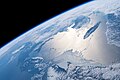
 Gulf of St Lawrence (MODIS 2019-07-20).jpg 4.318×3.217; 1,1 MB
-
 Havrestpierre4.jpg 2.304×1.728; 500 kB
-
 Havrestpierre5.jpg 2.304×1.728; 591 kB
-
 Ice as far as the eye can see in the Gulf of St. Lawrence (39250866530).jpg 4.608×3.456; 3,82 MB
-
 ISS-27 HTV-2 Canadarm2 and Dextre.jpg 4.288×2.848; 1,26 MB
-
 ISS-58 Anticosti Island in the Gulf of St. Lawrence.jpg 5.568×3.712; 4,06 MB
-
 ISS-59 Canada, Gulf of St. Lawrence.jpg 5.568×3.712; 2,56 MB
-
 ISS-59 Canada, Saint Lawrence River and Gulf of St. Lawrence.jpg 5.568×3.712; 3,17 MB
-
 ISS-59 East coasts of Canada and the United States.jpg 5.568×3.712; 2,74 MB
-
 ISS006-E-28943 - View of the Gulf of Saint Lawrence.jpg 3.032×2.064; 887 kB
-
 ISS006-E-28944 - View of the Gulf of Saint Lawrence.jpg 3.032×2.064; 894 kB
-
 ISS006-E-28945 - View of the Gulf of Saint Lawrence.jpg 3.032×2.064; 885 kB
-
 ISS006-E-28946 - View of the Gulf of Saint Lawrence.jpg 3.032×2.064; 858 kB
-
 ISS006-E-34091 - View of the Gulf of Saint Lawrence.jpg 3.032×2.064; 1,56 MB
-
 ISS006-E-34633 - View of the Gulf of Saint Lawrence.jpg 3.032×2.064; 1,61 MB
-
 ISS007-E-13069 - View of the Gulf of Saint Lawrence.jpg 3.032×2.064; 650 kB
-
 ISS040-E-129913 - View of the Gulf of Saint Lawrence.jpg 4.256×2.832; 1,11 MB
-
 Karte von dem Laufe des Flusses St. Laurenz.jpg 2.545×2.015; 1,03 MB
-
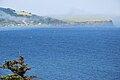 L'Anse-au-Griffon.jpg 3.872×2.592; 4,58 MB
-
 Lighthouse Rd, East Point (471409) (9450822562).jpg 3.800×2.136; 1,95 MB
-
 Mares résiduelles.jpg 960×539; 64 kB
-
 Naufrage, PEI (38044435).jpg 1.800×1.200; 249 kB
-
 Naufrage, PEI (38044438).jpg 1.800×1.200; 315 kB
-
 Nissan LEAF au bout de la Route 138 Kegaska, Quebec.jpg 4.032×1.952; 3 MB
-

-
 Parc national de l'Archipel-de-Mingan, Monolithes.jpg 5.616×2.570; 10,07 MB
-
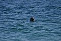 PhoqueDeBaie.jpg 604×403; 49 kB
-
 Phytoplankton Bloom in the Gulf of St Lawrence (MODIS 2021-07-14).jpg 7.141×6.186; 4,22 MB
-
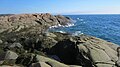
 Pleasant bay shoreline.jpg 4.000×3.000; 2,03 MB
-
 Prince Edward Island Farm Vineyard, Canada (24237039920).jpg 5.117×3.044; 9,26 MB
-
 Quebec DGJ 8822 - Sunrise on the Gaspe (4975985927).jpg 4.288×2.848; 9,7 MB
-
 Quebec, New Brunswick, and the Gulf of St Lawrence (MODIS 2019-01-06).jpg 7.741×7.056; 10,33 MB
-
 Rorqual.gif 100×60; 225 kB
-
 Sea ice in the Gulf of St. Lawrence.jpg 3.200×4.200; 3,22 MB
-
 Skyline Trail.jpg 2.048×1.354; 824 kB
-
 St-Paul-s-bay-st-lawrence-river.jpg 500×368; 13 kB
-
 Ste Anne des Mont 20020916 23a.jpg 3.559×2.354; 2,5 MB
-
 Sunset over the Gulf of Saint Lawrence - Port au Choix, Newfoundland 2019-08-19.jpg 5.607×3.154; 10,69 MB
-
 The Bell System technical journal (1922) (14752715181).jpg 3.216×1.666; 1,08 MB
-
 Trail Views (15348183258).jpg 6.000×4.000; 23,88 MB
-
 Wood Islands (Point Prim) Lighthouse, Prince Edward Island, Canada (24506417296).jpg 3.583×2.071; 4,07 MB
-
 Érosion aux îles-de-la-Madeleine, l'anse-aux-herbes, Québec, Canada.jpg 5.432×3.648; 14,57 MB


_(20374481596).jpg)


_(1858)_(20007632494).jpg)
_(1858)_(20007635534).jpg)
_(1858)_(20603943016).jpg)


_(9448033319).jpg)
.jpg)

.jpg)
_(9448035123).jpg)
_(9448036233).jpg)
.jpg)


.jpg)


_(9450822562).jpg)

.jpg)
.jpg)

.jpg)


.jpg)

.jpg)
.jpg)
.jpg)


_(14752715181).jpg)
.jpg)
_Lighthouse,_Prince_Edward_Island,_Canada_(24506417296).jpg)
