Category:Gunthorpe, Peterborough
Jump to navigation
Jump to search
English: Gunthorpe is an area of Peterborough, in the unparished area of Peterborough, in the Peterborough district, in the county of Cambridgeshire, England.
residential area of Peterborough, Cambridgeshire, United Kingdom | |||||
| Upload media | |||||
| Instance of | |||||
|---|---|---|---|---|---|
| Location | City of Peterborough, Cambridgeshire, East of England, England | ||||
 | |||||
Media in category "Gunthorpe, Peterborough"
The following 9 files are in this category, out of 9 total.
-
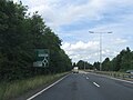 A15 northwest bound - geograph.org.uk - 5072028.jpg 640 × 480; 56 KB
-
 Brookside Methodist Church, Gunthorpe - geograph.org.uk - 6276881.jpg 1,632 × 920; 415 KB
-
 EIIR postbox on Coniston Road, Gunthorpe - geograph.org.uk - 6276857.jpg 920 × 1,632; 416 KB
-
 Foot bridge over A15 - geograph.org.uk - 5072032.jpg 640 × 480; 57 KB
-
 Hallfields Lane, Gunthorpe - geograph.org.uk - 3119927.jpg 640 × 480; 61 KB
-
 Paston Parkway, Gunthorpe - geograph.org.uk - 6193430.jpg 1,888 × 1,232; 1.18 MB
-
 Paston Parkway, Gunthorpe - geograph.org.uk - 6207602.jpg 1,658 × 1,051; 804 KB
-
 Roundabout on Gunthorpe Road - geograph.org.uk - 5653372.jpg 2,304 × 1,728; 844 KB
-
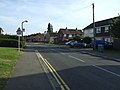
 The Harrier, Gunthorpe - geograph.org.uk - 6276872.jpg 1,632 × 920; 404 KB


