Category:Hülle (Oberdollendorf)
Jump to navigation
Jump to search
| Object location | | View all coordinates using: OpenStreetMap |
|---|
Media in category "Hülle (Oberdollendorf)"
The following 6 files are in this category, out of 6 total.
-
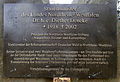 Königswinter-Oberdollendorf Hülle Gedenktafel.jpg 4,567 × 3,110; 3.77 MB
-
 Königswinter-Oberdollendorf Hülle Tafel.jpg 5,273 × 2,988; 6.54 MB
-
 Königswinter-Oberdollendorf Hütte Rheinblick.jpg 3,836 × 2,812; 2.51 MB
-
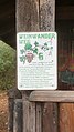 Königswinter-Oberdollendorf Weinwanderweg Station 6.jpg 2,690 × 4,769; 3.66 MB
-
 Weinbergoberdollendorf12.JPG 4,000 × 3,000; 4.62 MB
-
 Weinbergoberdollendorf15.JPG 3,000 × 4,000; 4.27 MB


