Help
Category
:
HAER images of the Blue Ridge Parkway
From Wikimedia Commons, the free media repository
Jump to navigation
Jump to search
English:
Historic American Engineering Record images of the
Blue Ridge Parkway
(HAER NC-42).
Media in category "HAER images of the Blue Ridge Parkway"
The following 200 files are in this category, out of 321 total.
(previous page) (
next page
)
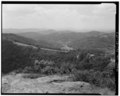
Axial Parkway alignment along ridge top. Note the open vistas to either side of the roadway. These are maintained through vegetation management. The wood guide rail is a HAER NC,11-ASHV.V,2-247 (CT).tif
5,000 × 4,004; 57.29 MB
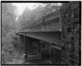
Big Laurel Mountain Viaduct. This steel girder viaduct was built in 1976. Since it is not visible from other sections of the parkway, the stone facing on the railing does not HAER NC,11-ASHV.V,2-165.tif
4,073 × 5,000; 19.42 MB
Big Laurel Mountain Viaduct. View of the steep slope upon which the steel pier is built. The construction of this viaduct eliminated either a large scar of fill, helping to HAER NC,11-ASHV.V,2-166.tif
3,995 × 5,000; 19.05 MB
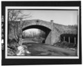
Big Pine Creek Bridge -1. This concrete slab bridge was built 1938. It is an example of where the stone railing continues across the bridge. Facing east. - Blue Ridge Parkway, HAER NC,11-ASHV.V,2-99.tif
5,000 × 4,020; 19.17 MB
Big Pine Creek Bridge -6, built in 1937, with its old wooden railings. - Blue Ridge Parkway, Between Shenandoah National Park and Great Smoky Mountains, Asheville, Buncombe HAER NC,11-ASHV.V,2-227.tif
5,000 × 4,030; 19.22 MB
Big Pine Creek Bridge -7 cost approximately 45,000 to complete. - Blue Ridge Parkway, Between Shenandoah National Park and Great Smoky Mountains, Asheville, Buncombe County, NC HAER NC,11-ASHV.V,2-228.tif
5,000 × 3,828; 18.26 MB
Bluff Mountain tunnel. View of the west porta. - Blue Ridge Parkway, Between Shenandoah National Park and Great Smoky Mountains, Asheville, Buncombe County, NC HAER NC,11-ASHV.V,2-23.tif
5,000 × 4,000; 19.08 MB
Camp Creek Bridge. This is a Roman spandrel arch bridge built in 1939. View shows the stone arch stones and the stone facing on the headwall and wing wall. Looking north HAER NC,11-ASHV.V,2-145.tif
4,003 × 5,000; 19.09 MB
Camp Creek Bridge. View of the road deck showing the stone-faced guard rails and the grass shoulders continuing across the bridge. Looking east-southeast. - Blue Ridge Parkway, HAER NC,11-ASHV.V,2-144.tif
5,000 × 3,981; 18.99 MB
CCC Camp NP-21 was established at the Bluffs (Doughton Park) located on what is now the Doughton Park Maintenance Area. It opened September 1, 1938 and was abandoned July 17, HAER NC,11-ASHV.V,2-230.tif
5,000 × 3,975; 18.96 MB
CCC crews loading a large tree for transplanting. - Blue Ridge Parkway, Between Shenandoah National Park and Great Smoky Mountains, Asheville, Buncombe County, NC HAER NC,11-ASHV.V,2-231.tif
5,000 × 4,024; 19.19 MB
Church on morning dew lane next to parkway. Looking southwest. - Blue Ridge Parkway, Between Shenandoah National Park and Great Smoky Mountains, Asheville, Buncombe County HAER NC,11-ASHV.V,2-250 (CT).tif
5,000 × 3,994; 57.14 MB
Closeup view of rock cut at east fork overlook. Looking northwest. - Blue Ridge Parkway, Between Shenandoah National Park and Great Smoky Mountains, Asheville, Buncombe County, HAER NC,11-ASHV.V,2-186.tif
5,000 × 4,020; 19.17 MB
Construction of the Back Creek Bridge over Back Creek and Virginia Route 613. This is a good example of a precast concrete girder bridge. Note the fallen beam at the far end. - HAER NC,11-ASHV.V,2-216.tif
3,974 × 5,000; 18.95 MB
Construction of tunnel portal in progress. Note the metal and timber bracing for the tunnel lining still in place. - Blue Ridge Parkway, Between Shenandoah National Park and HAER NC,11-ASHV.V,2-243.tif
5,000 × 4,036; 19.25 MB
Craggy Flats Tunnel. Detail of the stone facing on the north portal. Looking southwest. - Blue Ridge Parkway, Between Shenandoah National Park and Great Smoky Mountains, HAER NC,11-ASHV.V,2-173.tif
4,078 × 5,000; 19.45 MB
Craggy Gardens Visitor Center. View of the rock retaining wall outside the women's restroom to the northeast. - Blue Ridge Parkway, Between Shenandoah National Park and Great HAER NC,11-ASHV.V,2-168.tif
5,000 × 3,994; 19.05 MB
Craggy Pinnacle Tunnel. View of the east portal and the stone road drain. The finished portal actually extend beyond the end of the tunnel. Facing west-southwest. - Blue Ridge HAER NC,11-ASHV.V,2-167.tif
3,953 × 5,000; 18.85 MB
Cumberland knob recreation area. The visitor contact center originally opened in 1941 as a combined sandwich shop, picnic area, and comfort station, the central building of the HAER NC,11-ASHV.V,2-97.tif
5,000 × 4,022; 19.18 MB
Cumberland knob recreation area. View of the historic chestnut timber and stone trail shelter. View to the north. - Blue Ridge Parkway, Between Shenandoah National Park and HAER NC,11-ASHV.V,2-98.tif
5,000 × 3,998; 19.07 MB
Devil's Courthouse Overlook. View of the parking area from the lookout at the top of Devil's Courthouse looking to the northwest. - Blue Ridge Parkway, Between Shenandoah HAER NC,11-ASHV.V,2-189.tif
5,000 × 4,013; 19.14 MB
Devil's Courthouse Overlook. View to the south-southwest from the lookout at the top of Devil's Courthouse. - Blue Ridge Parkway, Between Shenandoah National Park and Great HAER NC,11-ASHV.V,2-190.tif
5,000 × 4,030; 19.22 MB
Doughton Park Recreation Area Comfort Station. Instead of trying to hide this building, it was decided to let it be seen. A salt box design reflecting a mountain building was HAER NC,11-ASHV.V,2-108.tif
5,000 × 3,999; 19.07 MB
Doughton Park Recreation Area concession building. Interior view of the coffee shop built in 1948. Facing west. - Blue Ridge Parkway, Between Shenandoah National Park and Great HAER NC,11-ASHV.V,2-106.tif
5,000 × 3,995; 19.05 MB
Doughton Park Recreation Area Lodge. Opened in 1949, this was the first lodge to open on the parkway. View looking north across the meadows. - Blue Ridge Parkway, Between HAER NC,11-ASHV.V,2-107.tif
5,000 × 4,010; 19.12 MB
Doughton Park Recreation Area Trail Shelter likely built in late 1930's. Looking south. - Blue Ridge Parkway, Between Shenandoah National Park and Great Smoky Mountains, HAER NC,11-ASHV.V,2-110.tif
5,000 × 4,045; 19.29 MB
Doughton Park Recreation Area. Distant view of road cut, roadway, and stone railing at ice cliffs. Looking northeast. - Blue Ridge Parkway, Between Shenandoah National Park and HAER NC,11-ASHV.V,2-113.tif
5,000 × 4,010; 19.12 MB
Doughton Park Recreation Area. View of alligator back and the parkway seen from bluff mountain. Looking west. - Blue Ridge Parkway, Between Shenandoah National Park and Great HAER NC,11-ASHV.V,2-109.tif
5,000 × 4,011; 19.13 MB
Doughton Park Recreation Area. View of Laurel Spring Valley in distance, alligator back, and overlook in foreground. Looking west. - Blue Ridge Parkway, Between Shenandoah HAER NC,11-ASHV.V,2-114.tif
5,000 × 4,030; 19.22 MB
Doughton Park Recreation Area. View of parkway with the road crossing alligator back. Facing southeast. - Blue Ridge Parkway, Between Shenandoah National Park and Great Smoky HAER NC,11-ASHV.V,2-111.tif
4,008 × 5,000; 19.11 MB
Doughton Park Recreation Area. View of road cut at ice cliffs. Looking east-northeast. - Blue Ridge Parkway, Between Shenandoah National Park and Great Smoky Mountains, HAER NC,11-ASHV.V,2-112.tif
5,000 × 4,013; 19.14 MB
Doughton Park Recreation Area. View of roadway alignment around alligator back and parking overlook in foreground. - Blue Ridge Parkway, Between Shenandoah National Park and HAER NC,11-ASHV.V,2-115.tif
5,000 × 3,976; 18.96 MB
Doughton Park Recreation Area. View of the chestnut post-and-rail fences and meadows for which the area is remembered. - Blue Ridge Parkway, Between Shenandoah National Park HAER NC,11-ASHV.V,2-116.tif
5,000 × 3,963; 18.9 MB
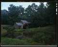
Doughton Park. View of the Martin Brinegar cabin which was restored for interpretative purposed in 1941 with the preparation of measured drawings for the Historic American HAER NC,11-ASHV.V,2-254 (CT).tif
5,000 × 4,021; 57.53 MB
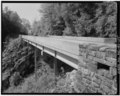
French Broad River Bridge. This 10-span, 925 concrete box girder bridge, built in 1967, also crosses North Carolina route 191. Looking north-northeast. - Blue Ridge Parkway, HAER NC,11-ASHV.V,2-180.tif
5,000 × 3,964; 18.9 MB
Goshen Creek Viaduct. This steel girder viaduct, built in 1949, is the only viaduct with solid, stone-faced, concrete reinforced piers. View facing north-northeast. - Blue HAER NC,11-ASHV.V,2-122.tif
3,999 × 5,000; 19.07 MB
Goshen Creek Viaduct. View showing the curvilinear alignment of the viaduct, its steel railings, and stone faced abutments. Looking northeast. - Blue Ridge Parkway, Between HAER NC,11-ASHV.V,2-123.tif
5,000 × 4,023; 19.19 MB
Grade separation structure over North Carolina Route 80 at Buck Creek Gap. - Blue Ridge Parkway, Between Shenandoah National Park and Great Smoky Mountains, Asheville, Buncombe HAER NC,11-ASHV.V,2-239.tif
5,000 × 3,971; 18.94 MB
Great Wall of China. This is a large stone retaining wall built to support the parkway around rough ridge on Grandfather Mountain. Linn Cove viaduct visible in the distance. HAER NC,11-ASHV.V,2-131.tif
5,000 × 3,992; 19.04 MB
A view of the parkway with an agricultural lease to the right. Facing south-southwest. - Blue Ridge Parkway, Between Shenandoah National Park and Great Smoky Mountains, HAER NC,11-ASHV.V,2-87.tif
5,000 × 4,048; 19.31 MB
Adney Gap. View of agricultural least. View to west-southwest. - Blue Ridge Parkway, Between Shenandoah National Park and Great Smoky Mountains, Asheville, Buncombe County, NC HAER NC,11-ASHV.V,2-59.tif
5,000 × 4,019; 19.17 MB
Adney Gap. View of curvilinear alignment of parkway passing through agricultural lease lands. - Blue Ridge Parkway, Between Shenandoah National Park and Great Smoky Mountains, HAER NC,11-ASHV.V,2-60.tif
5,000 × 4,018; 19.16 MB
Adney Gap. View of curvilinear. Alignment of parkway passing through agricultural lease lands. Looking south-southwest. - Blue Ridge Parkway, Between Shenandoah National Park HAER NC,11-ASHV.V,2-58.tif
5,000 × 3,946; 18.82 MB
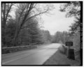
Axial Parkway alignment along ridge top. Note the open vistas to either side of the roadway and the wood guardrail. View is to the northeast. - Blue Ridge Parkway, Between HAER NC,11-ASHV.V,2-48.tif
5,000 × 3,997; 19.06 MB
E.B. Jeffress Recreation Area. View of stone-walled pedestrian overlook at the cascades, a waterfall on falls creek. Looking southwest. - Blue Ridge Parkway, Between Shenandoah HAER NC,11-ASHV.V,2-120.tif
5,000 × 4,037; 19.25 MB
E.B. Jeffress Recreational Area. View of the Cool Springs Baptist Church on the left and the Jessie Brown Cabin on the foreground. The church when acquired by the Park Service HAER NC,11-ASHV.V,2-121.tif
5,000 × 4,037; 19.25 MB
Harry Byrd Flood Memorial Bride. This 1,040 prestressed concrete girder bridge, built in 1959, is the longest of its type on the parkway. - Blue Ridge Parkway, Between HAER NC,11-ASHV.V,2-39.tif
5,000 × 4,078; 19.45 MB
Harry Flood Byrd Memorial Bridge. View of the underslung pedestrian bridge which provides access between the James River Visitor Center and the James River and Kanawha Canal. HAER NC,11-ASHV.V,2-37.tif
5,000 × 4,010; 19.12 MB
Heintooga Spur Road, view from the mile high overlook looking north-northwest. - Blue Ridge Parkway, Between Shenandoah National Park and Great Smoky Mountains, Asheville, HAER NC,11-ASHV.V,2-199.tif
5,000 × 4,043; 19.28 MB
Heintooga Spur Road, view of comfort station. Looking south. - Blue Ridge Parkway, Between Shenandoah National Park and Great Smoky Mountains, Asheville, Buncombe County, NC HAER NC,11-ASHV.V,2-202.tif
5,000 × 4,002; 19.09 MB
Heintooga Spur Road, view of road cuts along roadway. Looking south. - Blue Ridge Parkway, Between Shenandoah National Park and Great Smoky Mountains, Asheville, Buncombe HAER NC,11-ASHV.V,2-201.tif
5,000 × 4,037; 19.25 MB
Heintooga Spur Road, view of the masonic marker built with contributions from lodges of every state. Looking southwest. - Blue Ridge Parkway, Between Shenandoah National Park HAER NC,11-ASHV.V,2-200.tif
5,000 × 4,033; 19.23 MB
Humpback Gap Overlook. View of stone rail-and-rider fences built in 1943 with the curvilinear alignment of the parkway in the background. View facing southwest. - Blue Ridge HAER NC,11-ASHV.V,2-7.tif
5,000 × 4,120; 19.65 MB
Humpback Gap Overlook. View of stone rail-and-rider fences, commonly referred to as hog fences. There were built by civilian public service employees in 1943. An original wall HAER NC,11-ASHV.V,2-6.tif
5,000 × 3,997; 19.06 MB
Humpback Mountain Viaduct. This steel girder viaduct, built in 1940, has the unusual feature os solid concrete railings. View shows the steel piers built upon a very steep HAER NC,11-ASHV.V,2-155.tif
5,000 × 3,986; 19.01 MB
Humpback Mountain Viaduct. View shows the stone faced abutment. Due to the skew of the abutment, it doubles as a foundation for one of the piers. Looking south. - Blue Ridge HAER NC,11-ASHV.V,2-156.tif
5,000 × 4,005; 19.1 MB
Humpback Rocks Visitor Center. Closeup view of the unmortared hand-laid stone and doorway of the root cellar, relocated from the John C. Clark Place. View faces east-southeast. - HAER NC,11-ASHV.V,2-5.tif
5,000 × 4,007; 19.11 MB
Humpback Rocks Visitor Center. Original was constructed in 1955 and opened 19 May 1956. Destroyed by arson in 1981, it was rebuilt as an expanded facility and opened the HAER NC,11-ASHV.V,2-2.tif
5,000 × 4,156; 19.82 MB
Humpback Rocks Visitor Center. View of the Mountain Farm Exhibit located on the general site of the Old Charlie Carter Farm. To the left is the CA. 1890 single-crib log HAER NC,11-ASHV.V,2-244 (CT).tif
5,000 × 4,055; 58.02 MB
Humpback Rocks Visitor Center. View of the Mountain Farm Exhibit located on the general site of the Old Charlie Carter Farm. To the left is the CA. 1890 single-crib log William HAER NC,11-ASHV.V,2-4.tif
5,000 × 4,014; 19.14 MB
Humpback Rocks Visitor Center. View of the self-guided interpretive mountain farm trail and a post-and-rail fence in the foreground with humpback rocks in the background. The HAER NC,11-ASHV.V,2-3.tif
3,936 × 5,000; 18.77 MB
Interstate 77 grade separation structure. This 377 four span structure, built in 1974, is typical of most interstate bridges built in America in recent years, except for its HAER NC,11-ASHV.V,2-92.tif
5,000 × 4,045; 19.29 MB
Interstate Route 26 Viaduct. This steel girder viaduct, built in 1966, is typical of many highway structures except for the height of its piers. Looking south-southeast. - Blue HAER NC,11-ASHV.V,2-179.tif
5,000 × 3,989; 19.02 MB
James River and Kanawha Canal Locks. The canal, which operated between 1835 to 1880, serves as the focal point of the area's interpretation. The Battery Creek Lock was HAER NC,11-ASHV.V,2-38.tif
5,000 × 3,994; 19.05 MB
James River Visitor Center. Opened as an open air visitor center in 1962, it was enclosed and a heating system installed in 1984 to allow use through the cooler months and help HAER NC,11-ASHV.V,2-35.tif
5,000 × 3,959; 18.88 MB
James River Visitor Center. View of visitor center entrance, bench, and drinking fountain. Looking west. - Blue Ridge Parkway, Between Shenandoah National Park and Great Smoky HAER NC,11-ASHV.V,2-36.tif
5,000 × 4,008; 19.11 MB
Julian Price Memorial Park. Forty-seven acre Julian Price Lake created by an impoundment. Looking west. - Blue Ridge Parkway, Between Shenandoah National Park and Great Smoky HAER NC,11-ASHV.V,2-130.tif
5,000 × 3,990; 19.03 MB
Julian Price Memorial Park. Price Lake Dam. A concrete slab bridge crosses the top of the dam impounding a forty-seven acre lake. Looking west. - Blue Ridge Parkway, Between HAER NC,11-ASHV.V,2-129.tif
5,000 × 3,997; 19.06 MB
Kelly School. The view of this school in its unrestored condition is an example of the many cultural resources to be found along th parkway. Looking southeast. - Blue Ridge HAER NC,11-ASHV.V,2-63.tif
5,000 × 4,050; 19.31 MB
Laurel Fork Creek Bridge -2. Detail of the wood guardrail with a concrete post. Looking northeast. - Blue Ridge Parkway, Between Shenandoah National Park and Great Smoky HAER NC,11-ASHV.V,2-81.tif
4,010 × 5,000; 19.12 MB
Laurel Fork Creek Bridge -2. Visitor's view of bridge and its stone railings and wood guide rails which provide views of the stream below. Facing north. - Blue Ridge Parkway, HAER NC,11-ASHV.V,2-82.tif
5,000 × 3,984; 19 MB
Laurel Fork Viaduct. Elevation view of this 545 1939 steel girder viaduct. Example of structure with plain reinforced concrete arches. Looking northwest. - Blue Ridge Parkway, HAER NC,11-ASHV.V,2-117.tif
5,000 × 3,940; 18.79 MB
Laurel Fork Viaduct. View of the curving alignment of viaduct deck with its concrete railings. Looking east. - Blue Ridge Parkway, Between Shenandoah National Park and Great HAER NC,11-ASHV.V,2-118.tif
5,000 × 4,018; 19.16 MB
Lickstone Ridge Tunnel. All but three of the tunnel have minimum height of 13, which accommodates most large recreational vehicles. This tunnel has the lowest clearance at 11-3 HAER NC,11-ASHV.V,2-203.tif
5,000 × 4,040; 19.27 MB
Linn Cove contact station. Center opened in 1987 to provide information about the Linn Cove viaduct. Looking south-southeast. - Blue Ridge Parkway, Between Shenandoah National HAER NC,11-ASHV.V,2-140.tif
5,000 × 4,034; 19.24 MB
Linn Cove Viaduct. Placement of its foundations were determined by the location of the numerous boulders its built around. Looking south-southwest. - Blue Ridge Parkway, HAER NC,11-ASHV.V,2-137.tif
5,000 × 3,983; 19 MB
Linn Cove Viaduct. This is the first precast concrete segmental concrete segmental viaduct to be built with the progressive method in the United States. It contains nearly HAER NC,11-ASHV.V,2-256 (CT).tif
4,616 × 3,693; 35.06 MB
Linn Cove Viaduct. This is the first precast concrete segmental viaduct to be built with the progressive method in the United States. It contains nearly every type of highway HAER NC,11-ASHV.V,2-136.tif
3,937 × 5,000; 18.78 MB
Linn Cove Viaduct. Underneath view of the viaduct showing placement of piers amongst Grandfather Mountain's boulders. Looking north. - Blue Ridge Parkway, Between Shenandoah HAER NC,11-ASHV.V,2-139.tif
5,000 × 4,049; 19.31 MB
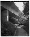
Linn Cove Viaduct. View of the Tanawha trail and underneath of the viaduct. Shape of the piers was designed to provide aesthetic sense of light and shadow. Looking north HAER NC,11-ASHV.V,2-138.tif
4,027 × 5,000; 19.2 MB
Linville Falls Contact Station. This is an example of a new contact station with comfort station. It was built in 1984. Looking south. - Blue Ridge Parkway, Between Shenandoah HAER NC,11-ASHV.V,2-146.tif
5,000 × 4,000; 19.08 MB
Linville Falls Recreation Area. Detail of the diamond shaped cutwaters of the Linville River Bridge. Looking south. - Blue Ridge Parkway, Between Shenandoah National Park and HAER NC,11-ASHV.V,2-151.tif
4,097 × 5,000; 19.54 MB
Linville Falls Recreation Area. The 309 Linville River Bridge is the parkway's largest stone-faced bridge. This triple span bridge, built in 1940, is an example of a spandrel HAER NC,11-ASHV.V,2-149.tif
5,000 × 4,012; 19.13 MB
Linville Falls Recreation Area. View of Linville Falls from castle view looking northwest. - Blue Ridge Parkway, Between Shenandoah National Park and Great Smoky Mountains, HAER NC,11-ASHV.V,2-147.tif
3,989 × 5,000; 19.02 MB
Linville Falls Recreation Area. View of Linville Falls from Erwin's view looking west. - Blue Ridge Parkway, Between Shenandoah National Park and Great Smoky Mountains, HAER NC,11-ASHV.V,2-148.tif
5,000 × 4,053; 19.33 MB
Linville River Recreation Area. View of the deck, sidewalks, and stone guardrails of the Linville River Bridge looking southwest. - Blue Ridge Parkway, Between Shenandoah HAER NC,11-ASHV.V,2-152.tif
5,000 × 3,967; 18.92 MB
Little Glade Mill Pond. One of the feature ponds along the parkway, this Mill Pond is popular for picnicking. View to the west-southwest. - Blue Ridge Parkway, Between HAER NC,11-ASHV.V,2-102.tif
5,000 × 4,062; 19.37 MB
Mabry Mill. The varying roof lines and siding gives the mill an interesting texture, increasing its photogenic value. Looking north. - Blue Ridge Parkway, Between HAER NC,11-ASHV.V,2-253 (CT).tif
4,013 × 4,973; 57.1 MB
Mabry Mill. The varying roof lines and siding gives the mill an interesting texture, increasing its photogenic value. Looking north. - Blue Ridge Parkway, Between Shenandoah HAER NC,11-ASHV.V,2-84.tif
3,979 × 5,000; 18.98 MB
Mabry Mill. View of the mill and its dredged reflecting pond illustrating how the parkway has manipulated the landscape to make it more picturesque. Looking north-northwest from HAER NC,11-ASHV.V,2-83.tif
5,000 × 4,006; 19.1 MB
Mabry Mill. View of the mill and the NPS dredged reflecting pond which illustrates how the parkway has manipulated the landscape to make it more picturesque. Looking north HAER NC,11-ASHV.V,2-252 (CT).tif
5,000 × 4,041; 57.81 MB
Metz Run Viaduct. Detail of the reinforced concrete arched piers. Looking south-southeast. - Blue Ridge Parkway, Between Shenandoah National Park and Great Smoky Mountains, HAER NC,11-ASHV.V,2-57.tif
5,000 × 4,057; 19.35 MB
Metz Run Viaduct. The viaduct, built in 1960, is a prime example of a precast concrete girder structure with arched piers. View is to the west-southwest from the overlook. - HAER NC,11-ASHV.V,2-56.tif
5,000 × 3,971; 18.94 MB
Model of stone masonry for a double box culvert. - Blue Ridge Parkway, Between Shenandoah National Park and Great Smoky Mountains, Asheville, Buncombe County, NC HAER NC,11-ASHV.V,2-219.tif
5,000 × 4,072; 19.42 MB
Moses H. Cone Memorial Park. View of barbed wire fence along carriage trail with a concrete box culvert for the carriage trail in the background. It is the only culvert on the HAER NC,11-ASHV.V,2-126.tif
5,000 × 4,024; 19.19 MB
Moses H. Cone Memorial Park. View of carriage trail and flat top mountain from cone cemetery. Looking north-northeast. - Blue Ridge Parkway, Between Shenandoah National Park HAER NC,11-ASHV.V,2-125.tif
5,000 × 4,014; 19.14 MB
Moses H. Cone Memorial Park. View of the flat top manor from the bass lake carriage road. Looking north-northwest. - Blue Ridge Parkway, Between Shenandoah National Park and HAER NC,11-ASHV.V,2-127.tif
5,000 × 4,005; 19.1 MB
Moses H. Cone Memorial Park. View of the flat top manor porch, carriage road, and pasture. View looking south-southwest. - Blue Ridge Parkway, Between Shenandoah National Park HAER NC,11-ASHV.V,2-124.tif
5,000 × 4,025; 19.2 MB
Moses H. Cone Memorial Park. View of the stone faced bridge on the bass lake carriage trail. Facing west. - Blue Ridge Parkway, Between Shenandoah National Park and Great Smoky HAER NC,11-ASHV.V,2-128.tif
5,000 × 4,017; 19.16 MB
Mount Pisgah Inn. This had been the site of a concessionaires since 1919. The first section of the present inn was completed in 1965. Looking west-southwest. - Blue Ridge HAER NC,11-ASHV.V,2-182.tif
5,000 × 4,042; 19.28 MB
North Carolina Route 1130 grade separation structure at Air Bellows Gap. Detail of the stepped wing wall. Looking southwest. - Blue Ridge Parkway, Between Shenandoah National HAER NC,11-ASHV.V,2-104.tif
5,000 × 4,020; 19.17 MB
North Carolina Route 1130 grade separation structure at Air Bellows Gap. Elevation view of concrete slab bridge built in 1937. Looking southeast. - Blue Ridge Parkway, Between HAER NC,11-ASHV.V,2-103.tif
5,000 × 4,015; 19.15 MB
North Carolina Route 1130 grade separation structure at Air Bellows Gap. View showing the access road from the parkway. - Blue Ridge Parkway, Between Shenandoah National Park HAER NC,11-ASHV.V,2-105.tif
5,000 × 4,051; 19.32 MB
North Carolina Route 181 grade separation structure is a single-span, reinforced concrete, elliptical spandrel arch structure built in 1959, it is on a slight skew as it HAER NC,11-ASHV.V,2-257 (CT).tif
5,000 × 4,013; 57.41 MB
North Carolina route 181 grade separation structure. Detail of the arch stones. View is east-southeast. - Blue Ridge Parkway, Between Shenandoah National Park and Great Smoky HAER NC,11-ASHV.V,2-143.tif
4,045 × 5,000; 19.29 MB
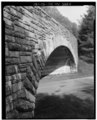
North Carolina route 181 grade separation structure. This single span, reinforced concrete, elliptical, spandrel arch structure, built in 1959, is on a slight skew as it passes HAER NC,11-ASHV.V,2-142.tif
5,000 × 4,036; 19.25 MB
North Carolina Route 80 grade separation structure. The structure at Buck Creek Gap, built in 1942, has a clear span of 139. Both the roadway running atop and under the HAER NC,11-ASHV.V,2-161.tif
5,000 × 3,984; 19 MB
Oconaluffee River Bridge is the southern terminus of the Blue Ride Parkway. It is a concrete girder bridge completed in 1957. It is the only concrete girder bridge with stone HAER NC,11-ASHV.V,2-207.tif
5,000 × 3,999; 19.07 MB
Original grade separation on the Moses Cone Estate for a carriage trial crossing over the Yonahlossee Trail, now designated U.S. 221. Publicity photo of the Linville River HAER NC,11-ASHV.V,2-237.tif
5,000 × 4,031; 19.22 MB
Otter Creek Bridge -2. View of the stone facing common on nearly all concrete box culverts. The stone faced arch mimics rigid frame structures. Culverts were used for a variety HAER NC,11-ASHV.V,2-25.tif
5,000 × 3,974; 18.95 MB
Otter Creek Bridge -5. Detail of the interior abutment wall. Wingwall, and facade thickness. - Blue Ridge Parkway, Between Shenandoah National Park and Great Smoky Mountains, HAER NC,11-ASHV.V,2-27.tif
4,015 × 5,000; 19.15 MB
Otter Creek Bridge -5. View of elevation of stone facing on concrete box culvert. Stone facing appears on the headwall, tail wall, wingwalls, interior abutment wall and the pier HAER NC,11-ASHV.V,2-26.tif
5,000 × 4,013; 19.14 MB
Otter Creek Campground, view of Creekside Campsite. Facing south-southwest. - Blue Ridge Parkway, Between Shenandoah National Park and Great Smoky Mountains, Asheville, Buncombe HAER NC,11-ASHV.V,2-28.tif
5,000 × 3,960; 18.89 MB
Otter Creek Campground, view of Creekside Campsite. Looking south-southeast. - Blue Ridge Parkway, Between Shenandoah National Park and Great Smoky Mountains, Asheville, HAER NC,11-ASHV.V,2-29.tif
4,003 × 5,000; 19.09 MB
Otter Lake Dam. Vertical view looking southeast. - Blue Ridge Parkway, Between Shenandoah National Park and Great Smoky Mountains, Asheville, Buncombe County, NC HAER NC,11-ASHV.V,2-31.tif
3,956 × 5,000; 18.87 MB
Otter Lake Dam. View from downstream show how the dam blends into its environment. Looking east-northeast. - Blue Ridge Parkway, Between Shenandoah National Park and Great Smoky HAER NC,11-ASHV.V,2-32.tif
3,991 × 5,000; 19.03 MB
Otter Lake Dam. View shows rustic stone facade of the dam. The stepped face of the dam gives the illusion of a natural cascade. Facing southeast. - Blue Ridge Parkway, Between HAER NC,11-ASHV.V,2-30.tif
5,000 × 3,972; 18.94 MB
Otter Lake. Tree framed view of Otter Lake. Facing southwest. - Blue Ridge Parkway, Between Shenandoah National Park and Great Smoky Mountains, Asheville, Buncombe County, NC HAER NC,11-ASHV.V,2-34.tif
5,000 × 4,036; 19.25 MB
Otter Lake. View of the lake created by Otter Lake Dam. View is northwest. - Blue Ridge Parkway, Between Shenandoah National Park and Great Smoky Mountains, Asheville, Buncombe HAER NC,11-ASHV.V,2-33.tif
5,000 × 4,025; 19.2 MB
Parkway ranger force with patrol vehicles. - Blue Ridge Parkway, Between Shenandoah National Park and Great Smoky Mountains, Asheville, Buncombe County, NC HAER NC,11-ASHV.V,2-209.tif
5,000 × 3,995; 19.05 MB
Parkway Road cut near Devil's Garden. - Blue Ridge Parkway, Between Shenandoah National Park and Great Smoky Mountains, Asheville, Buncombe County, NC HAER NC,11-ASHV.V,2-229.tif
5,000 × 3,606; 17.2 MB
Paynes Creek Culvert. This concrete box culvert is a typical example of a concrete box culvert finished with rusticated stone. Its arches reflect the rigid frame structures. HAER NC,11-ASHV.V,2-64.tif
5,000 × 3,955; 18.86 MB
Peaks of Otter Visitor Center. The stone faced visitor was completed in 1957 with a comfort station added in the mid-1960's. View is to the northwest. - Blue Ridge Parkway, HAER NC,11-ASHV.V,2-40.tif
5,000 × 4,000; 19.08 MB
Peaks of Otter, Abbott Lake. View across lake to peaks of Outter Lodge, completed in 1964. Construction of the lake got underway in 1964. Looking east-northeast. - Blue Ridge HAER NC,11-ASHV.V,2-42.tif
5,000 × 4,120; 19.65 MB
Peaks of Otter, Rosser Cabin. The cabin had been interpreted by the National Park Service ad Polly Woods Ordinary since its relocation from the present location of Abbott Lake. HAER NC,11-ASHV.V,2-45.tif
5,000 × 3,934; 18.76 MB
Peaks of Otter. Bus shelter on top of sharp top. Facing south-southeast. - Blue Ridge Parkway, Between Shenandoah National Park and Great Smoky Mountains, Asheville, Buncombe HAER NC,11-ASHV.V,2-44.tif
5,000 × 4,001; 19.08 MB
Peaks of Otter. View of the Johnson Farm, one of two historic structures left at peak of otter. The farm's interpretation focuses on the 1930's. Looking southeast. - Blue Ridge HAER NC,11-ASHV.V,2-46.tif
5,000 × 4,009; 19.12 MB
Pine Creek Bridge -7. Built in 1937, This was the earliest steel girder bridge built on the parkway. Looking east-northeast. - Blue Ridge Parkway, Between Shenandoah National HAER NC,11-ASHV.V,2-100.tif
5,000 × 4,017; 19.16 MB
Pine Creek Bridge -7. It is the only parkway bridge with steel arch piers and the only one whose piers are attached to its foundations with steel pins allowing it to flex HAER NC,11-ASHV.V,2-101.tif
5,000 × 4,025; 19.2 MB
Pisgah National Forest Inn, Blue Ridge Parkway Milepost 408.6, Asheville, Buncombe County, NC HABS NC-356-1.tif
4,419 × 5,408; 22.79 MB
Pisgah National Forest Inn, Blue Ridge Parkway Milepost 408.6, Asheville, Buncombe County, NC HABS NC-356-10.tif
5,401 × 4,286; 22.08 MB
Pisgah National Forest Inn, Blue Ridge Parkway Milepost 408.6, Asheville, Buncombe County, NC HABS NC-356-11.tif
5,428 × 4,359; 22.57 MB
Pisgah National Forest Inn, Blue Ridge Parkway Milepost 408.6, Asheville, Buncombe County, NC HABS NC-356-12.tif
5,401 × 4,292; 22.11 MB
Pisgah National Forest Inn, Blue Ridge Parkway Milepost 408.6, Asheville, Buncombe County, NC HABS NC-356-13.tif
5,415 × 4,346; 22.45 MB
Pisgah National Forest Inn, Blue Ridge Parkway Milepost 408.6, Asheville, Buncombe County, NC HABS NC-356-14.tif
4,339 × 5,381; 22.27 MB
Pisgah National Forest Inn, Blue Ridge Parkway Milepost 408.6, Asheville, Buncombe County, NC HABS NC-356-15.tif
5,408 × 4,352; 22.45 MB
Pisgah National Forest Inn, Blue Ridge Parkway Milepost 408.6, Asheville, Buncombe County, NC HABS NC-356-16.tif
5,402 × 4,292; 22.11 MB
Pisgah National Forest Inn, Blue Ridge Parkway Milepost 408.6, Asheville, Buncombe County, NC HABS NC-356-17.tif
5,381 × 4,359; 22.37 MB
Pisgah National Forest Inn, Blue Ridge Parkway Milepost 408.6, Asheville, Buncombe County, NC HABS NC-356-18.tif
5,415 × 4,299; 22.2 MB
Pisgah National Forest Inn, Blue Ridge Parkway Milepost 408.6, Asheville, Buncombe County, NC HABS NC-356-2.tif
5,414 × 4,306; 22.24 MB
Pisgah National Forest Inn, Blue Ridge Parkway Milepost 408.6, Asheville, Buncombe County, NC HABS NC-356-20.tif
5,395 × 4,293; 22.09 MB
Pisgah National Forest Inn, Blue Ridge Parkway Milepost 408.6, Asheville, Buncombe County, NC HABS NC-356-21.tif
5,382 × 4,366; 22.41 MB
Pisgah National Forest Inn, Blue Ridge Parkway Milepost 408.6, Asheville, Buncombe County, NC HABS NC-356-22.tif
5,408 × 4,326; 22.31 MB
Pisgah National Forest Inn, Blue Ridge Parkway Milepost 408.6, Asheville, Buncombe County, NC HABS NC-356-23.tif
5,414 × 4,359; 22.51 MB
Pisgah National Forest Inn, Blue Ridge Parkway Milepost 408.6, Asheville, Buncombe County, NC HABS NC-356-24.tif
5,408 × 4,326; 22.31 MB
Pisgah National Forest Inn, Blue Ridge Parkway Milepost 408.6, Asheville, Buncombe County, NC HABS NC-356-25.tif
5,415 × 4,352; 22.48 MB
Pisgah National Forest Inn, Blue Ridge Parkway Milepost 408.6, Asheville, Buncombe County, NC HABS NC-356-26.tif
5,408 × 4,299; 22.18 MB
Pisgah National Forest Inn, Blue Ridge Parkway Milepost 408.6, Asheville, Buncombe County, NC HABS NC-356-27.tif
5,428 × 4,379; 22.67 MB
Pisgah National Forest Inn, Blue Ridge Parkway Milepost 408.6, Asheville, Buncombe County, NC HABS NC-356-28.tif
5,381 × 4,299; 22.06 MB
Pisgah National Forest Inn, Blue Ridge Parkway Milepost 408.6, Asheville, Buncombe County, NC HABS NC-356-29.tif
5,408 × 4,339; 22.38 MB
Pisgah National Forest Inn, Blue Ridge Parkway Milepost 408.6, Asheville, Buncombe County, NC HABS NC-356-3.tif
5,428 × 4,392; 22.74 MB
Pisgah National Forest Inn, Blue Ridge Parkway Milepost 408.6, Asheville, Buncombe County, NC HABS NC-356-31.tif
5,421 × 4,340; 22.44 MB
Pisgah National Forest Inn, Blue Ridge Parkway Milepost 408.6, Asheville, Buncombe County, NC HABS NC-356-32.tif
5,395 × 4,293; 22.09 MB
Pisgah National Forest Inn, Blue Ridge Parkway Milepost 408.6, Asheville, Buncombe County, NC HABS NC-356-33.tif
4,419 × 5,414; 22.82 MB
Pisgah National Forest Inn, Blue Ridge Parkway Milepost 408.6, Asheville, Buncombe County, NC HABS NC-356-34.tif
5,401 × 4,313; 22.22 MB
Pisgah National Forest Inn, Blue Ridge Parkway Milepost 408.6, Asheville, Buncombe County, NC HABS NC-356-35.tif
5,408 × 4,339; 22.38 MB
Pisgah National Forest Inn, Blue Ridge Parkway Milepost 408.6, Asheville, Buncombe County, NC HABS NC-356-36.tif
5,408 × 4,299; 22.18 MB
Pisgah National Forest Inn, Blue Ridge Parkway Milepost 408.6, Asheville, Buncombe County, NC HABS NC-356-37.tif
5,415 × 4,366; 22.55 MB
Pisgah National Forest Inn, Blue Ridge Parkway Milepost 408.6, Asheville, Buncombe County, NC HABS NC-356-38.tif
4,379 × 5,408; 22.59 MB
Pisgah National Forest Inn, Blue Ridge Parkway Milepost 408.6, Asheville, Buncombe County, NC HABS NC-356-39.tif
5,408 × 4,333; 22.35 MB
Pisgah National Forest Inn, Blue Ridge Parkway Milepost 408.6, Asheville, Buncombe County, NC HABS NC-356-4.tif
4,379 × 5,422; 22.65 MB
Pisgah National Forest Inn, Blue Ridge Parkway Milepost 408.6, Asheville, Buncombe County, NC HABS NC-356-5.tif
5,381 × 4,353; 22.34 MB
Pisgah National Forest Inn, Blue Ridge Parkway Milepost 408.6, Asheville, Buncombe County, NC HABS NC-356-6.tif
5,402 × 4,286; 22.08 MB
Pisgah National Forest Inn, Blue Ridge Parkway Milepost 408.6, Asheville, Buncombe County, NC HABS NC-356-7.tif
5,421 × 4,379; 22.64 MB
Pisgah National Forest Inn, Blue Ridge Parkway Milepost 408.6, Asheville, Buncombe County, NC HABS NC-356-8.tif
4,353 × 5,375; 22.32 MB
Pisgah National Forest Inn, Blue Ridge Parkway Milepost 408.6, Asheville, Buncombe County, NC HABS NC-356-9.tif
4,413 × 5,401; 22.73 MB
Pisgah National Forest Inn, Chewink Cabin, Blue Ridge Parkway Milepost 408.6, Asheville, Buncombe County, NC HABS NC-356-D-1.tif
5,375 × 4,279; 21.94 MB
Pisgah National Forest Inn, Chewink Cabin, Blue Ridge Parkway Milepost 408.6, Asheville, Buncombe County, NC HABS NC-356-D-2.tif
5,408 × 4,333; 22.35 MB
Pisgah National Forest Inn, Chewink Cabin, Blue Ridge Parkway Milepost 408.6, Asheville, Buncombe County, NC HABS NC-356-D-3.tif
5,408 × 4,313; 22.25 MB
Pisgah National Forest Inn, Chewink Cabin, Blue Ridge Parkway Milepost 408.6, Asheville, Buncombe County, NC HABS NC-356-D-4.tif
5,381 × 4,372; 22.44 MB
Pisgah National Forest Inn, Chewink Cabin, Blue Ridge Parkway Milepost 408.6, Asheville, Buncombe County, NC HABS NC-356-D-5.tif
5,402 × 4,299; 22.15 MB
Pisgah National Forest Inn, Chewink Cabin, Blue Ridge Parkway Milepost 408.6, Asheville, Buncombe County, NC HABS NC-356-D-6.tif
5,401 × 4,359; 22.46 MB
Pisgah National Forest Inn, Chewink Cabin, Blue Ridge Parkway Milepost 408.6, Asheville, Buncombe County, NC HABS NC-356-D-7.tif
5,388 × 4,279; 21.99 MB
Pisgah National Forest Inn, Chinquapin Cabin, Blue Ridge Parkway Milepost 408.6, Asheville, Buncombe County, NC HABS NC-356-E-1.tif
5,402 × 4,333; 22.33 MB
Pisgah National Forest Inn, Chinquapin Cabin, Blue Ridge Parkway Milepost 408.6, Asheville, Buncombe County, NC HABS NC-356-E-2.tif
5,395 × 4,279; 22.02 MB
Pisgah National Forest Inn, Chinquapin Cabin, Blue Ridge Parkway Milepost 408.6, Asheville, Buncombe County, NC HABS NC-356-E-3.tif
5,402 × 4,352; 22.42 MB
Pisgah National Forest Inn, Chinquapin Cabin, Blue Ridge Parkway Milepost 408.6, Asheville, Buncombe County, NC HABS NC-356-E-4.tif
5,381 × 4,279; 21.96 MB
Pisgah National Forest Inn, Chinquapin Cabin, Blue Ridge Parkway Milepost 408.6, Asheville, Buncombe County, NC HABS NC-356-E-5.tif
5,408 × 4,372; 22.55 MB
Pisgah National Forest Inn, Chinquapin Cabin, Blue Ridge Parkway Milepost 408.6, Asheville, Buncombe County, NC HABS NC-356-E-6.tif
4,372 × 5,401; 22.52 MB
Pisgah National Forest Inn, Chinquapin Cabin, Blue Ridge Parkway Milepost 408.6, Asheville, Buncombe County, NC HABS NC-356-E-7.tif
5,422 × 4,385; 22.68 MB
Pisgah National Forest Inn, Kalmia Cabin, Blue Ridge Parkway Milepost 408.6, Asheville, Buncombe County, NC HABS NC-356-F-1.tif
5,415 × 4,306; 22.24 MB
Pisgah National Forest Inn, Kalmia Cabin, Blue Ridge Parkway Milepost 408.6, Asheville, Buncombe County, NC HABS NC-356-F-2.tif
5,394 × 4,359; 22.43 MB
Pisgah National Forest Inn, Kalmia Cabin, Blue Ridge Parkway Milepost 408.6, Asheville, Buncombe County, NC HABS NC-356-F-3.tif
5,394 × 4,286; 22.05 MB
Pisgah National Forest Inn, Kalmia Cabin, Blue Ridge Parkway Milepost 408.6, Asheville, Buncombe County, NC HABS NC-356-F-4.tif
5,408 × 4,366; 22.52 MB
Pisgah National Forest Inn, Kalmia Cabin, Blue Ridge Parkway Milepost 408.6, Asheville, Buncombe County, NC HABS NC-356-F-5.tif
5,394 × 4,299; 22.12 MB
Pisgah National Forest Inn, Kalmia Cabin, Blue Ridge Parkway Milepost 408.6, Asheville, Buncombe County, NC HABS NC-356-F-6.tif
5,401 × 4,366; 22.49 MB
Pisgah National Forest Inn, Kalmia Cabin, Blue Ridge Parkway Milepost 408.6, Asheville, Buncombe County, NC HABS NC-356-F-7.tif
5,408 × 4,306; 22.21 MB
Pisgah National Forest Inn, Kalmia Cabin, Blue Ridge Parkway Milepost 408.6, Asheville, Buncombe County, NC HABS NC-356-F-8.tif
5,415 × 4,373; 22.59 MB
Pisgah National Forest Inn, Laundry Building, Blue Ridge Parkway Milepost 408.6, Asheville, Buncombe County, NC HABS NC-356-A-1.tif
5,435 × 4,379; 22.7 MB
Pisgah National Forest Inn, Laundry Building, Blue Ridge Parkway Milepost 408.6, Asheville, Buncombe County, NC HABS NC-356-A-2.tif
5,408 × 4,312; 22.24 MB
Pisgah National Forest Inn, Laundry Building, Blue Ridge Parkway Milepost 408.6, Asheville, Buncombe County, NC HABS NC-356-A-3.tif
5,448 × 4,393; 22.83 MB
Pisgah National Forest Inn, Laundry Building, Blue Ridge Parkway Milepost 408.6, Asheville, Buncombe County, NC HABS NC-356-A-4.tif
5,448 × 4,319; 22.44 MB
Pisgah National Forest Inn, Laundry Building, Blue Ridge Parkway Milepost 408.6, Asheville, Buncombe County, NC HABS NC-356-A-5.tif
5,448 × 4,392; 22.82 MB
Pisgah National Forest Inn, Laundry Building, Blue Ridge Parkway Milepost 408.6, Asheville, Buncombe County, NC HABS NC-356-A-6.tif
5,441 × 4,299; 22.31 MB
Pisgah National Forest Inn, Tree Top Cabin, Blue Ridge Parkway Milepost 408.6, Asheville, Buncombe County, NC HABS NC-356-C-1.tif
5,408 × 4,379; 22.59 MB
Pisgah National Forest Inn, Tree Top Cabin, Blue Ridge Parkway Milepost 408.6, Asheville, Buncombe County, NC HABS NC-356-C-2.tif
5,395 × 4,306; 22.16 MB
Pisgah National Forest Inn, Tree Top Cabin, Blue Ridge Parkway Milepost 408.6, Asheville, Buncombe County, NC HABS NC-356-C-3.tif
5,421 × 4,345; 22.47 MB
Pisgah National Forest Inn, Tree Top Cabin, Blue Ridge Parkway Milepost 408.6, Asheville, Buncombe County, NC HABS NC-356-C-4.tif
4,352 × 5,388; 22.37 MB
Pisgah National Forest Inn, Tree Top Cabin, Blue Ridge Parkway Milepost 408.6, Asheville, Buncombe County, NC HABS NC-356-C-5.tif
4,405 × 5,381; 22.61 MB
Pisgah National Forest Inn, Tree Top Cabin, Blue Ridge Parkway Milepost 408.6, Asheville, Buncombe County, NC HABS NC-356-C-6.tif
5,395 × 4,273; 21.99 MB
(previous page) (
next page
)
Categories
:
Historic American Engineering Record images of North Carolina
Blue Ridge Parkway
Navigation menu
Personal tools
English
Not logged in
Talk
Contributions
Create account
Log in
Namespaces
Category
Discussion
English
Views
View
Edit
History
More
Search
Navigate
Main page
Welcome
Community portal
Village pump
Help center
Participate
Upload file
Recent changes
Latest files
Random file
Contact us
Tools
What links here
Related changes
Special pages
Permanent link
Page information
Get shortened URL
Download QR code
Print/export
Create a book
Download as PDF
Printable version
In other projects
In Wikipedia
Add links