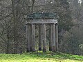
Category:Hagley Park Rotunda
Jump to navigation
Jump to search
This is a category about listed building number 1348598. |
| Object location | | View all coordinates using: OpenStreetMap |
|---|
architectural structure in Hagley, Bromsgrove District, England, UK .jpg) | |||||
| Upload media | |||||
| Instance of | |||||
|---|---|---|---|---|---|
| Location | Hagley, Bromsgrove, Worcestershire, West Midlands, England | ||||
| Heritage designation |
| ||||
 | |||||
Media in category "Hagley Park Rotunda"
The following 2 files are in this category, out of 2 total.
-
 Hagley Hall Rotunda (geograph 2291698).jpg 640 × 480; 85 KB
-
 The Rotunda, Hagley Park (geograph 4181959).jpg 800 × 531; 135 KB
.jpg)