Category:Hambledon, Hampshire
Jump to navigation
Jump to search

village and civil parish in the county of Hampshire in England  | |||||
| Upload media | |||||
| Instance of | |||||
|---|---|---|---|---|---|
| Located in protected area | |||||
| Location | City of Winchester, Hampshire, South East England, England | ||||
| Said to be the same as | Hambledon (Wikimedia duplicated page, civil parish) | ||||
| official website | |||||
 | |||||
English: Hambledon is a small village and civil parish in the county of Hampshire in England, situated about north of Portsmouth.
Italiano: Hambledon è un villaggio e una parrocchia civile nell' Hampshire, Gran Bretagna, situato a circa 6 km a nord-ovest di Waterlooville e 15 miglia a nord di Portsmouth.
Subcategories
This category has the following 6 subcategories, out of 6 total.
B
- The Bat and Ball, Hambledon (8 F)
H
- Hambledon Methodist Church (3 F)
- Hambledon Vineyard (3 F)
P
V
Media in category "Hambledon, Hampshire"
The following 200 files are in this category, out of 873 total.
(previous page) (next page)-
 "Improving" the Grass. - geograph.org.uk - 379388.jpg 640 × 428; 161 KB
-
 "The Red House" on East Street - geograph.org.uk - 4297922.jpg 800 × 600; 138 KB
-
 2016, a year on Geograph (Day 191) - geograph.org.uk - 5029484.jpg 640 × 480; 54 KB
-
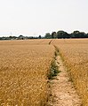
 A field of oats - geograph.org.uk - 3589899.jpg 800 × 600; 167 KB
-
 A sort of ruined pillbox - geograph.org.uk - 4084455.jpg 640 × 480; 155 KB
-
 A striped field - geograph.org.uk - 3769351.jpg 640 × 480; 96 KB
-

-
 Abundant rape - geograph.org.uk - 1905983.jpg 640 × 426; 169 KB
-
 Abundant rape - geograph.org.uk - 1905989.jpg 640 × 428; 229 KB
-
 Access ramp to The Maltings housing - geograph.org.uk - 3874557.jpg 640 × 427; 149 KB
-
-
 Along the Monarch's Way - geograph.org.uk - 2036915.jpg 1,512 × 2,016; 751 KB
-

-
 Approaching Hermitage Farm at Chidden - geograph.org.uk - 2037068.jpg 1,512 × 2,016; 650 KB
-
 Approaching Hole Farm on Hole Lane - geograph.org.uk - 901823.jpg 640 × 427; 132 KB
-
-

-

-
 April , hillside near Hambledon - geograph.org.uk - 437536.jpg 480 × 640; 176 KB
-
 B2150 at Hambledon village boundary - geograph.org.uk - 3113816.jpg 640 × 480; 96 KB
-
 B2150 north of Hambledon - geograph.org.uk - 456966.jpg 640 × 480; 91 KB
-
 B2150-E Hoe Road junction - geograph.org.uk - 3113831.jpg 640 × 480; 59 KB
-
 Backs of new housing at The Maltings - geograph.org.uk - 2951477.jpg 640 × 427; 183 KB
-
 Backs of new housing at The Maltings - geograph.org.uk - 2951485.jpg 640 × 427; 214 KB
-

-
 Barley field on Windmill Down - geograph.org.uk - 2036970.jpg 2,016 × 1,512; 1.49 MB
-
 Barn at Teglease Farm - geograph.org.uk - 4279310.jpg 800 × 600; 177 KB
-
 Barn off Dogkennel Lane, Hambledon - geograph.org.uk - 251762.jpg 640 × 478; 49 KB
-
 Barn south of Glidden Farm - geograph.org.uk - 3607083.jpg 640 × 427; 104 KB
-
 Bend in Old Mill Lane - geograph.org.uk - 3607193.jpg 640 × 427; 122 KB
-
 Bend on Dogkennel Lane - geograph.org.uk - 6040639.jpg 1,024 × 768; 437 KB
-
 Bent Lane heading towards Bent Farm - geograph.org.uk - 2047212.jpg 640 × 480; 63 KB
-
 Bluebells by track - geograph.org.uk - 4431505.jpg 800 × 600; 194 KB
-
 Boarhuts Copse - geograph.org.uk - 1273975.jpg 640 × 480; 219 KB
-
 Boarhuts Copse - geograph.org.uk - 1273978.jpg 640 × 480; 208 KB
-
 Boarhuts Copse - geograph.org.uk - 1273986.jpg 640 × 480; 197 KB
-
 Boundary Cottage, West Street, Hambledon - geograph.org.uk - 900237.jpg 472 × 640; 145 KB
-

-

-
 Bridleway at Chidden - geograph.org.uk - 2037012.jpg 1,512 × 2,016; 944 KB
-
 Bridleway towards Hermitage Farm - geograph.org.uk - 6040475.jpg 1,024 × 768; 304 KB
-

-
 Broadhalfpenny Down Trig Point S2645 - geograph.org.uk - 269411.jpg 640 × 480; 174 KB
-
 Brook Lane at turning for Beckless Farm - geograph.org.uk - 3908635.jpg 640 × 480; 112 KB
-
-
 Brook Lane, Chidden - geograph.org.uk - 2036995.jpg 2,016 × 1,512; 1.52 MB
-
 Buildings at Brook End Farm - geograph.org.uk - 4298060.jpg 800 × 600; 79 KB
-
 Buildings at Glidden Farm - geograph.org.uk - 2037045.jpg 1,512 × 2,016; 503 KB
-

-
 Bumble Bee Cottage pumping out - geograph.org.uk - 3874260.jpg 640 × 427; 145 KB
-
 Bus shelter in West Street - geograph.org.uk - 3873828.jpg 427 × 640; 114 KB
-

-
 Byway approaches pile of bales - geograph.org.uk - 4280499.jpg 800 × 600; 180 KB
-
 Byway heads north east from minor road - geograph.org.uk - 4431625.jpg 800 × 600; 251 KB
-
 Byway meets tarmac track - geograph.org.uk - 4280533.jpg 600 × 800; 217 KB
-
 Cams Hill emerges onto B2150 at Hambledon - geograph.org.uk - 901411.jpg 640 × 427; 156 KB
-
 Cams Hill Wood, Cams Hill, Hambledon - geograph.org.uk - 901752.jpg 427 × 640; 129 KB
-
 Cams Hill, Hambledon - geograph.org.uk - 901304.jpg 640 × 455; 170 KB
-

-

-
 Clanfield Off Road RC Club - geograph.org.uk - 3607157.jpg 640 × 427; 131 KB
-
 Clanfield Off Road RC Club - geograph.org.uk - 4297244.jpg 800 × 600; 115 KB
-
 Clanfield Off Road RC Club notice - geograph.org.uk - 3607172.jpg 640 × 604; 177 KB
-
 Clanfield Off Road RC Club track - geograph.org.uk - 3607181.jpg 640 × 427; 164 KB
-

-
 Clubhouse at Hambledon CC - geograph.org.uk - 4298081.jpg 800 × 600; 153 KB
-
 Copse next to field at Chidden - geograph.org.uk - 2037031.jpg 2,016 × 1,512; 1.49 MB
-

-
 Corner of lane going to Glidden Farm - geograph.org.uk - 4297898.jpg 800 × 600; 102 KB
-
 Cottage and general store in Hambledon - geograph.org.uk - 2888977.jpg 3,872 × 2,592; 4.54 MB
-
 Country lane, Chidden - geograph.org.uk - 2037084.jpg 1,512 × 2,016; 508 KB
-
 Country road, northwest of Denmead - geograph.org.uk - 251703.jpg 640 × 478; 43 KB
-
 Cricket club at Broadhalfpenny Down - geograph.org.uk - 2037230.jpg 3,072 × 2,304; 1.29 MB
-
 Crossroads at "The Bat and Ball" PH - geograph.org.uk - 4298134.jpg 800 × 600; 141 KB
-
 Crossroads by Pithill Farm - geograph.org.uk - 4284007.jpg 800 × 600; 182 KB
-
 Crossways, West Street, Hambledon - geograph.org.uk - 899581.jpg 640 × 427; 124 KB
-
 Cycling back from Winchester (2) - geograph.org.uk - 2764583.jpg 1,798 × 1,177; 2.01 MB
-
 Disguised minor road to Rushmere - geograph.org.uk - 901415.jpg 640 × 430; 171 KB
-
 Dogkennel Lane - geograph.org.uk - 3908731.jpg 640 × 480; 131 KB
-

-

-
 Down House and kennels - geograph.org.uk - 3607110.jpg 640 × 427; 111 KB
-
 Drive to Beckless Farm - geograph.org.uk - 6040496.jpg 1,024 × 768; 274 KB
-
 Droxford Road, on Chidden Down - geograph.org.uk - 6167878.jpg 4,000 × 3,000; 4.77 MB
-
 Droxford Road, on Chidden Down - geograph.org.uk - 6167881.jpg 4,000 × 3,000; 4.67 MB
-
 Dwelling on Green Lane - geograph.org.uk - 4297957.jpg 800 × 600; 203 KB
-
 Dwellings at the west end of Brook Lane - geograph.org.uk - 4298040.jpg 800 × 600; 131 KB
-
 East Hoe Manor, from Hambledon Lane - geograph.org.uk - 1273948.jpg 640 × 480; 105 KB
-
 East Street and The Hangars - geograph.org.uk - 5568835.jpg 640 × 427; 73 KB
-

-

-
 Entering Hambledon - geograph.org.uk - 2887309.jpg 3,872 × 2,592; 4.84 MB
-
 Entrance to Hambledon Cricket Club - geograph.org.uk - 2036983.jpg 2,016 × 1,512; 1.51 MB
-
 Entrance to Meadow Villa - geograph.org.uk - 4298016.jpg 800 × 600; 169 KB
-
 Farmland beside East Street - geograph.org.uk - 5944717.jpg 1,024 × 683; 241 KB
-
 Farmland beside Veniss Copse - geograph.org.uk - 3592863.jpg 1,037 × 778; 803 KB
-
 Farmland east of Hambledon - geograph.org.uk - 251746.jpg 640 × 478; 57 KB
-
 Farmland from Broadhalfpenny Down - geograph.org.uk - 269398.jpg 640 × 480; 73 KB
-
 Farmland near Teglease Down - geograph.org.uk - 2758743.jpg 1,799 × 1,172; 1.23 MB
-
 Farmland north of Teglease Down - geograph.org.uk - 2764576.jpg 1,800 × 1,175; 1.85 MB
-
 Farmland on Broadhalfpenny Down - geograph.org.uk - 3607100.jpg 640 × 427; 135 KB
-
 Farmland south-east of Chidden - geograph.org.uk - 5029466.jpg 640 × 480; 56 KB
-
 Field and hillside east of Boarhuts Copse - geograph.org.uk - 901223.jpg 640 × 427; 128 KB
-
 Field beside East Street - geograph.org.uk - 5568839.jpg 640 × 427; 90 KB
-
 Field boundary, Chidden Down - geograph.org.uk - 3979936.jpg 640 × 480; 94 KB
-
 Field east of Menslands Lane - geograph.org.uk - 901307.jpg 640 × 402; 159 KB
-
 Field edge near Park Farm - geograph.org.uk - 5568832.jpg 640 × 427; 80 KB
-
 Field near Chidden - geograph.org.uk - 2037023.jpg 2,016 × 1,512; 1.45 MB
-
 Field near Clanfield - geograph.org.uk - 2037103.jpg 2,016 × 1,512; 1.49 MB
-
 Field northeast of Bury Lodge - geograph.org.uk - 900556.jpg 640 × 427; 133 KB
-
 Field of sheep just west of Coombe Wood - geograph.org.uk - 4431590.jpg 800 × 533; 136 KB
-
 Field on western edge of Hambledon - geograph.org.uk - 2951495.jpg 640 × 427; 166 KB
-

-

-

-
 Field with sheep, Hambledon - geograph.org.uk - 6040504.jpg 1,024 × 768; 223 KB
-
 Field with two roads - geograph.org.uk - 4284052.jpg 800 × 600; 134 KB
-
 Fields of cattle - geograph.org.uk - 3750447.jpg 640 × 480; 91 KB
-
 Flood Update 26th February 2014 - geograph.org.uk - 3874622.jpg 640 × 389; 114 KB
-
 Flood Update 30th January 2014 - geograph.org.uk - 3874607.jpg 640 × 467; 154 KB
-
 Flooded road, south of Hambledon - geograph.org.uk - 251712.jpg 640 × 478; 80 KB
-
 Flooding in West Street, Hambledon - geograph.org.uk - 3873307.jpg 640 × 427; 178 KB
-
 Footpath across field near Beckless Farm - geograph.org.uk - 6085818.jpg 1,024 × 683; 254 KB
-
 Footpath along Speltham Down - geograph.org.uk - 900596.jpg 640 × 427; 108 KB
-

-
 Footpath approaches yard on minor road - geograph.org.uk - 4279336.jpg 800 × 600; 200 KB
-
 Footpath crosses Harrowgate Lane - geograph.org.uk - 4297203.jpg 800 × 600; 155 KB
-

-

-

-
 Footpath from Cams Hill to Hill View Farm - geograph.org.uk - 901841.jpg 526 × 640; 149 KB
-
 Footpath from Hambledon to Boarhuts Copse - geograph.org.uk - 901202.jpg 427 × 640; 149 KB
-

-
 Footpath goes north from minor road - geograph.org.uk - 4279427.jpg 800 × 600; 177 KB
-

-
 Footpath goes uphill to open field - geograph.org.uk - 4283905.jpg 600 × 800; 198 KB
-
 Footpath goes west from Hole Farm - geograph.org.uk - 4306090.jpg 800 × 600; 260 KB
-

-
 Footpath going west near Glidden Farm - geograph.org.uk - 4297874.jpg 800 × 557; 140 KB
-
-
 Footpath joins minor road - geograph.org.uk - 4279430.jpg 800 × 600; 178 KB
-

-

-

-
 Footpath near Rushmere Farm - geograph.org.uk - 3590758.jpg 800 × 600; 215 KB
-
 Footpath near Rushmere Farm - geograph.org.uk - 3590767.jpg 1,037 × 778; 783 KB
-
 Footpath near Rushmere Farm - geograph.org.uk - 3590773.jpg 1,038 × 789; 879 KB
-
 Footpath on Glebelands Farm, Hambledon - geograph.org.uk - 901763.jpg 640 × 427; 149 KB
-
 Footpath on track at Glidden Farm - geograph.org.uk - 4297879.jpg 800 × 576; 137 KB
-
-

-
 Footpath reaches minor road near Chidden - geograph.org.uk - 4431485.jpg 800 × 671; 193 KB
-
 Footpath sign on Pitt Hill Lane - geograph.org.uk - 4283951.jpg 800 × 600; 118 KB
-
 Footpath splits from farm track - geograph.org.uk - 4279323.jpg 800 × 573; 144 KB
-
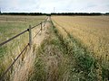
 Footpath through barley, Hambledon - geograph.org.uk - 1589637.jpg 640 × 480; 133 KB
-
 Footpath through oats - geograph.org.uk - 3590737.jpg 1,037 × 778; 958 KB
-
 Footpath through oats - geograph.org.uk - 3590751.jpg 800 × 600; 239 KB
-
 Footpath to Hole Farm - geograph.org.uk - 4306084.jpg 800 × 570; 127 KB
-
-
 Footpath towards Coombe Wood - geograph.org.uk - 2155238.jpg 640 × 480; 197 KB
-
 Footpath towards Hambledon - geograph.org.uk - 3908577.jpg 640 × 480; 146 KB
-
 Footpath towards lane to Chidden - geograph.org.uk - 6040370.jpg 1,024 × 768; 305 KB
-
 Footpath west of Rushmere - geograph.org.uk - 901436.jpg 640 × 427; 131 KB
-
-
 Footpaths cross west of Glidden Farm - geograph.org.uk - 4297895.jpg 800 × 589; 106 KB
-

-
 Frances Emilia Crofton VIII (8).jpg 972 × 636; 136 KB
-
 Frances Emilia Crofton VIII (8c).jpg 5,416 × 3,556; 3.64 MB
-
 From Hambledon Lane - geograph.org.uk - 1273882.jpg 640 × 480; 133 KB
-
 From the King's Way - geograph.org.uk - 1272997.jpg 640 × 480; 81 KB
-
 From the King's Way - geograph.org.uk - 1273005.jpg 640 × 480; 99 KB
-
 From the King's Way - geograph.org.uk - 1273123.jpg 640 × 480; 139 KB
-
 From the King's Way - geograph.org.uk - 1273437.jpg 640 × 480; 103 KB
-
 From the King's Way - geograph.org.uk - 1273459.jpg 640 × 480; 97 KB
-
 From the King's Way - geograph.org.uk - 1273487.jpg 640 × 480; 82 KB
-
 From the Wayfarer's Walk Hambledon - geograph.org.uk - 1268271.jpg 640 × 480; 194 KB
-

-

-
-

-

-
-
 From the Wayfarer's Walk near Hambledon - geograph.org.uk - 1268493.jpg 640 × 480; 215 KB
-
 From the Wayfarer's Walk near Hambledon - geograph.org.uk - 1268494.jpg 480 × 640; 204 KB
-

-
 Gate at footpath junction - geograph.org.uk - 4297930.jpg 600 × 800; 230 KB
-
 Gate into woodland - geograph.org.uk - 6040597.jpg 1,024 × 768; 507 KB
-
 Gate with trough at field boundary - geograph.org.uk - 4297885.jpg 800 × 600; 127 KB
-
 George House on East Street - geograph.org.uk - 4297924.jpg 800 × 600; 106 KB
-
 George House, East Street - geograph.org.uk - 934096.jpg 640 × 480; 66 KB
-
 Glidden Farm - geograph.org.uk - 2037040.jpg 2,016 × 1,512; 1.52 MB
-
 Glidden Farm buildings - geograph.org.uk - 3607090.jpg 640 × 427; 104 KB
-
 Glidden Farm House - geograph.org.uk - 2037052.jpg 2,016 × 1,512; 1.52 MB
-
 Glidden Lane - geograph.org.uk - 3908720.jpg 640 × 480; 206 KB
-

-
 Going uphill on Harrowgate Lane - geograph.org.uk - 4284038.jpg 800 × 600; 97 KB
-
 Gorse besides restricted byway - geograph.org.uk - 4280477.jpg 800 × 600; 171 KB
-
 Green Lane - geograph.org.uk - 6040713.jpg 1,024 × 684; 234 KB
-
 Green Lane at Lashly Meadow - geograph.org.uk - 3113823.jpg 640 × 480; 70 KB
-
 Green Lane at the junction of West Street, Hambledon - geograph.org.uk - 5051015.jpg 2,048 × 1,536; 944 KB


_-_geograph.org.uk_-_5029484.jpg)


_-_geograph.org.uk_-_2764583.jpg)


.jpg)
.jpg)


