Category:Hambleton End
Jump to navigation
Jump to search
English: Hambleton End is a hill in North Yorkshire, UK with a triangulation point at 399m, the peak is within Hawnby CP, the flanks lie in the civil parishes of Over Silton, Nether Silton, Kepwick, and Osmotherley
Media in category "Hambleton End"
The following 6 files are in this category, out of 6 total.
-
 Hambleton End and the Cleveland Way - geograph.org.uk - 891655.jpg 640 × 272; 45 KB
-
 On Pie Shaw Corner - geograph.org.uk - 909836.jpg 640 × 427; 237 KB
-
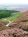
 The Cleveland Way near Hambleton End - geograph.org.uk - 1766366.jpg 2,048 × 1,536; 1.58 MB
-
 Hambleton Drove Road - geograph.org.uk - 52925.jpg 360 × 480; 49 KB
-
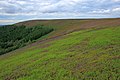
 Hambleton End from Thimbleby Moor - geograph.org.uk - 47691.jpg 640 × 480; 129 KB
-
 North York Moors - geograph.org.uk - 33603.jpg 640 × 480; 82 KB


