Category:Hampstead Garden Suburb
Jump to navigation
Jump to search
English: Hampstead Garden Suburb is a suburb, north of Hampstead, west of Highgate and east of Golders Green. It is an example of early twentieth-century domestic architecture and town planning located in the London Borough of Barnet in northwest London. The master plan was prepared by Barry Parker and Sir Raymond Unwin.
हिन्दी: हैम्पस्टेड गार्डन सबर्ब ( अंग्रेज़ी: Hampstead Garden Suburb) एक उत्तर लंदन में बार्नेट बरो का जिला है।
日本語: ハムステッド・ガーデン・サバーブ (Hampstead Garden Suburb) は、 イギリスの首都ロンドン北西部バーネット・ロンドン特別区にある郊外住宅地区。ハムステッドの北、ハイゲートの西、ゴールダーズ・グリーンの東に位置する。20世紀初頭の住宅建築と都市計画の事例として知られており、マスタープランはバリー・パーカーとサー・レイモンド・アンウィンによって作成されている。
suburb of Hampstead, United Kingdom  | |||||
| Upload media | |||||
| Instance of | |||||
|---|---|---|---|---|---|
| Location | London Borough of Barnet, Greater London, London, England | ||||
| Founded by | |||||
 | |||||
Subcategories
This category has the following 28 subcategories, out of 28 total.
A
- Asmuns Hill (19 F)
B
- Barnett Homestead (3 F)
C
F
H
- Heathgate (25 F)
- Henrietta Barnett Memorial (6 F)
- Henrietta Barnett School (16 F)
- Hutchings Walk, London NW11 (4 F)
L
- Linnell Close (6 F)
- Lytton Close (12 F)
M
N
S
- Spaniards Mount (2 F)
T
- Turner Drive (4 F)
W
- Wyldes Farm (2 F)
Media in category "Hampstead Garden Suburb"
The following 200 files are in this category, out of 275 total.
(previous page) (next page)-
 1 and 2 Farm Walk, Hampstead Garden Suburb, June 2021.jpg 4,032 × 3,024; 6.49 MB
-
 1 and 3 Corringway, Hampstead Garden Suburb, July 2021.jpg 4,032 × 3,024; 5.4 MB
-
 1 and 3 Rotherwick Road, Hampstead Garden Suburb, July 2021.jpg 4,032 × 3,024; 4.47 MB
-
 1 Erskine Hill, Hampstead Garden Suburb, July 2021 02.jpg 3,024 × 4,032; 3.66 MB
-
 1 Erskine Hill, Hampstead Garden Suburb, July 2021.jpg 4,032 × 3,024; 5.23 MB
-
 1-7 Meadway Gate, Hampstead Garden Suburb, May 2011.jpg 3,264 × 2,448; 1.28 MB
-
 10 Erskine Hill, Hampstead Garden Suburb, July 2021.jpg 3,024 × 4,032; 4.73 MB
-
 10 Southway, Hampstead Garden Suburb, July 2021.jpg 3,024 × 4,032; 3.94 MB
-
 11 Constable Close, Hampstead Garden Suburb, July 2021.jpg 4,032 × 3,024; 6.5 MB
-
 12 Southway, Hampstead Garden Suburb, July 2021.jpg 3,024 × 4,032; 4.28 MB
-
 12 Temple Fortune Lane, Hampstead Garden Suburb, July 2022.jpg 4,032 × 3,024; 4.86 MB
-
 13 Erskine Hill, Hampstead Garden Suburb, July 2021.jpg 3,024 × 4,032; 4.51 MB
-
 14 and 16 Temple Fortune Lane, Hampstead Garden Suburb, July 2022.jpg 4,032 × 3,024; 4.22 MB
-
 14 Erskine Hill, Hampstead Garden Suburb, July 2021.jpg 3,024 × 4,032; 5.14 MB
-
 16 Ingram Avenue, Hampstead Garden Suburb, June 2021.jpg 4,032 × 3,024; 5.18 MB
-
 1930s house, Hampstead Garden Suburb - geograph.org.uk - 3699171.jpg 1,024 × 611; 500 KB
-
 1930s house, Hampstead Garden Suburb - geograph.org.uk - 3699220.jpg 1,024 × 767; 591 KB
-
 2 and 4 Asmuns Place, Hampstead Garden Suburb, July 2022.jpg 4,032 × 3,024; 4.54 MB
-
 2 Turner Drive, Hampstead Garden Suburb, July 2021.jpg 4,032 × 3,024; 5.55 MB
-
 2-8 Erskine Hill, Hampstead Garden Suburb, July 2021 01.jpg 4,032 × 3,024; 5.13 MB
-
 2-8 Erskine Hill, Hampstead Garden Suburb, July 2021 02.jpg 4,032 × 3,024; 5.39 MB
-
 2-8 Meadway Gate, Hampstead Garden Suburb, June 2021 (1).jpg 4,032 × 3,024; 4.75 MB
-
 2-8 Meadway Gate, Hampstead Garden Suburb, June 2021 (2).jpg 4,032 × 3,024; 4.15 MB
-
 20 Temple Fortune Lane, Hampstead Garden Suburb, July 2022.jpg 4,032 × 3,024; 3.65 MB
-
 20110531 London 183.JPG 3,264 × 2,448; 1.89 MB
-
 22 Asmuns Place, Hampstead Garden Suburb, July 2022.jpg 3,024 × 4,032; 5.14 MB
-
 22 Temple Fortune Lane, Hampstead Garden Suburb, July 2022.jpg 4,032 × 3,024; 4.24 MB
-
 24 and 26 Temple Fortune Lane, Hampstead Garden Suburb, July 2022.jpg 4,032 × 3,024; 3.09 MB
-
 28 Temple Fortune Lane, Hampstead Garden Suburb, July 2021.jpg 4,032 × 3,024; 3.77 MB
-
 28, 30, and 32 Temple Fortune Lane, Hampstead Garden Suburb, July 2022.jpg 4,032 × 3,024; 3.45 MB
-
 28-38 Hogarth Hill 1259597.jpg 4,032 × 3,024; 4.02 MB
-
 3 Fairway Close, Hampstead Garden Suburb, March 2022.jpg 4,032 × 3,024; 5.18 MB
-
 3 Turner Close, Hampstead Garden Suburb, July 2021.jpg 4,032 × 3,024; 5.38 MB
-
 3 Turner Drive, Hampstead Garden Suburb, July 2021.jpg 4,032 × 3,024; 4.88 MB
-
 3-5 Hill Close, Hampstead Garden Suburb, June 2021 (2).jpg 4,032 × 3,024; 4.74 MB
-
 3-5 Hill Close, Hampstead Garden Suburb, June 2021.jpg 4,032 × 3,024; 4.59 MB
-
 3-6 Farm Walk, Hampstead Garden Suburb, June 2021.jpg 4,032 × 3,024; 4.12 MB
-
 36 Temple Fortune Lane, Hampstead Garden Suburb, July 2021.jpg 3,024 × 4,032; 6.34 MB
-
 37-43 Hogarth Hill 1259598.jpg 4,032 × 3,024; 2.35 MB
-
 39 Temple Fortune Hill, Hampstead Garden Suburb, December 2016.jpg 4,032 × 3,024; 2.58 MB
-
 4 and 6 Rotherwick Road, Hampstead Garden Suburb, July 2021.jpg 4,032 × 3,024; 4.35 MB
-
 5 and 7 Corringway, Hampstead Garden Suburb, July 2021.jpg 4,032 × 3,024; 4.97 MB
-
 5-13 Denman Drive, Hampstead Garden Suburb, December 2016 1.jpg 4,032 × 3,024; 4.3 MB
-
 6 Linnel Drive, Hampstead Garden Suburb, June 2021.jpg 4,032 × 3,024; 5.2 MB
-
 6-14 Denman Drive, Hampstead Garden Suburb, December 2016 1.jpg 4,032 × 3,024; 3.41 MB
-
 6-16 Asmuns Place, Hampstead Garden Suburb, July 2022.jpg 4,032 × 3,024; 3.87 MB
-
 6-18 Corringway, Hampstead Garden Suburb, July 2021.jpg 4,032 × 3,024; 6.81 MB
-
 7 Farm Walk, Hampstead Garden Suburb, June 2021.jpg 3,024 × 4,032; 5.71 MB
-
 7 Meadway Gate, Hampstead Garden Suburb, June 2021.jpg 4,032 × 3,024; 5.7 MB
-
 7 Rotherwick Road, Hampstead Garden Suburb, July 2021.jpg 3,024 × 4,032; 4.81 MB
-
 8 and 10 Rotherwick Road, Hampstead Garden Suburb, July 2021.jpg 4,032 × 3,024; 5.93 MB
-
 8 Linnell Drive, Hampstead Garden Suburb, June 2021.jpg 4,032 × 3,024; 5.07 MB
-
 8 Rotherwick Road, Hampstead Garden Suburb, July 2021.jpg 3,024 × 4,032; 5.78 MB
-
 9 and 11 Erskine Hill, Hampstead Garden Suburb, July 2021.jpg 3,024 × 4,032; 4.45 MB
-
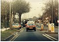
 A1 Falloden Way in Hampstead - geograph.org.uk - 2285011.jpg 640 × 480; 78 KB
-
 Asmuns Place, NW11 - geograph.org.uk - 2604045.jpg 640 × 480; 85 KB
-

-
 Bigwood Court, Hampstead Garden Suburb, July 2021 1.jpg 4,032 × 3,024; 5.32 MB
-
 Blandford Close, Hampstead Garden Suburb - geograph.org.uk - 3581508.jpg 1,600 × 1,200; 572 KB
-
 Brick building near the Heathgate entrance to Hampstead Heath Extension, London NW11.jpg 3,264 × 2,448; 1.7 MB
-
 Bridge over Mutton Brook, Northway Gardens - geograph.org.uk - 2665871.jpg 1,600 × 1,200; 463 KB
-
 Brim Hill, Hampstead Garden Suburb - geograph.org.uk - 3969082.jpg 2,304 × 1,728; 819 KB
-
 Brim Hill, Hampstead Garden Suburb - geograph.org.uk - 4700478.jpg 4,608 × 3,456; 3.35 MB
-
 Brookland Close, Hampstead Garden Suburb - geograph.org.uk - 3559696.jpg 1,600 × 1,200; 606 KB
-
 Brookland Rise looking towards Falloden Way - geograph.org.uk - 3559703.jpg 1,600 × 1,200; 620 KB
-
 Carlyle Close, Hampstead Garden Suburb - geograph.org.uk - 3471253.jpg 1,600 × 1,200; 559 KB
-
 Casualty of the 1987 storm, Erskine Hill - geograph.org.uk - 3827863.jpg 6,912 × 4,584; 3.87 MB
-
 Central Square at dusk - geograph.org.uk - 4760772.jpg 2,254 × 1,660; 1.21 MB
-
 Central Square, Hampstead Garden Suburb - geograph.org.uk - 5145422.jpg 4,128 × 3,096; 2.71 MB
-
 Chatham Close, Hampstead Garden Suburb - geograph.org.uk - 2601949.jpg 1,600 × 1,200; 569 KB
-
 Clere House, Hampstead Garden Suburb, June 2021.jpg 3,024 × 4,032; 6.33 MB
-
 Clere, Hampstead Garden Suburb, the south loggia.png 715 × 949; 1.12 MB
-
 Conifers in Northway Gardens, Hampstead Garden Suburb - geograph.org.uk - 4699027.jpg 2,304 × 1,728; 1.33 MB
-
 Cornwood Close, Hampstead Garden Suburb - geograph.org.uk - 3581503.jpg 1,600 × 1,200; 568 KB
-
 Crossroads on Market Place, Hampstead Garden Suburb - geograph.org.uk - 5551182.jpg 2,034 × 1,526; 1.56 MB
-

-
 Denman Drive North - geograph.org.uk - 838506.jpg 640 × 427; 252 KB
-
 Denman Drive North and Little Wood - geograph.org.uk - 838500.jpg 640 × 427; 241 KB
-
 Denman Drive South - geograph.org.uk - 838498.jpg 640 × 427; 177 KB
-
 Denman Drive, NW11 - geograph.org.uk - 2603627.jpg 640 × 481; 81 KB
-
 Eastern gazebo at end of Heathgate, Hampstead Garden Suburb, June 2021.jpg 4,032 × 3,024; 6.2 MB
-
 Erskine Hill - geograph.org.uk - 1141177.jpg 640 × 427; 205 KB
-
 Erskine Hill NW11 - geograph.org.uk - 2257807.jpg 1,600 × 1,200; 607 KB
-
 Erskine Hill, NW11 (2) - geograph.org.uk - 2603620.jpg 640 × 480; 87 KB
-
 Erskine Hill, NW11 (3) - geograph.org.uk - 2603719.jpg 640 × 480; 101 KB
-
 Erskine Hill, NW11 - geograph.org.uk - 2603609.jpg 640 × 480; 83 KB
-
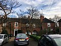
 Erskine House, 1-4 Homefield, Hampstead Garden Suburb, December 2016.jpg 4,032 × 3,024; 4.2 MB
-
 Falloden Way, Hampstead Garden Suburb - geograph.org.uk - 2456652.jpg 1,600 × 1,200; 550 KB
-
 Falloden Way, Hampstead Garden Suburb in 1983 - geograph.org.uk - 3185782.jpg 1,492 × 1,080; 358 KB
-
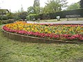 Flowerbed by Northway, Hampstead Garden Suburb - geograph.org.uk - 3946197.jpg 2,304 × 1,728; 768 KB
-
 Front garden on Heathgate, Hampstead Garden Suburb - geograph.org.uk - 3813919.jpg 2,304 × 1,728; 863 KB
-
 Garages on Bute Mews, Hampstead Garden Suburb - geograph.org.uk - 3946199.jpg 2,304 × 1,728; 811 KB
-
 Garden on Kingsley Way, Hampstead Garden Suburb - geograph.org.uk - 3471237.jpg 1,600 × 1,200; 587 KB
-
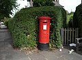 George V postbox on Bigwood Road NW11 - geograph.org.uk - 5208506.jpg 3,408 × 2,503; 1.97 MB
-
 Green on Vivian Way, Hampstead Garden Suburb - geograph.org.uk - 3969100.jpg 2,304 × 1,728; 765 KB
-
 Gurney Drive, Hampstead Garden Suburb - geograph.org.uk - 3969085.jpg 2,304 × 1,728; 809 KB
-
 Hampstead Garden Suburb Synogogue - geograph.org.uk - 5546634.jpg 640 × 426; 87 KB
-
 Hampstead Garden Suburb Synogogue - geograph.org.uk - 5546637.jpg 640 × 426; 82 KB
-
 Hampstead Garden Suburb, December 2016 01.jpg 4,032 × 3,024; 2.91 MB
-
 Hampstead Garden Suburb, December 2016 02.jpg 3,024 × 4,032; 2.89 MB
-
 Hampstead Garden Suburb, December 2016 04.jpg 3,024 × 4,032; 2.43 MB
-
 Hampstead Garden Suburb, December 2016 06.jpg 3,024 × 4,032; 3.83 MB
-
 Hampstead Garden Suburb, December 2016 07.jpg 4,032 × 3,024; 3.22 MB
-
 Hampstead Garden Suburb, December 2016 10.jpg 3,024 × 4,032; 5.09 MB
-
 Hampstead Garden Suburb, December 2016 14.jpg 4,032 × 3,024; 3.53 MB
-
 Hampstead Garden Suburb, December 2016 22.jpg 4,032 × 3,024; 4.49 MB
-
 Hampstead Garden Suburb, December 2016 25.jpg 4,032 × 3,024; 2.84 MB
-
 Hampstead Garden Suburb, December 2016 26.jpg 4,032 × 3,024; 2.59 MB
-
 Hampstead Garden Suburb, December 2016 28.jpg 4,032 × 3,024; 4.32 MB
-
 Hampstead Garden Suburb, December 2016 29.jpg 4,032 × 3,024; 2.2 MB
-
 Hampstead Garden Suburb, July 2021 12.jpg 4,032 × 3,024; 3.76 MB
-
 Hampstead Garden Suburb, July 2021 19.jpg 4,032 × 3,024; 4.95 MB
-
 Hampstead Garden Suburb, July 2021 23.jpg 3,024 × 4,032; 6.94 MB
-
 Hampstead Garden Suburb, July 2022 01.jpg 4,032 × 3,024; 5.64 MB
-
 Hampstead Garden Suburb, July 2022 02.jpg 4,032 × 3,024; 7.55 MB
-
 Hampstead Garden Suburb, July 2022 03.jpg 4,032 × 3,024; 3.47 MB
-
 Hampstead Garden Suburb, July 2022 11.jpg 4,032 × 3,024; 3.8 MB
-
 Hampstead Garden Suburb, July 2022 15.jpg 4,032 × 3,024; 6.02 MB
-
 Hampstead Garden Suburb, July 2022 16.jpg 4,032 × 3,024; 4.84 MB
-
 Hampstead Garden Suburb, July 2022 18.jpg 4,032 × 3,024; 4.93 MB
-
 Hampstead Garden Suburb, July 2022 19.jpg 4,032 × 3,024; 5.09 MB
-
 Hampstead Garden Suburb, July 2022 20.jpg 4,032 × 3,024; 4.61 MB
-
 Hampstead Garden Suburb, July 2022 21.jpg 3,024 × 4,032; 5.27 MB
-
 Hampstead Garden Suburb, July 2022 22.jpg 4,032 × 3,024; 5.51 MB
-
 Hampstead Garden Suburb, July 2022 23.jpg 4,032 × 3,024; 6.16 MB
-
 Hampstead Garden Suburb, July 2022 24.jpg 4,032 × 3,024; 6.1 MB
-
 Hampstead Garden Suburb, July 2022 25.jpg 4,032 × 3,024; 6.43 MB
-
 Hampstead Garden Suburb, July 2022 26.jpg 4,032 × 3,024; 5.67 MB
-
 Hampstead Garden Suburb, June 2021 06.jpg 4,032 × 3,024; 4.59 MB
-
 Hampstead Garden Suburb, June 2021 18.jpg 4,032 × 3,024; 5 MB
-
 Hampstead Garden Suburb, June 2021 22.jpg 4,032 × 3,024; 4.09 MB
-
 Hampstead Garden Suburb, June 2021 23.jpg 4,032 × 3,024; 5.75 MB
-
 Hampstead Garden Suburb, June 2021 26.jpg 4,032 × 3,024; 4.42 MB
-
 Hampstead Garden village - panoramio.jpg 1,730 × 2,622; 2.09 MB
-
 Hampstead Way - Wellgarth Road, NW11 - geograph.org.uk - 3013244.jpg 640 × 480; 78 KB
-
 Hampstead Way from the heath extension - geograph.org.uk - 2768076.jpg 1,600 × 1,200; 527 KB
-
 Heath House, Turner Drive, Hampstead Garden Suburb, July 2021.jpg 4,032 × 3,024; 5.6 MB
-
 Heathgate, Hampstead Garden Suburb - geograph.org.uk - 5206884.jpg 640 × 480; 55 KB
-
 Heathgate, Hampstead Garden Suburb, in 1985 - geograph.org.uk - 3187371.jpg 1,766 × 1,205; 448 KB
-
 Hogarth Hill - geograph.org.uk - 1141187.jpg 640 × 408; 160 KB
-
 Holne Chase - geograph.org.uk - 943503.jpg 640 × 427; 129 KB
-
 Holne Chase and Rowan Walk - geograph.org.uk - 943506.jpg 640 × 427; 134 KB
-
 House by South Square, Hampstead Garden Suburb - geograph.org.uk - 5675436.jpg 1,600 × 1,200; 359 KB
-
 House on Brim Hill - geograph.org.uk - 3521648.jpg 1,200 × 1,600; 594 KB
-
 House on Central Square, Hampstead Garden Suburb, London NW11.jpg 3,264 × 2,448; 1.4 MB
-
 House on Meadway, Hampstead Garden Suburb - geograph.org.uk - 3800962.jpg 2,304 × 1,728; 1.28 MB
-
 House on North Square, Hampstead Garden Suburb - geograph.org.uk - 4629182.jpg 1,600 × 1,200; 302 KB
-
 House on the corner of Meadway and Burnside Close - geograph.org.uk - 3789253.jpg 2,304 × 1,728; 1.26 MB
-
 House on Wildwood Road, Hampstead Garden Suburb - geograph.org.uk - 3375632.jpg 1,600 × 1,200; 536 KB
-
 Houses on Blandford Close, Hampstead Garden Suburb - geograph.org.uk - 3581507.jpg 1,600 × 1,200; 662 KB
-
 Houses on Brim Hill, Hampstead Garden Suburb - geograph.org.uk - 4594696.jpg 1,600 × 1,200; 329 KB
-
 Houses on Brookland Rise, Hampstead Garden Suburb - geograph.org.uk - 5213698.jpg 2,048 × 1,152; 971 KB
-
 Houses on Brookland Rise, Hampstead Garden Suburb - geograph.org.uk - 5213699.jpg 2,048 × 1,152; 805 KB
-
 Houses on Kingsley Way, Hampstead Garden Suburb - geograph.org.uk - 5350489.jpg 2,304 × 1,728; 833 KB
-
 Houses on Temple Fortune Hill - geograph.org.uk - 3473293.jpg 1,600 × 1,200; 554 KB
-
 Houses on the corner of Hampstead Way and Meadway, London NW11.jpg 3,264 × 2,448; 1.39 MB
-
 Houses, Emmott Close, Hampstead Garden Suburb - geograph.org.uk - 4747288.jpg 2,204 × 1,532; 1.34 MB
-
 Housing terrace, Emmott Close, Hampstead Garden Suburb - geograph.org.uk - 4747329.jpg 2,260 × 1,559; 1.32 MB
-
 Howard Walk from the junction with Brim Hill, 1992 - geograph.org.uk - 3777705.jpg 1,828 × 1,220; 461 KB
-
 Howard Walk, East Finchley - geograph.org.uk - 4700482.jpg 4,608 × 3,456; 3.6 MB
-
 Howard Walk, Hampstead Garden Suburb - geograph.org.uk - 3777704.jpg 1,600 × 1,200; 436 KB
-
 Ivy-covered house on Hampstead Way, London NW11.jpg 3,264 × 2,448; 1.24 MB
-

-
-
 K6 telephone kiosk opposite 5 to 11 Cosway House, Hampstead Garden Suburb, June 2021.jpg 3,024 × 4,032; 6.61 MB
-
 K6 telephone kiosk outside 132 to 134 Hampstead Way, Hampstead Garden Suburb, June 2021.jpg 3,024 × 4,032; 5.35 MB
-
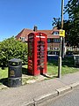
 K6 telephone kiosk outside Fellowship House 1359132.jpg 3,024 × 4,032; 2.97 MB
-
 K6 telephone kiosk, Kingsley Way, Hampstead Garden Suburb, June 2021 01.jpg 3,024 × 4,032; 5.41 MB
-
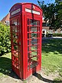 K6 telephone kiosk, Kingsley Way, Hampstead Garden Suburb, June 2021 02.jpg 3,024 × 4,032; 5.31 MB
-
 Kingsley Way, Hampstead Garden Suburb - geograph.org.uk - 3471235.jpg 1,600 × 1,200; 584 KB
-
 Left gate pier at entrance to Rotherwick Road, Hampstead Garden Suburb, July 2021.jpg 3,024 × 4,032; 5.82 MB
-
 Litchfield Way, Hampstead Garden Suburb.jpg 640 × 479; 229 KB
-
 Lutyens houses and gardens (1921) (14577381827).jpg 3,264 × 1,546; 475 KB
-
 Lyttleton Road from the corner of Greenhalgh Walk - geograph.org.uk - 3628457.jpg 2,560 × 1,920; 1.06 MB
-
 Market Place, Hampstead Garden Suburb - geograph.org.uk - 2456625.jpg 1,600 × 1,200; 829 KB
-
 Market Place, Hampstead Garden Suburb - geograph.org.uk - 5387287.jpg 7,070 × 4,672; 3.87 MB
-
 Market Place, Hampstead Garden Suburb - geograph.org.uk - 5551181.jpg 2,034 × 1,526; 1.76 MB
-
 Maurice Walk NW11 - geograph.org.uk - 2705313.jpg 480 × 640; 76 KB
-
 Maurice Walk, Hampstead Garden Suburb - geograph.org.uk - 2481312.jpg 1,600 × 1,200; 487 KB
-
 Maurice Walk, Hampstead Garden Suburb - geograph.org.uk - 2481316.jpg 1,600 × 1,200; 577 KB
-
 Meadway Gate NW11 - geograph.org.uk - 2038663.jpg 640 × 480; 74 KB
-
 Meadway Gate, Hampstead Garden Suburb - geograph.org.uk - 2874423.jpg 1,600 × 1,200; 594 KB
-
 Middleway, Hampstead Garden Suburb - geograph.org.uk - 3913383.jpg 2,304 × 1,728; 833 KB
-
 Mutton Brook in Hampstead Garden Suburb - geograph.org.uk - 2285056.jpg 640 × 480; 135 KB
-
 Mutton Brook in Hampstead Garden Suburb - geograph.org.uk - 2285078.jpg 640 × 480; 109 KB
-
 Mutton Brook in Hampstead Garden Suburb - geograph.org.uk - 2285100.jpg 640 × 480; 112 KB
-
 Mutton Brook in Hampstead Garden Suburb - geograph.org.uk - 2285137.jpg 640 × 480; 126 KB
-
 Mutton Brook in Hampstead Garden Suburb - geograph.org.uk - 2285174.jpg 640 × 480; 137 KB
-
 Norrice Lea - geograph.org.uk - 438853.jpg 640 × 480; 146 KB
-
 Norrice Lea - geograph.org.uk - 943492.jpg 640 × 381; 119 KB
-
 Norrice Lea, Hampstead Garden Suburb - geograph.org.uk - 3946183.jpg 2,304 × 1,728; 817 KB
-
 Northway - geograph.org.uk - 5542042.jpg 640 × 426; 98 KB
-
 Northway Gardens, Hampstead Garden Suburb - geograph.org.uk - 2665875.jpg 1,200 × 1,600; 431 KB
-
 Northway Gardens, Hampstead Garden Suburb - geograph.org.uk - 2665881.jpg 1,200 × 1,600; 555 KB
-
 Northway Gardens, Hampstead Garden Suburb - geograph.org.uk - 4699022.jpg 2,304 × 1,728; 1.9 MB
-
 Northway Gardens, Hampstead Garden Suburb - geograph.org.uk - 4699024.jpg 2,304 × 1,728; 842 KB
-
 Northway Gardens, Hampstead Garden Suburb - geograph.org.uk - 4699025.jpg 1,728 × 2,304; 1.5 MB
-
 Northway Gardens, Hampstead Garden Suburb - geograph.org.uk - 5304172.jpg 2,304 × 1,728; 778 KB
-
 Northway Gardens, Hampstead Garden Suburb - geograph.org.uk - 5304175.jpg 2,304 × 1,728; 787 KB
-
 Northway Gardens, Hampstead Garden Suburb - geograph.org.uk - 5305019.jpg 2,304 × 1,728; 810 KB


.jpg)
.jpg)


.jpg)


_-_geograph.org.uk_-_2603620.jpg)
_-_geograph.org.uk_-_2603719.jpg)


,_June_2021.jpg)


_(14577381827).jpg)


