Category:Hamsey
Jump to navigation
Jump to search
village and civil parish in East Sussex, UK  | |||||
| Upload media | |||||
| Instance of | |||||
|---|---|---|---|---|---|
| Location | Lewes, East Sussex, South East England, England | ||||
| Area |
| ||||
| official website | |||||
 | |||||
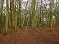
English: Hamsey is a civil parish in the Lewes District of East Sussex, England. It is located three miles (5 km) north of Lewes on the Prime Meridian. The original village, now abandoned apart from the church and a few cottages, lay on an island in the River Ouse; the parish consists of the villages of Hamsey with Offham and Cooksbridge being the main centres of population in the parish.
Subcategories
This category has the following 5 subcategories, out of 5 total.
Media in category "Hamsey"
The following 200 files are in this category, out of 467 total.
(previous page) (next page)-
 'Holters Green', a house near Cooksbridge - geograph.org.uk - 2752631.jpg 1,600 × 1,035; 552 KB
-
 A glimpse of Coombe Place - geograph.org.uk - 5171437.jpg 640 × 480; 123 KB
-
 A glimpse of Yeomans - geograph.org.uk - 2086864.jpg 2,592 × 1,944; 2.34 MB
-
 A27 pillbox beside Ivors Lane, Hamsey - geograph.org.uk - 2086990.jpg 2,592 × 1,944; 1.83 MB
-
 A275 north through Offham - geograph.org.uk - 2088301.jpg 2,592 × 1,944; 1.46 MB
-
 A275 south bound to Lewes - geograph.org.uk - 3114925.jpg 3,264 × 2,448; 4.05 MB
-
 Aerial view towards Hamsey church - geograph.org.uk - 4543500.jpg 640 × 480; 142 KB
-
 Allington Lane joining Beechwood Lane on a bend - geograph.org.uk - 2090330.jpg 2,592 × 1,944; 1.3 MB
-
 Allotments - geograph.org.uk - 4702141.jpg 640 × 426; 105 KB
-
 Along the line to Cooksbridge station - geograph.org.uk - 2438066.jpg 640 × 480; 147 KB
-
 Approaching Cooksbridge - geograph.org.uk - 5706743.jpg 1,024 × 622; 163 KB
-
 Approaching Hamsey Church - geograph.org.uk - 4764217.jpg 1,406 × 2,103; 430 KB
-
 Ashcombe Bottom - geograph.org.uk - 2644801.jpg 4,000 × 3,000; 3.66 MB
-
 B2116 approaching A275 - geograph.org.uk - 2119173.jpg 640 × 480; 159 KB
-
 B2116 near East Chiltington - geograph.org.uk - 3165327.jpg 1,600 × 1,108; 566 KB
-
 B2116 near Tulleys Wells Farm - geograph.org.uk - 2850045.jpg 4,320 × 3,240; 4.81 MB
-
 Banky Field - geograph.org.uk - 2218390.jpg 640 × 480; 89 KB
-
 Barley field - geograph.org.uk - 4702013.jpg 640 × 426; 48 KB
-
 Barley, Offham Hill - geograph.org.uk - 4702024.jpg 640 × 426; 58 KB
-
 Barn at North End - geograph.org.uk - 4886966.jpg 640 × 426; 75 KB
-
 Barn Field - geograph.org.uk - 2218457.jpg 640 × 480; 76 KB
-
 Barn Field - geograph.org.uk - 2218526.jpg 640 × 480; 88 KB
-
 Barns, Bretts Farm - geograph.org.uk - 4893623.jpg 640 × 426; 68 KB
-
 Beachy Wood - geograph.org.uk - 2218399.jpg 640 × 480; 131 KB
-
 Beacon on Mount Harry - geograph.org.uk - 2045198.jpg 640 × 428; 75 KB
-
 Beacon on Mount Harry - geograph.org.uk - 2088735.jpg 2,592 × 1,944; 1.32 MB
-
 Beacon, Mount Harry - geograph.org.uk - 4698614.jpg 640 × 426; 37 KB
-
 Beacon, Mount Harry - geograph.org.uk - 4698634.jpg 426 × 640; 33 KB
-
 Bend, Hamsey Lane - geograph.org.uk - 4893537.jpg 640 × 426; 72 KB
-
 Bevern Stream - geograph.org.uk - 3051332.jpg 640 × 480; 127 KB
-
 Bretts Cottages, Whitfield Lane - geograph.org.uk - 1099428.jpg 479 × 640; 78 KB
-
 Bretts Farm - geograph.org.uk - 4893625.jpg 640 × 426; 114 KB
-
 Bretts Farm - geograph.org.uk - 4893628.jpg 640 × 426; 57 KB
-
 Bretts Farm, Whitfield Lane - geograph.org.uk - 1097033.jpg 479 × 640; 74 KB
-
 Bridlegate at field edge in Ashcombe Bottom - geograph.org.uk - 2822433.jpg 1,024 × 768; 380 KB
-
 Bridlegate on Offham Hill - geograph.org.uk - 2822786.jpg 1,024 × 768; 359 KB
-
 Bridleway - geograph.org.uk - 4698685.jpg 640 × 426; 93 KB
-
 Bridleway - geograph.org.uk - 4698695.jpg 640 × 426; 48 KB
-
 Bridleway - geograph.org.uk - 4702003.jpg 640 × 426; 111 KB
-
 Bridleway - geograph.org.uk - 4702023.jpg 640 × 426; 118 KB
-
 Bridleway along fence - geograph.org.uk - 4701992.jpg 640 × 426; 74 KB
-
 Bridleway and Stream - geograph.org.uk - 2218345.jpg 640 × 480; 141 KB
-
 Bridleway at Offham Hill - geograph.org.uk - 3071845.jpg 640 × 480; 111 KB
-
 Bridleway climbing the northern escarpment of Offham - geograph.org.uk - 2088309.jpg 2,592 × 1,944; 2.12 MB
-
 Bridleway from Mount Harry nears Offham - geograph.org.uk - 2822767.jpg 768 × 1,024; 381 KB
-
 Bridleway from nowhere - geograph.org.uk - 2045371.jpg 640 × 428; 194 KB
-
 Bridleway gate marker near Mount Harry - geograph.org.uk - 3072559.jpg 480 × 640; 129 KB
-
 Bridleway going up out of Offham - geograph.org.uk - 2822777.jpg 1,024 × 768; 357 KB
-
 Bridleway Junction - geograph.org.uk - 4702005.jpg 640 × 426; 128 KB
-

-

-
 Bridleway NW to Mount Harry - geograph.org.uk - 2088498.jpg 2,592 × 1,944; 1.27 MB
-
 Bridleway off Mount Harry - geograph.org.uk - 4698643.jpg 640 × 426; 68 KB
-
 Bridleway on the South Downs - geograph.org.uk - 4701996.jpg 640 × 426; 71 KB
-
 Bridleway reaches the A275 at Offham - geograph.org.uk - 2822582.jpg 768 × 1,024; 216 KB
-
 Bridleway to Lewes - geograph.org.uk - 4702006.jpg 640 × 426; 89 KB
-
 Bridleway to Lewes - geograph.org.uk - 4702009.jpg 640 × 426; 73 KB
-
 Bridleway to Lewes - geograph.org.uk - 4702019.jpg 640 × 426; 61 KB
-
 Bridleway to Lewes - geograph.org.uk - 4702031.jpg 640 × 426; 119 KB
-
 Bridleway to Lewes - geograph.org.uk - 4702033.jpg 640 × 426; 112 KB
-
 Bridleway to Lewes - geograph.org.uk - 4702161.jpg 640 × 426; 113 KB
-
 Bridleway to Nevill Road - geograph.org.uk - 3070946.jpg 640 × 480; 104 KB
-
 Bridleway to nowhere - geograph.org.uk - 2646241.jpg 4,000 × 3,000; 3.52 MB
-
 Bridleway with parallel track - geograph.org.uk - 2822781.jpg 1,024 × 768; 239 KB
-
 Bridleway, Mount Harry - geograph.org.uk - 4698648.jpg 640 × 426; 61 KB
-
 Bridleways diverge - geograph.org.uk - 2822815.jpg 1,024 × 610; 179 KB
-
 Bus stop and shelter, Offham - geograph.org.uk - 5171417.jpg 640 × 480; 190 KB
-
 Bush on Mount Harry - geograph.org.uk - 4698610.jpg 640 × 426; 81 KB
-
 Cemetery opposite St Peter's Churchyard - geograph.org.uk - 2701782.jpg 640 × 480; 108 KB
-
 Chalk grasses - geograph.org.uk - 4702021.jpg 640 × 426; 69 KB
-
 Chalk grasses - geograph.org.uk - 4702026.jpg 640 × 426; 57 KB
-
 Chalk grassland - geograph.org.uk - 4702014.jpg 640 × 426; 62 KB
-
 Chalk grassland - geograph.org.uk - 4702016.jpg 640 × 426; 69 KB
-
 Chalkpit cut, Offham - geograph.org.uk - 2421877.jpg 1,600 × 1,200; 744 KB
-
 Chalkpits ahead - geograph.org.uk - 2822760.jpg 1,024 × 768; 197 KB
-
 Channel of River Ouse - geograph.org.uk - 4898465.jpg 640 × 426; 81 KB
-
 Channel of River Ouse - geograph.org.uk - 4898729.jpg 640 × 426; 85 KB
-
 Channel of River Ouse - geograph.org.uk - 4898733.jpg 640 × 426; 79 KB
-
 Channels merge - geograph.org.uk - 4901142.jpg 640 × 426; 76 KB
-
 Channels merge - geograph.org.uk - 4901145.jpg 640 × 426; 53 KB
-
 Church Rd - geograph.org.uk - 4886932.jpg 640 × 426; 65 KB
-
 Church Rd - geograph.org.uk - 4886940.jpg 640 × 426; 65 KB
-
 Church Rd - geograph.org.uk - 4886949.jpg 640 × 426; 62 KB
-
 Church Rd - geograph.org.uk - 4886977.jpg 640 × 426; 94 KB
-
 Church Rd - geograph.org.uk - 4893491.jpg 640 × 426; 50 KB
-
 Church Rd - geograph.org.uk - 4893507.jpg 640 × 426; 75 KB
-
 Church Rd crosses a stream - geograph.org.uk - 4886926.jpg 640 × 426; 68 KB
-
 Church Road crosses minor watercourse - geograph.org.uk - 3009482.jpg 3,553 × 2,476; 2.65 MB
-
 Church Road heads south - geograph.org.uk - 4886937.jpg 640 × 426; 68 KB
-
 Closed petrol station on the A275 - geograph.org.uk - 2597931.jpg 4,000 × 3,000; 3.44 MB
-
 Cooksbridge from the air - geograph.org.uk - 4543812.jpg 640 × 480; 161 KB
-
 Cooksbridge Railway Station - geograph.org.uk - 3816397.jpg 1,600 × 1,199; 417 KB
-
 Cooksbridge Railway Station - geograph.org.uk - 3816404.jpg 1,600 × 1,197; 344 KB
-
 Cooksbridge Railway Station - geograph.org.uk - 3816408.jpg 1,600 × 1,196; 368 KB
-
 Cooksbridge railway station, Sussex - geograph.org.uk - 4222044.jpg 1,024 × 768; 195 KB
-
 Cooksbridge railway station, Sussex - geograph.org.uk - 4222057.jpg 1,024 × 768; 190 KB
-
 Coombe Place from the air - geograph.org.uk - 4544068.jpg 640 × 480; 145 KB
-
 Coombe Place nestling at the bottom of Mount Harry - geograph.org.uk - 2088354.jpg 2,592 × 1,944; 1.28 MB
-
 Coombe Plantation - geograph.org.uk - 2421740.jpg 1,600 × 944; 407 KB
-
 Coombe Plantation - geograph.org.uk - 4698616.jpg 640 × 426; 70 KB
-
 Coombe Plantation - geograph.org.uk - 4698650.jpg 640 × 426; 73 KB
-
 Coombe Plantation - geograph.org.uk - 4698658.jpg 640 × 426; 87 KB
-
 Copyhold Cottages - geograph.org.uk - 1099497.jpg 640 × 479; 77 KB
-
 Copyhold Farm on Hamsey Lane - geograph.org.uk - 2085590.jpg 2,592 × 1,944; 1.79 MB
-
 Cottage Field - geograph.org.uk - 2218023.jpg 640 × 480; 86 KB
-
 Cottage Mead - geograph.org.uk - 2218087.jpg 640 × 480; 104 KB
-
 Cottage, Hamsey - geograph.org.uk - 4893648.jpg 640 × 422; 71 KB
-
 Cottage, Hamsey - geograph.org.uk - 4893653.jpg 640 × 426; 67 KB
-
 Course of the dismantled Lewes to Uckfield line - geograph.org.uk - 2086899.jpg 2,592 × 1,944; 2.23 MB
-
 Cowlease Farm - geograph.org.uk - 1096714.jpg 640 × 479; 87 KB
-
 Cowlease Farm - geograph.org.uk - 1096749.jpg 479 × 640; 108 KB
-
 Cowlease Farm Access Road - geograph.org.uk - 1096732.jpg 640 × 479; 62 KB
-
 Cowlease Farm entrance - geograph.org.uk - 4886952.jpg 640 × 426; 58 KB
-
 Cowlease Farm from the air - geograph.org.uk - 4543978.jpg 640 × 480; 117 KB
-
 Cows lying down - geograph.org.uk - 2421891.jpg 1,600 × 1,200; 524 KB
-
 Crop on Cuckoo Bottom - geograph.org.uk - 2645138.jpg 4,000 × 3,000; 3.32 MB
-
 Cropfield by Ivors Lane - geograph.org.uk - 3051366.jpg 640 × 480; 116 KB
-
 Danes Meadow - geograph.org.uk - 2218358.jpg 640 × 478; 71 KB
-
 Dead tree and mast on Deadmantree Hill - geograph.org.uk - 2085330.jpg 2,592 × 1,944; 1.55 MB
-
 Deadmantree Hill - geograph.org.uk - 2085341.jpg 2,592 × 1,944; 1.51 MB
-
 Deadmantree Hill - geograph.org.uk - 5741275.jpg 1,600 × 1,097; 437 KB
-
 Deadmantree Hill approaching Springles Farm - geograph.org.uk - 3116407.jpg 3,264 × 2,448; 5.14 MB
-
 Deadmantree Hill approaching the northern end of Cooksbridge - geograph.org.uk - 2085505.jpg 2,592 × 1,944; 1.82 MB
-
 Departing St Peter's at Hamsey - geograph.org.uk - 2701795.jpg 640 × 480; 98 KB
-
 Descending Mount Harry - geograph.org.uk - 4698663.jpg 640 × 426; 85 KB
-
 Dismantled Railway - geograph.org.uk - 1097039.jpg 640 × 479; 113 KB
-
 Dismantled Railway - geograph.org.uk - 1097085.jpg 640 × 479; 66 KB
-
 Dismantled railway line - geograph.org.uk - 4893651.jpg 640 × 426; 72 KB
-
 Disused barrels at Thatchers Cottage - geograph.org.uk - 2090256.jpg 2,592 × 1,944; 2.19 MB
-
 Ditch by the River Ouse - geograph.org.uk - 4898478.jpg 640 × 426; 59 KB
-
 Drive to Springles Farm - geograph.org.uk - 2218459.jpg 640 × 480; 104 KB
-

-
 Entering Folly Wood - geograph.org.uk - 5741554.jpg 1,600 × 1,009; 812 KB
-
 Farmland by Church Rd - geograph.org.uk - 4893498.jpg 640 × 426; 51 KB
-
 Farmland, Hamsey - geograph.org.uk - 4893503.jpg 640 × 426; 51 KB
-
 Farmland, Hamsey - geograph.org.uk - 4893511.jpg 640 × 426; 65 KB
-
 Field gate by bridleway in Ashcombe Bottom - geograph.org.uk - 2822443.jpg 1,024 × 768; 307 KB
-
 Field near Bevern Bridge - geograph.org.uk - 2217957.jpg 640 × 480; 91 KB
-
 Field near Cowlease Farm - geograph.org.uk - 1096759.jpg 640 × 479; 77 KB
-
 Field near Mount Harry - geograph.org.uk - 3074682.jpg 640 × 480; 88 KB
-
 Field near Mount Harry - geograph.org.uk - 3074685.jpg 640 × 480; 74 KB
-
 Field near Mount Harry - geograph.org.uk - 3074687.jpg 640 × 480; 87 KB
-
 Field near Mount Harry - geograph.org.uk - 3074689.jpg 640 × 480; 99 KB
-
 Field near Mount Harry - geograph.org.uk - 3080579.jpg 640 × 480; 100 KB
-
 Field near South Downs way - geograph.org.uk - 2421758.jpg 1,600 × 1,200; 483 KB
-
 Field of Barley - geograph.org.uk - 4698705.jpg 640 × 426; 59 KB
-
 Field of Barley - geograph.org.uk - 4701999.jpg 640 × 426; 49 KB
-
 Field of Barley - geograph.org.uk - 4702002.jpg 640 × 426; 45 KB
-
 Fields near Ashcombe Bottom - geograph.org.uk - 3079336.jpg 640 × 480; 92 KB
-
 Fish pond at Fishpond House, Beechwood Lane - geograph.org.uk - 2090389.jpg 2,592 × 1,944; 1.48 MB
-
 Flood plain field for North End Stream - geograph.org.uk - 2085569.jpg 2,592 × 1,944; 1.84 MB
-
 Folly Wood - geograph.org.uk - 5741559.jpg 1,024 × 645; 297 KB
-
 Footbridge on the path - geograph.org.uk - 5741063.jpg 1,024 × 652; 293 KB
-
 Footpath and byway junction south of Offham - geograph.org.uk - 2822612.jpg 1,024 × 768; 270 KB
-
 Footpath and farm road under railway bridge - geograph.org.uk - 2090819.jpg 2,592 × 1,944; 1.68 MB
-
 Footpath off Church Rd - geograph.org.uk - 4886991.jpg 640 × 426; 80 KB
-
 Footpath off Hamsey Lane - geograph.org.uk - 4893539.jpg 640 × 426; 61 KB
-
 Footpath on Mount Harry - geograph.org.uk - 4698621.jpg 640 × 426; 66 KB
-
 Footpath Stile - geograph.org.uk - 5741191.jpg 1,024 × 638; 244 KB
-
 For sale Fiesta cabriolet - geograph.org.uk - 2646224.jpg 4,000 × 3,000; 3.4 MB
-
 Former Lewes Racecourse - geograph.org.uk - 3070495.jpg 640 × 480; 116 KB
-
 Former Lewes Racecourse - geograph.org.uk - 3070498.jpg 640 × 480; 97 KB
-
 Frosty Ground, Horse Brook - geograph.org.uk - 1099562.jpg 640 × 479; 164 KB
-
 Gate into woodland on the South Downs - geograph.org.uk - 2822924.jpg 1,024 × 765; 296 KB
-
 Gate near Mount Harry - geograph.org.uk - 3072550.jpg 640 × 480; 114 KB
-
 Gate on a bridleway - geograph.org.uk - 4698697.jpg 640 × 426; 70 KB
-
 Gate on bridleway ascending Mount Harry - geograph.org.uk - 2822959.jpg 1,024 × 768; 160 KB
-
 Gate on the bridleway to Mount Harry - geograph.org.uk - 2822791.jpg 1,024 × 768; 321 KB
-
 Glider above Coombe Plantation near Mount Harry - geograph.org.uk - 2088509.jpg 2,592 × 1,944; 937 KB
-
 Grassland, Landport Bottom - geograph.org.uk - 4702121.jpg 640 × 426; 60 KB
-
 Grassland, Landport Bottom - geograph.org.uk - 4702123.jpg 640 × 426; 56 KB
-
 Grassy downland with a view over the Weald - geograph.org.uk - 2822921.jpg 1,024 × 768; 168 KB
-
 Grazing in the Ouse Valley - geograph.org.uk - 4898727.jpg 640 × 426; 63 KB
-
 Great Jointure - geograph.org.uk - 2217981.jpg 640 × 480; 74 KB
-
 Great North Barn - geograph.org.uk - 1097064.jpg 479 × 640; 66 KB
-
 Great North Barn - geograph.org.uk - 4893665.jpg 640 × 426; 99 KB
-
 Greenwich Meridian at North End Stream - geograph.org.uk - 2415517.jpg 1,600 × 1,067; 764 KB
-
 Greenwich Meridian crossing Hamsey Lane - geograph.org.uk - 2415458.jpg 1,600 × 1,067; 580 KB
-
 Greenwich meridian crossing Pelbrook Cut - geograph.org.uk - 2450697.jpg 3,072 × 2,048; 1.8 MB
-
 Greenwich Meridian crossing the Drove - geograph.org.uk - 2412141.jpg 3,072 × 2,048; 4.88 MB
-
 Greenwich Meridian crossing the river Ouse - geograph.org.uk - 2423704.jpg 3,072 × 2,048; 1.73 MB
-
 Greenwich Meridian crossing Upland Wish - geograph.org.uk - 2450688.jpg 3,072 × 2,048; 1.69 MB
-
 Greenwich Meridian in Big Mill field - geograph.org.uk - 2412134.jpg 1,600 × 1,067; 625 KB
-
 Greenwich Meridian in Big Mill field - geograph.org.uk - 2450708.jpg 1,600 × 1,067; 500 KB
-
 Greenwich Meridian in Pond Field - geograph.org.uk - 2415531.jpg 1,600 × 1,067; 456 KB
-
 Greenwich Meridian in Upland Wish meadow - geograph.org.uk - 2423692.jpg 1,600 × 1,067; 452 KB
-
 Greenwich Meridian in Upland Wish water meadow - geograph.org.uk - 2412117.jpg 1,600 × 1,067; 509 KB
-
 Greenwich Meridian in Upland Wish water meadow - geograph.org.uk - 2412121.jpg 1,600 × 1,067; 422 KB
-
 Greenwich Meridian just north of the Drove - geograph.org.uk - 2412146.jpg 1,600 × 1,067; 409 KB
-
 Greenwich Meridian just west of Hamsey Manor - geograph.org.uk - 2412151.jpg 1,600 × 1,067; 419 KB
-
 Greenwich Meridian Marker - geograph.org.uk - 5741546.jpg 1,600 × 942; 670 KB
-
 Greenwich Meridian Marker - geograph.org.uk - 5859773.jpg 3,648 × 5,472; 2.56 MB
-
 Greenwich Meridian Marker - geograph.org.uk - 5859860.jpg 4,706 × 3,139; 2.12 MB
-
 Greenwich Meridian Marker - geograph.org.uk - 5859862.jpg 3,648 × 5,472; 3.07 MB
-
 Greenwich meridian near North End stream - geograph.org.uk - 2408240.jpg 3,072 × 2,048; 3.41 MB
-
 Greenwich Meridian near North End stream. - geograph.org.uk - 2457152.jpg 3,072 × 2,048; 4.51 MB
-
 Greenwich Meridian north of Cooksbridge sewage works - geograph.org.uk - 2457143.jpg 1,600 × 1,067; 657 KB
-
 Greenwich Meridian north of Hamsey Lane - geograph.org.uk - 2450719.jpg 1,600 × 1,067; 559 KB
-
 Greenwich Meridian north of North End stream - geograph.org.uk - 2457169.jpg 1,600 × 1,067; 564 KB
-
 Greenwich Meridian north of the Drove - geograph.org.uk - 2415480.jpg 1,600 × 1,067; 531 KB


