Category:Hanging Heaton
Jump to navigation
Jump to search
village in West Yorkshire, England, UK  | |||||
| Upload media | |||||
| Instance of | |||||
|---|---|---|---|---|---|
| Location | Kirklees, West Yorkshire, Yorkshire and the Humber, England | ||||
 | |||||
English: Hanging Heaton is a large village in West Yorkshire, England. Partly in both Batley and Dewsbury it is a historic village mentioned in the Domesday Book under the name 'Etun'. The prefix 'Hanging' refers to a steep hillside hanging above lower ground. Heaton means 'High Farm' therefore Hanging Heaton was a lonely hillside farmstead and is identified in GENUKI. With housing dating from the 16th century to the present-day, it is a varied community with a successful cricket club, golf club, two churches and a community group in Hanging Heaton Community Group.
Subcategories
This category has the following 13 subcategories, out of 13 total.
C
- Chidswell Lane (18 F)
- Commonside, Batley (8 F)
- Croftlands, Hanging Heaton (4 F)
D
- Dogloitch Wood (14 F)
F
G
- Glenlow Road (3 F)
- Grange Road, Hanging Heaton (4 F)
- Grasmere Road, Dewsbury (3 F)
H
- Hey Beck (5 F)
- Hey Beck Farm (2 F)
- Horace Waller VC Parade (4 F)
S
- St Paul, Hanging Heaton (8 F)
Media in category "Hanging Heaton"
The following 71 files are in this category, out of 71 total.
-
 Albert Place - Leeds Road - geograph.org.uk - 3437685.jpg 640 × 480; 66 KB
-
 Alderney Road - Croftlands - geograph.org.uk - 3437730.jpg 640 × 480; 59 KB
-
 Arable crop alongside Hey Beck - geograph.org.uk - 4195010.jpg 1,024 × 768; 173 KB
-
 Bare earth and autumn trees - geograph.org.uk - 2148732.jpg 1,024 × 768; 167 KB
-
 Benchmark on stone post beside footpath - geograph.org.uk - 6471948.jpg 683 × 1,024; 278 KB
-
 Benchmark on ^12 Bennett Lane - geograph.org.uk - 6471160.jpg 1,024 × 651; 233 KB
-
 Benchmark on ^65 Kirkgate (Quarry House) - geograph.org.uk - 6471034.jpg 1,024 × 662; 338 KB
-
 Bennett Lane Boundary Stone - geograph.org.uk - 1764633.jpg 1,673 × 2,618; 4.19 MB
-
 Boundary between two arable fields - geograph.org.uk - 2148711.jpg 1,024 × 768; 221 KB
-

-

-

-

-

-
 Croftlands - Kirkgate - geograph.org.uk - 1419972.jpg 640 × 480; 203 KB
-
 Derwent Road, Hanging Heaton - geograph.org.uk - 5745026.jpg 1,600 × 1,065; 465 KB
-
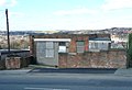 Disused community centre, Hanging Heaton, Soothill - geograph.org.uk - 1929586.jpg 2,000 × 1,364; 503 KB
-

-

-

-

-
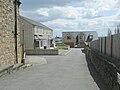
 Footpath - Kirkgate - geograph.org.uk - 1419984.jpg 480 × 640; 236 KB
-
 Footpath - Kirkgate - geograph.org.uk - 1419991.jpg 480 × 640; 311 KB
-

-

-
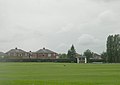
 Hanging Heaton Cricket Club - geograph.org.uk - 1764634.jpg 3,928 × 1,440; 866 KB
-
-
 Hanging Heaton Footpath - geograph.org.uk - 1762396.jpg 4,000 × 3,000; 3.7 MB
-
 Highgate Street - High Street - geograph.org.uk - 1420002.jpg 480 × 640; 211 KB
-
 Highgate Street - Kirkgate - geograph.org.uk - 1419967.jpg 640 × 480; 240 KB
-
 Kennedy Close - Glenlow Road - geograph.org.uk - 3437739.jpg 640 × 480; 57 KB
-
 Kirkgate - Hanging Heaton - geograph.org.uk - 1419966.jpg 640 × 480; 261 KB
-
 Kirkgate - High Street - geograph.org.uk - 3436598.jpg 640 × 480; 58 KB
-
 Kirkgate - High Street - geograph.org.uk - 3436613.jpg 640 × 480; 56 KB
-
 Kirkgate - looking towards High Street - geograph.org.uk - 1419974.jpg 640 × 480; 240 KB
-
 Kirkgate, Hanging Heaton - geograph.org.uk - 6032656.jpg 1,600 × 1,064; 561 KB
-
 Kirklees Way at Hanging Heaton - geograph.org.uk - 5744871.jpg 1,600 × 1,065; 619 KB
-
 Kirklees Way at Hanging Heaton - geograph.org.uk - 6032602.jpg 1,600 × 1,064; 595 KB
-
 Kirklees Way at Hanging Heaton - geograph.org.uk - 6032701.jpg 1,600 × 1,064; 908 KB
-
 Kirklees Way near Hanging Heaton - geograph.org.uk - 6032596.jpg 1,600 × 1,064; 576 KB
-
 Kirklees Way, Down from Hanging Heaton - geograph.org.uk - 442574.jpg 479 × 640; 152 KB
-
 Langdale Road - Bennett Lane - geograph.org.uk - 1419553.jpg 640 × 480; 211 KB
-
 Langdale Road - Croftlands - geograph.org.uk - 1419577.jpg 640 × 480; 214 KB
-

-

-
 Leeds Road towards Dewsbury - geograph.org.uk - 3057627.jpg 800 × 600; 99 KB
-
 Leeds Road towards Dewsbury - geograph.org.uk - 3097075.jpg 800 × 600; 84 KB
-
 Leeds Road, Dewsbury - geograph.org.uk - 5127205.jpg 1,024 × 682; 207 KB
-
 Leeds Road, Earlsheaton - geograph.org.uk - 1929746.jpg 2,000 × 1,178; 442 KB
-
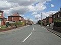
 Leeds Road, Hanging Heaton - geograph.org.uk - 5745042.jpg 1,600 × 1,065; 435 KB
-
 Mill Lane, Hanging Heaton - geograph.org.uk - 2542679.jpg 640 × 480; 69 KB
-
 New Street - Mill Lane - geograph.org.uk - 3436637.jpg 640 × 480; 76 KB
-
 Newgate - Highgate Street - geograph.org.uk - 1419970.jpg 640 × 480; 246 KB
-
 Newgate Street - High Street - geograph.org.uk - 1420005.jpg 640 × 480; 262 KB
-
 Ornamental gateway to Kirklees Way. - geograph.org.uk - 442566.jpg 640 × 480; 120 KB
-
 Rathlin Road - High Street - geograph.org.uk - 1419684.jpg 640 × 480; 212 KB
-
 Rugby pitch, Chidswell - geograph.org.uk - 6410424.jpg 640 × 436; 37 KB
-
 Selso Road - Bendigo Road - geograph.org.uk - 3437649.jpg 640 × 480; 54 KB
-
 Selso Road - Rumble Road - geograph.org.uk - 3437652.jpg 640 × 480; 57 KB
-
 Service station, Shaw Cross - geograph.org.uk - 6410055.jpg 640 × 402; 56 KB
-
 Service station, Shaw Cross - geograph.org.uk - 6410062.jpg 800 × 506; 77 KB
-
 St Paul's Church Hall - Kirkgate - geograph.org.uk - 1419964.jpg 640 × 413; 186 KB
-
 St Paul's Vicarage - off High Street - geograph.org.uk - 1419957.jpg 640 × 488; 272 KB
-
 Trenton Road - Croftlands - geograph.org.uk - 1419571.jpg 640 × 480; 227 KB
-
 Ullswater Avenue - Ullswater Road - geograph.org.uk - 3437115.jpg 640 × 480; 56 KB
-
 Ullswater Close - Ullswater Avenue - geograph.org.uk - 3437121.jpg 640 × 480; 56 KB
-

-
 Unnatural patterns near Dogloitch Wood - geograph.org.uk - 2148735.jpg 1,024 × 768; 193 KB
-
 Welwyn Road - Rathlin Road - geograph.org.uk - 1419677.jpg 640 × 480; 231 KB
-
 Westway - Croftlands - geograph.org.uk - 1419569.jpg 640 × 480; 229 KB
-
 Westway - Derwent Road - geograph.org.uk - 1419568.jpg 640 × 480; 238 KB


_-_geograph.org.uk_-_6471034.jpg)


_-_geograph.org.uk_-_6410422.jpg)


