Category:Harescombe
Jump to navigation
Jump to search
village in United Kingdom | |||||
| Upload media | |||||
| Instance of | |||||
|---|---|---|---|---|---|
| Location | Stroud, Gloucestershire, South West England, England | ||||
| Population |
| ||||
 | |||||
Harescombe is a small village in Gloucestershire, England.
Subcategories
This category has the following 2 subcategories, out of 2 total.
H
- Haresfield Beacon (27 F)
Media in category "Harescombe"
The following 87 files are in this category, out of 87 total.
-
A4173 near Sparrow Farm, Harescombe - geograph.org.uk - 6413175.jpg 800 × 600; 119 KB
-
A4173 nearing Upper Wells - geograph.org.uk - 6413182.jpg 800 × 600; 125 KB
-
A4173, Brookthorpe - geograph.org.uk - 3597459.jpg 800 × 451; 202 KB
-
A4173, Brookthorpe - geograph.org.uk - 3597465.jpg 800 × 451; 182 KB
-
Abandoned property - geograph.org.uk - 6503863.jpg 3,573 × 2,681; 3.04 MB
-
Alpaca at the edge of Standish Wood - geograph.org.uk - 5490541.jpg 3,776 × 2,520; 4.35 MB
-
Beech trees on Scottsquar Hill - geograph.org.uk - 2737520.jpg 1,024 × 768; 616 KB
-
Between Brookthorpe and Edge - geograph.org.uk - 3080962.jpg 2,970 × 2,456; 2.31 MB
-
Brookethorpe road - geograph.org.uk - 2751987.jpg 1,024 × 576; 440 KB
-
Bus stop and junction at Edge - geograph.org.uk - 4270167.jpg 640 × 415; 49 KB
-
Cattle near The Reddings - geograph.org.uk - 5052677.jpg 6,000 × 4,000; 6.55 MB
-
Chest tombs, Harescombe church - geograph.org.uk - 3357007.jpg 1,024 × 680; 273 KB
-
Church Farm, Harescombe - geograph.org.uk - 3357556.jpg 1,024 × 680; 236 KB
-
Country road near Harescombe - geograph.org.uk - 3297098.jpg 1,024 × 680; 225 KB
-
Countryside near Colethrop, Gloucestershire - geograph.org.uk - 3286849.jpg 1,600 × 1,194; 517 KB
-
Direction Sign – Signpost - geograph.org.uk - 6563073.jpg 750 × 1,000; 791 KB
-
Direction Sign – Signpost in Edge - geograph.org.uk - 6516703.jpg 1,100 × 1,500; 607 KB
-
Edge of access woodland - geograph.org.uk - 2737523.jpg 1,024 × 768; 639 KB
-
Edge, literally - geograph.org.uk - 3842473.jpg 800 × 450; 241 KB
-
Farm at Harescombe - geograph.org.uk - 3291697.jpg 1,024 × 680; 204 KB
-
Farmland near Harescombe - geograph.org.uk - 3291694.jpg 1,024 × 680; 216 KB
-
Farmland near Harescombe - geograph.org.uk - 3310203.jpg 1,024 × 680; 191 KB
-
Field leading to Stockend Wood - geograph.org.uk - 5490566.jpg 3,361 × 1,865; 3.19 MB
-
Footpath entering Stockend Wood - geograph.org.uk - 5490572.jpg 3,776 × 2,520; 4.04 MB
-
Footpath from Styles Lane - geograph.org.uk - 3844546.jpg 800 × 600; 329 KB
-
Footpath to Harescombe - geograph.org.uk - 3297103.jpg 1,024 × 680; 233 KB
-
Footpath to Harescombe - geograph.org.uk - 3842506.jpg 800 × 450; 267 KB
-
Full barn at Brookthorpe - geograph.org.uk - 3288286.jpg 1,600 × 1,113; 570 KB
-
Halliday's Wood - geograph.org.uk - 3443336.jpg 800 × 600; 178 KB
-
Halliday's Wood - geograph.org.uk - 3443356.jpg 800 × 600; 155 KB
-
Harescombe church - geograph.org.uk - 3356989.jpg 1,024 × 680; 165 KB
-
Harescombe church - geograph.org.uk - 3356999.jpg 1,024 × 680; 188 KB
-
In Stockend Wood - geograph.org.uk - 5490578.jpg 3,776 × 2,520; 3.6 MB
-
Interior of Harescombe church - geograph.org.uk - 3357013.jpg 680 × 1,024; 120 KB
-
Memorial in Harescombe church - geograph.org.uk - 3359050.jpg 680 × 1,024; 119 KB
-
Milestone at Brookthorpe - geograph.org.uk - 3356212.jpg 680 × 1,024; 254 KB
-
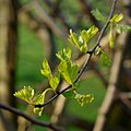
New foliage, Cretaegus monogyna - geograph.org.uk - 3844534.jpg 800 × 800; 270 KB
-
Oak, pasture and hawthorn hedge - geograph.org.uk - 3844538.jpg 598 × 800; 321 KB
-
Oak, pasture and sheep - geograph.org.uk - 3844528.jpg 800 × 451; 216 KB
-
Old Boundary Post, Edge (geograph 7123147).jpg 768 × 1,024; 495 KB
-
Old Rectory at Harescombe - geograph.org.uk - 3842490.jpg 800 × 450; 267 KB
-
Pasture on the Cotswold edge - geograph.org.uk - 2737526.jpg 1,024 × 768; 664 KB
-
Remains of a preaching cross - geograph.org.uk - 3357003.jpg 1,024 × 680; 278 KB
-
Road into Harescombe - geograph.org.uk - 3357557.jpg 1,024 × 680; 231 KB
-
Road passing through Cliff Wood - geograph.org.uk - 5199279.jpg 1,024 × 768; 369 KB
-
Road through Halliday's Wood - geograph.org.uk - 5199290.jpg 1,024 × 768; 360 KB
-
Stockend (road) from the Cotswold Way - geograph.org.uk - 3443299.jpg 800 × 600; 169 KB
-
Stockend Wood - geograph.org.uk - 3443328.jpg 800 × 600; 162 KB
-
Stroud District , Hillside Scenery - geograph.org.uk - 3724119.jpg 4,288 × 2,848; 4.87 MB
-
Styles Farm, Styles Lane - geograph.org.uk - 3844548.jpg 800 × 600; 299 KB
-
Styles Lane junction with A4173 - geograph.org.uk - 2518950.jpg 3,088 × 2,056; 1.17 MB
-
The Cotswold Way along Stockend (road) - geograph.org.uk - 3443291.jpg 800 × 600; 175 KB
-
The Cotswold Way at Lantern Cottage - geograph.org.uk - 3443288.jpg 800 × 600; 158 KB
-
The Cotswold Way at Standish Wood - geograph.org.uk - 3443651.jpg 800 × 600; 125 KB
-
The Cotswold Way at Stockend - geograph.org.uk - 3443282.jpg 800 × 600; 162 KB
-
The Cotswold Way at Stockend Wood - geograph.org.uk - 3443323.jpg 800 × 600; 144 KB
-
The Cotswold Way at Stockend Wood - geograph.org.uk - 3443340.jpg 600 × 800; 163 KB
-
The Cotswold Way at the bottom of Maitlands Wood - geograph.org.uk - 5052634.jpg 6,000 × 4,000; 6.5 MB
-
The Cotswold Way below Maitlands Wood - geograph.org.uk - 5052660.jpg 6,000 × 4,000; 4.81 MB
-
The Cotswold Way enters Maitlands Wood - geograph.org.uk - 3443272.jpg 800 × 600; 136 KB
-
The Cotswold Way in Halliday's Wood - geograph.org.uk - 3443358.jpg 800 × 600; 133 KB
-
The Cotswold Way in Halliday's Wood - geograph.org.uk - 5052960.jpg 6,000 × 4,000; 5.26 MB
-
The Cotswold Way in Halliday's Wood - geograph.org.uk - 5052967.jpg 6,000 × 4,000; 5.51 MB
-
The Cotswold Way in Maitlands Wood - geograph.org.uk - 3443277.jpg 800 × 600; 168 KB
-
The Cotswold Way in Maitlands Wood - geograph.org.uk - 3443280.jpg 800 × 600; 142 KB
-
The Cotswold Way in Maitlands Wood - geograph.org.uk - 5052612.jpg 6,000 × 4,000; 4.43 MB
-
The Cotswold Way in Stockend Wood - geograph.org.uk - 5052947.jpg 6,000 × 4,000; 4.72 MB
-
The Cotswold Way joins a minor road - geograph.org.uk - 3443368.jpg 800 × 600; 188 KB
-
The Cotswold Way leaves Stockend (road) - geograph.org.uk - 3443296.jpg 800 × 600; 161 KB
-
The Cotswold Way towards Halliday's Wood - geograph.org.uk - 3443319.jpg 800 × 600; 175 KB
-
The Cotswold Way towards Halliday's Wood - geograph.org.uk - 3443332.jpg 800 × 600; 154 KB
-
The edge of Stockend Wood - geograph.org.uk - 5052956.jpg 6,000 × 4,000; 5.55 MB
-
The Reddings - geograph.org.uk - 5052878.jpg 5,566 × 3,710; 3.11 MB
-
The Reddings - geograph.org.uk - 6503885.jpg 4,032 × 3,024; 7.6 MB
-
Threshold Farm, Harescombe - geograph.org.uk - 2737528.jpg 768 × 1,024; 605 KB
-
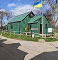
Ukrainian flag, Harescombe, Gloucestershire (geograph 7123639).jpg 1,000 × 1,024; 327 KB
-
View from the Edge - geograph.org.uk - 3842479.jpg 800 × 450; 255 KB
-
View over Harescombe - geograph.org.uk - 3297110.jpg 1,024 × 680; 176 KB
-
View towards the Vale of Gloucester - geograph.org.uk - 3087778.jpg 2,265 × 1,935; 1.59 MB
-
Village hall entrance, Harescombe (geograph 7124178).jpg 858 × 1,024; 335 KB
-
Walking along Stockend (road) - geograph.org.uk - 3443285.jpg 800 × 600; 155 KB
-
Road to Haresfield Beacon - geograph.org.uk - 145942.jpg 640 × 480; 100 KB


