Category:Harrington, Cumbria
Jump to navigation
Jump to search
town in Cumbria, England  | |||||
| Upload media | |||||
| Instance of | |||||
|---|---|---|---|---|---|
| Location | Workington, Allerdale, Cumbria, North West England, England | ||||
 | |||||
English: Harrington is on the Cumbrian coast south of Workington and north of Whitehaven. Its industrial history, which largely ended in the late 1930s, included an iron works, coal mining, and steel making. It once had five railway stations. It still has one station, on the Cumbrian Coast Line, near the harbour.
Subcategories
This category has the following 3 subcategories, out of 3 total.
H
- Harrington railway station (6 F)
M
- St Mary's, Harrington (3 F)
Media in category "Harrington, Cumbria"
The following 35 files are in this category, out of 35 total.
-
 A winter afternoon at Harrington Harbour - geograph.org.uk - 1078435.jpg 640 × 480; 340 KB
-
 Disused railway, Harrington, West Cumbria - geograph.org.uk - 60239.jpg 640 × 427; 140 KB
-

-
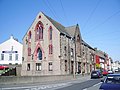 Ex-Wesleyan Church, Harrington - geograph.org.uk - 426014.jpg 640 × 480; 101 KB
-
 Harrington harbour - geograph.org.uk - 1265365.jpg 640 × 480; 42 KB
-
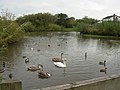 Harrington Pond - geograph.org.uk - 573515.jpg 640 × 480; 107 KB
-
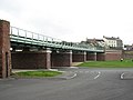 Harrington Railway Viaduct - geograph.org.uk - 573524.jpg 640 × 480; 83 KB
-
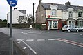 High Harrington Post Office - geograph.org.uk - 88879.jpg 640 × 427; 89 KB
-
 New industrial units - geograph.org.uk - 518714.jpg 640 × 480; 77 KB
-
 Old building on Harrington Harbour - geograph.org.uk - 1116633.jpg 640 × 480; 43 KB
-
 Rose Hill, Harrington - geograph.org.uk - 1265363.jpg 640 × 480; 55 KB
-
 Salterbeck Cemetery, Workington - geograph.org.uk - 47644.jpg 640 × 480; 165 KB
-
 Train - geograph.org.uk - 475389.jpg 640 × 480; 181 KB
-
 United Reformed Church, Harrington - geograph.org.uk - 425939.jpg 640 × 480; 103 KB
-
 A shelter for the young ones - geograph.org.uk - 518686.jpg 640 × 480; 223 KB
-
 Barn at Low Scaw Farm - geograph.org.uk - 475394.jpg 604 × 452; 182 KB
-
 Beckstone Primary School, Harrington - geograph.org.uk - 425927.jpg 640 × 480; 102 KB
-
 Cumbria Coastal Way - geograph.org.uk - 516804.jpg 640 × 480; 222 KB
-
 Cyclepath on rail line. - geograph.org.uk - 88965.jpg 640 × 480; 109 KB
-
 Entrance to Harrington Harbour - geograph.org.uk - 425998.jpg 640 × 480; 102 KB
-
 Galloping Horse High Harrington - geograph.org.uk - 88882.jpg 640 × 427; 57 KB
-
 Harringdale - geograph.org.uk - 475395.jpg 640 × 480; 203 KB
-
 Harrington - geograph.org.uk - 5781.jpg 640 × 425; 44 KB
-
 Harrington Harbour - geograph.org.uk - 32518.jpg 640 × 480; 99 KB
-
 Harrington Methodist Church - geograph.org.uk - 425985.jpg 640 × 480; 103 KB
-
 Key Brow, Grayson Green - geograph.org.uk - 583690.jpg 640 × 480; 171 KB
-
 Lime Road, Harrington - geograph.org.uk - 475385.jpg 584 × 438; 149 KB
-
 Main Road Scaw Road. - geograph.org.uk - 88963.jpg 640 × 480; 80 KB
-

-
 Sea wall at Bellaport Marina - geograph.org.uk - 519695.jpg 640 × 480; 139 KB
-
 Seagulls Harrington Harbour - geograph.org.uk - 426011.jpg 640 × 480; 102 KB
-
 Shore Road Reservoir - geograph.org.uk - 518680.jpg 640 × 480; 238 KB
-
 Southern breakwater Harrington Harbour - geograph.org.uk - 425991.jpg 640 × 480; 104 KB
-
 West Ghyll Farm. - geograph.org.uk - 88973.jpg 640 × 480; 79 KB
-
 Y Junction. - geograph.org.uk - 88974.jpg 640 × 480; 67 KB


.jpg)


