Category:Hatfield, Hertfordshire
Jump to navigation
Jump to search
town and civil parish in Hertfordshire, England  | |||||
| Upload media | |||||
| Instance of | |||||
|---|---|---|---|---|---|
| Location | Welwyn Hatfield, Hertfordshire, East of England, England | ||||
| Said to be the same as | Hatfield (Wikimedia duplicated page, civil parish) | ||||
 | |||||
Pictures related to en:Hatfield, Hertfordshire.
Subcategories
This category has the following 21 subcategories, out of 21 total.
B
- Colin Blunstone (13 F)
- Hatfield Business Park (11 F)
C
D
H
- Hedges in Hatfield (6 F)
- Howe Dell (12 F)
M
O
- Oxleys Wood (7 F)
P
R
- RAF Hatfield (9 F)
S
T
- The Galleria, Hatfield (9 F)
U
Media in category "Hatfield, Hertfordshire"
The following 200 files are in this category, out of 697 total.
(previous page) (next page)-
 "It is an ex-airfield . . ." - geograph.org.uk - 5344609.jpg 640 × 480; 78 KB
-
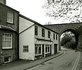
 "The Town Inn", Hatfield New Town - geograph.org.uk - 4587960.jpg 1,600 × 1,200; 358 KB
-
 A churchyard without a church - geograph.org.uk - 4299370.jpg 4,320 × 3,240; 4.62 MB
-

-

-

-

-
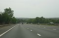
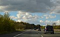
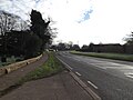
 A1(M) - A414 - geograph.org.uk - 1994651.jpg 640 × 446; 43 KB
-
 A1(M) - approaching junction 4 - geograph.org.uk - 2458536.jpg 640 × 416; 31 KB
-
 A1(M) - approaching junction 4 - geograph.org.uk - 2461686.jpg 640 × 418; 41 KB
-
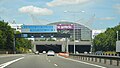 A1(M) approaching The Galleria - geograph.org.uk - 4646687.jpg 640 × 364; 52 KB
-
 A1(M) approaching The Galleria - geograph.org.uk - 4985452.jpg 640 × 426; 49 KB
-
 A1(M) below The Galleria - geograph.org.uk - 4646689.jpg 640 × 391; 47 KB
-
 A1(M) below The Galleria - geograph.org.uk - 4646690.jpg 640 × 392; 31 KB
-
 A1(M) from Cavendish Way - geograph.org.uk - 5382286.jpg 5,202 × 3,465; 3.33 MB
-
 A1(M) in a tunnel - geograph.org.uk - 4646694.jpg 640 × 392; 29 KB
-
 A1(M) north of J4 - geograph.org.uk - 4646709.jpg 640 × 369; 40 KB
-
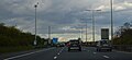
 A1(M) northbound - geograph.org.uk - 2513552.jpg 640 × 480; 43 KB
-
 A1(M) northbound - geograph.org.uk - 5682792.jpg 640 × 428; 96 KB
-
 A1(M) northbound - geograph.org.uk - 5682843.jpg 640 × 428; 99 KB
-
 A1(M) northbound - geograph.org.uk - 5682853.jpg 640 × 428; 88 KB
-
 A1(M) northbound - geograph.org.uk - 5682884.jpg 640 × 428; 86 KB
-
 A1(M) northbound - Hatfield Tunnel - geograph.org.uk - 5682822.jpg 640 × 428; 129 KB
-
 A1(M) northbound - Hatfield Tunnel - geograph.org.uk - 6317013.jpg 1,024 × 576; 106 KB
-
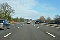
 A1(M) northbound near Stanborough - geograph.org.uk - 2513519.jpg 640 × 480; 34 KB
-

-
 A1(M) Slip Road - geograph.org.uk - 4770387.jpg 3,072 × 2,304; 1.55 MB
-
 A1(M) tunnel exit - geograph.org.uk - 4985466.jpg 640 × 368; 38 KB
-
 A1(M), north - geograph.org.uk - 4646682.jpg 640 × 379; 45 KB
-
 A1(M), north - geograph.org.uk - 4646699.jpg 640 × 426; 56 KB
-
 A1(M), north - geograph.org.uk - 4985489.jpg 640 × 281; 31 KB
-
 A1(M), north - geograph.org.uk - 4985496.jpg 640 × 294; 27 KB
-
 A1(M), north - geograph.org.uk - 4985513.jpg 640 × 426; 52 KB
-
 A1(M), north near J3 - geograph.org.uk - 4646676.jpg 640 × 417; 46 KB
-
 A1(M), north of J3 - geograph.org.uk - 4985448.jpg 640 × 357; 31 KB
-
 A1(M), north of J5 - geograph.org.uk - 4985503.jpg 640 × 394; 39 KB
-
 A1(M), northbound - geograph.org.uk - 4646710.jpg 640 × 351; 53 KB
-
 A1(M), northbound - geograph.org.uk - 4646719.jpg 640 × 380; 36 KB
-
 A1(M), northbound - geograph.org.uk - 4646722.jpg 640 × 378; 49 KB
-
 A1(M), northbound - geograph.org.uk - 4985446.jpg 640 × 305; 29 KB
-

-
 A1(M), tunnel - geograph.org.uk - 4985458.jpg 640 × 396; 49 KB
-
 A1000 and A1001 part company - geograph.org.uk - 6062925.jpg 1,024 × 684; 232 KB
-
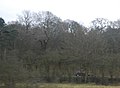 A1000 in woodland by the ECML - geograph.org.uk - 2380043.jpg 640 × 468; 45 KB
-
 A1001 bridge over the Alban Way - geograph.org.uk - 5382266.jpg 5,202 × 3,465; 3.7 MB
-
 A1001 overbridge, A1(M) - geograph.org.uk - 4646693.jpg 640 × 386; 44 KB
-
 A414 eastbound - geograph.org.uk - 6062890.jpg 1,024 × 684; 285 KB
-
 A414 eastbound - geograph.org.uk - 6063076.jpg 1,024 × 684; 243 KB
-
 A414 eastbound - geograph.org.uk - 6063086.jpg 1,024 × 684; 197 KB
-
 A414 eastbound - geograph.org.uk - 6063095.jpg 1,024 × 684; 225 KB
-
 A6129 at Hatfield Garden Village - geograph.org.uk - 4799107.jpg 3,072 × 2,304; 1.74 MB
-
 A6129 at the junction with the A414 - geograph.org.uk - 4770426.jpg 3,072 × 2,304; 1.78 MB
-

-
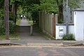
 Access road off Mosquito Way - geograph.org.uk - 4602543.jpg 2,304 × 1,728; 854 KB
-
 Alban Way crosses Ellenbrook Lane - geograph.org.uk - 5382245.jpg 5,202 × 3,465; 3.94 MB
-
 Alban Way final section at Hatfield - geograph.org.uk - 5382412.jpg 5,202 × 3,465; 3.64 MB
-
 Alban Way footbridge over Wellfield Road-Wells Way - geograph.org.uk - 5382351.jpg 5,202 × 3,465; 4.31 MB
-
 Alban Way through Birchwood - geograph.org.uk - 5382370.jpg 5,202 × 3,465; 4.65 MB
-
 Alban Way, Hatfield (29618763640).jpg 4,288 × 3,216; 4.22 MB
-
 Alban Way, Hatfield - geograph.org.uk - 5382323.jpg 5,202 × 3,465; 3.97 MB
-

-
 Allotments at Hatfield - geograph.org.uk - 432291.jpg 640 × 465; 81 KB
-
 Apollo Court Table Tennis Hatfield.jpg 1,895 × 840; 573 KB
-
 Approaching Hatfield Tunnel - geograph.org.uk - 2513480.jpg 640 × 480; 38 KB
-
 Approaching Hillend Cottages - geograph.org.uk - 5427171.jpg 1,600 × 991; 420 KB
-
 Approaching junction 4 northbound - geograph.org.uk - 2513497.jpg 640 × 480; 35 KB
-
 Artwork at the Hatfield end of the Alban Way - geograph.org.uk - 5382444.jpg 5,202 × 3,465; 4.08 MB
-
 Ascots Lane, Mill Green - geograph.org.uk - 5528686.jpg 2,048 × 1,536; 1.51 MB
-
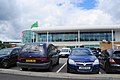 Asda in Hatfield - geograph.org.uk - 3030769.jpg 3,612 × 2,408; 1.84 MB
-
 Astwick Manor - geograph.org.uk - 213920.jpg 600 × 481; 134 KB
-

-

-

-

-

-
 Avenue from S.E. entrance to Hatfield House - geograph.org.uk - 4299115.jpg 4,320 × 3,240; 4.42 MB
-

-
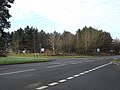
 B197 Great North Road Stanborough - geograph.org.uk - 2208850.jpg 1,600 × 1,200; 541 KB
-
 B197 Great North Road ^ Roadsign - geograph.org.uk - 4936036.jpg 3,057 × 2,238; 2.43 MB
-
 B197 Great North Road, Lemsford - geograph.org.uk - 4935953.jpg 3,072 × 2,262; 3.42 MB
-
 B197 Great North Road, Lemsford - geograph.org.uk - 4936019.jpg 3,072 × 2,304; 2.01 MB
-
 B197 Great North Road, Stanborough - geograph.org.uk - 4936058.jpg 2,779 × 1,845; 2.48 MB
-
 B6426 & Queensway roundabout and underpass Hatfield Hertfordshire England.jpg 4,724 × 3,240; 9.88 MB
-
 B6426 St Albans Road East, Hatfield - geograph.org.uk - 6063071.jpg 1,024 × 684; 223 KB
-
 B653 Brocket Road, Lemsford - geograph.org.uk - 4770828.jpg 3,072 × 2,304; 1.82 MB
-
 B653 Brocket Road, Lemsford - geograph.org.uk - 4799206.jpg 3,072 × 2,304; 1.75 MB
-
 B653 Brocket Road, Lemsford - geograph.org.uk - 4799208.jpg 3,072 × 2,304; 2.13 MB
-
 B653 Brocket Road, Lemsford - geograph.org.uk - 4799298.jpg 3,072 × 2,304; 1.74 MB
-
 B653 Brocket Road, Lemsford - geograph.org.uk - 4799304.jpg 3,072 × 2,304; 1.79 MB
-
 B653 Brocket Road, Stanborough - geograph.org.uk - 4770450.jpg 3,072 × 2,304; 1.3 MB
-
 B653 Brocket Road, Stanborough - geograph.org.uk - 4770463.jpg 3,072 × 2,282; 1.36 MB
-
 B653 Marford Road, Cromer Hyde - geograph.org.uk - 5047497.jpg 3,072 × 2,304; 1.82 MB
-
 B653 Marford Road, Cromer Hyde, Lemsford - geograph.org.uk - 4770857.jpg 3,072 × 2,304; 1.94 MB
-
 B653 Marford Road, Cromer Hyde, Lemsford - geograph.org.uk - 4770862.jpg 3,072 × 2,304; 2.84 MB
-
 B653 Marford Road, Cromer Hyde, Lemsford - geograph.org.uk - 4799424.jpg 3,072 × 2,304; 1.68 MB
-
 B653 Marford Road, Lemsford - geograph.org.uk - 4799309.jpg 3,072 × 2,304; 1.89 MB
-
 Back of Hatfield Town Centre - geograph.org.uk - 1313141.jpg 640 × 480; 71 KB
-
 Back of The Galleria Shopping Centre - geograph.org.uk - 5382296.jpg 5,202 × 3,465; 3.25 MB
-

-
 Badminton courts, Hertfordshire Sports Village - geograph.org.uk - 4467790.jpg 3,648 × 2,736; 2.29 MB
-
 Bar in a Bus, Hatfield Park - geograph.org.uk - 5427050.jpg 3,888 × 2,592; 3.11 MB
-
 Battle Proms 2015, Hatfield Park, Hertfordshire - geograph.org.uk - 4577931.jpg 1,400 × 1,050; 145 KB
-
 Battle Proms, Hatfield House, Hertfordshire - geograph.org.uk - 5049515.jpg 700 × 1,050; 761 KB
-
 Baxter Webbe Solicitors - geograph.org.uk - 3999815.jpg 640 × 543; 86 KB
-
 Birchwood Leisure Centre.jpg 3,554 × 1,999; 1.36 MB
-
 Bishop's Palace, Old Hatfield - geograph.org.uk - 4021699.jpg 1,200 × 1,600; 791 KB
-
 BOC by the East Coast Main Line - geograph.org.uk - 3767922.jpg 640 × 430; 62 KB
-
 BOC, Hatfield - geograph.org.uk - 4174463.jpg 640 × 337; 32 KB
-
 Bollards galore^ - geograph.org.uk - 1994655.jpg 800 × 590; 80 KB
-
 Bourne End Farm - geograph.org.uk - 4929694.jpg 640 × 480; 83 KB
-
 Brewhouse Farm, Woodside - geograph.org.uk - 4161237.jpg 2,560 × 1,920; 1.98 MB
-
 Bridge in Hatfield - geograph.org.uk - 6144251.jpg 4,032 × 3,024; 4.83 MB
-
 Bridleway in Woodside - geograph.org.uk - 6190590.jpg 1,920 × 1,280; 2.18 MB
-
 Bridleway in Woodside - geograph.org.uk - 6190607.jpg 1,920 × 1,280; 1.47 MB
-
 Bridleway in Woodside - geograph.org.uk - 6190611.jpg 1,920 × 1,280; 1.89 MB
-
 Bridleway in Woodside - geograph.org.uk - 6190618.jpg 1,920 × 1,280; 2.51 MB
-
 Bridleway in Woodside - geograph.org.uk - 6190623.jpg 1,920 × 1,280; 2.16 MB
-
 Bridleway near Symondshyde Farm - geograph.org.uk - 5391773.jpg 640 × 480; 154 KB
-
 Bridleway to Cromer Hyde - geograph.org.uk - 2177378.jpg 640 × 480; 121 KB
-
 Bridleway to Hammond's Lane - geograph.org.uk - 5047068.jpg 3,072 × 2,304; 1.8 MB
-
 Broadwater Road, Hatfield - geograph.org.uk - 6189189.jpg 1,920 × 1,280; 1.42 MB
-
 Brocket Hall - Bridge across the River Lea - geograph.org.uk - 6278019.jpg 1,024 × 575; 263 KB
-
 Brocket Hall Gates - geograph.org.uk - 6278029.jpg 1,024 × 575; 217 KB
-
 Brocket Hall sign - geograph.org.uk - 4799276.jpg 2,192 × 2,914; 2.27 MB
-
 Brocket Road sign - geograph.org.uk - 4799218.jpg 3,072 × 2,304; 1.81 MB
-
 By the East Coast Main Line - geograph.org.uk - 4152368.jpg 640 × 430; 58 KB
-
 Byway to the B653 Marford Road - geograph.org.uk - 5047883.jpg 3,072 × 2,304; 1.96 MB
-
 C91 Green Lanes ^ roadsign - geograph.org.uk - 5046146.jpg 3,072 × 2,304; 2.27 MB
-
 C91 Green Lanes, Stanborough - geograph.org.uk - 5046124.jpg 3,072 × 2,304; 2.58 MB
-
 C91 Green Lanes, Stanborough - geograph.org.uk - 5046135.jpg 2,852 × 1,904; 2.04 MB
-
 C91 Green Lanes, Stanborough - geograph.org.uk - 5046169.jpg 2,845 × 2,133; 2.58 MB
-
 C91 Green Lanes, Stanborough - geograph.org.uk - 5046980.jpg 3,072 × 2,252; 2.27 MB
-
 Carbone Hill, Newgate Street - geograph.org.uk - 2291065.jpg 1,600 × 1,200; 515 KB
-
 Carbone Hill, Newgate Street - geograph.org.uk - 3660370.jpg 2,048 × 1,536; 1.94 MB
-
 Chequers, The Ryde - geograph.org.uk - 5610470.jpg 2,304 × 1,728; 838 KB
-
 Chilterns, Hatfield - geograph.org.uk - 2202629.jpg 640 × 480; 49 KB
-
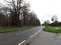
 Church Lane at the junction of Great North Road - geograph.org.uk - 6190639.jpg 1,920 × 1,280; 1.5 MB
-
 Clarke's Road, Birchwood - geograph.org.uk - 5382390.jpg 5,202 × 3,465; 3.83 MB
-
 Close up, Elizabeth II postbox, Newgate Street Village - geograph.org.uk - 4934445.jpg 1,669 × 2,783; 964 KB
-
 Comet Way looking towards The Galleria - geograph.org.uk - 5610469.jpg 2,304 × 1,728; 1,019 KB
-
 Comet Way, Hatfield - geograph.org.uk - 5528671.jpg 2,048 × 1,536; 977 KB
-
 Comet Way, Hatfield - geograph.org.uk - 5609967.jpg 2,250 × 1,654; 1.22 MB
-
 Commons Wood Caravan Club Site - geograph.org.uk - 1729361.jpg 2,816 × 1,880; 1.52 MB
-
 Commons Wood Caravan Club Site - geograph.org.uk - 3430901.jpg 5,184 × 3,456; 4 MB
-

-
 Concrete Relics - geograph.org.uk - 3645733.jpg 1,600 × 1,067; 1.53 MB
-
 Conveyor Belt - geograph.org.uk - 2177405.jpg 640 × 480; 88 KB
-
 Coopers Green Lane - geograph.org.uk - 4497328.jpg 2,304 × 1,728; 788 KB
-
 Coopers Green Lane - geograph.org.uk - 4498744.jpg 2,250 × 1,654; 1.52 MB
-
 Coopers Green Lane - geograph.org.uk - 4500659.jpg 2,304 × 1,728; 814 KB
-
 Coopers Green Lane at the junction of Woodcock Hill - geograph.org.uk - 4497327.jpg 2,200 × 1,580; 1.6 MB
-
 Coopers Green Lane, Hatfield - geograph.org.uk - 4497323.jpg 2,304 × 1,728; 1.33 MB
-
 Coopers Green Lane, Hatfield - geograph.org.uk - 4497325.jpg 2,304 × 1,728; 1.13 MB
-
 Corner by tennis courts, Newgate Street - geograph.org.uk - 4955598.jpg 640 × 480; 156 KB
-
 Cottages on Wildhill Road - geograph.org.uk - 4161398.jpg 2,560 × 1,920; 1.99 MB
-
 Cottages on Woodside Lane - geograph.org.uk - 4161423.jpg 2,560 × 1,920; 2.04 MB
-
 Creek in Woodside - geograph.org.uk - 6190596.jpg 1,920 × 1,280; 1.85 MB
-
 Cromer Hyde Lane sign - geograph.org.uk - 4799399.jpg 3,072 × 2,304; 1.91 MB
-
 Cromer Hyde Lane sign - geograph.org.uk - 5047285.jpg 3,072 × 2,304; 1.9 MB
-
 Cromer Hyde Lane ^ footpath - geograph.org.uk - 5047274.jpg 2,803 × 2,102; 3.22 MB
-
 Cromer Hyde Lane, Cromer Hyde - geograph.org.uk - 4799431.jpg 3,072 × 2,304; 1.8 MB
-
 Cromer Hyde Lane, Cromer Hyde - geograph.org.uk - 5046998.jpg 3,072 × 2,304; 1.86 MB
-
 Cromer Hyde Lane, Cromer Hyde - geograph.org.uk - 5047046.jpg 3,072 × 2,304; 2 MB
-
 Cromer Hyde Lane, Cromer Hyde - geograph.org.uk - 5047082.jpg 3,072 × 2,148; 2.61 MB
-
 Cromer Hyde Lane, Cromer Hyde - geograph.org.uk - 5047278.jpg 3,072 × 2,304; 1.93 MB
-
 Cromer Hyde Lane, Cromer Hyde - geograph.org.uk - 5047281.jpg 3,072 × 2,212; 3.38 MB
-
 Cromer Hyde Lane, footpath ^ bridleway - geograph.org.uk - 5047010.jpg 3,072 × 2,304; 1.73 MB
-
 Cromer Hyde Lane, footpath ^ bridleway - geograph.org.uk - 5047051.jpg 3,072 × 2,304; 1.79 MB
-
 Cromer Hyde Postbox - geograph.org.uk - 4799367.jpg 3,072 × 2,304; 1.97 MB
-
 Cromer Hyde Postbox - geograph.org.uk - 4799378.jpg 3,072 × 2,304; 1.94 MB
-
 Cromer Hyde Postbox - geograph.org.uk - 4799379.jpg 2,228 × 2,962; 5.17 MB
-
 Cromer Hyde Postbox - geograph.org.uk - 4799409.jpg 2,265 × 3,011; 3.24 MB
-
 Crossing sign near Nast Hyde - geograph.org.uk - 5382221.jpg 5,202 × 3,465; 3.23 MB
-
 Cuffley Brook - geograph.org.uk - 3645722.jpg 1,600 × 1,067; 1.73 MB
-
 Cyclists on West End Lane - geograph.org.uk - 5353577.jpg 640 × 421; 97 KB
-

-

-
 Dappled light on French Horn Drive footpath Hatfield Hertfordshire England.jpg 3,648 × 5,472; 27.02 MB
-
 Darnicle Hill, Newgate Street - geograph.org.uk - 2290950.jpg 1,600 × 1,200; 602 KB
-
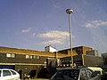
 David Lloyd leisure centre on Mosquito Way - geograph.org.uk - 4602510.jpg 2,258 × 1,666; 1.08 MB
-
 Derelict Cottage - geograph.org.uk - 371903.jpg 640 × 444; 74 KB
-
 Dive to Hatfield House - geograph.org.uk - 5353554.jpg 640 × 480; 75 KB
-
 Dogs must be kept on leads at all times - geograph.org.uk - 5591235.jpg 640 × 480; 151 KB
-

-
 Eisai Offices, Hatfield - geograph.org.uk - 4601740.jpg 2,246 × 1,648; 1 MB
-
 Elizabeth II postbox, Newgate Street Village - geograph.org.uk - 4934442.jpg 3,648 × 2,736; 2.08 MB
-
 Ellenbrook Stream (9733259235).jpg 2,947 × 2,213; 1.93 MB
-

-
 Ellenbrooke Lane crossing looking south west - geograph.org.uk - 5382254.jpg 5,202 × 3,465; 3.73 MB
-
 Entering Hatfield on the B653 Marford Road - geograph.org.uk - 4799335.jpg 3,072 × 2,304; 1.9 MB
-

-
 Entering Lemsford Village on Lemsford Village - geograph.org.uk - 4799253.jpg 3,072 × 2,304; 2.02 MB
-
 Entering Newgate Street - geograph.org.uk - 4929648.jpg 640 × 480; 93 KB
-
 Entrance to Brocket Hall - geograph.org.uk - 4770885.jpg 3,072 × 2,304; 1.83 MB
-
 Entrance to Brocket Hall - geograph.org.uk - 4799228.jpg 2,304 × 3,072; 2.03 MB
-
 Entrance to Bush Hall, A1000 Hatfield - geograph.org.uk - 2265089.jpg 1,600 × 1,200; 543 KB
-

-
 Entrance to Hatfield House Estate - geograph.org.uk - 2953186.jpg 2,560 × 1,920; 2.24 MB
-
 Entrance to Hatfield House on Broadwater Road - geograph.org.uk - 6189190.jpg 1,920 × 1,280; 2.12 MB
-
 Entrance to Home Farm, Ponsbourne Park - geograph.org.uk - 3659951.jpg 1,930 × 1,362; 1.08 MB


_-_A414_-_geograph.org.uk_-_1994651.jpg)
_-_approaching_junction_4_-_geograph.org.uk_-_2458536.jpg)
_-_approaching_junction_4_-_geograph.org.uk_-_2461686.jpg)
_approaching_The_Galleria_-_geograph.org.uk_-_4646687.jpg)
_approaching_The_Galleria_-_geograph.org.uk_-_4985452.jpg)
_below_The_Galleria_-_geograph.org.uk_-_4646689.jpg)
_below_The_Galleria_-_geograph.org.uk_-_4646690.jpg)
_from_Cavendish_Way_-_geograph.org.uk_-_5382286.jpg)
_in_a_tunnel_-_geograph.org.uk_-_4646694.jpg)
_north_of_J4_-_geograph.org.uk_-_4646709.jpg)
_northbound_-_geograph.org.uk_-_2513552.jpg)
_northbound_-_geograph.org.uk_-_5682792.jpg)
_northbound_-_geograph.org.uk_-_5682843.jpg)
_northbound_-_geograph.org.uk_-_5682853.jpg)
_northbound_-_geograph.org.uk_-_5682884.jpg)
_northbound_-_Hatfield_Tunnel_-_geograph.org.uk_-_5682822.jpg)
_northbound_-_Hatfield_Tunnel_-_geograph.org.uk_-_6317013.jpg)
_northbound_near_Stanborough_-_geograph.org.uk_-_2513519.jpg)
_passing_slip_road_from_junction_5_-_geograph.org.uk_-_2513537.jpg)
_Slip_Road_-_geograph.org.uk_-_4770387.jpg)
_tunnel_exit_-_geograph.org.uk_-_4985466.jpg)
,_north_-_geograph.org.uk_-_4646682.jpg)
,_north_-_geograph.org.uk_-_4646699.jpg)
,_north_-_geograph.org.uk_-_4985489.jpg)
,_north_-_geograph.org.uk_-_4985496.jpg)
,_north_-_geograph.org.uk_-_4985513.jpg)
,_north_near_J3_-_geograph.org.uk_-_4646676.jpg)
,_north_of_J3_-_geograph.org.uk_-_4985448.jpg)
,_north_of_J5_-_geograph.org.uk_-_4985503.jpg)
,_northbound_-_geograph.org.uk_-_4646710.jpg)
,_northbound_-_geograph.org.uk_-_4646719.jpg)
,_northbound_-_geograph.org.uk_-_4646722.jpg)
,_northbound_-_geograph.org.uk_-_4985446.jpg)
,_southbound_-_approaching_junction_3_-_geograph.org.uk_-_2461969.jpg)
,_tunnel_-_geograph.org.uk_-_4985458.jpg)


_-_geograph.org.uk_-_4646693.jpg)


.jpg)


_-_geograph.org.uk_-_6165585.jpg)
_-_geograph.org.uk_-_6165567.jpg)


.jpg)


_-_A1(M)_-_geograph.org.uk_-_2450381.jpg)


