Category:Hattwichstraße (Glienicke/Nordbahn)
Jump to navigation
Jump to search
Deutsch: Ansichten der "Hattwichstraße" in Glienicke/Nordbahn , Gemeinde Glienicke/Nordbahn , Landkreis Oberhavel , Land Brandenburg, Deutschland.
English: Pictures of the street "Hattwichstraße" in Glienicke/Nordbahn , Glienicke/Nordbahn municipality , Oberhavel district, Brandenburg state, Germany.
Français : Photos de la rue "Hattwichstraße" à Glienicke/Nordbahn , commune de Glienicke/Nordbahn , arrondissement de Oberhavel , état fédéral de Brandebourg, Allemagne
Español: Vistas de la calle "Hattwichstraße" en Glienicke/Nordbahn , municipio de Glienicke/Nordbahn , distrito de Oberhavel , estado federado de Brandeburgo, Alemania
| Object location | | View all coordinates using: OpenStreetMap |
|---|
Adress
Hattwichstraße, 16548 Glienicke/Nordbahn
street in Glienicke/Nordbahn, Brandenburg state, Germany | |||||
| Upload media | |||||
| Instance of | |||||
|---|---|---|---|---|---|
| Location | Glienicke/Nordbahn, Oberhavel District, Brandenburg, Germany | ||||
| Connects with | |||||
| Length |
| ||||
 | |||||
Media in category "Hattwichstraße (Glienicke/Nordbahn)"
The following 6 files are in this category, out of 6 total.
-
 Trafo Dorfpfuhl Glienicke-Nordbahn 2020 NE.jpg 4,864 × 3,648; 6.58 MB
-
 Trafo Dorfpfuhl Glienicke-Nordbahn 2020 SW.jpg 4,864 × 3,648; 8.06 MB
-
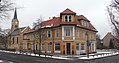
 Hattwichstraße 92a GlienickeNordbahn 2014 ENE.jpg 2,544 × 1,878; 1.4 MB
-
 Glienicke-Nordbahn Hauptstraße 70.jpg 3,352 × 1,766; 2.92 MB
-
 Glienicke Nordbahn Gartenstraße 17 Picture 1.jpg 4,641 × 2,391; 5.94 MB
-
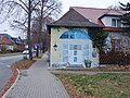 Trafo Hattwichstraße Glienicke-Nordbahn 2020 E.jpg 4,864 × 3,648; 7.76 MB


