Category:Haven 5, Rottevalle
Jump to navigation
Jump to search
| Object location | | View all coordinates using: OpenStreetMap |
|---|
 | |||||
| Upload media | |||||
| Instance of | |||||
|---|---|---|---|---|---|
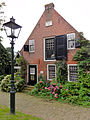
| Location | Rottevalle, Smallingerland, Friesland, Netherlands | ||||
| Located on street |
| ||||
| Heritage designation |
| ||||
 | |||||
|
This is a category about rijksmonument number 33996
|
| Address |
|
Media in category "Haven 5, Rottevalle"
The following 3 files are in this category, out of 3 total.
-
 Aanzicht - Rottevalle - 20192699 - RCE.jpg 1,200 × 799; 193 KB
-
 Haven 5 Rottevalle1.jpg 1,368 × 1,824; 619 KB
-
 Voorm. Graanpakhuis.JPG 4,608 × 3,456; 1.72 MB

