Category:Hawes
Jump to navigation
Jump to search
town in North Yorkshire, England  Main Street | |||||
| Upload media | |||||
| Instance of | |||||
|---|---|---|---|---|---|
| Located in protected area | |||||
| Location | Richmondshire, North Yorkshire, Yorkshire and the Humber, England | ||||
 | |||||
Main Wikipedia article: Hawes.
Subcategories
This category has the following 17 subcategories, out of 17 total.
D
- Dodd Fell (25 F)
G
H
- Hardraw Force (48 F)
- Hawes Methodist Church (7 F)
- Hawes Primary School (6 F)
- Haylands Bridge (9 F)
L
P
S
- Shops in Hawes (11 F)
T
- The Ropemaker, Hawes (5 F)
W
- Wensleydale Creamery (25 F)
- West Cam Road (12 F)
- Wether Fell (5 F)
Media in category "Hawes"
The following 200 files are in this category, out of 1,704 total.
(previous page) (next page)-
 'Spring Gathering' by Andris Bergs, Hawes - geograph.org.uk - 2619241.jpg 768 × 1,024; 233 KB
-
 'The Barn', Lanacar Lane - geograph.org.uk - 3072636.jpg 1,024 × 683; 195 KB
-
 (Hawes, Hardrow Scar, Yorkshire, England) (LOC) (16595505087).jpg 1,024 × 779; 381 KB
-
 015-Simonstone-Hall-North-Yorkshire.jpg 4,000 × 2,667; 11.06 MB
-
 A barn near Snaizeholme Beck - geograph.org.uk - 3873013.jpg 600 × 800; 177 KB
-
 A Classic coach - geograph.org.uk - 5574241.jpg 2,000 × 1,333; 1.81 MB
-
 A coal train heads north at Shaw Paddock - geograph.org.uk - 3770913.jpg 1,024 × 683; 150 KB
-
 A Corner of Burtersett - geograph.org.uk - 4515212.jpg 5,184 × 3,456; 4.85 MB
-
 A fine day on the fells - geograph.org.uk - 5385348.jpg 4,320 × 2,251; 1.55 MB
-
 A Pennine curiosity - geograph.org.uk - 5385330.jpg 4,320 × 3,240; 3.08 MB
-
 A Pennine Journey, South Lunds Pasture - geograph.org.uk - 4370187.jpg 1,024 × 768; 156 KB
-
 A quiet stretch of the Ure - geograph.org.uk - 3437250.jpg 3,872 × 2,592; 4.54 MB
-
 A rather strange pond - geograph.org.uk - 6419297.jpg 5,184 × 3,888; 3.86 MB
-
 A rock outcrop on Little Fell - geograph.org.uk - 824669.jpg 640 × 480; 94 KB
-
 A Short Respite - geograph.org.uk - 286101.jpg 640 × 480; 90 KB
-
 A Sleddale scene - geograph.org.uk - 5206774.jpg 4,320 × 3,240; 3.64 MB
-
 A snow covered Wensleydale - geograph.org.uk - 1718614.jpg 3,072 × 2,304; 3.07 MB
-
 A twisty B6255, Widdale - geograph.org.uk - 5412825.jpg 640 × 480; 53 KB
-
 A View from Mossdale Moor - geograph.org.uk - 5798943.jpg 5,184 × 3,456; 6.47 MB
-
 A view from the Creamery - geograph.org.uk - 5574250.jpg 2,000 × 1,333; 1.86 MB
-
 A View over the Upper Reaches of the Ure Valley - geograph.org.uk - 5799554.jpg 5,184 × 3,456; 7.66 MB
-
 A View towards Wild Boar Fell - geograph.org.uk - 5354783.jpg 5,184 × 3,456; 7.61 MB
-
 A684 and Mire Bank Lane - geograph.org.uk - 5486468.jpg 1,024 × 683; 250 KB
-
 A684 at Badger Hill - geograph.org.uk - 1952132.jpg 768 × 1,024; 214 KB
-
 A684 Bridge - geograph.org.uk - 1955535.jpg 1,024 × 768; 216 KB
-
 A684 by Badger Rigg - geograph.org.uk - 5282982.jpg 1,024 × 683; 248 KB
-
 A684 east approaching Raygill House - geograph.org.uk - 2960529.jpg 640 × 481; 77 KB
-
 A684 from Thwaite Bridge - geograph.org.uk - 1962068.jpg 640 × 480; 89 KB
-
 A684 heading east at Badger Hill - geograph.org.uk - 5283329.jpg 1,024 × 683; 159 KB
-
 A684 heading towards Hawes at Moss Bridge - geograph.org.uk - 6127731.jpg 1,024 × 683; 193 KB
-
 A684 passing Thwaite Bridge - geograph.org.uk - 5172150.jpg 1,600 × 1,200; 675 KB
-
 A684 towards Bainbridge - geograph.org.uk - 5413402.jpg 640 × 480; 63 KB
-
 A684 towards Garsdale - geograph.org.uk - 5413297.jpg 640 × 480; 59 KB
-
 A684 west of Moorland Cottage - geograph.org.uk - 1924452.jpg 1,024 × 768; 195 KB
-

-
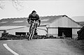
 A684, Tour de France day - geograph.org.uk - 4347976.jpg 427 × 640; 584 KB
-
 Abandoned Stone Barn below Hollin Bank - geograph.org.uk - 5797280.jpg 5,184 × 3,456; 5.37 MB
-
 Above Cam High Road - geograph.org.uk - 4471770.jpg 4,608 × 3,456; 3.49 MB
-
 Above Mossdale Tunnel - geograph.org.uk - 5798720.jpg 5,184 × 3,456; 6.98 MB
-
 Above Shaking Moss - geograph.org.uk - 281108.jpg 640 × 480; 115 KB
-
 Access track to Stone Gill Foot - geograph.org.uk - 6419283.jpg 5,184 × 3,888; 4.85 MB
-
 Across gardens to Stags Fell - geograph.org.uk - 533186.jpg 640 × 478; 140 KB
-
 Across Sleddale - geograph.org.uk - 4483116.jpg 640 × 428; 91 KB
-
 Across Sleddale - geograph.org.uk - 4953867.jpg 640 × 427; 79 KB
-
 Aisgill Moor Cottages - geograph.org.uk - 2035615.jpg 1,280 × 960; 234 KB
-
 Alleyway in Hawes - geograph.org.uk - 3849143.jpg 3,648 × 2,736; 3.34 MB
-
 An extension being added at South Lunds - geograph.org.uk - 3768464.jpg 1,024 × 683; 203 KB
-
 Another Shot at Widdale Bridge - geograph.org.uk - 5355429.jpg 5,184 × 3,456; 6.73 MB
-
 Appersett - geograph.org.uk - 5477400.jpg 1,704 × 1,123; 964 KB
-

-
 Appersett Viaduct - geograph.org.uk - 4782254.jpg 1,600 × 1,067; 525 KB
-
 Appersett Viaduct - geograph.org.uk - 5555763.jpg 2,160 × 1,215; 2.2 MB
-
 Appersett Viaduct - geograph.org.uk - 5580450.jpg 640 × 480; 196 KB
-
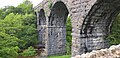 Appersett Viaduct - geograph.org.uk - 6435632.jpg 4,032 × 1,960; 4.92 MB
-
 Appersett Viaduct Crossing Widdale Beck - geograph.org.uk - 4782260.jpg 1,600 × 1,067; 356 KB
-

-
 Approaching Gavel Gap - geograph.org.uk - 3260172.jpg 3,648 × 2,736; 992 KB
-
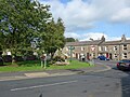
 Approaching Hawes from the east - geograph.org.uk - 3587425.jpg 640 × 481; 66 KB
-

-
 Approaching Hawes. - geograph.org.uk - 3914407.jpg 640 × 437; 70 KB
-

-
 Approaching Sargill Beck - geograph.org.uk - 373006.jpg 640 × 480; 111 KB
-
 Approaching Swarth Fell Pike from the southeast - geograph.org.uk - 5799136.jpg 1,600 × 1,200; 570 KB
-
-
 Approaching West Shaw - geograph.org.uk - 4781056.jpg 1,600 × 1,067; 499 KB
-
 Approaching Western Crag End on Widdale Fell - geograph.org.uk - 6127423.jpg 1,024 × 683; 182 KB
-
 Ascending Shutt Lane - geograph.org.uk - 372985.jpg 640 × 480; 95 KB
-
 Ashes - geograph.org.uk - 2307457.jpg 640 × 480; 74 KB
-
 Ashes.jpg 8,000 × 6,000; 20.87 MB
-
 Aysgill Force in spate - geograph.org.uk - 4619222.jpg 800 × 600; 155 KB
-
 B and Bs, Burtersett Road, Hawes - geograph.org.uk - 1378607.jpg 640 × 480; 105 KB
-
 B6255 approaching Birk Rigg - geograph.org.uk - 3085748.jpg 640 × 417; 71 KB
-

-
 B6255 at High Bridge, Widdale - geograph.org.uk - 5707738.jpg 1,024 × 683; 219 KB
-

-
 B6255 at opposite 'Tarney Fors' - geograph.org.uk - 3059450.jpg 1,024 × 683; 239 KB
-
 B6255 at Tarney Force - geograph.org.uk - 3085733.jpg 640 × 472; 99 KB
-
 B6255 at Widdale Head - geograph.org.uk - 5112508.jpg 1,600 × 1,067; 287 KB
-
 B6255 beside Tarneyforce Plantation - geograph.org.uk - 5413258.jpg 640 × 480; 116 KB
-
 B6255 entering woodland at Honeycott - geograph.org.uk - 5171951.jpg 1,600 × 800; 514 KB
-
 B6255 from Swineley House entrance - geograph.org.uk - 3085797.jpg 640 × 445; 40 KB
-
 B6255 near Tarney Fors - geograph.org.uk - 3058623.jpg 1,024 × 683; 239 KB
-
 B6255 near Widdale Bridge - geograph.org.uk - 3085754.jpg 640 × 464; 63 KB
-
 B6255 passing Birk Rigg - geograph.org.uk - 3085740.jpg 640 × 416; 48 KB
-
 B6255 passing Dairy Farm in Widdale - geograph.org.uk - 3085774.jpg 640 × 345; 45 KB
-
 B6255 towards Hawes - geograph.org.uk - 5412807.jpg 640 × 480; 53 KB
-
 B6255 towards Hawes - geograph.org.uk - 5412821.jpg 640 × 480; 56 KB
-
 B6255 towards Hawes - geograph.org.uk - 5412848.jpg 640 × 480; 53 KB
-
 B6255 towards Hawes - geograph.org.uk - 5413272.jpg 640 × 480; 61 KB
-
 B6255, High Bridge - geograph.org.uk - 5412804.jpg 640 × 480; 47 KB
-
 B6255, Tarney Force - geograph.org.uk - 5413240.jpg 640 × 480; 94 KB
-
 B6255, Widdale - geograph.org.uk - 5412843.jpg 640 × 480; 56 KB
-
 B6259 enters Yorkshire Dales National Park - geograph.org.uk - 3660229.jpg 4,320 × 3,240; 3.32 MB
-
 B6259 near Moorcock Tunnel - geograph.org.uk - 3768459.jpg 1,024 × 683; 232 KB
-
 B6259 south at White Birch Cottage - geograph.org.uk - 2960465.jpg 640 × 476; 66 KB
-
 B6289 road looking south - geograph.org.uk - 1962237.jpg 640 × 480; 56 KB
-
 Badger Hill - geograph.org.uk - 5172151.jpg 1,600 × 1,200; 793 KB
-

-

-

-

-
 Baled grass crop, lower Widdale - geograph.org.uk - 3591978.jpg 600 × 800; 177 KB
-
 Bands Lane - geograph.org.uk - 4781952.jpg 1,600 × 1,067; 511 KB
-
 Bank Gill - geograph.org.uk - 1753986.jpg 480 × 640; 73 KB
-
 Bank Gill - geograph.org.uk - 1753987.jpg 640 × 480; 79 KB
-
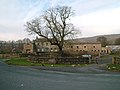
 Barn above Hawes (7182).jpg 4,288 × 2,848; 6.14 MB
-
 Barn above Wensleydale - geograph.org.uk - 3878022.jpg 4,320 × 3,240; 4.98 MB
-
 Barn and log shed at Redshaw Farm - geograph.org.uk - 5707792.jpg 1,024 × 726; 154 KB
-
 Barn and woodland at Widdale Foot - geograph.org.uk - 5171905.jpg 1,600 × 1,200; 737 KB
-
 Barn at Birk Rigg - geograph.org.uk - 5171930.jpg 1,600 × 960; 612 KB
-
 Barn at High Houses, Snaizeholme - geograph.org.uk - 3872977.jpg 800 × 600; 186 KB
-
 Barn below Cobbles Hill - geograph.org.uk - 3437143.jpg 3,872 × 2,592; 4.7 MB
-
 Barn beside B6259 at Shaw Paddock - geograph.org.uk - 3770852.jpg 1,024 × 683; 154 KB
-
 Barn beside B6259 opposite White Birch Cottage - geograph.org.uk - 3771178.jpg 1,024 × 683; 201 KB
-
 Barn by Widdale Beck - geograph.org.uk - 2413466.jpg 640 × 480; 77 KB
-
 Barn conversion near Hawes - geograph.org.uk - 2198979.jpg 640 × 480; 80 KB
-
 Barn conversion on Turfy Hill - geograph.org.uk - 3059341.jpg 1,024 × 683; 188 KB
-
 Barn in field opposite cemetery - geograph.org.uk - 1961998.jpg 640 × 480; 65 KB
-
 Barn in field south of River Ure - geograph.org.uk - 2073433.jpg 2,592 × 1,944; 1.6 MB
-
 Barn in Lanacar Lane - geograph.org.uk - 3021016.jpg 640 × 480; 92 KB
-
 Barn in pasture, lower Widdale - geograph.org.uk - 2413377.jpg 640 × 480; 140 KB
-
 Barn in pasture, lower Widdale - geograph.org.uk - 2615122.jpg 621 × 800; 178 KB
-
 Barn in Sleddale - geograph.org.uk - 4483074.jpg 640 × 428; 91 KB
-
 Barn in Sleddale - geograph.org.uk - 4483122.jpg 640 × 428; 77 KB
-
 Barn in Snaizeholme and Grove Head (7088).jpg 4,288 × 2,848; 6.65 MB
-
 Barn near Hawes (6223).jpg 4,288 × 2,848; 6.58 MB
-
 Barn near Hawes (6963).jpg 4,288 × 2,848; 6.72 MB
-
 Barn near the road - geograph.org.uk - 4483124.jpg 640 × 428; 87 KB
-
 Barn off Beggermans Road - geograph.org.uk - 4483069.jpg 640 × 428; 80 KB
-
 Barn on Lanacar Lane - geograph.org.uk - 3059542.jpg 1,024 × 683; 171 KB
-
 Barn on Lanacar Lane - geograph.org.uk - 3059583.jpg 1,024 × 683; 197 KB
-
 Barn on Snaizeholme Pasture (7047).jpg 4,288 × 2,848; 6.12 MB
-
 Barn on Snaizeholme Pasture and Widdale (7032).jpg 4,288 × 2,848; 6.1 MB
-
 Barn on Turfy Hill near Honeycott Caravan Site - geograph.org.uk - 3059386.jpg 1,024 × 683; 239 KB
-
 Barn SE of Gayle - geograph.org.uk - 6115807.jpg 1,024 × 683; 177 KB
-
 Barn south-east of Birkrigg Farm - geograph.org.uk - 2628644.jpg 1,024 × 769; 152 KB
-
 Barn west of Hawes - geograph.org.uk - 2510115.jpg 800 × 574; 86 KB
-
 Barn, Redshaw - geograph.org.uk - 2199067.jpg 640 × 481; 74 KB
-
 Barns and Widdale Foot from Snaizeholme Pasture (7046).jpg 4,288 × 2,848; 6.13 MB
-
 Barns beside Mossy Lane, near Gayle - geograph.org.uk - 6013336.jpg 1,600 × 1,066; 697 KB
-
 Barns in Wensleydale from Rottenstone Hill (7168).jpg 4,288 × 2,848; 6.02 MB
-
 Barns in Wensleydale from Rottenstone Hill (7174).jpg 4,288 × 2,848; 5.56 MB
-
-
 Barns near Hawes (6969).jpg 4,288 × 2,848; 5.52 MB
-
 Bear Cottage Interiors Hawes - geograph.org.uk - 4436371.jpg 3,951 × 2,964; 6.32 MB
-
 Beck Side Pasture - geograph.org.uk - 3812181.jpg 640 × 592; 82 KB
-
 Beggarmans Road - geograph.org.uk - 1959785.jpg 1,024 × 768; 173 KB
-
 Beggarmans Road - geograph.org.uk - 4483089.jpg 640 × 428; 92 KB
-
 Beggarmans Road - geograph.org.uk - 4483111.jpg 640 × 428; 76 KB
-
 Beggarmans Road - geograph.org.uk - 4512621.jpg 5,184 × 3,456; 6.43 MB
-
 Beggarmans Road near track to Busk - geograph.org.uk - 2665556.jpg 1,024 × 683; 178 KB
-
-
 Beggarsman Rd leading down to Sleddale ^ Cam High Rd - geograph.org.uk - 6326934.jpg 5,184 × 2,920; 5.98 MB
-
 Beldie Gill - geograph.org.uk - 4563180.jpg 640 × 480; 82 KB
-
 Beldie Gill south of the track to Widdale - geograph.org.uk - 3058258.jpg 1,024 × 683; 234 KB
-
 Bench mark on barn at Honeycott - geograph.org.uk - 1978236.jpg 1,024 × 768; 290 KB
-
 Bench mark on barn conversion, Hawes - geograph.org.uk - 2198997.jpg 480 × 640; 75 KB
-
 Bench mark on boundary stone, near Dent - geograph.org.uk - 1815977.jpg 480 × 640; 158 KB
-
 Bench Mark, Redshaw Farm - geograph.org.uk - 2199087.jpg 480 × 640; 75 KB
-

-
 Benchmark at Old Dairy Farm - geograph.org.uk - 3058319.jpg 683 × 1,024; 262 KB
-
 Benchmark at Shaw Paddock - geograph.org.uk - 1942825.jpg 1,024 × 768; 237 KB
-
 Benchmark at south end of New Lane - geograph.org.uk - 1964592.jpg 768 × 1,024; 227 KB
-
 Benchmark at South Lunds - geograph.org.uk - 1928714.jpg 1,024 × 768; 195 KB
-
 Benchmark on Appersett Bridge - geograph.org.uk - 3072385.jpg 683 × 1,024; 278 KB
-
 Benchmark on Ashes' dovecote - geograph.org.uk - 1930498.jpg 768 × 1,024; 227 KB
-
 Benchmark on barn - geograph.org.uk - 1964609.jpg 768 × 1,024; 252 KB
-
 Benchmark on barn at Redshaw Farm - geograph.org.uk - 5707778.jpg 1,024 × 689; 267 KB
-
 Benchmark on barn at Scaur Head, Beggarmans Road - geograph.org.uk - 2665472.jpg 1,024 × 683; 266 KB
-
 Benchmark on barn conversion on B6255 - geograph.org.uk - 1925541.jpg 768 × 1,024; 152 KB
-
 Benchmark on barn in Lanacar Lane - geograph.org.uk - 1977152.jpg 768 × 1,024; 214 KB
-
 Benchmark on barn off High Lane - geograph.org.uk - 1964618.jpg 1,024 × 768; 254 KB
-
 Benchmark on barn on Beggarmans Road - geograph.org.uk - 1959759.jpg 1,024 × 768; 302 KB
-
 Benchmark on barn on Lanacar Lane - geograph.org.uk - 3059495.jpg 683 × 1,024; 270 KB
-
 Benchmark on barn opposite White Birch Cottage - geograph.org.uk - 3771106.jpg 683 × 1,024; 251 KB
-

-
 Benchmark on Brunt Acres Road railway bridge - geograph.org.uk - 3552714.jpg 683 × 1,024; 254 KB
-
 Benchmark on former Widdale Methodist Chapel - geograph.org.uk - 5708200.jpg 1,024 × 650; 265 KB
-
 Benchmark on Gate House - geograph.org.uk - 1978510.jpg 768 × 1,024; 287 KB
-
 Benchmark on Hawes Primary School - geograph.org.uk - 5449620.jpg 661 × 1,024; 245 KB
-
 Benchmark on High Bridge, Widdale - geograph.org.uk - 5707725.jpg 661 × 1,024; 290 KB
-
 Benchmark on New Bridge - geograph.org.uk - 1959799.jpg 1,024 × 768; 243 KB
-
 Benchmark on New Lane wall pier - geograph.org.uk - 1964399.jpg 768 × 1,024; 337 KB
-

-
 Benchmark on Railway Bridge by Moorcock Cottages - geograph.org.uk - 1899111.jpg 1,024 × 768; 344 KB
-
 Benchmark on Redshaw farmhouse - geograph.org.uk - 5707809.jpg 643 × 1,024; 201 KB
-
 Benchmark on rock in moorland off Cam High Road - geograph.org.uk - 2665611.jpg 1,024 × 683; 364 KB
-
 Benchmark on rock in wall beside Cam High Road - geograph.org.uk - 2665602.jpg 683 × 1,024; 312 KB
-
 Benchmark on rock outcrop at Tarney Force - geograph.org.uk - 3059421.jpg 683 × 1,024; 202 KB
-
 Benchmark on small bridge in Beck Side Pasture - geograph.org.uk - 3770834.jpg 1,024 × 683; 286 KB
-

-
 Benchmark on stone at base of wall beside A684 - geograph.org.uk - 5644629.jpg 1,024 × 683; 320 KB
-

-
 Benchmark on stone in arch of Long Gill Bridge - geograph.org.uk - 5707891.jpg 1,024 × 677; 257 KB
-

-
 Benchmark on stone in wall near Tarney Fors - geograph.org.uk - 3058457.jpg 683 × 1,024; 258 KB
-
 Benchmark on stone in wall of Cam High Road - geograph.org.uk - 2665660.jpg 1,024 × 683; 320 KB
-

-
 Benchmark on Thorney Mire Barn B^B - geograph.org.uk - 1977081.jpg 768 × 1,024; 168 KB
-


_(LOC)_(16595505087).jpg)


.jpg)


.jpg)
.jpg)
.jpg)


.jpg)
.jpg)


.jpg)

.jpg)
.jpg)

.jpg)


