Category:Haydon Bridge
Jump to navigation
Jump to search
English: Haydon Bridge is a village in Northumberland, England, with a population of about 2000. Its most distinctive feature is the two bridges crossing the River South Tyne: one the picturesque original bridge for which the village was named now restricted to pedestrian use; and a modern bridge which used to carry the A69 road. A bypass was completed in 2009 and the A69 now bypasses the village to the south.
Italiano: Haydon Bridge è un paese di 2.000 abitanti della contea del Northumberland, in Inghilterra.
village in Northumberland, United Kingdom  | |||||
| Upload media | |||||
| Instance of | |||||
|---|---|---|---|---|---|
| Location | Haydon, Northumberland, North East England, England | ||||
 | |||||
Subcategories
This category has the following 8 subcategories, out of 8 total.
C
H
- Haydon Bridge railway station (38 F)
- Haydon Bridge War Memorial (2 F)
L
- Langley Burn (7 F)
N
- New Haydon Bridge (3 F)
O
- Old Haydon Bridge (10 F)
Media in category "Haydon Bridge"
The following 147 files are in this category, out of 147 total.
-
 "Put out more flags" - geograph.org.uk - 4643559.jpg 640 × 480; 397 KB
-

-
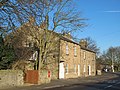
 (Former) Primitive Methodist Chapel - geograph.org.uk - 626189.jpg 640 × 442; 56 KB
-

-
 156479 approaching Haydon Bridge - September 2016 - geograph.org.uk - 5129219.jpg 1,250 × 863; 1,021 KB
-
 156481 at Haydon Bridge - September 2016 - geograph.org.uk - 5129238.jpg 1,073 × 1,250; 1.08 MB
-
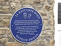
 1A Ratcliffe Road, Haydon Bridge - geograph.org.uk - 4643944.jpg 640 × 480; 446 KB
-
 66144 at Haydon Bridge - September 2016 - geograph.org.uk - 5129233.jpg 1,250 × 916; 1.01 MB
-
 A69 Bypass, Haydon Bridge - geograph.org.uk - 3880841.jpg 2,592 × 1,936; 2.02 MB
-
 A69 Bypass, Haydon Bridge - geograph.org.uk - 3880860.jpg 2,518 × 1,291; 1.34 MB
-
 A69 Bypass, Haydon Bridge - geograph.org.uk - 3882209.jpg 2,334 × 1,450; 1.57 MB
-
 A69 Bypass, Haydon Bridge - geograph.org.uk - 3882213.jpg 2,413 × 1,633; 1.76 MB
-

-

-

-
 Anchor Hotel, Haydon Bridge - August 2016 (1) - geograph.org.uk - 5088286.jpg 1,250 × 1,027; 1.05 MB
-
 Anchor Hotel, Haydon Bridge - August 2016 (2) - geograph.org.uk - 5088290.jpg 1,250 × 838; 1.05 MB
-

-
 Bed and Breakfast at Haydon Bridge - geograph.org.uk - 1563208.jpg 640 × 480; 85 KB
-

-
-
 Cairn and sheepfold on Howden Hill - geograph.org.uk - 1091012.jpg 640 × 480; 125 KB
-
 Church Street (2) - geograph.org.uk - 3413526.jpg 640 × 480; 79 KB
-
 Church Street - geograph.org.uk - 3413523.jpg 640 × 480; 76 KB
-
 Church Street, Haydon Bridge - geograph.org.uk - 3431103.jpg 640 × 513; 69 KB
-
 Church Street, Haydon Bridge - geograph.org.uk - 4643971.jpg 640 × 480; 381 KB
-
 Church Street, Haydon Bridge - geograph.org.uk - 5931114.jpg 1,600 × 915; 406 KB
-
 Cotton Grass on Nubbock Fell (3) - geograph.org.uk - 838042.jpg 640 × 359; 56 KB
-
 Cotton Grass on Nubbock Fell - geograph.org.uk - 838033.jpg 640 × 359; 47 KB
-
 Elrington Station - geograph.org.uk - 332065.jpg 640 × 407; 59 KB
-
 First World War Memorial - Haydon Bridge - geograph.org.uk - 3100069.jpg 2,952 × 4,428; 2.89 MB
-

-
 Fish and Chips - geograph.org.uk - 601700.jpg 480 × 640; 65 KB
-
 Haydon Bridge - geograph.org.uk - 2138728.jpg 3,849 × 2,313; 1.63 MB
-
 Haydon Bridge - geograph.org.uk - 2138757.jpg 3,888 × 2,592; 1.73 MB
-
 Haydon Bridge - geograph.org.uk - 4696135.jpg 2,592 × 1,944; 1.33 MB
-
 Haydon Bridge Bypass - geograph.org.uk - 2217631.jpg 3,888 × 2,423; 1.3 MB
-
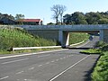 Haydon Bridge bypass - geograph.org.uk - 2653145.jpg 3,264 × 2,448; 4.6 MB
-

-

-
 Haydon Bridge Fire Station - geograph.org.uk - 1216699.jpg 640 × 480; 82 KB
-
 Haydon Bridge Fire Station - geograph.org.uk - 4643562.jpg 640 × 480; 408 KB
-
 Haydon Bridge Level Crossing - geograph.org.uk - 2343379.jpg 640 × 518; 81 KB
-
 Haydon Bridge Library - geograph.org.uk - 830014.jpg 640 × 480; 107 KB
-
 Highland cow on Moralee Fell - geograph.org.uk - 396590.jpg 640 × 480; 73 KB
-

-
 John Martin Street, Haydon Bridge - geograph.org.uk - 3243577.jpg 640 × 480; 120 KB
-
 Langley Cross - geograph.org.uk - 12250.jpg 640 × 480; 194 KB
-
 Lead Mining Landscape - geograph.org.uk - 249088.jpg 640 × 457; 61 KB
-
 Lead Mining Site - geograph.org.uk - 248394.jpg 480 × 640; 99 KB
-
 Lime kilns near Lough Green - geograph.org.uk - 396547.jpg 640 × 480; 106 KB
-
 Looking west up the Tyne Valley - geograph.org.uk - 37233.jpg 640 × 480; 263 KB
-
 Lowes Fell - geograph.org.uk - 38997.jpg 640 × 480; 262 KB
-
 Near a picnic area, Haydon Bridge - geograph.org.uk - 1310777.jpg 640 × 480; 96 KB
-
 New Alston - geograph.org.uk - 249042.jpg 640 × 457; 83 KB
-
 Newcastle -Carlisle express at Haydon Bridge, c.1954 - geograph.org.uk - 4976201.jpg 2,288 × 1,421; 1.37 MB
-
 North Bank - geograph.org.uk - 1216697.jpg 640 × 492; 107 KB
-
 Oddfellows Hall Haydon Bridge - geograph.org.uk - 1563206.jpg 640 × 480; 68 KB
-
 Old Bridge - geograph.org.uk - 249103.jpg 640 × 480; 88 KB
-

-
 Old lime kiln - geograph.org.uk - 474351.jpg 640 × 480; 100 KB
-

-

-

-
 Sign for the General Havelock Inn (2) - geograph.org.uk - 829971.jpg 480 × 640; 65 KB
-
 Sign for the General Havelock Inn - geograph.org.uk - 829964.jpg 480 × 640; 62 KB
-

-
 Sign for the Railway Hotel - geograph.org.uk - 829940.jpg 480 × 640; 71 KB
-
 Stublick Chimney - geograph.org.uk - 37244.jpg 538 × 640; 63 KB
-

-
 The Old Bridge with Anchor Hotel, Haydon Bridge.jpg 3,456 × 5,184; 5.87 MB
-

-
 The Railway Hotel Haydon Bridge - geograph.org.uk - 1563204.jpg 640 × 480; 65 KB
-

-
-
 The Railway Hotel, Haydon Bridge - geograph.org.uk - 4971868.jpg 1,600 × 1,267; 248 KB
-

-
 The stripey bikes of Haydon Bridge (1) - geograph.org.uk - 4643555.jpg 640 × 480; 410 KB
-
 The stripey bikes of Haydon Bridge (2) - geograph.org.uk - 4643962.jpg 640 × 480; 448 KB
-
 The stripey bikes of Haydon Bridge (3) - geograph.org.uk - 4643976.jpg 640 × 480; 372 KB
-
 The stripey bikes of Haydon Bridge (4) - geograph.org.uk - 4644416.jpg 640 × 480; 527 KB
-
 The stripey bikes of Haydon Bridge (5) - geograph.org.uk - 4644418.jpg 640 × 480; 494 KB
-
 The stripey bikes of Haydon Bridge (6) - geograph.org.uk - 4644420.jpg 640 × 480; 599 KB
-
 The stripey bikes of Haydon Bridge (7) - geograph.org.uk - 4644425.jpg 640 × 480; 478 KB
-
 Threepwood Hall - geograph.org.uk - 116026.jpg 640 × 480; 97 KB
-
 Track and copse - geograph.org.uk - 390869.jpg 640 × 480; 107 KB
-
 Trackbed of the Allendale Branch - geograph.org.uk - 332070.jpg 640 × 480; 91 KB
-
 Victorian postbox in Haydon Bridge - geograph.org.uk - 474484.jpg 480 × 640; 116 KB
-
 Victorian postbox in Haydon Bridge - geograph.org.uk - 485792.jpg 480 × 640; 90 KB
-

-

-
 (This used to be) Cemetery Road - geograph.org.uk - 601688.jpg 640 × 480; 107 KB
-
 Anchey Cleugh (2) - geograph.org.uk - 416523.jpg 640 × 480; 100 KB
-
 Byway to Elrington - geograph.org.uk - 396522.jpg 640 × 480; 151 KB
-
 Cart's Bog Inn (2) - geograph.org.uk - 601673.jpg 640 × 395; 61 KB
-
 Coastley Farm under a threatening sky - geograph.org.uk - 255751.jpg 640 × 480; 73 KB
-
 Cross Lane Cottage - geograph.org.uk - 601677.jpg 640 × 404; 57 KB
-
 East Brokenheugh - geograph.org.uk - 473546.jpg 640 × 480; 132 KB
-
 East Land Ends - geograph.org.uk - 291422.jpg 640 × 412; 54 KB
-
 East Mill Hills Farm and Pasture - geograph.org.uk - 248370.jpg 640 × 457; 80 KB
-
 Elrington - geograph.org.uk - 37232.jpg 640 × 480; 212 KB
-
 Farm Track Level Crossing - geograph.org.uk - 15999.jpg 640 × 480; 127 KB
-
 Field above Honeycrook Burn - geograph.org.uk - 637909.jpg 640 × 480; 66 KB
-
 Field Sunset - geograph.org.uk - 72045.jpg 640 × 480; 50 KB
-
 Footbridge near Hill House - geograph.org.uk - 637904.jpg 640 × 480; 103 KB
-
 Ford at Coastley - geograph.org.uk - 255766.jpg 640 × 480; 128 KB
-
 Grouse butts (2) - geograph.org.uk - 416549.jpg 640 × 480; 123 KB
-
 Grouse butts - geograph.org.uk - 416539.jpg 640 × 480; 107 KB
-
 Haydon Bridge Cemetery - geograph.org.uk - 601679.jpg 640 × 438; 73 KB
-
 Haydon Bridge Co-op - geograph.org.uk - 601714.jpg 640 × 495; 82 KB
-
 Haydon Bridge Community Centre - geograph.org.uk - 601731.jpg 640 × 480; 71 KB
-
 Haydon Fell trig - geograph.org.uk - 304606.jpg 640 × 480; 115 KB
-
 Haydon Spa Well - geograph.org.uk - 296951.jpg 640 × 480; 166 KB
-
 Haydonfell Plantation - geograph.org.uk - 474459.jpg 640 × 480; 87 KB
-
 Haydonian Social Club - geograph.org.uk - 601690.jpg 640 × 427; 58 KB
-
 Honeycrook Burn - geograph.org.uk - 1434278.jpg 640 × 441; 122 KB
-
 Honeycrook Burn - geograph.org.uk - 637905.jpg 640 × 480; 81 KB
-
 Langley Sawmill - geograph.org.uk - 568108.jpg 640 × 480; 119 KB
-
 Lead smelting flue chimney, Stublick - geograph.org.uk - 594482.jpg 640 × 480; 101 KB
-
 Lees Farm, near Haydon Bridge - geograph.org.uk - 127984.jpg 640 × 480; 114 KB
-
 Lees Farm, near Haydon Bridge - geograph.org.uk - 127988.jpg 640 × 480; 106 KB
-
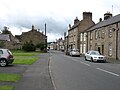
 Main Street Haydon Bridge - geograph.org.uk - 302671.jpg 640 × 590; 189 KB
-
 Mounds of mineral tailings - geograph.org.uk - 396514.jpg 640 × 480; 97 KB
-
 North Eastern Railway. Public Warning. - geograph.org.uk - 601746.jpg 480 × 640; 183 KB
-
 Oddfellows Hall - geograph.org.uk - 601695.jpg 544 × 640; 82 KB
-
 Old lead smelting flue near Langley - geograph.org.uk - 527703.jpg 640 × 377; 81 KB
-
 Page Croft House - geograph.org.uk - 249027.jpg 640 × 457; 90 KB
-
 Pastures and woods near Chesterwood - geograph.org.uk - 474347.jpg 640 × 480; 70 KB
-
 Probably mineral tailings - geograph.org.uk - 396505.jpg 640 × 480; 93 KB
-
 Road junction on Moralee Fell - geograph.org.uk - 396564.jpg 640 × 480; 73 KB
-
 Road signs at junction - geograph.org.uk - 396572.jpg 640 × 480; 96 KB
-
 Roadsign to Plankey Mill - geograph.org.uk - 396578.jpg 640 × 480; 103 KB
-
 Robbs Dene - geograph.org.uk - 396609.jpg 640 × 480; 163 KB
-
 Rough pasture and moorland - geograph.org.uk - 404301.jpg 640 × 480; 105 KB
-

-
 Stream in Robbs Dene - geograph.org.uk - 396601.jpg 640 × 480; 168 KB
-
 Stublick Bog - geograph.org.uk - 494524.jpg 640 × 328; 63 KB
-
 Stublick Hill Farm - geograph.org.uk - 594476.jpg 640 × 321; 63 KB
-
 Tarn on Coastley fell - geograph.org.uk - 255759.jpg 640 × 480; 77 KB
-
 Terraced houses in Haydon Bridge (2) - geograph.org.uk - 601727.jpg 640 × 480; 91 KB
-
 Terraced houses in Haydon Bridge - geograph.org.uk - 601694.jpg 640 × 480; 88 KB
-
 The Anchor Hotel - geograph.org.uk - 601697.jpg 640 × 480; 53 KB
-
 The General Havelock Inn - geograph.org.uk - 601716.jpg 640 × 480; 79 KB
-
 The Railway Hotel - geograph.org.uk - 601712.jpg 640 × 480; 77 KB
-
 Track near Rebel Hill - geograph.org.uk - 413575.jpg 640 × 480; 115 KB
-
 West Deanraw - geograph.org.uk - 396530.jpg 640 × 480; 68 KB
-
 West Rattenraw - geograph.org.uk - 398920.jpg 640 × 480; 137 KB


_Primitive_Methodist_Chapel_-_geograph.org.uk_-_626189.jpg)
_cleugh_feeding_into_Anchey_Sike_-_geograph.org.uk_-_416528.jpg)


_-_geograph.org.uk_-_5088331.jpg)
_-_geograph.org.uk_-_5088342.jpg)
_-_geograph.org.uk_-_5088346.jpg)
_-_geograph.org.uk_-_5088286.jpg)
_-_geograph.org.uk_-_5088290.jpg)


_-_geograph.org.uk_-_3413526.jpg)


_-_geograph.org.uk_-_838042.jpg)


_Primitive_Methodist_Chapel_-_geograph.org.uk_-_626196.jpg)


_-_geograph.org.uk_-_829971.jpg)

_-_spot_the_difference_-_geograph.org.uk_-_829952.jpg)


_-_geograph.org.uk_-_1216686.jpg)


_-_geograph.org.uk_-_5088319.jpg)
_-_geograph.org.uk_-_5088323.jpg)


_-_geograph.org.uk_-_4643555.jpg)
_-_geograph.org.uk_-_4643962.jpg)
_-_geograph.org.uk_-_4643976.jpg)
_-_geograph.org.uk_-_4644416.jpg)
_-_geograph.org.uk_-_4644418.jpg)
_-_geograph.org.uk_-_4644420.jpg)
_-_geograph.org.uk_-_4644425.jpg)


_-_geograph.org.uk_-_830002.jpg)

_Cemetery_Road_-_geograph.org.uk_-_601688.jpg)
_-_geograph.org.uk_-_416523.jpg)

_-_geograph.org.uk_-_601673.jpg)


_-_geograph.org.uk_-_416549.jpg)


_Haydonfell_Plantation_-_geograph.org.uk_-_474451.jpg)


_-_geograph.org.uk_-_601727.jpg)


