Category:Heřmanice (Náchod District)
Jump to navigation
Jump to search
village in Náchod District of Hradec Králové region  Letecký snímek _vlajka.jpg) _znak.jpg) | |||||
| Upload media | |||||
| Instance of | |||||
|---|---|---|---|---|---|
| Location |
| ||||
| Located in or next to body of water | |||||
| Population |
| ||||
| Area |
| ||||
| Elevation above sea level |
| ||||
| official website | |||||
 | |||||
Subcategories
This category has the following 5 subcategories, out of 5 total.
B
- Brod (Heřmanice) (21 F)
- Běluň (Heřmanice) (15 F)
S
Media in category "Heřmanice (Náchod District)"
The following 45 files are in this category, out of 45 total.
-
 Hasičský pomník v Brodu nad Labem (Q66220407) 01.jpg 857 × 1,200; 166 KB
-
 Hasičský pomník v Brodu nad Labem (Q66220407) 02.jpg 1,200 × 800; 178 KB
-
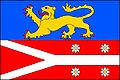 Heřmanice (okres Náchod) vlajka.jpg 600 × 400; 40 KB
-
 Heřmanice (okres Náchod) znak.jpg 1,078 × 1,192; 603 KB
-
 Heřmanice from air 1.jpg 2,800 × 1,671; 2.88 MB
-
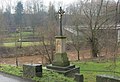
 Heřmanice křížek.JPG 2,336 × 3,504; 3.98 MB
-
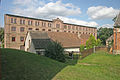
 Heřmanice mlýn.JPG 3,504 × 2,336; 3.01 MB
-
 Heřmanice mlýn1.JPG 3,504 × 2,336; 2.94 MB
-
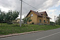
 Heřmanice obecní úřad.JPG 2,336 × 3,504; 2.95 MB
-
 Heřmanice pomník padlých.JPG 2,336 × 3,504; 3.06 MB
-
 Heřmanice pošta.JPG 3,504 × 2,336; 3.18 MB
-
 Heřmanice čp. 1.JPG 3,504 × 2,336; 3.1 MB
-
 Heřmanice čp. 15.JPG 3,504 × 2,336; 1.27 MB
-
 Heřmanice čp. 18.JPG 3,504 × 2,336; 1.18 MB
-
 Heřmanice čp. 2.JPG 3,504 × 2,336; 3.03 MB
-
 Heřmanice čp. 22.JPG 3,504 × 2,336; 3.05 MB
-
 Heřmanice čp. 23.JPG 3,504 × 2,336; 3.52 MB
-
 Heřmanice čp. 24.JPG 3,504 × 2,336; 3.24 MB
-
 Heřmanice čp. 26.JPG 3,504 × 2,336; 2.88 MB
-
 Heřmanice čp. 3.JPG 3,504 × 2,336; 3.48 MB
-
 Heřmanice čp. 35.JPG 3,504 × 2,336; 2.76 MB
-
 Heřmanice čp. 49.JPG 3,504 × 2,336; 3.11 MB
-
 Heřmanice čp. 8.JPG 3,504 × 2,336; 3.33 MB
-
 Heřmanice školka.JPG 3,504 × 2,336; 3.84 MB
-
 Kříž na rozcestí v Brodu nad Labem (Q66220416) 01.jpg 1,200 × 827; 109 KB
-
 Kříž na rozcestí v Brodu nad Labem (Q66220416) 02.jpg 884 × 1,200; 62 KB
-
 Kříž na rozcestí v Brodu nad Labem (Q66220416) 03.jpg 876 × 1,200; 127 KB
-
 Kříž na rozcestí v Brodu nad Labem (Q66220416) 04.jpg 1,200 × 812; 175 KB
-
 Kříž na rozcestí ve Slotově (Q66220403) 01.jpg 886 × 1,200; 166 KB
-
 Kříž na rozcestí ve Slotově (Q66220403) 02.jpg 922 × 1,200; 185 KB
-
 Kříž na rozcestí ve Slotově (Q66220403) 03.jpg 1,200 × 800; 163 KB
-
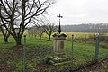
 Kříž u kostela v Heřmanicích (Q66220430).jpg 1,200 × 800; 111 KB
-
 Kříž u mostu v Brodu nad Labem (Q66220420) 01.jpg 898 × 1,200; 133 KB
-
 Kříž u mostu v Brodu nad Labem (Q66220420) 02.jpg 842 × 1,200; 130 KB
-
 Kříž u mostu v Brodu nad Labem (Q66220420) 03.jpg 1,200 × 820; 182 KB
-
 Kříž v zahradě domu v centru Slotova (Q66220398) 01.jpg 1,200 × 800; 194 KB
-
 Kříž v zahradě domu v centru Slotova (Q66220398) 02.jpg 936 × 1,200; 206 KB
-
 Kříž v zahradě na severním okraji Heřmanic (Q66220425) 01.jpg 1,200 × 800; 176 KB
-
 Kříž v zahradě na severním okraji Heřmanic (Q66220425) 02.jpg 796 × 1,200; 247 KB
-
 Kříž v zahradě u Labské stezky v Brodu nad Labem (Q66220410) 01.jpg 1,200 × 814; 133 KB
-
 Kříž v zahradě u Labské stezky v Brodu nad Labem (Q66220410) 02.jpg 880 × 1,200; 77 KB
-
 Kříž v zahradě u Labské stezky v Brodu nad Labem (Q66220410) 03.jpg 928 × 1,200; 174 KB
-
 Pomník padlým v 1. světové válce v Heřmanicích (Q66220435) 01.jpg 920 × 1,200; 218 KB
-
 Pomník padlým v 1. světové válce v Heřmanicích (Q66220435) 02.jpg 847 × 1,200; 186 KB
-
 Pomník padlým v 1. světové válce v Heřmanicích (Q66220435) 03.jpg 1,200 × 794; 148 KB
_01.jpg)
_02.jpg)


_01.jpg)
_02.jpg)
_03.jpg)
_04.jpg)
_01.jpg)
_02.jpg)
_03.jpg)
.jpg)
_01.jpg)
_02.jpg)
_03.jpg)
_01.jpg)
_02.jpg)
_01.jpg)
_02.jpg)
_01.jpg)
_02.jpg)
_03.jpg)
_01.jpg)
_02.jpg)
_03.jpg)