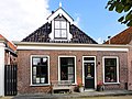
Category:Heerenwal 64 (Sloten, Friesland)
Jump to navigation
Jump to search
| Object location | | View all coordinates using: OpenStreetMap |
|---|
 | |||||
| Upload media | |||||
| Instance of |
| ||||
|---|---|---|---|---|---|
| Location | Sloten, De Fryske Marren, Friesland, Netherlands | ||||
| Street address |
| ||||
| Located on street | |||||
| Heritage designation |
| ||||
 | |||||
|
This is a category about rijksmonument number 33857
|
| Address |
|
Media in category "Heerenwal 64 (Sloten, Friesland)"
The following 3 files are in this category, out of 3 total.
-
 Heerenwal64 Sloten.jpg 3,648 × 2,736; 866 KB
-
 Huisjes aan de Heerengracht Sloten.JPG 4,608 × 3,456; 3.07 MB
-
 Voorgevels overzicht - Sloten - 20201193 - RCE.jpg 1,200 × 807; 185 KB

