Category:Heidenkopfturm
Jump to navigation
Jump to search
| Object location | | View all coordinates using: OpenStreetMap |
|---|
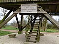
observation tower near Ormesheim, Saarland   | |||||
| Upload media | |||||
| Instance of | |||||
|---|---|---|---|---|---|
| Made from material | |||||
| Location | Ormesheim, Mandelbachtal, Saarpfalz-Kreis, Saarland, Germany | ||||
| Inception |
| ||||
| Height |
| ||||
 | |||||
Media in category "Heidenkopfturm"
The following 10 files are in this category, out of 10 total.
-
 20210829 Heidenkopfturm 01.jpg 6,016 × 4,016; 8.72 MB
-
 20210829 Heidenkopfturm 02.jpg 6,016 × 4,016; 7.26 MB
-
 20210829 Heidenkopfturm 03.jpg 6,016 × 4,016; 8.8 MB
-
 20210829Heidenkopfturm1.jpg 2,540 × 1,816; 1.62 MB
-
 20210829Heidenkopfturm2.jpg 3,000 × 2,250; 1.33 MB
-
 20210829Heidenkopfturm3.jpg 2,500 × 1,875; 964 KB
-
 20210829Heidenkopfturm4.jpg 2,607 × 1,799; 889 KB
-
 Heidenkopfturm-01.jpg 3,240 × 4,320; 4.85 MB
-
 Heidenkopfturm-02-Zugang.jpg 4,320 × 3,240; 5.56 MB
-
 Heidenkopfturm-03-Aussicht.jpg 4,320 × 3,240; 5.69 MB


