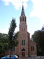
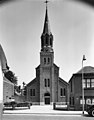
Category:Heilige Henricuskerk (Clinge)
Jump to navigation
Jump to search
| Object location | | View all coordinates using: OpenStreetMap |
|---|
church in Clinge, Netherlands  | |||||
| Upload media | |||||
| Instance of | |||||
|---|---|---|---|---|---|
| Part of | |||||
| Dedicated to | |||||
| Location | Clinge, Zeeland, Netherlands | ||||
| Street address |
| ||||
| Located on street |
| ||||
| Diocese | |||||
| Architect |
| ||||
| Heritage designation |
| ||||
| Inception |
| ||||
| Religion or worldview | |||||
 | |||||
Nederlands: Henricuskerk - anno 1876
|
This is a category about rijksmonument number 509696
|
| Address |
|
Subcategories
This category has only the following subcategory.
Media in category "Heilige Henricuskerk (Clinge)"
The following 6 files are in this category, out of 6 total.
-
 Clinge - Heilige Henricuskerk 1.jpg 1,728 × 2,304; 769 KB
-
 Clinge, de Heilige Henricuskerk RM509696 foto14 2013-05-06 14.41.jpg 3,309 × 4,411; 9.28 MB
-
 Exterieur naar het oosten - Clinge - 20046904 - RCE.jpg 941 × 1,200; 181 KB
-
 Exterieur naar het westen - Clinge - 20046903 - RCE.jpg 944 × 1,200; 240 KB
-
 Overzicht noordwestgevel met kerktoren - Clinge - 20352998 - RCE.jpg 944 × 1,200; 198 KB
-


