Category:Hendreforgan
Jump to navigation
Jump to search
English: Hendreforgan is a settlement in the community of Gilfach Goch, in the principal area of Rhondda Cynon Taf, Wales.
settlement in Rhondda Cynon Taf, Wales | |||||
| Upload media | |||||
| Instance of | |||||
|---|---|---|---|---|---|
| Location | Rhondda Cynon Taf, Wales | ||||
 | |||||
Subcategories
This category has only the following subcategory.
B
- Bethel Chapel, Hendreforgan (3 F)
Media in category "Hendreforgan"
The following 57 files are in this category, out of 57 total.
-
 A4093-Ffordd Llanbad junction - geograph.org.uk - 2935182.jpg 640 × 480; 43 KB
-

-

-
 Claret House - geograph.org.uk - 5778933.jpg 3,264 × 2,448; 2.59 MB
-
 Claret House, Gilfach Goch - geograph.org.uk - 3947461.jpg 800 × 518; 119 KB
-
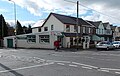
 Co-op store on Cambrian Avenue - geograph.org.uk - 2555024.jpg 640 × 480; 108 KB
-
 Community cafe - geograph.org.uk - 5778925.jpg 3,264 × 2,448; 1.67 MB
-

-
 D ^ P Price, Gilfach Goch - geograph.org.uk - 3936790.jpg 800 × 563; 129 KB
-

-
 Distant view of Hendreforgan - geograph.org.uk - 2721059.jpg 4,032 × 3,024; 7.5 MB
-
 Elm Street, Gilfach Goch - geograph.org.uk - 3936789.jpg 800 × 484; 94 KB
-

-
 Fern Street, Hendreforgan, Gilfach Goch - geograph.org.uk - 3933795.jpg 800 × 485; 100 KB
-

-
 Ffordd Llanbad, Hendreforgan - geograph.org.uk - 3926202.jpg 800 × 614; 104 KB
-
 Footpath through a green in Gilfach Goch - geograph.org.uk - 3933748.jpg 782 × 800; 211 KB
-
-
 Garden Village, Gilfach Goch - geograph.org.uk - 1276272.jpg 640 × 452; 70 KB
-
 Gelli Arael Road houses, Gilfach Goch - geograph.org.uk - 3947450.jpg 800 × 583; 122 KB
-
 Gilfach Goch Amateur Boxing Club - geograph.org.uk - 3933741.jpg 800 × 681; 128 KB
-
 Gilfach Goch fire station - geograph.org.uk - 3926226.jpg 800 × 616; 108 KB
-
 Gilfach Goch Fire Station - geograph.org.uk - 460886.jpg 640 × 427; 205 KB
-
 Gilfach Goch fire station tower - geograph.org.uk - 3926234.jpg 800 × 585; 108 KB
-
 Gilfach Goch off-licence and shop - geograph.org.uk - 3933721.jpg 800 × 791; 150 KB
-
 Griffin Inn - geograph.org.uk - 6052672.jpg 3,264 × 2,448; 1.65 MB
-

-
 Hendreforgan Crescent, Gilfach Goch - geograph.org.uk - 3927334.jpg 800 × 519; 100 KB
-
 JAG-Saracen, Hendreforgan, Gilfach Goch - geograph.org.uk - 3926307.jpg 800 × 543; 110 KB
-
 Jeans, Hendreforgan, Gilfach Goch - geograph.org.uk - 3933686.jpg 800 × 611; 140 KB
-
 Junction of two streams - geograph.org.uk - 5778936.jpg 3,264 × 2,448; 4.06 MB
-
 Meadow Street, Gilfach Goch - geograph.org.uk - 3936793.jpg 800 × 514; 95 KB
-
-

-

-

-

-

-

-

-

-
 SW boundary of Gilfach Goch - geograph.org.uk - 3927351.jpg 800 × 601; 111 KB
-
 The Griffin Inn from the hillside below Gelli'r-haidd-uchaf - geograph.org.uk - 3121037.jpg 2,288 × 1,712; 1.34 MB
-

-
 The Legion, Gilfach Goch - geograph.org.uk - 3936784.jpg 800 × 500; 99 KB
-
 The road to Gilfach Goch - geograph.org.uk - 2382893.jpg 640 × 480; 121 KB
-

-

-

-
 Tracy's Classic Cuts in Gilfach Goch - geograph.org.uk - 3947467.jpg 800 × 503; 106 KB
-

-
 Valley houses, Gilfach Goch - geograph.org.uk - 3927366.jpg 800 × 597; 160 KB
-

-
 Welcome to Gilfach Goch - geograph.org.uk - 3926193.jpg 800 × 595; 124 KB
-

-

-
 Wood Street, Hendreforgan, Gilfach Goch - geograph.org.uk - 3936772.jpg 800 × 583; 130 KB


