Category:Hengrove (ward)
Jump to navigation
Jump to search
suburb and former ward of Bristol in the United Kingdom  | |||||
| Upload media | |||||
| Instance of |
| ||||
|---|---|---|---|---|---|
| Location | City of Bristol, South West England, England | ||||
 | |||||
Subcategories
This category has the following 2 subcategories, out of 2 total.
A
H
- Hengrove Park Leisure Centre (8 F)
Media in category "Hengrove (ward)"
The following 65 files are in this category, out of 65 total.
-

-
 A final end - geograph.org.uk - 4004282.jpg 2,304 × 1,704; 1.7 MB
-
 A37 Wells Road near Long Eaton Drive - geograph.org.uk - 5818082.jpg 1,024 × 728; 107 KB
-
 A4174 Hengrove Way - geograph.org.uk - 5818093.jpg 1,024 × 737; 97 KB
-
 All new at Hengrove Park - geograph.org.uk - 2834568.jpg 2,304 × 1,704; 1.27 MB
-
 Bridge over the Pigeonhouse - geograph.org.uk - 4004236.jpg 2,304 × 1,704; 1.68 MB
-
 Bridge to The Junction - geograph.org.uk - 4004295.jpg 1,704 × 2,304; 2.25 MB
-
 Bristol hengrove.png 702 × 780; 149 KB
-
 B^Q, Imperial Retail Park - geograph.org.uk - 3714727.jpg 1,920 × 972; 248 KB
-
 Crox Bottom pond - geograph.org.uk - 4004258.jpg 2,304 × 1,704; 1.64 MB
-
 Crox Bottom weir - geograph.org.uk - 4004272.jpg 2,304 × 1,704; 1.79 MB
-
 Damaged fence, Pigeonhouse Stream - geograph.org.uk - 3749104.jpg 1,920 × 2,560; 1.15 MB
-
 Down the drain - geograph.org.uk - 4004222.jpg 2,304 × 1,704; 1.57 MB
-
 Dropping underground - geograph.org.uk - 4004210.jpg 2,304 × 1,704; 1.69 MB
-
 Filwood Green Business Park - geograph.org.uk - 5531332.jpg 2,304 × 1,704; 1.68 MB
-
 Gates to the work - geograph.org.uk - 6162329.jpg 3,296 × 2,472; 3.43 MB
-
 Greenery at the Green - geograph.org.uk - 5531333.jpg 2,304 × 1,704; 1.74 MB
-
 Half way to the Urban Quarter - geograph.org.uk - 6162324.jpg 3,296 × 2,472; 3.48 MB
-
 Hengrove (8129079894).jpg 4,000 × 3,000; 2.08 MB
-
 Hengrove - Bath Bus Company A508 (WA64GXW).JPG 1,366 × 910; 436 KB
-
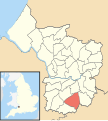 Hengrove Bristol UK ward map.svg 1,138 × 1,266; 709 KB
-
 Hengrove bus depot (8621023627).jpg 3,390 × 2,622; 1.22 MB
-
 Hengrove Mounds - geograph.org.uk - 4472339.jpg 2,304 × 1,704; 1.65 MB
-
 Hengrove Park - geograph.org.uk - 2487105.jpg 1,024 × 768; 214 KB
-
 Hengrove Park.jpg 640 × 512; 107 KB
-
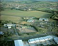
 Hengrove Way from the air - geograph.org.uk - 2613012.jpg 640 × 480; 194 KB
-
 High rise - geograph.org.uk - 6162346.jpg 3,296 × 2,472; 3.29 MB
-
 Hoops and bars - geograph.org.uk - 2827071.jpg 1,704 × 2,304; 1.59 MB
-
 House at Hengrove by P. Morley Horder (1).png 877 × 644; 805 KB
-
 House at Hengrove by Percy Morley Horder (2).png 1,384 × 699; 1.42 MB
-
 Houses on Mowbray Road, Hengrove - geograph.org.uk - 1034577.jpg 640 × 480; 59 KB
-
 KFC at Hengrove - geograph.org.uk - 1594025.jpg 640 × 480; 194 KB
-
 Levelled by fire - geograph.org.uk - 4004290.jpg 2,304 × 1,704; 1.68 MB
-
 New hospital - geograph.org.uk - 2828589.jpg 2,304 × 1,704; 1.36 MB
-
 No more happy landings - geograph.org.uk - 2834566.jpg 2,304 × 1,704; 1.52 MB
-
 North Somerset , Bristol Scenery - geograph.org.uk - 5844541.jpg 6,000 × 4,000; 6.1 MB
-
 Not good for Pooh Sticks - geograph.org.uk - 4004244.jpg 2,304 × 1,704; 1.8 MB
-
 Oasis Academy John Williams (geograph 2487071).jpg 1,024 × 547; 89 KB
-
 Picnic spot - geograph.org.uk - 4004267.jpg 2,304 × 1,704; 1.63 MB
-
 Pond in Crox Bottom - geograph.org.uk - 3749218.jpg 1,920 × 1,429; 710 KB
-
 Pond in Crox Bottom - geograph.org.uk - 3749234.jpg 1,920 × 1,440; 834 KB
-
 Right on your doorstep - geograph.org.uk - 6170771.jpg 3,296 × 2,472; 3.37 MB
-
 Rosedale House Care Home - geograph.org.uk - 6124904.jpg 4,000 × 3,000; 2.46 MB
-
 Showing off the homes - geograph.org.uk - 6162339.jpg 3,296 × 2,472; 3.41 MB
-
 Side of The Range, Imperial Retail Park - geograph.org.uk - 3714735.jpg 1,901 × 1,409; 354 KB
-
 So just watch it^ - geograph.org.uk - 2827076.jpg 1,704 × 2,304; 1.56 MB
-
 South Bristol Community Hospital.jpg 3,264 × 2,448; 2.61 MB
-
 South Bristol Skills Academy - geograph.org.uk - 2487141.jpg 1,024 × 686; 124 KB
-
 Space around the new housing - geograph.org.uk - 6162326.jpg 3,296 × 2,472; 3.66 MB
-
 The bottom of Crox Bottom - geograph.org.uk - 4004229.jpg 2,304 × 1,704; 1.75 MB
-
 The Copper Building - geograph.org.uk - 6170793.jpg 3,296 × 2,472; 3.3 MB
-
 The Copper Building, Lakeshore - geograph.org.uk - 6170835.jpg 3,296 × 2,472; 3.36 MB
-
 The end of the runway - geograph.org.uk - 2834570.jpg 2,304 × 1,704; 1.55 MB
-
 The first of the many - geograph.org.uk - 6162334.jpg 3,296 × 2,472; 3.51 MB
-
 The middle bit of the Copper Building - geograph.org.uk - 6170827.jpg 3,296 × 2,472; 3.21 MB
-
 The new houses on Imperial Park - geograph.org.uk - 6170781.jpg 3,296 × 2,472; 3.38 MB
-

-
 Tree by Hartcliffe Way - geograph.org.uk - 3749207.jpg 4,000 × 3,000; 3.16 MB
-
 Trees by Crox Bottom - geograph.org.uk - 3749196.jpg 3,937 × 2,914; 2.7 MB
-
 Upper weir - geograph.org.uk - 4004299.jpg 1,704 × 2,304; 2.14 MB
-
 Welcome to Crox Bottom - geograph.org.uk - 4004198.jpg 2,304 × 1,704; 1.8 MB
-
 Welcome to the Pleasuredome - geograph.org.uk - 2834558.jpg 2,304 × 1,704; 1.64 MB
-
 Wells Road, Whitchurch - geograph.org.uk - 6124898.jpg 3,342 × 2,204; 1.36 MB
-

-
 Wills Way - geograph.org.uk - 6170779.jpg 3,296 × 2,472; 3.46 MB


.jpg)
.JPG)

.jpg)


.png)
.png)


.jpg)


