Category:Hennessy Road Government Primary School
Jump to navigation
Jump to search
| Object location | | View all coordinates using: OpenStreetMap |
|---|
primary school in Hong Kong  | |||||
| Upload media | |||||
| Instance of | |||||
|---|---|---|---|---|---|
| Location | Wan Chai District, Hong Kong, PRC | ||||
| Street address |
| ||||
| Inception |
| ||||
| official website | |||||
 | |||||
Subcategories
This category has only the following subcategory.
Media in category "Hennessy Road Government Primary School"
The following 22 files are in this category, out of 22 total.
-
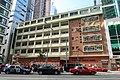 Hennessy Road Government Primary School 2019.jpg 2,736 × 1,824; 3.5 MB
-
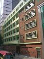
 Hennessy Road Government Primary School part 1 in August 2022.jpg 4,000 × 3,000; 3.14 MB
-
 Hennessy Road Government Primary School part 2 in August 2022.jpg 3,000 × 4,000; 3.3 MB
-
 Hennessy Road Government Primary School part 3 in August 2022.jpg 3,000 × 4,000; 3.63 MB
-
 Hennessy Road Government Primary School part 4 in August 2022.jpg 3,000 × 4,000; 4.13 MB
-
 Hennessy Road Government Primary School part 5 in August 2022.jpg 3,000 × 4,000; 5.32 MB
-
 Hennessy Road Government Primary School part 6 in August 2022.jpg 3,000 × 4,000; 3.65 MB
-
 HK Wan Chai Road night Dec 2018 SSG 13.jpg 3,264 × 2,448; 2.78 MB
-
 HK Wan Chai Thomson Road Hennessy Road Government Primary School.JPG 1,200 × 1,600; 1.12 MB
-
 HK Wan Chai Thomson Road Hennessy Road Primary School 1a.jpg 1,600 × 1,200; 370 KB
-
 HK Wan Chai Thomson Road Hennessy Road Primary School 3a.jpg 1,600 × 1,200; 390 KB
-
 HK Wan Chai 莊士敦道 199 Johnston Road Thomson Rd June 2016 banyan tree.jpg 3,648 × 2,736; 4.98 MB
-

-

-

-

-
-

-

-
 Hong Kong (2017) - 1,126.jpg 4,000 × 3,000; 2.62 MB
-
 Johnston Road 201909.jpg 2,736 × 1,824; 3.85 MB
-
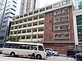
 Street sign at Thomson Road, Wan Chai in August 2022.jpg 3,000 × 4,000; 3.17 MB


_-_1,126.jpg)

