Category:Henshaw, Northumberland
Aller à la navigation
Aller à la recherche
village britannique  | |||||
| Téléverser des médias | |||||
| Nature de l’élément | |||||
|---|---|---|---|---|---|
| Lieu | Northumberland, Angleterre du Nord-Est, Angleterre | ||||
 | |||||
Sous-catégories
Cette catégorie comprend 4 sous-catégories, dont les 4 ci-dessous.
Média dans la catégorie « Henshaw, Northumberland »
Cette catégorie comprend 838 fichiers, dont les 200 ci-dessous.
(page précédente) (page suivante)-
 "Back of the Wall" - geograph.org.uk - 2109310.jpg 640 × 480 ; 69 kio
-
 "The Shadows" Rambling Club - geograph.org.uk - 2109490.jpg 640 × 480 ; 91 kio
-
 'Permissive' access map, Gibbs Hill - geograph.org.uk - 5027491.jpg 960 × 1 200 ; 458 kio
-
 'The Sill' - view north - geograph.org.uk - 5490311.jpg 1 024 × 768 ; 226 kio
-
 'The Sill' from the south - geograph.org.uk - 5490290.jpg 1 024 × 772 ; 225 kio
-

-
 (Remains of a) lime kiln north of Steel Rigg - geograph.org.uk - 4920567.jpg 640 × 480 ; 93 kio
-
-
 A cycle route to Once Brewed - geograph.org.uk - 2933215.jpg 800 × 600 ; 118 kio
-
 A frosty morning at Steel Rigg car park - geograph.org.uk - 6335503.jpg 640 × 480 ; 111 kio
-
 A frosty morning at Steel Rigg car park - geograph.org.uk - 6335509.jpg 640 × 480 ; 107 kio
-
 A frosty morning on the roof of the Sill - geograph.org.uk - 6335488.jpg 640 × 480 ; 93 kio
-
 A particularly large puddle - geograph.org.uk - 5248379.jpg 640 × 480 ; 248 kio
-
 A path leading to Greenlee Plantation - geograph.org.uk - 2934834.jpg 800 × 600 ; 102 kio
-
 A path towards Peatrigg Plantation - geograph.org.uk - 2934822.jpg 800 × 600 ; 83 kio
-
 A very clear day across North Cumbria - geograph.org.uk - 1779305.jpg 1 024 × 768 ; 139 kio
-
 A69 junction at Henshaw - geograph.org.uk - 3478676.jpg 640 × 434 ; 87 kio
-
 Above Crag Lough - geograph.org.uk - 4425610.jpg 640 × 480 ; 287 kio
-
 Access road for Hotbank Farm - geograph.org.uk - 5919329.jpg 2 000 × 1 333 ; 1,88 Mio
-
 Across the fields to Sycamore Gap - geograph.org.uk - 4181613.jpg 3 894 × 2 039 ; 4,6 Mio
-
 AD122 Hadrian's Wall bus service - geograph.org.uk - 4593018.jpg 1 024 × 768 ; 135 kio
-
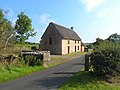
 All Hallows Church, Henshaw - geograph.org.uk - 1772571.jpg 600 × 450 ; 311 kio
-
 Alternative view at Sycamore Gap - geograph.org.uk - 5289454.jpg 4 147 × 3 110 ; 5,94 Mio
-
 Approaching Once Brewed crossroads - geograph.org.uk - 3478650.jpg 640 × 379 ; 43 kio
-
 Approaching Twice Brewed from Winshields - geograph.org.uk - 3478647.jpg 640 × 422 ; 47 kio
-
-
 Atop Peel Crags - geograph.org.uk - 6335511.jpg 640 × 480 ; 81 kio
-
 B6318 heading east - geograph.org.uk - 3429401.jpg 640 × 480 ; 64 kio
-
 B6318 heading east - geograph.org.uk - 3429427.jpg 640 × 480 ; 47 kio
-
 B6318 heading east - geograph.org.uk - 3429434.jpg 640 × 480 ; 47 kio
-
 B6318 heading east at East Twice Brewed - geograph.org.uk - 3429425.jpg 640 × 480 ; 71 kio
-
 B6318 heading east at Once Brewed - geograph.org.uk - 3429417.jpg 640 × 480 ; 64 kio
-
 Bardon Mill pottery - June 2016 - geograph.org.uk - 5003946.jpg 1 250 × 1 110 ; 1,28 Mio
-
 Barn and ruin at Peatrigg - geograph.org.uk - 4920886.jpg 640 × 480 ; 89 kio
-
 Beacons lit along Hadrians Wall (geograph 4917923).jpg 1 200 × 800 ; 923 kio
-
 Bean Burn - geograph.org.uk - 1772555.jpg 600 × 450 ; 429 kio
-
 Bill's Hill - geograph.org.uk - 2476672.jpg 3 888 × 2 592 ; 2,27 Mio
-
 Bin - Blackrigg Park. - geograph.org.uk - 2830924.jpg 3 072 × 2 304 ; 1,1 Mio
-
 Black Fell - geograph.org.uk - 2475894.jpg 3 888 × 2 592 ; 1,51 Mio
-
 Black Fell - geograph.org.uk - 2476569.jpg 3 888 × 2 311 ; 1,91 Mio
-

-
 Boardwalk west of Greenlee Lough - geograph.org.uk - 2372265.jpg 640 × 480 ; 76 kio
-
 Boardwalk west of Greenlee Lough - geograph.org.uk - 2372353.jpg 640 × 480 ; 71 kio
-
 Boggy land west of Greenlee Lough - geograph.org.uk - 2372370.jpg 640 × 480 ; 70 kio
-
 Brackies Burn (2) - geograph.org.uk - 2064564.jpg 480 × 640 ; 137 kio
-
 Brackies Burn - geograph.org.uk - 1555533.jpg 480 × 640 ; 143 kio
-
 Brackies Burn - geograph.org.uk - 2064559.jpg 640 × 480 ; 97 kio
-
 Brackies Burn - geograph.org.uk - 3232526.jpg 480 × 640 ; 161 kio
-
 Bradley Burn valley south-east of Vindolanda - geograph.org.uk - 2860388.jpg 3 000 × 1 128 ; 1,11 Mio
-
 Bridge crossing the Tipalt Burn - geograph.org.uk - 5469637.jpg 2 000 × 1 500 ; 539 kio
-
 Bridge on the B6318 near East Twice Brewed - geograph.org.uk - 1941802.jpg 640 × 480 ; 76 kio
-
 Bridge over the Caw Burn - geograph.org.uk - 2109330.jpg 640 × 480 ; 108 kio
-
 Bridleway diversion at Brown Rigg - geograph.org.uk - 1829568.jpg 640 × 480 ; 137 kio
-
 Building 'The Sill', Twice Brewed - geograph.org.uk - 5096936.jpg 800 × 600 ; 96 kio
-
 Building at Hopealone - geograph.org.uk - 5248676.jpg 640 × 480 ; 278 kio
-
 Burndivot Common - geograph.org.uk - 1834728.jpg 600 × 450 ; 313 kio
-
 Byway leading to Vindolanda - geograph.org.uk - 1772185.jpg 600 × 450 ; 283 kio
-
 Byway near Cranberry Brow - geograph.org.uk - 1776003.jpg 600 × 450 ; 225 kio
-
 Byway towards Grindon Green - geograph.org.uk - 4144375.jpg 1 066 × 800 ; 322 kio
-
 Carrsgate Burn near Woodhall Farm - geograph.org.uk - 1774593.jpg 600 × 450 ; 382 kio
-
 Cattle on the farm track south of Hotbank Farm - geograph.org.uk - 3100478.jpg 4 608 × 3 072 ; 3,08 Mio
-
 Causeway House - geograph.org.uk - 4049345.jpg 640 × 480 ; 49 kio
-
 Causeway House - geograph.org.uk - 4181454.jpg 4 608 × 3 456 ; 6,62 Mio
-
 Causeway House lime kiln (2) - geograph.org.uk - 3232562.jpg 640 × 480 ; 114 kio
-
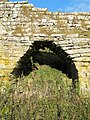
 Causeway House lime kiln - geograph.org.uk - 3232533.jpg 640 × 480 ; 116 kio
-
 Causeway House lime kiln - left hand arch - geograph.org.uk - 3232564.jpg 480 × 640 ; 142 kio
-
 Causeway House lime kiln - the pot (2) - geograph.org.uk - 3232591.jpg 640 × 480 ; 107 kio
-
 Causeway House lime kiln - the pot - geograph.org.uk - 3232573.jpg 640 × 480 ; 101 kio
-
 Causeway House lime kiln - the pot and arches - geograph.org.uk - 3232588.jpg 640 × 480 ; 125 kio
-
 Causeway House near Vindolanda (Henshaw) - geograph.org.uk - 5737725.jpg 5 184 × 3 888 ; 1,41 Mio
-
 Caw Burn and Greenlee Lough NNR - geograph.org.uk - 2109576.jpg 640 × 480 ; 113 kio
-
 Caw Burn and Greenlee Lough NNR - geograph.org.uk - 2109580.jpg 640 × 480 ; 106 kio
-
 Caw Burn at Gibbs Hill (3) - geograph.org.uk - 1398153.jpg 640 × 480 ; 96 kio
-
 Caw Burn south of Swallow Crags (2) - geograph.org.uk - 3235921.jpg 640 × 480 ; 85 kio
-
 Caw Burn south of Swallow Crags - geograph.org.uk - 3235385.jpg 640 × 480 ; 93 kio
-
 Caw Burn west of Greenlee Lough - geograph.org.uk - 2372330.jpg 640 × 480 ; 78 kio
-
 Centurion Bottle - geograph.org.uk - 5876058.jpg 3 456 × 4 608 ; 3,12 Mio
-
 Chainley Burn running through Roman Vindolanda - geograph.org.uk - 6358837.jpg 4 000 × 3 000 ; 2,87 Mio
-
 Chatley Crags - geograph.org.uk - 1399850.jpg 640 × 480 ; 81 kio
-
 Cleared area in Greenlee Plantation (2) - geograph.org.uk - 1399922.jpg 640 × 480 ; 107 kio
-
 Cleared area in Greenlee Plantation (3) - geograph.org.uk - 1399931.jpg 640 × 480 ; 112 kio
-
 Cleared area in Greenlee Plantation (4) - geograph.org.uk - 1399937.jpg 640 × 480 ; 109 kio
-
 Cleared area in Greenlee Plantation - geograph.org.uk - 1399917.jpg 640 × 480 ; 70 kio
-
-
 Cleared plantation below Sweet Rigg (2) - geograph.org.uk - 1295040.jpg 640 × 480 ; 99 kio
-
 Cleared plantation below Sweet Rigg (3) - geograph.org.uk - 1295044.jpg 640 × 480 ; 103 kio
-
 Cleared plantation below Sweet Rigg - geograph.org.uk - 1295032.jpg 640 × 480 ; 102 kio
-
 Cliff edge at Highshield Crag - geograph.org.uk - 5919100.jpg 2 000 × 1 333 ; 1,85 Mio
-
 Climbers on Peel Crags - geograph.org.uk - 5815015.jpg 3 648 × 5 472 ; 2,72 Mio
-
 Common reed - geograph.org.uk - 3947601.jpg 480 × 640 ; 54 kio
-
 Corrugated Building near Vindolanda - geograph.org.uk - 1772543.jpg 600 × 450 ; 335 kio
-
 Cottages above the Chainley Burn at Westwood - geograph.org.uk - 5302982.jpg 1 066 × 800 ; 379 kio
-
 Cottages by the Chainley Burn - geograph.org.uk - 3516968.jpg 640 × 480 ; 106 kio
-
 Country road east of Scotchcoultard - geograph.org.uk - 5501911.jpg 2 000 × 1 500 ; 466 kio
-
 Countryside around Greenlee Lough - geograph.org.uk - 2765989.jpg 640 × 480 ; 62 kio
-
 Crag and Lough - geograph.org.uk - 4209180.jpg 4 468 × 3 199 ; 2,47 Mio
-
 Crag and Lough ^2 - geograph.org.uk - 4209181.jpg 3 802 × 2 544 ; 1,67 Mio
-
 Crag and Lough ^3 - geograph.org.uk - 4209182.jpg 4 515 × 3 059 ; 3,66 Mio
-
 Crag and Lough ^4 - geograph.org.uk - 4209183.jpg 2 091 × 2 970 ; 1,16 Mio
-
 Crag and Lough ^5 - geograph.org.uk - 4209184.jpg 4 468 × 1 192 ; 779 kio
-
 Crag and Lough ^7 - geograph.org.uk - 4209186.jpg 2 788 × 2 008 ; 1,44 Mio
-
 Crag Lough (2) - geograph.org.uk - 599760.jpg 640 × 480 ; 89 kio
-
 Crag Lough - geograph.org.uk - 1410949.jpg 640 × 480 ; 94 kio
-
 Crag Lough and Highshield Crags - geograph.org.uk - 5161582.jpg 683 × 1 024 ; 117 kio
-
 Crag Lough and Highshield Crags from the north - geograph.org.uk - 4306902.jpg 1 600 × 1 064 ; 374 kio
-
 Crag Lough below Highshield Crags (2) - geograph.org.uk - 4894202.jpg 640 × 480 ; 77 kio
-
 Crag Lough below Highshield Crags - geograph.org.uk - 4894198.jpg 640 × 480 ; 59 kio
-
 Crag Lough from Hadrian's Wall Trail - geograph.org.uk - 4181506.jpg 4 608 × 3 456 ; 6,46 Mio
-
 Crag Lough from Highshield Crags - geograph.org.uk - 2888594.jpg 800 × 600 ; 123 kio
-
 Crag Lough from Highshields Crag - geograph.org.uk - 3120446.jpg 1 600 × 1 064 ; 283 kio
-
 Crag Lough from Highshields Crag - geograph.org.uk - 4300093.jpg 1 600 × 1 064 ; 301 kio
-
 Crag Lough from Highshields Crag - geograph.org.uk - 4300930.jpg 1 600 × 1 064 ; 276 kio
-
 Crag Lough from Highshields Crag - geograph.org.uk - 4300931.jpg 1 600 × 1 064 ; 392 kio
-
 Crag Lough seen from the Hadrian's Wall Path - geograph.org.uk - 6447639.jpg 2 000 × 1 184 ; 2,11 Mio
-
 Crags along the line of Hadrian's Wall, from the north - geograph.org.uk - 3121020.jpg 1 600 × 1 064 ; 324 kio
-
 Crags at Steel Rig - geograph.org.uk - 2530577.jpg 800 × 531 ; 77 kio
-
 Cragside - geograph.org.uk - 1434262.jpg 640 × 423 ; 100 kio
-
 Datestone, Causeway House - geograph.org.uk - 3450843.jpg 640 × 480 ; 174 kio
-
 Dawn mist north of Hadrian's Wall - geograph.org.uk - 5009433.jpg 800 × 600 ; 91 kio
-
 Day 3 at 7am taken from my bedroom window - geograph.org.uk - 2888396.jpg 800 × 600 ; 137 kio
-
 Dead tree at Grindon Green - geograph.org.uk - 1829586.jpg 640 × 480 ; 109 kio
-
 Defensive Ditch - geograph.org.uk - 2530547.jpg 800 × 531 ; 92 kio
-
 Derelict buildings west of Haining Head - geograph.org.uk - 5469723.jpg 2 000 × 1 500 ; 322 kio
-
 Derelict lime kiln, Brackies Burn - geograph.org.uk - 1941852.jpg 640 × 480 ; 119 kio
-
 Disused quarry and lime kiln by Caw Burn - geograph.org.uk - 3235965.jpg 640 × 480 ; 101 kio
-
-

-
 Disused quarry north of Bayldon - geograph.org.uk - 2071323.jpg 640 × 480 ; 84 kio
-
 Double sheephole near Greenlee Farm - geograph.org.uk - 1442851.jpg 640 × 480 ; 90 kio
-
 Drainage channels near Brown Rigg - geograph.org.uk - 5469689.jpg 2 000 × 1 500 ; 573 kio
-
 Drainage work at Grindon Green - geograph.org.uk - 5248683.jpg 640 × 480 ; 273 kio
-
 Dry Stone Wall - geograph.org.uk - 852975.jpg 480 × 640 ; 68 kio
-
 Dry Stone Wall, Smallburn Hill - geograph.org.uk - 4144085.jpg 1 066 × 800 ; 238 kio
-
 Drystane Dyke - geograph.org.uk - 4784053.jpg 640 × 427 ; 507 kio
-
 Enclosed Cremation Cemetery near Chatley Crags (geograph 7084996).jpg 1 024 × 683 ; 396 kio
-
 End of the motorable road, Grindon Green - geograph.org.uk - 1829580.jpg 640 × 480 ; 143 kio
-
 Entering Kielder Forest Park - geograph.org.uk - 2933143.jpg 800 × 600 ; 108 kio
-
 Evening light on Peel Crags - geograph.org.uk - 3452580.jpg 800 × 600 ; 130 kio
-
 Farm Buildings at Cranberry Brow Farm - geograph.org.uk - 1776005.jpg 600 × 450 ; 307 kio
-
 Farmland east of Hardriding (2) - geograph.org.uk - 2063514.jpg 640 × 480 ; 84 kio
-
 Farmland east of Hardriding (3) - geograph.org.uk - 2063518.jpg 640 × 480 ; 86 kio
-
 Farmland east of Hardriding - geograph.org.uk - 2063508.jpg 640 × 480 ; 87 kio
-
 Farmland east of Woodhall (2) - geograph.org.uk - 2071892.jpg 640 × 480 ; 74 kio
-
 Farmland east of Woodhall - geograph.org.uk - 2071886.jpg 640 × 480 ; 87 kio
-
 Farmland north of Layside - geograph.org.uk - 2064501.jpg 640 × 480 ; 71 kio
-
 Farmland north of the Stanegate - geograph.org.uk - 3233335.jpg 640 × 480 ; 99 kio
-
 Farmland north of Woodhall - geograph.org.uk - 2071870.jpg 640 × 480 ; 89 kio
-
 Farmland northeast of Woodhall - geograph.org.uk - 2071877.jpg 640 × 480 ; 84 kio
-
 Farmland northwest of Layside (2) - geograph.org.uk - 2064497.jpg 640 × 480 ; 71 kio
-
 Farmland northwest of Layside - geograph.org.uk - 2064493.jpg 640 × 480 ; 75 kio
-
 Farmland on Shawhead Hill (2) - geograph.org.uk - 2064467.jpg 640 × 480 ; 77 kio
-
 Farmland on Shawhead Hill - geograph.org.uk - 2064457.jpg 640 × 480 ; 76 kio
-
 Farmland west of Vindolanda (2) - geograph.org.uk - 2064509.jpg 640 × 480 ; 72 kio
-
 Farmland west of Vindolanda - geograph.org.uk - 2064505.jpg 640 × 480 ; 75 kio
-
 Farmland west of Winshields - geograph.org.uk - 2067794.jpg 640 × 480 ; 56 kio
-
 Farmland, Bardon Mill - geograph.org.uk - 3431079.jpg 800 × 577 ; 73 kio
-
 Felled Trees, Wark Forest - geograph.org.uk - 2774086.jpg 600 × 450 ; 63 kio
-
 Fence and wall heading north from Windshield Crags - geograph.org.uk - 6267323.jpg 1 200 × 1 600 ; 757 kio
-
 Fence Near Seatsides - geograph.org.uk - 3944215.jpg 640 × 427 ; 351 kio
-
 Fields below Hotbank Farm - geograph.org.uk - 2109545.jpg 640 × 480 ; 76 kio
-
 Fingerpost, track to Greenlee - geograph.org.uk - 5027494.jpg 720 × 540 ; 113 kio
-
 Firebreak and Dry Stone Wall, Robinrock Flothers, Kielder Forest - geograph.org.uk - 3197096.jpg 3 648 × 2 736 ; 1,45 Mio
-
 Firebreak and Telegraph Ploes and Wires, Kielder Forest - geograph.org.uk - 3197088.jpg 3 648 × 2 736 ; 1,34 Mio
-
 Flat land below Greenlee Lough - geograph.org.uk - 2109531.jpg 640 × 480 ; 82 kio
-
 Fond Tom's Pool - geograph.org.uk - 3235966.jpg 640 × 480 ; 84 kio
-
 Footbridge across the Sunday Burn - geograph.org.uk - 1832166.jpg 600 × 450 ; 325 kio
-
 Footbridge over Brackies Burn - geograph.org.uk - 3232520.jpg 640 × 480 ; 159 kio
-
 Footbridge over the Bradley Burn - geograph.org.uk - 1772127.jpg 600 × 450 ; 377 kio
-
 Footbridge over the Small Burn - geograph.org.uk - 1832125.jpg 600 × 450 ; 303 kio
-
 Footbridge over Tipalt Burn - geograph.org.uk - 1831007.jpg 600 × 450 ; 280 kio
-
 Footbridge over Tipalt Burn - geograph.org.uk - 4144075.jpg 1 066 × 800 ; 264 kio
-
 Footbridge over Tod Sike - geograph.org.uk - 4144367.jpg 1 066 × 800 ; 532 kio
-

-
 Footpath at East Twice Brewed - geograph.org.uk - 1941798.jpg 640 × 480 ; 92 kio
-
-
 Footpath in Wark Forest - geograph.org.uk - 3201304.jpg 640 × 480 ; 136 kio
-
 Footpath in Wark Forest - geograph.org.uk - 3201315.jpg 640 × 480 ; 111 kio
-
 Footpath near Smallburn Hill - geograph.org.uk - 1832146.jpg 450 × 600 ; 386 kio
-
 Footpath near Smallburn Hill - geograph.org.uk - 1832161.jpg 600 × 450 ; 261 kio
-
 Footpath signpost near Long Side - geograph.org.uk - 5371552.jpg 6 000 × 4 000 ; 5,13 Mio
-
 Footpath through High Plantation - geograph.org.uk - 1830974.jpg 600 × 450 ; 362 kio
-
 Footpath through High Plantation - geograph.org.uk - 4144072.jpg 1 066 × 800 ; 384 kio
-
 Footpath through Scotchcoultard Waste - geograph.org.uk - 4144080.jpg 1 066 × 800 ; 331 kio
-
 Footpath through Scotchcoultard Waste Forest - geograph.org.uk - 1831032.jpg 600 × 450 ; 297 kio
-
 Footpath to Bardon Mill - geograph.org.uk - 4696242.jpg 2 592 × 1 944 ; 1,59 Mio
-
 Footpath to East Twice Brewed - geograph.org.uk - 3232502.jpg 640 × 480 ; 132 kio
-
 Footpath towards Bean Burn - geograph.org.uk - 1772557.jpg 600 × 450 ; 396 kio
-
 Footpath towards Robin Rock, Kielder Forest - geograph.org.uk - 3197123.jpg 3 648 × 2 736 ; 1,22 Mio
-
 Footpath west of Hotbank Farm - geograph.org.uk - 3121028.jpg 1 600 × 1 064 ; 348 kio
-
 Footpath west of Scotchcoulthard - geograph.org.uk - 5468637.jpg 2 000 × 1 500 ; 291 kio
-
 Ford and footbridge, Greenlee Burn - geograph.org.uk - 5015161.jpg 640 × 480 ; 133 kio
-
 Ford at Chesterholm - geograph.org.uk - 3976610.jpg 3 872 × 2 592 ; 4,6 Mio
-
 Ford at Tod Syke - geograph.org.uk - 5248383.jpg 640 × 480 ; 319 kio
-
 Ford on Forest track - geograph.org.uk - 5469678.jpg 2 000 × 1 500 ; 565 kio
-
 Ford on the track to Greenlee (2) - geograph.org.uk - 1399382.jpg 640 × 480 ; 88 kio
-
 Ford on the track to Greenlee - geograph.org.uk - 1399377.jpg 640 × 480 ; 76 kio
-
 Ford on track north of Gibbs Hill - geograph.org.uk - 5015142.jpg 640 × 480 ; 109 kio
-
 Ford over Tod Sike - geograph.org.uk - 1829526.jpg 640 × 480 ; 122 kio
-
 Ford through Tod Sike - geograph.org.uk - 4144371.jpg 1 066 × 800 ; 334 kio
-
 Forest road at Bill's Hill - geograph.org.uk - 3201265.jpg 640 × 480 ; 95 kio


_lime_kiln_north_of_Steel_Rigg_(2)_-_geograph.org.uk_-_4920830.jpg)
_lime_kiln_north_of_Steel_Rigg_-_geograph.org.uk_-_4920567.jpg)
_Hadrian%E2%80%99s_Wall_above_Winshields_Crags_-_geograph.org.uk_-_5640077.jpg)


_-_geograph.org.uk_-_2064564.jpg)


_-_geograph.org.uk_-_3232562.jpg)


_-_geograph.org.uk_-_3232591.jpg)


_-_geograph.org.uk_-_5737725.jpg)


_-_geograph.org.uk_-_1398153.jpg)
_-_geograph.org.uk_-_3235921.jpg)


_-_geograph.org.uk_-_599760.jpg)


_-_geograph.org.uk_-_4894202.jpg)


.jpg)


_-_geograph.org.uk_-_2063514.jpg)
_-_geograph.org.uk_-_2063518.jpg)

_-_geograph.org.uk_-_2071892.jpg)


_-_geograph.org.uk_-_2064497.jpg)

_-_geograph.org.uk_-_2064467.jpg)

_-_geograph.org.uk_-_2064509.jpg)


_-_geograph.org.uk_-_1399382.jpg)


.jpg)
_-_geograph.org.uk_-_1399922.jpg)
_-_geograph.org.uk_-_1399931.jpg)
_-_geograph.org.uk_-_1399937.jpg)
_-_geograph.org.uk_-_1295040.jpg)
_-_geograph.org.uk_-_1295044.jpg)