Category:Herlaar (Tienhoven)
Jump to navigation
Jump to search
| Object location | | View all coordinates using: OpenStreetMap |
|---|
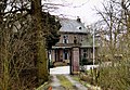
fence in Zederik, Netherlands  | |||||
| Upload media | |||||
| Instance of | |||||
|---|---|---|---|---|---|
| Location | Tienhoven aan de Lek, Vijfheerenlanden, Utrecht, Netherlands | ||||
| Street address |
| ||||
| Located on street |
| ||||
| Heritage designation |
| ||||
 | |||||
|
This is a category about rijksmonument number 35632
|
| Address |
|
Media in category "Herlaar (Tienhoven)"
The following 2 files are in this category, out of 2 total.
-
 Herlaar-hek.jpg 2,102 × 1,452; 699 KB
-
 Huis Herlaar, hekpijlers - Tienhoven - 20209129 - RCE.jpg 1,200 × 805; 332 KB
