Category:Herm
Jump to navigation
Jump to search
One of the Channel Islands. Part of the Bailiwick of Guernsey, which is one of the British Crown Dependencies.     | |||||
| Upload media | |||||
| Instance of |
| ||||
|---|---|---|---|---|---|
| Part of | |||||
| Location | Saint Peter Port, Guernsey, Guernsey | ||||
| Located in or next to body of water | |||||
| Anthem |
| ||||
| Width |
| ||||
| Length |
| ||||
| Population |
| ||||
| Area |
| ||||
| Elevation above sea level |
| ||||
| official website | |||||
 | |||||
English: Herm is the smallest of the Channel Islands that is open to the public and is part of the Bailiwick of Guernsey.
Subcategories
This category has the following 4 subcategories, out of 4 total.
Media in category "Herm"
The following 51 files are in this category, out of 51 total.
-
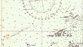
 Admiralty Chart No 262a Guernsey Herm & Sark Eastern Sheet, Published 1954.jpg 11,052 × 16,192; 34.3 MB
-
 Admiralty Chart No 262b Guernsey Herm and Sark Middle Sheet, Published 1863.jpg 11,059 × 16,201; 48.72 MB
-
 Admiralty Chart No 3400 Guernsey Herm and Sark, Published 1961.jpg 18,416 × 11,260; 41.08 MB
-
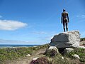 Antony Gormley's "Another Time XI" on Herm - facing nothing.JPG 4,000 × 3,000; 3.13 MB
-
 Antony Gormley's "Another Time XI" on Herm - facing right.JPG 3,000 × 4,000; 3.66 MB
-
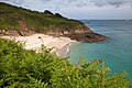
 Beach in Herm.jpg 1,024 × 768; 243 KB
-
 Caquorobert.jpg 3,294 × 2,195; 3.74 MB
-
 Castle Cornet and Herm - panoramio.jpg 1,600 × 1,200; 884 KB
-
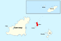
 Channel Islands - Herm.PNG 736 × 532; 19 KB
-
 Ferry approaching the Rosaire Landing, Herm - geograph.org.uk - 87.jpg 640 × 455; 105 KB
-
 Ferry to Herm.jpg 3,008 × 2,000; 3.93 MB
-
 Guernsey by Sentinel-2.jpg 3,330 × 2,240; 6.93 MB
-
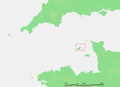
 Guernsey-Herm.png 926 × 864; 44 KB
-
 Haven van Herm bij eb.JPG 999 × 726; 451 KB
-
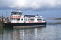
 HD Ferries at Port Peter St John Guernsey.jpg 2,592 × 1,944; 2.07 MB
-
 Herm - Bailiwick of Guernsey.svg 547 × 369; 488 KB
-
 Herm 2.jpg 3,008 × 2,000; 4.44 MB
-
 Herm Belvoir Beach.jpg 3,234 × 2,156; 3.36 MB
-
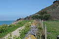 Herm Coast Path.JPG 3,008 × 2,008; 3.18 MB
-
 Herm ferry.jpg 4,318 × 2,255; 995 KB
-
 Herm Harbour in 1968 - geograph.ci - 77.jpg 640 × 426; 133 KB
-
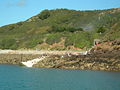
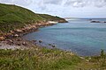 Herm Island Coast.jpg 3,124 × 2,083; 3.52 MB
-
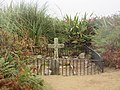 Herm Mystery Grave.jpg 4,608 × 3,456; 2.73 MB
-
 Herm Northern Beach.jpg 4,608 × 3,456; 1.96 MB
-
 Herm path south-east.jpg 4,609 × 3,234; 1.84 MB
-
 Herm Roberts Cross.jpg 3,370 × 2,246; 5.3 MB
-
 Herm Rosaire Steps 20160905.jpg 4,896 × 3,672; 2.06 MB
-
 Herm Rosaire Steps.jpg 4,986 × 3,324; 7.67 MB
-
 Herm Trident V F Herm 17-08-2016.jpg 2,560 × 1,920; 1.36 MB
-
 Herm, Sark and Jethou.jpg 2,048 × 1,536; 1.09 MB
-
 Hermdunord.jpg 1,087 × 783; 75 KB
-
 Hermhomefield.jpg 1,215 × 762; 75 KB
-
 HermPortMB.JPG 3,072 × 2,304; 1.23 MB
-
 HermShellBeach.JPG 3,072 × 2,304; 1.16 MB
-
-
 Hâvre Saint Pièrre Port Dgèrnésy.jpg 1,578 × 961; 1,024 KB
-
 Jétho Hèrme Sèr L'Êta.jpg 1,554 × 586; 555 KB
-
 Le Manoir - panoramio.jpg 2,336 × 1,411; 2.7 MB
-
 LocationGuernsey.png 182 × 115; 5 KB
-
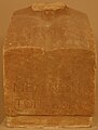 Marathon museum - Λ 214 - SEG 35-210.jpg 2,685 × 3,547; 1.32 MB
-
 Mouliere - geograph.org.uk - 1463.jpg 640 × 480; 78 KB
-
 Putrainez - geograph.org.uk - 1449.jpg 640 × 480; 109 KB
-
 Roberts Cross Herm.jpg 3,207 × 2,138; 4.21 MB
-
 Rosaire (low water) landing, Herm 1968 - geograph.ci - 82.jpg 640 × 424; 112 KB
-
 Rosaire (low water) landing, Herm 2008 - geograph.ci - 83.jpg 640 × 442; 137 KB
-
 Shell Beach Herm.jpg 4,416 × 3,244; 1.21 MB
-
 Shell Beach op Herm.JPG 1,024 × 768; 153 KB
-
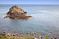
 Southern tip of Herm - geograph.ci - 78.jpg 640 × 424; 82 KB
-
 The Channel Islands 1862 Ansted Latham 20.jpg 2,058 × 1,158; 2.25 MB
-
 Ward Lock's Illustrated Guide to, and Popular History of the Channel Islands 1882 22.jpg 2,973 × 1,883; 6.38 MB
-
 Xenoliths Herm.jpg 2,063 × 1,410; 3.36 MB


_landing,_Herm_1968_-_geograph.ci_-_82.jpg)
_landing,_Herm_2008_-_geograph.ci_-_83.jpg)


