Category:Hervormde Kerk, Sprang
Jump to navigation
Jump to search
| Object location | | View all coordinates using: OpenStreetMap |
|---|
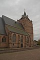
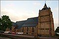
church building in Waalwijk, Netherlands  | |||||
| Upload media | |||||
| Instance of | |||||
|---|---|---|---|---|---|
| Named after | |||||
| Dedicated to | |||||
| Location | Sprang-Capelle, Sprang-Capelle | ||||
| Street address |
| ||||
| Located on street |
| ||||
| Heritage designation |
| ||||
 | |||||
Nederlands: Hervormde Kerk, Sprang-Capelle
|
This is a category about rijksmonument number 34133
|
| Address |
|
Subcategories
This category has the following 2 subcategories, out of 2 total.
I
T
- Tower of Hervormde kerk, Sprang (23 F)
Media in category "Hervormde Kerk, Sprang"
The following 28 files are in this category, out of 28 total.
-
 34133 Nederlands Hervormde Kerk (Grote of Sint Nicolaaskerk) (2).jpg 2,000 × 3,000; 4.35 MB
-
 34133 Nederlands Hervormde Kerk (Grote of Sint Nicolaaskerk) (3).jpg 5,184 × 3,456; 12.81 MB
-
 34133 Nederlands Hervormde Kerk (Grote of Sint Nicolaaskerk).jpg 2,132 × 3,000; 5.18 MB
-
 Aanzicht - Sprang - 20203495 - RCE.jpg 953 × 1,200; 331 KB
-
 Exterieur DICHT GEMETSELDE RAMEN - Sprang - 20292633 - RCE.jpg 1,200 × 783; 348 KB
-
 Exterieur PINAKEL - Sprang - 20292634 - RCE.jpg 788 × 1,200; 289 KB
-
 Geschilderd tekstbord - Sprang - 20203455 - RCE.jpg 804 × 1,200; 155 KB
-
 Grote of Sint Nicolaaskerk te Sprang 2.jpg 5,117 × 4,404; 13.37 MB
-
 Grote of Sint Nicolaaskerk te Sprang.jpg 5,927 × 3,951; 13.31 MB
-
 Kerk - Sprang - 20203428 - RCE.jpg 1,200 × 884; 289 KB
-
 Kerk - Sprang - 20203429 - RCE.jpg 946 × 1,200; 293 KB
-
 Kerk - Sprang - 20203430 - RCE.jpg 957 × 1,200; 352 KB
-
 Kerk - Sprang - 20203431 - RCE.jpg 952 × 1,200; 289 KB
-
 Kerk - Sprang - 20203432 - RCE.jpg 1,200 × 948; 365 KB
-
 Kerk - Sprang - 20203433 - RCE.jpg 1,200 × 955; 325 KB
-
 Kerk noord-west zijde naar het zuid-westen - Sprang - 20203437 - RCE.jpg 947 × 1,200; 295 KB
-
 Kerk sprang 1.jpg 400 × 266; 30 KB
-
 Kerk vanuit het noord-westen - Sprang - 20203427 - RCE.jpg 1,200 × 884; 264 KB
-
 Kerk vanuit het zuid-oosten - Sprang - 20203426 - RCE.jpg 1,200 × 886; 332 KB
-
 KerkSprang.jpg 575 × 383; 74 KB
-
 Noord gevel gezien naar het zuid-oosten - Sprang - 20203439 - RCE.jpg 1,200 × 951; 296 KB
-
 Noord gevel gezien naar het zuid-westen - Sprang - 20203438 - RCE.jpg 937 × 1,200; 298 KB
-
 Noord-oost zijde exterieur - Sprang - 20203447 - RCE.jpg 1,200 × 951; 243 KB
-
 Noord-zijde - Sprang - 20203448 - RCE.jpg 953 × 1,200; 215 KB
-
 Overzicht Kerkstraat - Sprang - 20203489 - RCE.jpg 1,200 × 784; 224 KB
-
 Overzicht noord-west zijde - Sprang - 20203446 - RCE.jpg 1,200 × 947; 211 KB
-
 Toren voor de restauratie - Sprang - 20203422 - RCE.jpg 838 × 1,200; 293 KB
-
 Zuid-zijde - Sprang - 20203449 - RCE.jpg 959 × 1,200; 366 KB
_(2).jpg)
_(3).jpg)
.jpg)


