Category:Hervormde pastorie (Niehove)
Jump to navigation
Jump to search
| Object location | | View all coordinates using: OpenStreetMap |
|---|
 | |||||
| Upload media | |||||
| Instance of | |||||
|---|---|---|---|---|---|
| Location | Niehove, Westerkwartier, Groningen, Netherlands | ||||
| Street address |
| ||||
| Located on street |
| ||||
| Heritage designation |
| ||||
 | |||||
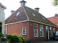
Nederlands: Vm. hervormde pastorie, Niehove
|
This is a category about rijksmonument number 31409
|
| Address |
|
Media in category "Hervormde pastorie (Niehove)"
The following 3 files are in this category, out of 3 total.
-
 Niehove - Kerkstraat 10 - oude pastorie.jpg 3,104 × 2,328; 2.99 MB
-
 Overzicht - Niehove - 20164036 - RCE.jpg 1,200 × 1,200; 361 KB
-
 Voorgevel - Niehove - 20164042 - RCE.jpg 1,200 × 1,200; 320 KB

