Category:High Halden
Jump to navigation
Jump to search
English: High Halden is a village and civil parish in the Ashford District of Kent, England. The village is located on the A28 road between Ashford town and Tenterden, 3miles (5km) north of the latter.
village and civil parish in Kent, United Kingdom  | |||||
| Upload media | |||||
| Instance of | |||||
|---|---|---|---|---|---|
| Location | Ashford, Kent, South East England, England | ||||
| Area |
| ||||
| Said to be the same as | High Halden (Wikimedia duplicated page, civil parish) | ||||
 | |||||
Subcategories
This category has the following 6 subcategories, out of 6 total.
Media in category "High Halden"
The following 200 files are in this category, out of 201 total.
(previous page) (next page)-
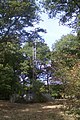
 1986 St Mary the Virgin Church at High Halden, Kent - geograph.org.uk - 5232193.jpg 1,959 × 3,162; 4.05 MB
-
 A footpath in The Grove - geograph.org.uk - 1526778.jpg 427 × 640; 121 KB
-
 A262, A28 junction - geograph.org.uk - 2972235.jpg 640 × 385; 46 KB
-
 A262, Biddenden Rd - geograph.org.uk - 2971898.jpg 640 × 430; 70 KB
-
 A28 north of Tenterden - geograph.org.uk - 2972251.jpg 640 × 430; 58 KB
-
 Animal feeders in field - geograph.org.uk - 2774050.jpg 2,256 × 1,496; 901 KB
-
 Ashford Road (A28) - geograph.org.uk - 3858853.jpg 3,696 × 2,448; 2.3 MB
-
 Ashford Road, High Halden - geograph.org.uk - 4848500.jpg 3,264 × 2,448; 1.6 MB
-
 Ashford Road, High Halden - geograph.org.uk - 4848541.jpg 3,264 × 2,448; 1.63 MB
-
 Ashford Road, High Halden - geograph.org.uk - 4848580.jpg 3,264 × 2,448; 1.45 MB
-
 Ashford Road, High Halden - geograph.org.uk - 4848605.jpg 3,264 × 2,448; 1.71 MB
-
 Ashford Road, High Halden - geograph.org.uk - 4848609.jpg 3,264 × 2,448; 1.88 MB
-
 Ashford Road, High Halden - geograph.org.uk - 4848612.jpg 3,264 × 2,448; 2.16 MB
-
 Banksy artwork, High Halden - geograph.org.uk - 5752441.jpg 2,887 × 2,165; 1.03 MB
-
 Beale's Farmhouse - geograph.org.uk - 1526727.jpg 640 × 427; 72 KB
-
 Biddenden Road - geograph.org.uk - 3215869.jpg 640 × 428; 85 KB
-
 Biddenden Road, High Halden - geograph.org.uk - 4848620.jpg 3,264 × 2,448; 2.5 MB
-
 Bridge Farm Barns, Middle Quarter - geograph.org.uk - 1524385.jpg 640 × 427; 51 KB
-
 Broken stile near Beale's Farm - geograph.org.uk - 1526725.jpg 640 × 427; 126 KB
-
 Brooksbourne Farm House - geograph.org.uk - 1526703.jpg 640 × 427; 96 KB
-
 Chequers on the Green sign - geograph.org.uk - 5752439.jpg 3,000 × 4,000; 1.68 MB
-
 Chequers on the Green, High Halden - geograph.org.uk - 5752436.jpg 4,000 × 2,667; 2.1 MB
-
 Church Hill, High Halden - geograph.org.uk - 4848557.jpg 3,264 × 2,448; 1.75 MB
-
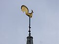
 Clock on the Spire of St Mary the Virgin at High Halden - geograph.org.uk - 6258598.jpg 3,525 × 2,644; 1.8 MB
-
 Closed Store on Ashford Road - geograph.org.uk - 1596486.jpg 640 × 427; 71 KB
-
 Converted barn - geograph.org.uk - 4394976.jpg 1,024 × 768; 165 KB
-
 Converted barn and tree - geograph.org.uk - 3121698.jpg 2,256 × 1,496; 716 KB
-
 Course of Old roman Road off Redbrook Street - geograph.org.uk - 3121692.jpg 2,256 × 1,496; 919 KB
-
 Crailyn Farm - geograph.org.uk - 6080135.jpg 4,100 × 2,734; 939 KB
-
 Cripple Hill, High Halden, Kent - geograph.org.uk - 1017830.jpg 640 × 427; 75 KB
-
 Cripple Hill, near High Halden - geograph.org.uk - 4848488.jpg 3,264 × 2,448; 2.67 MB
-
 Crop field near Further Quarter - geograph.org.uk - 4579182.jpg 1,024 × 768; 322 KB
-
 Crop field near Wagstaff Farm - geograph.org.uk - 4579178.jpg 1,024 × 768; 220 KB
-
 Crossroads on Plurenden Road - geograph.org.uk - 3121683.jpg 2,256 × 1,496; 892 KB
-
 Cuckolds Corner - geograph.org.uk - 4946372.jpg 640 × 481; 315 KB
-
 Cyclists on Cripple Hill - geograph.org.uk - 1524360.jpg 640 × 427; 76 KB
-

-
 Derelict house at Ledger Farm - geograph.org.uk - 6080130.jpg 5,184 × 3,456; 1.97 MB
-
 Derelict site, Ashford Road (A28) - geograph.org.uk - 4607729.jpg 3,264 × 2,448; 3.75 MB
-
 Derelict-looking chicken sheds, Plurenden Road - geograph.org.uk - 4607775.jpg 3,264 × 2,448; 3.78 MB
-
 Derelict-looking chicken sheds, Plurenden Road - geograph.org.uk - 4607783.jpg 3,264 × 2,448; 2.32 MB
-

-

-
 Double kissing gates near High Halden - geograph.org.uk - 1526734.jpg 640 × 427; 123 KB
-

-
 Drive to Harbourne Hall - geograph.org.uk - 397643.jpg 640 × 420; 385 KB
-
 Dry pond near Gadsby Lane - geograph.org.uk - 1526722.jpg 640 × 427; 91 KB
-
 Entering Tenterden, A28 - geograph.org.uk - 2988127.jpg 640 × 479; 100 KB
-
 Fallen Tree on Woodchurch Road - geograph.org.uk - 1596513.jpg 640 × 480; 137 KB
-
 Farm on High Halden Road - geograph.org.uk - 976176.jpg 640 × 427; 74 KB
-
 Footpath to the Grove - geograph.org.uk - 1526770.jpg 640 × 427; 76 KB
-
 Gadsby Lane near Oaks Farm - geograph.org.uk - 1526694.jpg 640 × 427; 74 KB
-
 Gate to Grass Field, near Brickhouse Farm - geograph.org.uk - 2942081.jpg 2,256 × 1,496; 913 KB
-
 Gated and Blocked Track - geograph.org.uk - 2942092.jpg 640 × 424; 145 KB
-
 Gore Lane, byway - geograph.org.uk - 1524323.jpg 640 × 427; 126 KB
-
 Gore Lane, byway to Marlands Farm - geograph.org.uk - 1524336.jpg 640 × 427; 126 KB
-
 Gore Lane, near High Halden - geograph.org.uk - 4848484.jpg 3,264 × 2,448; 2.89 MB
-
 Green pond near High Halden - geograph.org.uk - 1526802.jpg 640 × 427; 83 KB
-
 Greenside, High Halden - geograph.org.uk - 4848564.jpg 3,264 × 2,448; 1.75 MB
-
 Greenside, High Halden - geograph.org.uk - 4848568.jpg 3,264 × 2,448; 2.04 MB
-
 Halden Heights Care Home - geograph.org.uk - 4394980.jpg 1,024 × 768; 165 KB
-
 Halden House, High Halden - geograph.org.uk - 1526791.jpg 640 × 427; 104 KB
-
 Halden House, High Halden - geograph.org.uk - 1533734.jpg 640 × 427; 105 KB
-
 Harbourne Lane - geograph.org.uk - 1136931.jpg 640 × 427; 124 KB
-
 Harbourne Lane - geograph.org.uk - 3121674.jpg 2,256 × 1,496; 918 KB
-
 Harbourne Lane in Pond Wood - geograph.org.uk - 1747882.jpg 3,072 × 2,304; 2.71 MB
-
 Harbourne Lodge - geograph.org.uk - 1747878.jpg 3,072 × 2,304; 2.41 MB
-
 Harris Lane, near High Halden - geograph.org.uk - 4848485.jpg 3,264 × 2,448; 2.73 MB
-
 Hathewolden Grange, High Halden - geograph.org.uk - 1526752.jpg 640 × 427; 105 KB
-
 Haunted horse riders on Cripple Hill - geograph.org.uk - 1524355.jpg 640 × 427; 70 KB
-
 Herontoll Wood - geograph.org.uk - 1747903.jpg 3,072 × 2,304; 1.53 MB
-
 High Halden 1913.jpg 972 × 1,571; 350 KB
-
 High Halden Road near Ledger Farm - geograph.org.uk - 1524316.jpg 640 × 427; 112 KB
-
 High Halden Road, near Crailyn Farm - geograph.org.uk - 1526840.jpg 640 × 427; 92 KB
-
 High Halden Road, near High Halden - geograph.org.uk - 4848476.jpg 3,264 × 2,448; 1.99 MB
-
 High Halden Village Sign - geograph.org.uk - 1596479.jpg 480 × 640; 67 KB
-
 High Halden village sign - geograph.org.uk - 5752440.jpg 3,000 × 4,000; 1.11 MB
-
 High Halden village sign - geograph.org.uk - 787116.jpg 480 × 640; 145 KB
-
 High Halden Village Store, Ashford Road (A28) - geograph.org.uk - 6127796.jpg 3,264 × 2,448; 1.99 MB
-
 High Halden, Ashford Road - geograph.org.uk - 3175485.jpg 3,648 × 2,736; 3.73 MB
-
 High Halden, Ashford Road - geograph.org.uk - 3175495.jpg 3,648 × 2,736; 4.19 MB
-
 High Halden, Ashford Road - geograph.org.uk - 3175497.jpg 3,648 × 2,736; 3.99 MB
-
 High Halden, Biddenden Road - geograph.org.uk - 3175683.jpg 3,648 × 2,736; 4.03 MB
-
 High Halden, Biddenden Road - geograph.org.uk - 3175685.jpg 3,648 × 2,736; 3.57 MB
-
 High Halden, Biddenden Road - geograph.org.uk - 3175686.jpg 3,648 × 2,736; 3.73 MB
-
 High Halden, Biddenden Road - geograph.org.uk - 3175692.jpg 3,648 × 2,736; 4.12 MB
-
 High Halden, Biddenden Road - geograph.org.uk - 3175699.jpg 3,648 × 2,736; 2.01 MB
-
 High Halden, Biddenden Road - geograph.org.uk - 3178409.jpg 3,647 × 2,736; 1.36 MB
-
 Hoarding, Ashford Road (A28) - geograph.org.uk - 4982007.jpg 3,264 × 2,448; 2.02 MB
-
 Hookstead Lane, High Halden - geograph.org.uk - 4848491.jpg 3,264 × 2,448; 2.2 MB
-
 Hookstead Lane, High Halden - geograph.org.uk - 4848494.jpg 3,264 × 2,448; 1.83 MB
-
 Hookstead Lane, near High Halden - geograph.org.uk - 4848482.jpg 3,264 × 2,448; 1.57 MB
-
 Hopes Grove, High Halden - geograph.org.uk - 4848501.jpg 3,264 × 2,448; 1.89 MB
-
 Hopes Grove, High Halden - geograph.org.uk - 4848507.jpg 3,264 × 2,448; 1.67 MB
-
 House at Crampton - geograph.org.uk - 4429406.jpg 1,024 × 768; 372 KB
-
 Housing Estate at High Halden, Kent - geograph.org.uk - 976220.jpg 640 × 427; 75 KB
-
 Junction of Harbourne Lane and a Private Road - geograph.org.uk - 3121666.jpg 2,256 × 1,496; 904 KB
-

-

-
 K6 Telephone Kiosk on The Green - geograph.org.uk - 1596546.jpg 640 × 480; 147 KB
-

-
 Kissing Gate near Little Hookstead Farm - geograph.org.uk - 1526812.jpg 640 × 427; 122 KB
-
 Lane and Rape Field, near Beale's Farm - geograph.org.uk - 2942012.jpg 2,256 × 1,496; 828 KB
-
 Lane at junction with Gore Lane - geograph.org.uk - 3215945.jpg 640 × 428; 146 KB
-
 Lane junction at Shawlands - geograph.org.uk - 1524378.jpg 640 × 427; 68 KB
-
 Lane junction near Bethersden - geograph.org.uk - 3858857.jpg 3,696 × 2,448; 2.35 MB
-
 Lane junction on Cripple Hill - geograph.org.uk - 1524363.jpg 640 × 427; 124 KB
-
 Lane near Springbourne Farm - geograph.org.uk - 2942001.jpg 640 × 424; 108 KB
-
 Ledger Farm - geograph.org.uk - 1524327.jpg 640 × 427; 93 KB
-
 Ledger Farm - geograph.org.uk - 6080155.jpg 3,963 × 2,642; 1,011 KB
-
 Lion House, High Halden - geograph.org.uk - 1526756.jpg 640 × 427; 59 KB
-
 Little Robhurst, High Halden - geograph.org.uk - 4848570.jpg 3,264 × 2,448; 1.72 MB
-
-
 Lost Load near High Halden, Kent - geograph.org.uk - 976195.jpg 640 × 480; 79 KB
-
 Main Church Door of St Mary the Virgin at High Halden - geograph.org.uk - 6258595.jpg 3,028 × 4,037; 2.66 MB
-
 Millfield, High Halden - geograph.org.uk - 4848537.jpg 3,264 × 2,448; 1.68 MB
-
 Mirror on High Halden Road - geograph.org.uk - 1526867.jpg 427 × 640; 69 KB
-
 Muddy field and makeshift stable - geograph.org.uk - 4946373.jpg 640 × 480; 299 KB
-
 New buildings, Plurenden Road - geograph.org.uk - 6127775.jpg 3,264 × 2,448; 3.75 MB
-
 Oaks Farm Barn - geograph.org.uk - 1526696.jpg 640 × 427; 58 KB
-
 Oaktree Farm, Plurenden Road - geograph.org.uk - 3872089.jpg 900 × 654; 189 KB
-
 Oaktree Farm, Plurenden Road - geograph.org.uk - 6127765.jpg 3,264 × 2,448; 2.53 MB
-
 Oast House - geograph.org.uk - 6080017.jpg 2,700 × 2,025; 695 KB
-
 Oast House - geograph.org.uk - 6080138.jpg 4,000 × 3,000; 1.55 MB
-
 Oast House - geograph.org.uk - 6080147.jpg 4,000 × 3,000; 1.17 MB
-
 Oast House - geograph.org.uk - 6080156.jpg 2,506 × 3,341; 1,013 KB
-
 Oilseed Rape fields near High Halden - geograph.org.uk - 2908750.jpg 640 × 424; 51 KB
-
 Oven Tomb, St Mary's church, High Halden - geograph.org.uk - 3125448.jpg 2,256 × 1,496; 934 KB
-
 Permissive Path Information Panel - geograph.org.uk - 1747868.jpg 2,304 × 3,072; 2.01 MB
-
 Plurenden Road - geograph.org.uk - 3121688.jpg 2,256 × 1,496; 911 KB
-
 Pond and barn - geograph.org.uk - 3479376.jpg 848 × 636; 207 KB
-
 Pond near Bay Ruffets Wood - geograph.org.uk - 3961350.jpg 3,696 × 2,448; 2.32 MB
-
 Pope House Lane Bridleway - geograph.org.uk - 1747850.jpg 1,728 × 3,072; 2.47 MB
-

-
 Raja of Kent - geograph.org.uk - 6080152.jpg 4,000 × 3,000; 1.19 MB
-
 Raja of Kent - geograph.org.uk - 6080153.jpg 4,000 × 3,000; 3.71 MB
-
 Ramstile Farm, access road - geograph.org.uk - 1526729.jpg 640 × 427; 54 KB
-
 Restricted Byway in the Grove - geograph.org.uk - 1526786.jpg 640 × 427; 125 KB
-

-
 Restricted Byway to the Grove - geograph.org.uk - 1526784.jpg 640 × 427; 84 KB
-
 Roadside cottage on Plurenden Road - geograph.org.uk - 4946375.jpg 640 × 480; 332 KB
-
 Shawlands, Middle Quarter - geograph.org.uk - 1524375.jpg 640 × 427; 84 KB
-
 Sheep Grazing - geograph.org.uk - 339955.jpg 640 × 428; 75 KB
-
 Sheep near Little Bedgebury Farm - geograph.org.uk - 2942109.jpg 2,256 × 1,496; 885 KB
-
 Shops and bus shelter, High Halden - geograph.org.uk - 787110.jpg 640 × 480; 160 KB
-
 Side door of St Mary the Virgin at High Halden - geograph.org.uk - 6258592.jpg 3,227 × 4,303; 3.34 MB
-

-

-

-
 Sportsman Farm - geograph.org.uk - 1526875.jpg 640 × 427; 76 KB
-
 St Mary the Virgin at High Halden - geograph.org.uk - 6258571.jpg 4,498 × 3,374; 2.92 MB
-
 St Mary the Virgin at High Halden - geograph.org.uk - 6258573.jpg 3,194 × 4,259; 2.07 MB
-
 St Mary the Virgin at High Halden - geograph.org.uk - 6258576.jpg 4,067 × 3,051; 2.8 MB
-
 St Mary the Virgin at High Halden - geograph.org.uk - 6258589.jpg 4,028 × 3,020; 2.02 MB
-
 St. Mary the Virgin, High Halden - geograph.org.uk - 4848562.jpg 2,448 × 3,264; 1.82 MB
-
 Stile near Oaks Farm - geograph.org.uk - 1526691.jpg 640 × 427; 85 KB
-
 Stile near Poppet Wood - geograph.org.uk - 1526822.jpg 640 × 427; 116 KB
-
 Stile near The Grove - geograph.org.uk - 1526775.jpg 427 × 640; 121 KB
-
 Stone circle near Stone Circle Livery - geograph.org.uk - 3479346.jpg 1,004 × 679; 138 KB
-
 Strange Building at the Lane Junction - geograph.org.uk - 339957.jpg 640 × 428; 122 KB
-
 Street Art on the side of High Halden Village Store - geograph.org.uk - 4848592.jpg 3,264 × 2,448; 2.88 MB
-

-
 The A262 west of High Halden - geograph.org.uk - 3044452.jpg 1,024 × 738; 225 KB
-
 The A28 Ashford Road at High Halden - geograph.org.uk - 787089.jpg 640 × 480; 182 KB
-
 The Chennells, High Halden - geograph.org.uk - 4848495.jpg 3,264 × 2,448; 1.71 MB
-
 The Chennells, High Halden - geograph.org.uk - 4848496.jpg 3,264 × 2,448; 2 MB
-
 The Chennells, High Halden - geograph.org.uk - 4848596.jpg 3,264 × 2,448; 2.19 MB
-
 The Chennells, High Halden - geograph.org.uk - 740229.jpg 640 × 239; 51 KB
-
 The Chequers on the Green, High Halden - geograph.org.uk - 4848553.jpg 3,264 × 2,448; 1.64 MB
-
 The edge of a crop field near Tiffenden Manor Farm - geograph.org.uk - 3961337.jpg 3,696 × 2,448; 2.26 MB
-
 The edge of the village green - geograph.org.uk - 787119.jpg 640 × 480; 181 KB
-
 The Raja of Kent Indian Restaurant - geograph.org.uk - 2774036.jpg 2,256 × 1,496; 887 KB
-
 Tilden Close, High Halden - geograph.org.uk - 4848548.jpg 3,264 × 2,448; 1.56 MB
-
 Tole Wood Lane - geograph.org.uk - 1526829.jpg 640 × 427; 112 KB
-
 Track in Lancefield Wood - geograph.org.uk - 1747895.jpg 3,072 × 2,304; 2.78 MB
-
 Track near Tiffenden Manor Farm - geograph.org.uk - 3961359.jpg 3,696 × 2,448; 2.32 MB
-
 Track to gated field - geograph.org.uk - 2774045.jpg 2,256 × 1,496; 936 KB
-
 Track to Tiffenden Manor Farm - geograph.org.uk - 3961366.jpg 3,696 × 2,448; 2.31 MB
-
 Tree House off Ashford Road - geograph.org.uk - 1596502.jpg 640 × 480; 89 KB
-
 View from Pope House Lane - geograph.org.uk - 1747843.jpg 3,072 × 1,728; 1.31 MB
-
 Vodaphone Mast in Poppet Wood - geograph.org.uk - 1526819.jpg 427 × 640; 123 KB
-
 Warm Oak Barn, Durrant Green - geograph.org.uk - 1526793.jpg 640 × 427; 72 KB
-
-
 Well by Great Doney Wood - geograph.org.uk - 412405.jpg 640 × 428; 427 KB
-
 Woodlands near Woodland Park - geograph.org.uk - 1532067.jpg 640 × 427; 88 KB
-
 Bridleway to Wagstaff - geograph.org.uk - 397776.jpg 640 × 422; 442 KB
-
 Bungalow at Lane Junction - geograph.org.uk - 339963.jpg 640 × 428; 102 KB
-
 Byway towards Marlands Farm - geograph.org.uk - 397738.jpg 640 × 388; 397 KB
-
 Converted Barn - geograph.org.uk - 339937.jpg 640 × 428; 101 KB
-
 Corner on Cycle Route 18 - geograph.org.uk - 339924.jpg 640 × 428; 107 KB
-
 Cottage, High Halden - geograph.org.uk - 397658.jpg 640 × 432; 280 KB
-
 Duck pond - geograph.org.uk - 408851.jpg 640 × 428; 478 KB
-
 Gas Pipeline Markers - geograph.org.uk - 339954.jpg 640 × 428; 130 KB
-
 Harbourne Lane - geograph.org.uk - 339948.jpg 428 × 640; 160 KB
-
 High Halden Road - geograph.org.uk - 397812.jpg 640 × 423; 307 KB
-
 High Halden village green - geograph.org.uk - 740234.jpg 640 × 378; 69 KB
-
 House at the junction - geograph.org.uk - 397836.jpg 640 × 413; 264 KB
-
 Lodge and Gates, Ingleden Park - geograph.org.uk - 339950.jpg 640 × 429; 92 KB
-
 Pond and Pen - geograph.org.uk - 339933.jpg 640 × 428; 160 KB
-
 Silos at Oaktree Farm - geograph.org.uk - 339918.jpg 640 × 428; 84 KB


_-_geograph.org.uk_-_3858853.jpg)


_-_geograph.org.uk_-_4607729.jpg)


_-_geograph.org.uk_-_6127796.jpg)


_-_geograph.org.uk_-_4982007.jpg)


