Category:High tide in the East Riding of Yorkshire
Jump to navigation
Jump to search
Ceremonial counties of England: East Riding of Yorkshire ·
City-counties:
Former historic counties:
Other former counties:
City-counties:
Former historic counties:
Other former counties:

Media in category "High tide in the East Riding of Yorkshire"
The following 22 files are in this category, out of 22 total.
-
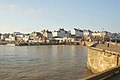 Bridlington Harbour at High Tide. - geograph.org.uk - 401774.jpg 640 × 426; 130 KB
-
 Dutch River - geograph.org.uk - 343257.jpg 640 × 480; 65 KB
-
 Hessle Haven - geograph.org.uk - 803234.jpg 640 × 461; 61 KB
-
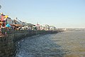 High tide at Bridlington. - geograph.org.uk - 391796.jpg 640 × 426; 128 KB
-
 High Tide at Hornsea - geograph.org.uk - 608126.jpg 640 × 480; 52 KB
-
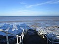
 High tide at Withernsea (geograph 4349152).jpg 1,600 × 1,062; 549 KB
-
 High tide at Withernsea (geograph 4349154).jpg 1,600 × 1,062; 544 KB
-
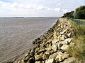 North Ferriby Foreshore - geograph.org.uk - 572382.jpg 640 × 480; 120 KB
-
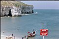 North Landing Bay 1 - geograph.org.uk - 266633.jpg 640 × 427; 67 KB
-
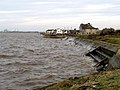 Paull's River Frontage at High Tide - geograph.org.uk - 668855.jpg 640 × 480; 81 KB
-
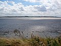
 Paull's Tidal Lagoon at High Tide - geograph.org.uk - 668850.jpg 640 × 447; 51 KB
-
 The Humber Bridge - High Tide - geograph.org.uk - 871443.jpg 640 × 505; 82 KB
-
 The Ouse at Saltmarshe - geograph.org.uk - 1326266.jpg 640 × 480; 59 KB
-
 The Ouse, south of Skelton - geograph.org.uk - 1326213.jpg 640 × 347; 46 KB
-

-
 View over Redcliff Sand at high tide - geograph.org.uk - 914938.jpg 640 × 480; 85 KB
-
 Warping Clough - geograph.org.uk - 859395.jpg 640 × 461; 221 KB
-
 Water Transfer - geograph.org.uk - 663929.jpg 640 × 480; 64 KB
-
 Where has the beach gone? (geograph 4330358).jpg 1,024 × 768; 152 KB
-
 Where the pier was (geograph 4330367).jpg 1,024 × 768; 153 KB
-
 Withernsea beach (geograph 1839163).jpg 640 × 426; 217 KB
-
 River Hull industrial area - geograph.org.uk - 160557.jpg 640 × 427; 66 KB


.jpg)
.jpg)


.jpg)
.jpg)
.jpg)
