Category:Higham Ferrers
Jump to navigation
Jump to search
town and civil parish in Northamptonshire, England  | |||||
| Upload media | |||||
| Instance of | |||||
|---|---|---|---|---|---|
| Location | North Northamptonshire, Northamptonshire, East Midlands, England | ||||
| Said to be the same as | Higham Ferrers (Wikimedia duplicated page, civil parish) | ||||
 | |||||
English: Higham Ferrers is a market town in east Northamptonshire, England, adjacent to (and forming a single urban area with) Rushden to the south. It has an estimated population of 7,204. The de Ferrers family were former Lords of the Manor. The town was one of the rotten boroughs and sent one MP to the unreformed House of Commons until it was stripped of its representation by the Reform Act 1832.
Nederlands: Higham Ferrers is een plaats in het bestuurlijke gebied East Northamptonshire, in het Engelse graafschap Northamptonshire. De plaats telt 6086 inwoners.
Română: Higham Ferrers este un oraş în comitatul Northamptonshire, regiunea East Midlands, Anglia. Oraşul se află în districtul East Northamptonshire.
Subcategories
This category has the following 10 subcategories, out of 10 total.
A
B
- Bede House, Higham Ferrers (8 F)
C
H
- Higham Ferrers Cemetery (2 F)
- Higham Ferrers Town Hall (6 F)
- Hope Methodist Church (3 F)
I
- Irthlingborough Old Bridge (2 F)
M
- Market Cross, Higham Ferrers (4 F)
T
- Higham Ferrers Town Sign (2 F)
Media in category "Higham Ferrers"
The following 64 files are in this category, out of 64 total.
-

-
 A45 southbound - geograph.org.uk - 5366794.jpg 640 × 374; 30 KB
-
 A45 southbound lay-by - geograph.org.uk - 5550954.jpg 640 × 480; 60 KB
-
 Chamberlain Way, Higham Ferrers - geograph.org.uk - 2545841.jpg 1,496 × 1,122; 499 KB
-
 Chelveston Road (B645) - geograph.org.uk - 1189627.jpg 640 × 480; 97 KB
-
 Chelveston Road, Higham Ferrers - geograph.org.uk - 5427517.jpg 1,990 × 1,454; 833 KB
-
 Chelveston Road, Higham Ferrers - geograph.org.uk - 5433991.jpg 1,990 × 1,454; 1,021 KB
-
 Elizabeth Way - geograph.org.uk - 1189465.jpg 640 × 480; 66 KB
-
 Farmers' Market, Higham Ferrers - geograph.org.uk - 864482.jpg 640 × 480; 117 KB
-
 Field and hedgerow - geograph.org.uk - 1189496.jpg 640 × 480; 121 KB
-
 Fishing Lake Higham Ferrers - geograph.org.uk - 1577216.jpg 640 × 428; 160 KB
-
 Footbridge over Lake next to the A45 - geograph.org.uk - 5546615.jpg 640 × 481; 512 KB
-
-
 Hajam Ferersas 20240319 155321.jpg 4,032 × 3,024; 3.92 MB
-
 Hajam Ferersas 20240319 155533.jpg 4,032 × 3,024; 3.72 MB
-
 Hajam Ferersas 20240319 155542.jpg 4,032 × 3,024; 4.99 MB
-
 Hajam Ferersas 20240319 155717.jpg 4,032 × 3,024; 4.77 MB
-
 Hajam Ferersas 20240319 155756.jpg 4,032 × 3,024; 4.13 MB
-
 Hajam Ferersas 20240319 161336.jpg 4,032 × 3,024; 3.5 MB
-
 High Street, Higham Ferrers - geograph.org.uk - 864323.jpg 480 × 640; 109 KB
-
 High Street, Higham Ferrers - geograph.org.uk - 864643.jpg 640 × 480; 87 KB
-
 Higham Auto Services, Higham Ferrers - geograph.org.uk - 864189.jpg 640 × 480; 97 KB
-
 Higham Ferrers geograph-3902560-by-Ben-Brooksbank.jpg 2,343 × 1,368; 2.86 MB
-

-
 Higham Ferrers Methodist Church - geograph.org.uk - 2545829.jpg 1,496 × 1,122; 614 KB
-
 Higham Ferrers Thatched Cottage.jpg 3,264 × 2,448; 2.91 MB
-
 Higham Ferrers, St Mary the Virgin - geograph.org.uk - 6370942.jpg 3,000 × 4,000; 3.96 MB
-
 House with a historic connection - geograph.org.uk - 2504558.jpg 640 × 480; 93 KB
-
 Lake by the A45 - geograph.org.uk - 3203400.jpg 2,560 × 1,920; 1.06 MB
-
 Lake near Higham Ferrers - geograph.org.uk - 5546611.jpg 640 × 481; 595 KB
-
 Lancaster Farm on Chelveston Road - geograph.org.uk - 5433504.jpg 2,032 × 1,514; 898 KB
-
 Market Street, Higham Ferrers - geograph.org.uk - 6190885.jpg 1,024 × 775; 184 KB
-
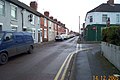
 Newton Road - geograph.org.uk - 1189508.jpg 640 × 480; 88 KB
-
 Newton Road - geograph.org.uk - 1189539.jpg 640 × 480; 57 KB
-
 Newton Road towards Higham Ferrers - geograph.org.uk - 2995345.jpg 640 × 480; 76 KB
-
 Newton Road,Chelveston Road junction - geograph.org.uk - 2461175.jpg 640 × 480; 55 KB
-
 Parking area on the A6, Higham Ferrers - geograph.org.uk - 5427519.jpg 2,048 × 1,536; 897 KB
-
 Plaque on a Higham Ferrers house - geograph.org.uk - 2504560.jpg 640 × 480; 88 KB
-
 River Nene below Higham Ferrers - geograph.org.uk - 120181.jpg 640 × 480; 147 KB
-
 River Nene below Higham Ferrers - geograph.org.uk - 120183.jpg 640 × 480; 81 KB
-
 Roundabout on the A6 at the A45 - geograph.org.uk - 5431032.jpg 2,048 × 1,536; 1.49 MB
-
 Roundabout on the A6, Higham Ferrers - geograph.org.uk - 5427518.jpg 2,008 × 1,482; 759 KB
-
 Rushden Lake - geograph.org.uk - 5546608.jpg 640 × 480; 502 KB
-
 Rushden Lakes near to Higham Ferrers - geograph.org.uk - 5546602.jpg 640 × 480; 508 KB
-
 Russell Way - geograph.org.uk - 6009912.jpg 640 × 360; 50 KB
-
 Saffron Road Recreation Ground - geograph.org.uk - 1189421.jpg 640 × 480; 61 KB
-
 Saffron Road, Higham Ferrers - geograph.org.uk - 228359.jpg 640 × 480; 95 KB
-
 School Lane - geograph.org.uk - 1189442.jpg 640 × 480; 75 KB
-

-
 The A6 entering Higham Ferrers - geograph.org.uk - 6351089.jpg 1,920 × 1,280; 1.19 MB
-
 The Garage - geograph.org.uk - 2504577.jpg 640 × 480; 76 KB
-
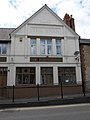
 The Green Dragon, Higham Ferrers - geograph.org.uk - 6190860.jpg 1,024 × 768; 162 KB
-
 The Swan - geograph.org.uk - 2504567.jpg 480 × 640; 61 KB
-
 Higham Ferrers Church and Free-School, Northamptonshire, Eng Wellcome V0012752.jpg 3,034 × 2,303; 2.83 MB
-
 Wildlife lake - geograph.org.uk - 5550952.jpg 640 × 480; 82 KB
-
 A6 Rushden Bypass - geograph.org.uk - 1145785.jpg 640 × 428; 47 KB
-
 Footbridge below Higham Ferrers - geograph.org.uk - 90939.jpg 640 × 480; 64 KB
-
 Footpath to Chelveston from Rushden - geograph.org.uk - 90905.jpg 640 × 480; 66 KB
-
 Footpath to Higham Ferrers - geograph.org.uk - 90911.jpg 640 × 480; 88 KB
-
 Footpath VC6, Higham Ferrers - geograph.org.uk - 228367.jpg 640 × 480; 93 KB
-
 Rushden, Moor Road - geograph.org.uk - 91313.jpg 640 × 425; 77 KB
-
 Rushden, Pemberton Street - geograph.org.uk - 91314.jpg 640 × 425; 87 KB
-
 Rushden, Pytchley Road - geograph.org.uk - 91290.jpg 640 × 425; 75 KB
-
 Winter wheat with tractor wheelings - geograph.org.uk - 92939.jpg 640 × 480; 71 KB


_-_geograph.org.uk_-_1189627.jpg)


