Category:Higher Chisworth
Jump to navigation
Jump to search
hamlet in Derbyshire, United Kingdom | |||||
| Upload media | |||||
| Instance of | |||||
|---|---|---|---|---|---|
| Location | Chisworth, High Peak, Derbyshire, East Midlands, England | ||||
 | |||||
Media in category "Higher Chisworth"
The following 16 files are in this category, out of 16 total.
-
 Cairn, Ludworth Intakes - geograph.org.uk - 44760.jpg 640 × 480; 116 KB
-
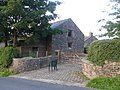
 Cottages at Higher Chisworth - geograph.org.uk - 3173800.jpg 1,600 × 1,198; 572 KB
-
 Field below Higher Chisworth - geograph.org.uk - 2023197.jpg 3,872 × 2,480; 3.26 MB
-
 Fold Cottage.jpg 4,000 × 3,000; 4.63 MB
-
 Fold Farmhouse 01.jpg 4,000 × 3,000; 4.82 MB
-
 Fold Farmhouse 02.jpg 4,000 × 3,000; 4.86 MB
-
 Great Luckins Barn.jpg 4,000 × 3,000; 4.81 MB
-
 Gun Road near Higher Chisworth - geograph.org.uk - 2819185.jpg 3,228 × 2,380; 1.68 MB
-
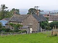
 Higher Chisworth - geograph.org.uk - 2023214.jpg 3,872 × 2,471; 3.95 MB
-
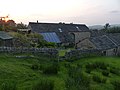
 Higher Chisworth - geograph.org.uk - 44754.jpg 640 × 480; 191 KB
-
 Higher Chisworth, Fold Farm - geograph.org.uk - 3238772.jpg 640 × 480; 625 KB
-
 Higher Chisworth, Sandy Lane - geograph.org.uk - 3238769.jpg 640 × 480; 724 KB
-
 Hilltop Farm, Higher Chisworth - geograph.org.uk - 3238773.jpg 640 × 480; 548 KB
-
 Hilltop Farmhouse.jpg 4,000 × 3,000; 4.82 MB
-
 Sandy Lane, Approaching Higher Chisworth - geograph.org.uk - 3238767.jpg 640 × 480; 574 KB
-
 Thornlea Farmhouse.jpg 4,000 × 3,000; 4.72 MB


