Category:Hightown, West Yorkshire
Jump to navigation
Jump to search
hamlet in Liversedge, West Yorkshire, England, UK  | |||||
| Upload media | |||||
| Instance of | |||||
|---|---|---|---|---|---|
| Part of | |||||
| Location | Kirklees, West Yorkshire, Yorkshire and the Humber, England | ||||
 | |||||
English: Hightown is a hamlet within Liversedge, West Yorkshire, England, with a diverse socioeconomic culture. To the north, neighbouring the border with Calderdale, is Windybank council estate. To the east is Hightown Rd, with some homes valued at over a million pounds, and to the south bordering Mirfield and Roberttown is a very middle-class private housing estate.
Subcategories
This category has the following 5 subcategories, out of 5 total.
Media in category "Hightown, West Yorkshire"
The following 11 files are in this category, out of 11 total.
-
 Central Avenue - Eighth Avenue - geograph.org.uk - 1311961.jpg 640 × 480; 206 KB
-
 Central Avenue - Ninth Avenue - geograph.org.uk - 1312421.jpg 640 × 480; 202 KB
-
 Cotswold Drive - Laverhills - geograph.org.uk - 3223794.jpg 640 × 480; 102 KB
-
 Cotswold Drive - Laverhills - geograph.org.uk - 3442693.jpg 640 × 480; 69 KB
-
-
 Fifth Avenue East - Ninth Avenue - geograph.org.uk - 1312422.jpg 640 × 480; 221 KB
-
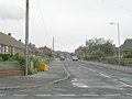
 Halifax Road, Hightown - geograph.org.uk - 4794614.jpg 1,024 × 768; 133 KB
-
 Halifax Road, Hightown, Liversedge - geograph.org.uk - 544990.jpg 640 × 453; 82 KB
-
 Laverhills - Halifax Road - geograph.org.uk - 3223793.jpg 640 × 480; 81 KB
-

-
 Upper Blacup, Hightown, Liversedge - geograph.org.uk - 247898.jpg 640 × 480; 101 KB


