Category:Hiking trails in Styria
Jump to navigation
Jump to search
States of Austria:  Burgenland ·
  Carinthia ·
  Lower Austria ·
  Salzburg ·
  Styria ·
  Tyrol ·
  Upper Austria ·
  Vienna ·
  Vorarlberg
Deutsch: Wanderwege in der Steiermark
· Subcategories
This category has the following 9 subcategories, out of 9 total.
B
G
- Geierwandweg (11 F)
- Geotrail Kapfenstein (23 F)
- Grazer Umland-Weg (2 F)
H
K
L
- Lukas-Max-Steig (31 F)
S
- Sagenhaftes Wölzertal (13 F)
T
- Trail Gellsee (27 F)
Media in category "Hiking trails in Styria"
The following 25 files are in this category, out of 25 total.
-
 05-Nord-Süd-Weg-gold.jpg 1,500 × 1,500; 687 KB
-
 FernwanderkreuzSeeberg.jpg 2,168 × 2,932; 5.07 MB
-
 Gleinalmsattel-Roßbachkogel Wanderweg 01.jpg 3,888 × 5,184; 7.94 MB
-
 Gleinalmsattel-Roßbachkogel Wanderweg 02.jpg 5,184 × 3,888; 9.73 MB
-
 Gleinalmsattel-Roßbachkogel Wanderweg 04.jpg 5,184 × 3,888; 9.08 MB
-
 GreithWanderung01.JPG 2,736 × 3,648; 5.58 MB
-
 GreithWanderung02Wezelsberg.JPG 3,648 × 2,736; 3.1 MB
-
 GreithWanderung03Gerschkogel.JPG 2,736 × 3,648; 5.95 MB
-
 GreithWanderung04Gerschkogel.JPG 3,648 × 2,736; 2.76 MB
-
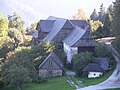
 GreithWanderung05Bauernhof.JPG 3,648 × 2,736; 2.99 MB
-
 GreithWanderung06BauernhofKapelle.JPG 3,648 × 2,736; 2.98 MB
-
 GreithWanderung07BauernhofKapelle.JPG 3,648 × 2,736; 2.67 MB
-
 GreithWanderung08BauernhofKapelle.JPG 3,648 × 2,736; 2.89 MB
-
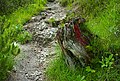 Gseng tree stump 20200622.jpg 4,549 × 3,079; 13.85 MB
-
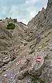 Gsengscharte 20200622.jpg 2,890 × 4,600; 12.99 MB
-
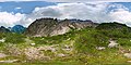 Haindlkar trail panosphere 20200622.jpg 12,702 × 6,351; 89.05 MB
-
 Hochwildstelle4076.JPG 3,888 × 2,592; 8.4 MB
-
 Loser Wanderweg I.jpg 3,120 × 4,160; 16.84 MB
-
 Loser Wanderweg II.jpg 3,120 × 4,160; 13.49 MB
-
 Loser Wanderweg III.jpg 3,120 × 4,160; 14.3 MB
-
 NSWWm1MittesteinMariaZell.jpg 2,638 × 1,769; 3.83 MB
-
 NSWWz2Endestein.jpg 2,254 × 3,401; 6.82 MB
-
 Spechtensee Wanderweg 01.JPG 6,000 × 4,000; 20.85 MB
-
 Wanderspruch.JPG 1,944 × 2,896; 1.37 MB
-
 Wasserweg.jpg 3,072 × 2,304; 2.44 MB


